| Home | City Bus | Maps | Villages | Cities | Rail | Tourist Places | School | College | Pin Codes | Corona Cases Count |
| Distance Calculator Bus Services IFSC Codes Trace Mobile Number Weather Search Place Trace IP Available Cash ATM/Banks Locate Polling Booth Report an Error contact People |
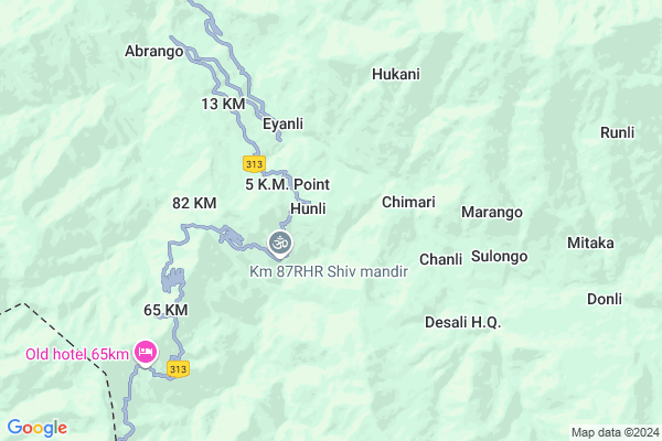
Elope
Elope Map
EDIT Map
Add Your House
 ..
..
Current Corona Virus Infected Patients Count in Lower Dibang Valley District
| City Name | District Name | Total Covid cases |
|---|
Locality Name :
Elope
( एलोपे )
Tehsil Name : Hunli-desali
District : Lower Dibang Valley
State : Arunachal Pradesh
Language : English and Adi & Idu, Endangered, Sino-tibetan
Current Time 01:19 PM
Date: Wednesday , Feb 05,2025 (IST)
Time zone: IST (UTC+5:30)
Elevation / Altitude: 131 meters. Above Seal level
Telephone Code / Std Code: 03803
Assembly constituency : Roing assembly constituency
Assembly MLA : Mutchu Mithi
Lok Sabha constituency : parliamentary constituency
Parliament MP :
Serpanch Name :
Pin Code : 792110
Post Office Name : Roing
Elope Live Weather
Temperature: 20.5 °C
overcast clouds
Humidity: 49%
Wind : 2.09 mt/sec towards SW
StationName : "Tezu"
observed on Now
Temperature: 20.5 °C
overcast clouds
Humidity: 49%
Wind : 2.09 mt/sec towards SW
StationName : "Tezu"
observed on Now
Elope Weather Forecast for Next 5 days
06-02-2025
10.3°C to 15.5°C
overcast clouds, light rain
10.3°C to 15.5°C
overcast clouds, light rain
07-02-2025
9.5°C to 13.9°C
overcast clouds, light rain, broken clouds
9.5°C to 13.9°C
overcast clouds, light rain, broken clouds
08-02-2025
9.2°C to 16.3°C
broken clouds, overcast clouds, light rain
9.2°C to 16.3°C
broken clouds, overcast clouds, light rain
09-02-2025
8.6°C to 19.4°C
broken clouds, few clouds, scattered clouds, overcast clouds
8.6°C to 19.4°C
broken clouds, few clouds, scattered clouds, overcast clouds
10-02-2025
9.0°C to 19.8°C
broken clouds, scattered clouds, overcast clouds
9.0°C to 19.8°C
broken clouds, scattered clouds, overcast clouds
National Highways Reachable To Elope
Nationa High Way :NH13
Nationa High Way :NH115
Nationa High Way :NH13
Nationa High Way :NH115
Rivers Near Elope
Dri river :Dri river :德利河
:Kacha River Kajap River :Kajap River :卡查河 :Kǎ chá hé
Dri river :Dri river :德利河
:Kacha River Kajap River :Kajap River :卡查河 :Kǎ chá hé
About Elope
Correct below Info and add more info about ElopeElope is a Village in Hunli-desali Tehsil in Lower Dibang Valley District of Arunachal Pradesh State, India. It is located 27 KM towards North from District head quarters Roing. 306 KM from State capital Itanagar
Elope Pin code is 792110 and postal head office is Roing .
Elope is surrounded by Lower Dibang Valley Tehsil towards South , Roing Tehsil towards South , Meka Tehsil towards South , Koronu Tehsil towards South .
Pasighat , Tinsukia , Digboi , Margherita are the near by Cities to Elope.
Elope 2011 Census Details
Elope Local Language is English. Elope Village Total population is and number of houses are . Female Population is -1.0%. Village literacy rate is -1.0% and the Female Literacy rate is -1.0%.
Population
| Census Parameter | Census Data |
| Total Population | |
| Total No of Houses | |
| Female Population % | -1.0 % ( ) |
| Total Literacy rate % | -1.0 % ( ) |
| Female Literacy rate | -1.0 % ( ) |
| Scheduled Tribes Population % | -1.0 % ( ) |
| Scheduled Caste Population % | -1.0 % ( ) |
| Working Population % | -1.0 % |
| Child(0 -6) Population by 2011 | |
| Girl Child(0 -6) Population % by 2011 | -1.0 % ( ) |
Elope Census More Deatils.
Politics in Elope
N.A , National People s Party , AITC , BJP , INC are the major political parties in this area.Polling Stations /Booths near Elope
1)Panchayat Hall Roing2)Rehko Building Epanli
3)U0027rehko Building Churoni
4)Govt. Primary School Bldg Brinli
5)Rehko Building Donli
HOW TO REACH Elope
By Rail
There is no railway station near to Elope in less than 10 km.Colleges near Elope
Indira Gandhi Government College,tezu
Address :
Schools near Elope
Govt.sec. School, Desali
Address : desali , hunli , lower dibang valley , Arunachal Pradesh . PIN- 792110 , Post - Roing
K.g.b.v, Hunli
Address : hunli , hunli , lower dibang valley , Arunachal Pradesh . PIN- 792110 , Post - Roing
Residential School, New Elope
Address : new elope , hunli , lower dibang valley , Arunachal Pradesh . PIN- 792110 , Post - Roing
Govt.middle School, Hunli
Address : hunli , hunli , lower dibang valley , Arunachal Pradesh . PIN- 792110 , Post - Roing
Govt Health Centers near Elope
1) SC Mipi , SC Mipi , SC Mipi ,2) SC New Anaya , SC New Anaya , SC New Anaya ,
3) SC Arzoo , SC Arzoo , ,
Schools in Elope,Hunli-desali
Electronic Shops in Elope,Hunli-desali
Super Markets in Elope,Hunli-desali
Local Parks in Elope,Hunli-desali
Police Stations near Elope,Hunli-desali
Governement Offices near Elope,Hunli-desali
About Elope &
History
How to reach Elope
Tourist Places Near By Elope
Schools in Elope
Colleges in Elope
Temperature & weather of Elope
places in Elope
Elope photos
More Information
How to reach Elope
Tourist Places Near By Elope
Schools in Elope
Colleges in Elope
Temperature & weather of Elope
places in Elope
Elope photos
More Information
Village Talk
Post News or Events about this Village
Near Cities
Pasighat 76 KM near
Tinsukia 123 KM near
Digboi 124 KM near
Margherita 132 KM near
Pasighat 76 KM near
Tinsukia 123 KM near
Digboi 124 KM near
Margherita 132 KM near
Near By Taluks
Hunli-Desali 0 KM near
Lower Dibang Valley 25 KM near
Roing 26 KM near
Meka 30 KM near
Hunli-Desali 0 KM near
Lower Dibang Valley 25 KM near
Roing 26 KM near
Meka 30 KM near
Near By Air Ports
Chabua Airport 147 KM near
Lilabari Airport 243 KM near
Rowriah Airport 279 KM near
Dimapur Airport 389 KM near
Chabua Airport 147 KM near
Lilabari Airport 243 KM near
Rowriah Airport 279 KM near
Dimapur Airport 389 KM near
Near By Tourist Places
Mayudia 12 KM near
Roing 26 KM near
Tezu(Parasuramkunda) 54 KM near
Daying Ering Wildlife Sanctuary 67 KM near
Pasighat 79 KM near
Mayudia 12 KM near
Roing 26 KM near
Tezu(Parasuramkunda) 54 KM near
Daying Ering Wildlife Sanctuary 67 KM near
Pasighat 79 KM near
Near By Districts
Lower Dibang Valley 26 KM near
Lohit 54 KM near
Dibang Valley 59 KM near
East Siang 91 KM near
Lower Dibang Valley 26 KM near
Lohit 54 KM near
Dibang Valley 59 KM near
East Siang 91 KM near
Near By RailWay Station
New Tinsukia Junction Rail Way Station 125 KM near
Naharkatiya Rail Way Station 146 KM near
New Tinsukia Junction Rail Way Station 125 KM near
Naharkatiya Rail Way Station 146 KM near