| Home | City Bus | Maps | Villages | Cities | Rail | Tourist Places | School | College | Pin Codes | Corona Cases Count |
| Distance Calculator Bus Services IFSC Codes Trace Mobile Number Weather Search Place Trace IP Available Cash ATM/Banks Locate Polling Booth Report an Error contact People |
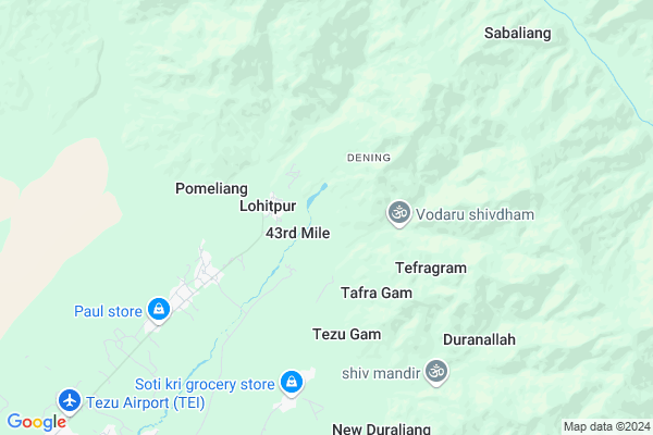
Mohaloni
Mohaloni Map
EDIT Map
Add Your House
 ..
..
Current Corona Virus Infected Patients Count in Lohit District
| City Name | District Name | Total Covid cases |
|---|---|---|
| Lohit District | Lohit | 1 |
Locality Name :
Mohaloni
( ंओहलोनि )
Tehsil Name : Lekang
District : Lohit
State : Arunachal Pradesh
Language : English and Galo, Endangered Sino-tibetan
Current Time 11:09 AM
Date: Friday , Mar 14,2025 (IST)
Time zone: IST (UTC+5:30)
Elevation / Altitude: 131 meters. Above Seal level
Telephone Code / Std Code: 03804
Assembly constituency : Tezu assembly constituency
Assembly MLA : Karikho Kri
Lok Sabha constituency : parliamentary constituency
Parliament MP :
Serpanch Name :
Mohaloni Live Weather
Temperature: 17.4 °C
overcast clouds
Humidity: 79%
Wind : 2.81 mt/sec towards NE
StationName : "Tezu"
observed on Now
Temperature: 17.4 °C
overcast clouds
Humidity: 79%
Wind : 2.81 mt/sec towards NE
StationName : "Tezu"
observed on Now
Mohaloni Weather Forecast for Next 5 days
15-03-2025
16.0°C to 20.7°C
light rain, overcast clouds
16.0°C to 20.7°C
light rain, overcast clouds
16-03-2025
17.8°C to 23.9°C
light rain, overcast clouds, broken clouds, scattered clouds
17.8°C to 23.9°C
light rain, overcast clouds, broken clouds, scattered clouds
17-03-2025
17.5°C to 24.8°C
scattered clouds, broken clouds, light rain
17.5°C to 24.8°C
scattered clouds, broken clouds, light rain
18-03-2025
17.1°C to 24.7°C
light rain, moderate rain
17.1°C to 24.7°C
light rain, moderate rain
19-03-2025
16.3°C to 24.4°C
light rain, moderate rain
16.3°C to 24.4°C
light rain, moderate rain
National Highways Reachable To Mohaloni
Nationa High Way :NH13
Nationa High Way :NH115
Nationa High Way :NH13
Nationa High Way :NH115
Rivers Near Mohaloni
:Du;Dau;Duo Dav river :Dav river
Lohit
:Du;Dau;Duo Dav river :Dav river
Lohit
About Mohaloni
Correct below Info and add more info about MohaloniMohaloni is a Village in Lekang Tehsil in Lohit District of Arunachal Pradesh State, India. It is located 11 KM towards North from District head quarters Tezu. 313 KM from State capital Itanagar
Mohaloni is surrounded by Sunpura Tehsil towards North , Tezu Tehsil towards South , Anjaw Tehsil towards East , Chowkham Tehsil towards South .
Pasighat , Digboi , Margherita , Tinsukia are the near by Cities to Mohaloni.
Mohaloni 2011 Census Details
Mohaloni Local Language is English. Mohaloni Village Total population is and number of houses are . Female Population is -1.0%. Village literacy rate is -1.0% and the Female Literacy rate is -1.0%.
Population
| Census Parameter | Census Data |
| Total Population | |
| Total No of Houses | |
| Female Population % | -1.0 % ( ) |
| Total Literacy rate % | -1.0 % ( ) |
| Female Literacy rate | -1.0 % ( ) |
| Scheduled Tribes Population % | -1.0 % ( ) |
| Scheduled Caste Population % | -1.0 % ( ) |
| Working Population % | -1.0 % |
| Child(0 -6) Population by 2011 | |
| Girl Child(0 -6) Population % by 2011 | -1.0 % ( ) |
Mohaloni Census More Deatils.
Politics in Mohaloni
N.A , Independent , AITC , INC are the major political parties in this area.Polling Stations /Booths near Mohaloni
1)D.i.c. Office Tezu2)Primary School Tezugam Village
3)Govt Middle School Old Sunpua
4)Govt.praimary School Alc Line
5)Upper Primary School Khoraliang Village
HOW TO REACH Mohaloni
By Rail
There is no railway station near to Mohaloni in less than 10 km.Pincodes near Mohaloni
792001 ( Tezu ) , 792102 ( Chowkham ) , 792111 ( Sunpura )Colleges near Mohaloni
Mahabodhi Lord Buddha College Namsai
Address :
Indira Gandhi Government College,tezu
Address :
Schools near Mohaloni
J.n.v. Central School
Address : mahadevpur - iv , lekang , lohit , Arunachal Pradesh . PIN- 792105 , Post - Mahadevpur (Lohit)
G.h.s.s.old Mohong
Address : old mohong , lekang , lohit , Arunachal Pradesh . PIN- 792105 , Post - Mahadevpur (Lohit)
Govt. Sec. School
Address : kumari kachari , lekang , lohit , Arunachal Pradesh . PIN- 792105 , Post - Mahadevpur (Lohit)
Govt.mid.school,lbs
Address : mahadevpur hq , lekang , lohit , Arunachal Pradesh . PIN- 792105 , Post - Mahadevpur (Lohit)
Govt Health Centers near Mohaloni
1) SC Sarti , , ,2) PHC Parsi Parlo , PHC Parsi Parlo , ,
3) SC Wamliang , SC Wamlaing , ,
Schools in Mohaloni,Lekang
Govt. Sec. School
Loiliang; Via Tezu; Dt- Lohit; Arunachal Pradesh- 792001; Lohit; Arunachal Pradesh 792001; India
5.3 KM distance Detail
Electronic Shops in Mohaloni,Lekang
DIGITALMIND
Kanchi Charali Arunachal Pradesh; Tezu; Arunachal Pradesh 792001; India
12.2 KM distance Detail
Super Markets in Mohaloni,Lekang
Police Stations near Mohaloni,Lekang
About Mohaloni &
History
How to reach Mohaloni
Tourist Places Near By Mohaloni
Schools in Mohaloni
Colleges in Mohaloni
Temperature & weather of Mohaloni
places in Mohaloni
Mohaloni photos
More Information
How to reach Mohaloni
Tourist Places Near By Mohaloni
Schools in Mohaloni
Colleges in Mohaloni
Temperature & weather of Mohaloni
places in Mohaloni
Mohaloni photos
More Information
Village Talk
Post News or Events about this Village
Near Cities
Pasighat 98 KM near
Digboi 102 KM near
Margherita 107 KM near
Tinsukia 114 KM near
Pasighat 98 KM near
Digboi 102 KM near
Margherita 107 KM near
Tinsukia 114 KM near
Near By Taluks
Lekang 0 KM near
Sunpura 0 KM near
Tezu 11 KM near
Anjaw 16 KM near
Lekang 0 KM near
Sunpura 0 KM near
Tezu 11 KM near
Anjaw 16 KM near
Near By Air Ports
Chabua Airport 146 KM near
Lilabari Airport 251 KM near
Rowriah Airport 274 KM near
Dimapur Airport 378 KM near
Chabua Airport 146 KM near
Lilabari Airport 251 KM near
Rowriah Airport 274 KM near
Dimapur Airport 378 KM near
Near By Tourist Places
Tezu(Parasuramkunda) 11 KM near
Mayudia 44 KM near
Roing 45 KM near
Namdhapa 66 KM near
Daying Ering Wildlife Sanctuary 86 KM near
Tezu(Parasuramkunda) 11 KM near
Mayudia 44 KM near
Roing 45 KM near
Namdhapa 66 KM near
Daying Ering Wildlife Sanctuary 86 KM near
Near By Districts
Lohit 11 KM near
Lower Dibang Valley 45 KM near
Anjaw 99 KM near
Dibang Valley 105 KM near
Lohit 11 KM near
Lower Dibang Valley 45 KM near
Anjaw 99 KM near
Dibang Valley 105 KM near
Near By RailWay Station
New Tinsukia Junction Rail Way Station 117 KM near
Naharkatiya Rail Way Station 132 KM near
New Tinsukia Junction Rail Way Station 117 KM near
Naharkatiya Rail Way Station 132 KM near