| Home | City Bus | Maps | Villages | Cities | Rail | Tourist Places | School | College | Pin Codes | Corona Cases Count |
| Distance Calculator Bus Services IFSC Codes Trace Mobile Number Weather Search Place Trace IP Available Cash ATM/Banks Locate Polling Booth Report an Error contact People |
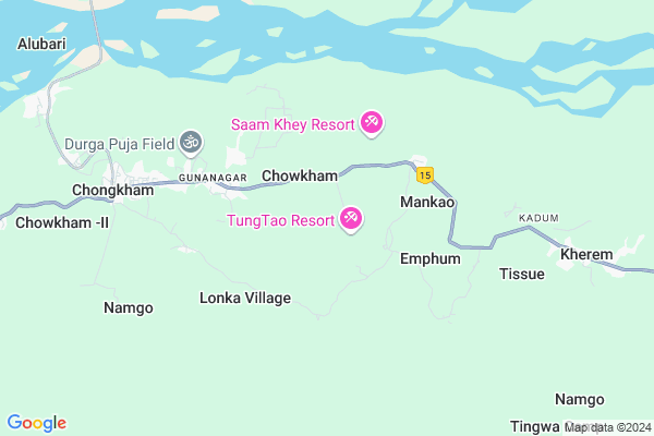
Momong
Momong Map
EDIT Map
Add Your House
 ..
..
Current Corona Virus Infected Patients Count in Lohit District
| City Name | District Name | Total Covid cases |
|---|---|---|
| Lohit District | Lohit | 1 |
Locality Name :
Momong
( मोमोंग )
Tehsil Name : Chowkham
District : Lohit
State : Arunachal Pradesh
Language : English and Galo, Endangered Sino-tibetan
Current Time 11:42 AM
Date: Sunday , Apr 27,2025 (IST)
Time zone: IST (UTC+5:30)
Elevation / Altitude: 131 meters. Above Seal level
Telephone Code / Std Code: 03806
Assembly constituency : Chowkham assembly constituency
Assembly MLA : CHOWNA MEIN
Lok Sabha constituency : parliamentary constituency
Parliament MP :
Serpanch Name :
Pin Code : 792102
Post Office Name : Chowkham
Momong Live Weather
Temperature: 32.6 °C
broken clouds
Humidity: 31%
Wind : 0.66 mt/sec towards W
StationName : "Tezu"
observed on 25 Mins Back
Temperature: 32.6 °C
broken clouds
Humidity: 31%
Wind : 0.66 mt/sec towards W
StationName : "Tezu"
observed on 25 Mins Back
Momong Weather Forecast for Next 5 days
28-04-2025
21.5°C to 32.9°C
light rain, overcast clouds
21.5°C to 32.9°C
light rain, overcast clouds
29-04-2025
21.6°C to 31.1°C
overcast clouds
21.6°C to 31.1°C
overcast clouds
30-04-2025
21.2°C to 29.9°C
overcast clouds, broken clouds
21.2°C to 29.9°C
overcast clouds, broken clouds
01-05-2025
20.5°C to 29.3°C
overcast clouds, light rain
20.5°C to 29.3°C
overcast clouds, light rain
02-05-2025
20.6°C to 33.6°C
overcast clouds, broken clouds, scattered clouds, light rain
20.6°C to 33.6°C
overcast clouds, broken clouds, scattered clouds, light rain
Edit below overview about Momong
Edit below overview about Momong
OverView of Momong
Momong is the oldest village in chowkham tehsil between the tai khamti village in lohit now namsai.The people here speak tai khamti, Assamese,Hindi,English etc.the people here belongs to Buddhists community.Edit below overview about Momong
National Highways Reachable To Momong
Nationa High Way :NH15
Nationa High Way :NH37
Nationa High Way :NH15
Nationa High Way :NH37
Rivers Near Momong
:丹巴曲;丹巴江;丹巴河 :Dān bā qū;dān bā jiāng;dān bā hé Dibang :Dibang River :丹龙曲 :dānlóng qǔ
:丹巴曲;丹巴江;丹巴河 :Dān bā qū;dān bā jiāng;dān bā hé Dibang :Dibang River :丹龙曲 :dānlóng qǔ
:丹巴曲;丹巴江;丹巴河 :Dān bā qū;dān bā jiāng;dān bā hé Dibang :Dibang River :丹龙曲 :dānlóng qǔ
:丹巴曲;丹巴江;丹巴河 :Dān bā qū;dān bā jiāng;dān bā hé Dibang :Dibang River :丹龙曲 :dānlóng qǔ
About Momong
Momong is a Village in Chowkham Tehsil in Lohit District of Arunachal Pradesh State, India. It is located 18 KM towards South from District head quarters Tezu. 292 KM from State capital Itanagar
Momong Pin code is 792102 and postal head office is Chowkham .
Momong is surrounded by Tezu Tehsil towards North , Wakro Tehsil towards East , Lekang Tehsil towards North , Sunpura Tehsil towards North .
Digboi , Margherita , Tinsukia , Pasighat are the near by Cities to Momong.
Momong 2011 Census Details
Momong Local Language is English. Momong Village Total population is and number of houses are . Female Population is -1.0%. Village literacy rate is -1.0% and the Female Literacy rate is -1.0%.
Population
| Census Parameter | Census Data |
| Total Population | |
| Total No of Houses | |
| Female Population % | -1.0 % ( ) |
| Total Literacy rate % | -1.0 % ( ) |
| Female Literacy rate | -1.0 % ( ) |
| Scheduled Tribes Population % | -1.0 % ( ) |
| Scheduled Caste Population % | -1.0 % ( ) |
| Working Population % | -1.0 % |
| Child(0 -6) Population by 2011 | |
| Girl Child(0 -6) Population % by 2011 | -1.0 % ( ) |
Momong Census More Deatils.
Politics in Momong
N.A , Bharatiya Janata Party , BJP , NCP , INC are the major political parties in this area.Polling Stations /Booths near Momong
1)Govt. Pry. School Inju2)Govt.middle School Kherem
3)Govt.middle. School Guna Nagar(east Wing)
4)Govt.middle School Namliang
5)Govt. Middle School
HOW TO REACH Momong
By Rail
There is no railway station near to Momong in less than 10 km.Colleges near Momong
Mahabodhi Lord Buddha College Namsai
Address :
Indira Gandhi Government College,tezu
Address :
Schools in Momong
Govt. Middle School Momong
Address : momong , chongkham , lohit , Arunachal Pradesh . PIN- 792104 , Post - Hayuliang
Govt Health Centers near Momong
1) SC Wamliang , SC Wamlaing , ,2) PHC Kherang , Kherang , ,
3) SC Blong , Blong , ,
About Momong &
History
How to reach Momong
Tourist Places Near By Momong
Schools in Momong
Colleges in Momong
Temperature & weather of Momong
places in Momong
Momong photos
More Information
How to reach Momong
Tourist Places Near By Momong
Schools in Momong
Colleges in Momong
Temperature & weather of Momong
places in Momong
Momong photos
More Information
Village Talk
Post News or Events about this Village
Near Cities
Digboi 75 KM near
Margherita 79 KM near
Tinsukia 90 KM near
Pasighat 91 KM near
Digboi 75 KM near
Margherita 79 KM near
Tinsukia 90 KM near
Pasighat 91 KM near
Near By Taluks
Chowkham 0 KM near
Tezu 16 KM near
Wakro 27 KM near
Lekang 27 KM near
Chowkham 0 KM near
Tezu 16 KM near
Wakro 27 KM near
Lekang 27 KM near
Near By Air Ports
Chabua Airport 125 KM near
Lilabari Airport 230 KM near
Rowriah Airport 250 KM near
Dimapur Airport 352 KM near
Chabua Airport 125 KM near
Lilabari Airport 230 KM near
Rowriah Airport 250 KM near
Dimapur Airport 352 KM near
Near By Tourist Places
Tezu(Parasuramkunda) 16 KM near
Namdhapa 50 KM near
Roing 51 KM near
Mayudia 57 KM near
Daying Ering Wildlife Sanctuary 79 KM near
Tezu(Parasuramkunda) 16 KM near
Namdhapa 50 KM near
Roing 51 KM near
Mayudia 57 KM near
Daying Ering Wildlife Sanctuary 79 KM near
Near By Districts
Lohit 16 KM near
Lower Dibang Valley 51 KM near
Tinsukia 89 KM near
Changlang 91 KM near
Lohit 16 KM near
Lower Dibang Valley 51 KM near
Tinsukia 89 KM near
Changlang 91 KM near
Near By RailWay Station
New Tinsukia Junction Rail Way Station 93 KM near
Naharkatiya Rail Way Station 106 KM near
New Tinsukia Junction Rail Way Station 93 KM near
Naharkatiya Rail Way Station 106 KM near