| Home | City Bus | Maps | Villages | Cities | Rail | Tourist Places | School | College | Pin Codes | Corona Cases Count |
| Distance Calculator Bus Services IFSC Codes Trace Mobile Number Weather Search Place Trace IP Available Cash ATM/Banks Locate Polling Booth Report an Error contact People |
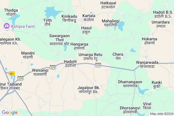
Umarga Retu
Umarga Retu Map
EDIT Map
Add Your House
 ..
..
Current Corona Virus Infected Patients Count in Latur District
| City Name | District Name | Total Covid cases |
|---|---|---|
| Latur District | Latur | 9 |
Locality Name :
Umarga Retu
( उमरगा रेटू )
Taluka Name : Jalkot
District : Latur
State : Maharashtra
Region : Marathwada
Division : Aurangabad
Language : Marathi Urdu and Telegu, Kannada, Hindi, Gujarati And Rajasthani
Current Time 01:01 PM
Date: Sunday , Apr 27,2025 (IST)
Time zone: IST (UTC+5:30)
Elevation / Altitude: 646 meters. Above Seal level
Telephone Code / Std Code: 02381
Assembly constituency : Udgir assembly constituency
Assembly MLA : Bansode Sanjay Baburao
Lok Sabha constituency : Latur parliamentary constituency
Parliament MP : Sudhakar Tukaram Shrangare
Serpanch Name :
Pin Code : 413514
Post Office Name : Shirur Tajband
Commodities Prices : Jalkot Market / Mandi
Umarga Retu Live Weather
Temperature: 38.1 °C
clear sky
Humidity: 19%
Wind : 2.33 mt/sec towards E
StationName : "Ahmadpur"
observed on 19 Mins Back
Temperature: 38.1 °C
clear sky
Humidity: 19%
Wind : 2.33 mt/sec towards E
StationName : "Ahmadpur"
observed on 19 Mins Back
Umarga Retu Weather Forecast for Next 5 days
28-04-2025
29.2°C to 38.2°C
scattered clouds, few clouds, clear sky
29.2°C to 38.2°C
scattered clouds, few clouds, clear sky
29-04-2025
28.9°C to 40.1°C
clear sky, scattered clouds
28.9°C to 40.1°C
clear sky, scattered clouds
30-04-2025
30.2°C to 41.9°C
clear sky, scattered clouds, broken clouds
30.2°C to 41.9°C
clear sky, scattered clouds, broken clouds
01-05-2025
30.2°C to 41.8°C
broken clouds, scattered clouds, clear sky
30.2°C to 41.8°C
broken clouds, scattered clouds, clear sky
02-05-2025
29.4°C to 42.3°C
clear sky
29.4°C to 42.3°C
clear sky
National Highways Reachable To Umarga Retu
Nationa High Way :NH63;NH752K
Nationa High Way :NH63
Nationa High Way :NH63;NH752K
Nationa High Way :NH63
Rivers Near Umarga Retu
Borna
Galati
Borna
Galati
About Umarga Retu
Correct below Info and add more info about Umarga RetuUmarga Retu is a Village in Jalkot Taluka in Latur District of Maharashtra State, India. It belongs to Marathwada region . It belongs to Aurangabad Division . It is located 68 KM towards East from District head quarters Latur. 11 KM from Jalkot. 519 KM from State capital Mumbai
Umarga Retu Pin code is 413514 and postal head office is Shirur Tajband .
Sheldara ( 3 KM ) , Chera ( 4 KM ) , Jagalpur (bk) ( 4 KM ) , Hawarga ( 6 KM ) , Kinikadu ( 6 KM ) are the nearby Villages to Umarga Retu. Umarga Retu is surrounded by Ahemadpur Taluka towards west , Chakur Taluka towards west , Udgir Taluka towards South , Kandhar Taluka towards North .
Udgir , Mukhed , Loha , Nanded-Waghala are the near by Cities to Umarga Retu.
Umarga Retu 2011 Census Details
Umarga Retu Local Language is Marathi Urdu. Umarga Retu Village Total population is 1760 and number of houses are 321. Female Population is 48.5%. Village literacy rate is 63.5% and the Female Literacy rate is 26.6%.
Population
| Census Parameter | Census Data |
| Total Population | 1760 |
| Total No of Houses | 321 |
| Female Population % | 48.5 % ( 853) |
| Total Literacy rate % | 63.5 % ( 1117) |
| Female Literacy rate | 26.6 % ( 468) |
| Scheduled Tribes Population % | 0.0 % ( 0) |
| Scheduled Caste Population % | 17.3 % ( 305) |
| Working Population % | 49.4 % |
| Child(0 -6) Population by 2011 | 240 |
| Girl Child(0 -6) Population % by 2011 | 50.4 % ( 121) |
Umarga Retu Census More Deatils.
Politics in Umarga Retu
Bharatiya Janata Party , BJP , NCP , INC are the major political parties in this area.Polling Stations /Booths near Umarga Retu
1)Z P P S Patoda Bk South Side2)Z.p.p.s. Umerga Retu
3)G. P. Pra. Shala Hali
4)G. P. Pra. Sha. Shekapur East Baju
5)G. P. Pra. Sha. Digras Uttar Baju
HOW TO REACH Umarga Retu
By Rail
There is no railway station near to Umarga Retu in less than 10 km. Kumtha Khurd Rail Way Station (near to Udgir) , Udgir Rail Way Station (near to Udgir) are the Rail way stations reachable from near by towns.By Road
Ahmadpur , Udgir are the nearby by towns to Umarga Retu having road connectivity to Umarga RetuColleges near Umarga Retu
Gurudatta Jr. College Jlkot
Address :
Ujwal Gramin Mahavidyalaya
Address : Gudsur Road
Schools near Umarga Retu
Sri Samarth Dhondu Tatya H.s.
Address : kolnur , jalkot , latur , Maharashtra . PIN- 433532
Sri Samarth Dhondu Tatya H.s.
Address : malhipperga , jalkot , latur , Maharashtra . PIN- 413532 , Post - Jalkot
Sri Gurudata Madhymik Vidy H.s
Address : jalkot , jalkot , latur , Maharashtra . PIN- 413532 , Post - Jalkot
Vikas Vidyalya H.s.
Address : atnur , jalkot , latur , Maharashtra . PIN- 413532 , Post - Jalkot
Govt Health Centers near Umarga Retu
1) Bolka , Bolka , Bolka , Bolka2) Hadoli , Hadoli , Hadoli , Hadoli
3) Kurla , Kurul , Kurula , Kurula
Petrol Bunks in Umarga Retu,Jalkot
HP PETROL PUMP - PUROHIT SERVICES
Shirur Tajbund TAL Ahmedpur Dist.; Sholapur; Maharashtra 413514; India
11.8 KM distance Detail
SHREE MAHASAI PETROLEUM
SHIRUR TAJBAND LATUR; LATUR; Maharashtra 413514; India
12.2 KM distance Detail
more ..
Colleges in Umarga Retu,Jalkot
L M D P College
Maharashtra State Highway 217; Mortalwadi; Maharashtra 413514; India
10.4 KM distance Detail
Swami Vivekanand Krushi Tantraniketan
Shiv Chhatrapati Nagar; Sirur Tajband; Maharashtra 413514; India
11.9 KM distance Detail
Swami Vivekananad Jr College; Shirur Tajband
Sirur Tajband; Maharashtra 413514; India
12.3 KM distance Detail
more ..
Schools in Umarga Retu,Jalkot
जिल्हा परिषद केंद्रीय प्राथमिक शाळा ;हिप्पळगाव.
Himppalgaon; Maharashtra 413514; India
4.4 KM distance Detail
Local Parks in Umarga Retu,Jalkot
Chame Garden
Chame Garden;Thodga Road;Ahmedpur; Basweshwar Nagar; Vidhya Nagar; اهمدپر Ahmadpur (अहमदपूर); Maharashtra 413515; India
14.8 KM distance Detail
Governement Offices near Umarga Retu,Jalkot
Grampanchayat Karyalaya Chobli
At-Chobali; Post-Shirur tajband ;Ahmdpur; Maharashtra 413514; India
13.4 KM distance Detail
About Umarga Retu &
History
How to reach Umarga Retu
Tourist Places Near By Umarga Retu
Schools in Umarga Retu
Colleges in Umarga Retu
Temperature & weather of Umarga Retu
places in Umarga Retu
Umarga Retu photos
More Information
How to reach Umarga Retu
Tourist Places Near By Umarga Retu
Schools in Umarga Retu
Colleges in Umarga Retu
Temperature & weather of Umarga Retu
places in Umarga Retu
Umarga Retu photos
More Information
Village Talk
Post News or Events about this Village
Near Cities
Udgir 34 KM near
Mukhed 36 KM near
Loha 37 KM near
Nanded-Waghala 58 KM near
Udgir 34 KM near
Mukhed 36 KM near
Loha 37 KM near
Nanded-Waghala 58 KM near
Near By Taluks
Jalkot 11 KM near
Ahemadpur 18 KM near
Chakur 29 KM near
Udgir 31 KM near
Jalkot 11 KM near
Ahemadpur 18 KM near
Chakur 29 KM near
Udgir 31 KM near
Near By Air Ports
Nanded Airport 71 KM near
Latur Airport 76 KM near
Sholapur Airport 184 KM near
Rajiv Gandhi International Airport 239 KM near
Nanded Airport 71 KM near
Latur Airport 76 KM near
Sholapur Airport 184 KM near
Rajiv Gandhi International Airport 239 KM near
Near By Tourist Places
Bidar 110 KM near
Hingoli 132 KM near
Tuljapur 142 KM near
Medak 161 KM near
Gulbarga 167 KM near
Bidar 110 KM near
Hingoli 132 KM near
Tuljapur 142 KM near
Medak 161 KM near
Gulbarga 167 KM near
Near By Districts
Latur 65 KM near
Nanded 68 KM near
Parbhani 82 KM near
Bidar 108 KM near
Latur 65 KM near
Nanded 68 KM near
Parbhani 82 KM near
Bidar 108 KM near
Near By RailWay Station
Latur Road Junction Rail Way Station 31 KM near
Udgir Rail Way Station 34 KM near
Latur Road Junction Rail Way Station 31 KM near
Udgir Rail Way Station 34 KM near