| Home | City Bus | Maps | Villages | Cities | Rail | Tourist Places | School | College | Pin Codes | Corona Cases Count |
| Distance Calculator Bus Services IFSC Codes Trace Mobile Number Weather Search Place Trace IP Available Cash ATM/Banks Locate Polling Booth Report an Error contact People |
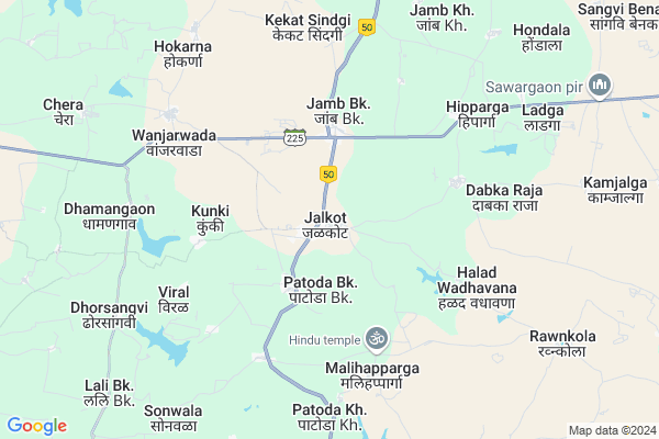
Jalkot
Jalkot Map
EDIT Map
Add Your House
 ..
..
Current Corona Virus Infected Patients Count in Latur District
| City Name | District Name | Total Covid cases |
|---|---|---|
| Latur District | Latur | 9 |
Locality Name :
Jalkot
( जळकोट )
Taluka Name : Jalkot
District : Latur
State : Maharashtra
Region : Marathwada
Division : Aurangabad
Language : Marathi Urdu and Telegu, Kannada, Hindi, Gujarati And Rajasthani
Current Time 12:35 PM
Date: Tuesday , Apr 29,2025 (IST)
Time zone: IST (UTC+5:30)
Elevation / Altitude: 646 meters. Above Seal level
Telephone Code / Std Code: 02381
Assembly constituency : Udgir assembly constituency
Assembly MLA : Bansode Sanjay Baburao
Lok Sabha constituency : Latur parliamentary constituency
Parliament MP : Sudhakar Tukaram Shrangare
Serpanch Name :
Pin Code : 413532
Post Office Name : Jalkot
Commodities Prices : Jalkot Market / Mandi
National Highways Reachable To Jalkot
Nationa High Way :NH63;NH752K
Nationa High Way :NH63
Nationa High Way :NH63;NH752K
Nationa High Way :NH63
Rivers Near Jalkot
Borna
Galati
Borna
Galati
About Jalkot
Correct below Info and add more info about JalkotJalkot is a Town in Jalkot Taluka in Latur District of Maharashtra State, India. It belongs to Marathwada region . It belongs to Aurangabad Division . It is located 79 KM towards East from District head quarters Latur. It is a Taluka head quarter.
Jalkot Pin code is 413532 and postal head office is Jalkot .
Patoda (kh) ( 2 KM ) , Kolnoor ( 5 KM ) , Karanji ( 6 KM ) , Viral ( 6 KM ) , Wanjarwada ( 6 KM ) are the nearby Villages to Jalkot. Jalkot is surrounded by Mokhed Taluka towards East , Kandhar Taluka towards North , Udgir Taluka towards South , Ahemadpur Taluka towards west .
Mukhed , Udgir , Loha , Nanded-Waghala are the nearby Cities to Jalkot.
Jalkot 2011 Census Details
Jalkot Local Language is Marathi Urdu. Jalkot town Total population is 9356 and number of houses are 1743. Female Population is 48.4%. town literacy rate is 66.4% and the Female Literacy rate is 28.3%.
Population
| Census Parameter | Census Data |
| Total Population | 9356 |
| Total No of Houses | 1743 |
| Female Population % | 48.4 % ( 4526) |
| Total Literacy rate % | 66.4 % ( 6214) |
| Female Literacy rate | 28.3 % ( 2644) |
| Scheduled Tribes Population % | 0.4 % ( 36) |
| Scheduled Caste Population % | 17.3 % ( 1621) |
| Working Population % | 35.3 % |
| Child(0 -6) Population by 2011 | 1251 |
| Girl Child(0 -6) Population % by 2011 | 50.4 % ( 631) |
Jalkot Census More Deatils.
Demographics of Jalkot
Marathi Urdu is the Local Language here.Politics in Jalkot
Bharatiya Janata Party , BJP , NCP , INC are the major political parties in this area.Polling Stations /Booths near Jalkot
1)G. P. Pra. Shala Ismalapur2)G. P. Pra. Shala Jalakot Dakshin Baju
3)G. P. Pra. Shala Jalakot Dakshin Baju
4)G. P. Pra. Shala Jalakot East Baju
5)Gandhi Gardan M. G. Road Udagir
HOW TO REACH Jalkot
By Rail
There is no railway station near to Jalkot in less than 10 km. Kumtha Khurd Rail Way Station (near to Udgir) , Udgir Rail Way Station (near to Udgir) are the Rail way stations reachable from near by towns.By Road
Ahmadpur , Udgir are the nearby by towns to Jalkot having road connectivity to JalkotGovt Health Centers near Jalkot
1) Mukarmabad , mukramabad , sc , sc2) Digras bk , Digras bk , Digras bk , Digras bk
3) Hadoli , Hadoli , Hadoli , Hadoli
Sub Villages in Jalkot
Petrol Bunks in Jalkot,Jalkot
ShriGaurikale Petrolium
Maharashtra; Jalkot - Kunki Rd; Jalkot; 413532; India
1.0 KM distance Detail
HP PETROL PUMP - SRI GIRIRAJ PETROLEUM SERVICES
ON SH 222 GUT NO. 327 Taluka Jalkot; Sholapur; Maharashtra 413532; India
2.3 KM distance Detail
more ..
Colleges in Jalkot,Jalkot
Sambhajirao Kendre Mahavidyalaya
Near Tahsil;Jalkot; Latur; Maharashtra 413532; India
0.2 KM distance Detail
more ..
Schools in Jalkot,Jalkot
Dr.Babasaheb Ambedkar Chowk Gaikwad Nagar Jalkot
Jalkot; Maharashtra 413532; India
0.1 KM distance Detail
Electronic Shops in Jalkot,Jalkot
Priyanka Electronics Jalkot
Chikhale novas main road; Jalkot; Maharashtra; India
0.2 KM distance Detail
Governement Offices near Jalkot,Jalkot
Mainoddin Maniyar Register Office Jalkot
Near by LDcc Bank bond office; Jalkot; Maharashtra; India
0.4 KM distance Detail
About Jalkot &
History
How to reach Jalkot
Tourist Places Near By Jalkot
Schools in Jalkot
Colleges in Jalkot
Temperature & weather of Jalkot
places in Jalkot
Jalkot photos
More Information
How to reach Jalkot
Tourist Places Near By Jalkot
Schools in Jalkot
Colleges in Jalkot
Temperature & weather of Jalkot
places in Jalkot
Jalkot photos
More Information
Town Talk
Post News or Events about this Town
Near Cities
Mukhed 24 KM near
Udgir 30 KM near
Loha 41 KM near
Nanded-Waghala 58 KM near
Mukhed 24 KM near
Udgir 30 KM near
Loha 41 KM near
Nanded-Waghala 58 KM near
Near By Taluks
Jalkot 5 KM near
Mokhed 23 KM near
Kandhar 28 KM near
Udgir 28 KM near
Jalkot 5 KM near
Mokhed 23 KM near
Kandhar 28 KM near
Udgir 28 KM near
Near By Air Ports
Nanded Airport 70 KM near
Latur Airport 88 KM near
Sholapur Airport 192 KM near
Rajiv Gandhi International Airport 227 KM near
Nanded Airport 70 KM near
Latur Airport 88 KM near
Sholapur Airport 192 KM near
Rajiv Gandhi International Airport 227 KM near
Near By Tourist Places
Bidar 100 KM near
Hingoli 135 KM near
Medak 147 KM near
Tuljapur 152 KM near
Gulbarga 166 KM near
Bidar 100 KM near
Hingoli 135 KM near
Medak 147 KM near
Tuljapur 152 KM near
Gulbarga 166 KM near
Near By Districts
Nanded 67 KM near
Latur 76 KM near
Parbhani 92 KM near
Bidar 98 KM near
Nanded 67 KM near
Latur 76 KM near
Parbhani 92 KM near
Bidar 98 KM near
Near By RailWay Station
Udgir Rail Way Station 30 KM near
Latur Road Junction Rail Way Station 42 KM near
Udgir Rail Way Station 30 KM near
Latur Road Junction Rail Way Station 42 KM near