| Home | City Bus | Maps | Villages | Cities | Rail | Tourist Places | School | College | Pin Codes | Corona Cases Count |
| Distance Calculator Bus Services IFSC Codes Trace Mobile Number Weather Search Place Trace IP Available Cash ATM/Banks Locate Polling Booth Report an Error contact People |
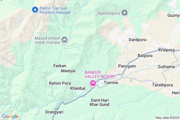
Panzgam A
Panzgam A Map
EDIT Map
Add Your House
 ..
..
Current Corona Virus Infected Patients Count in Kupwara District
| City Name | District Name | Total Covid cases |
|---|---|---|
| Kupwara District | Kupwara | 47 |
Locality Name :
Panzgam A
( पंजगाम ा )
Block Name : Kralpora
District : Kupwara
State : Jammu & Kashmir
Language : Urdu and Kashmiri
Current Time 09:33 PM
Date: Thursday , Apr 24,2025 (IST)
Time zone: IST (UTC+5:30)
Telephone Code / Std Code: 01952
Assembly constituency : assembly constituency
Assembly MLA :
Lok Sabha constituency : parliamentary constituency
Parliament MP :
Serpanch Name :
Pin Code : 193224
Post Office Name : Trehgam
Commodities Prices : Bumhama-Kupwara (F&V) Market / Mandi
Panzgam A Live Weather
Temperature: 0.1 °C
snow
Humidity: 94%
Wind : 1.71 mt/sec towards NE
StationName : "Athmuqam"
observed on 36 Mins Back
Temperature: 0.1 °C
snow
Humidity: 94%
Wind : 1.71 mt/sec towards NE
StationName : "Athmuqam"
observed on 36 Mins Back
Panzgam A Weather Forecast for Next 5 days
25-04-2025
3.5°C to 4.6°C
light rain, few clouds
3.5°C to 4.6°C
light rain, few clouds
26-04-2025
2.6°C to 17.4°C
clear sky, scattered clouds, few clouds
2.6°C to 17.4°C
clear sky, scattered clouds, few clouds
27-04-2025
3.8°C to 16.5°C
scattered clouds, overcast clouds, clear sky
3.8°C to 16.5°C
scattered clouds, overcast clouds, clear sky
28-04-2025
3.8°C to 20.4°C
clear sky
3.8°C to 20.4°C
clear sky
29-04-2025
5.0°C to 22.2°C
clear sky
5.0°C to 22.2°C
clear sky
Edit below overview about Panzgam A
Edit below overview about Panzgam A
OverView of Panzgam A
Panzgam A refers to one of the three blocks of village panzam. It is located near the karna kupwara highway.The place is considered as the head of the other village which come after it. Most of the people are farmers and a good no are also serving in various departments of jak government . The youth here are well aware of the avenues available to them I A large airfield is also present which caters the need of sporting to the adjacent villages as well.it is developing at a good pace and the tourist destination bungus is going to ccreat employment avenues to the down and out section of the village in particular. Moreover panzgam is endowed with natural beauty grass land forests river kehmil which is life line of the whole area.students from panzgam are capable of cracking every exam be it at state or national level. A bunch of students are also crazy after fashion and modelling. The facilities available to the ppl of panzgam are a govt boyd school and a gitls middle school along with a private school which was once producing good students but due to corruption and chauvinistic approach is on wane.Edit below overview about Panzgam A
National Highways Reachable To Panzgam A
Nationa High Way :NH701
Nationa High Way :NH1
Nationa High Way :NH701
Nationa High Way :NH1
Rivers Near Panzgam A
Hamal Nala
Talri Nala
Hamal Nala
Talri Nala
About Panzgam A
Panzgam A is a Village in Kralpora Block in Kupwara District of Jammu & Kashmir State, India. It is located 24 KM towards west from District head quarters Kupwara. 98 KM from State capital Srinagar, Jammu
Panzgam A Pin code is 193224 and postal head office is Trehgam .
Panzgam B ( KM ) , Chowkibal ( 3 KM ) , Tumina ( 3 KM ) , Hafrada ( 7 KM ) , Dard Harie ( 8 KM ) are the nearby Villages to Panzgam A. Panzgam A is surrounded by Ramhal Block towards East , Trehgam Block towards East , Rajwar Block towards East , Kupwara Block towards East .
Baramula , Sopore , Bandipore , Punch are the near by Cities to Panzgam A.
Panzgam 2011 Census Details
Panzgam A Local Language is Urdu. Panzgam Village Total population is 14453 and number of houses are 1410. Female Population is 40.9%. Village literacy rate is 56.0% and the Female Literacy rate is 17.1%.
Population
| Census Parameter | Census Data |
| Total Population | 14453 |
| Total No of Houses | 1410 |
| Female Population % | 40.9 % ( 5910) |
| Total Literacy rate % | 56.0 % ( 8091) |
| Female Literacy rate | 17.1 % ( 2467) |
| Scheduled Tribes Population % | 13.9 % ( 2002) |
| Scheduled Caste Population % | 0.1 % ( 10) |
| Working Population % | 30.5 % |
| Child(0 -6) Population by 2011 | 3554 |
| Girl Child(0 -6) Population % by 2011 | 47.2 % ( 1678) |
Panzgam Census More Deatils.
HOW TO REACH Panzgam A
By Rail
There is no railway station near to Panzgam A in less than 10 km.Colleges near Panzgam A
Govt Degree Collage Sogam
Address :
Govt. Degree College Tangdhar Karnah
Address :
Govt Degree College Handwara
Address :
Govt. Degree College Langate
Address :
Govt. Degree College Handwara
Address :
Schools in Panzgam A
Ms Ridi
Address : panzgam , kralpora , kupwara , Jammu & Kashmir . PIN- 193224 , Post - Trehgam
H S Panzgam
Address : panzgam , kralpora , kupwara , Jammu & Kashmir . PIN- 193224 , Post - Trehgam
Ssa Bara Mohala
Address : panzgam , kralpora , kupwara , Jammu & Kashmir . PIN- 193224 , Post - Trehgam
Ssa Mondra Bala
Address : panzgam , kralpora , kupwara , Jammu & Kashmir . PIN- 193224 , Post - Trehgam
Mps Bunpora
Address : panzgam , kralpora , kupwara , Jammu & Kashmir . PIN- 193224 , Post - Trehgam
Govt Health Centers near Panzgam A
1) NTPHC Balhama , Balhama , Near Jamia Masjid , Balhama2) Phc Panzalla , Panzalla , Near Police Station , Panzalla
3) Sc Braman , Braman , Shalkote Road , Near Jamia Masjid
Petrol Bunks in Panzgam A,Kralpora
HP PETROL PUMP - HABIB MOTORS
HPC Petrol Pump chokibal Road Tehsil Kupwara; Jammu; Jammu and Kashmir 193222
21.5 KM distance Detail
more ..
Colleges in Panzgam A,Kralpora
VIIT COMPUTER INSTITUTE
CHOWKIBAL ROAD KRALPORA NEAR ZEO OFFICE KUPWARA Jammu and Kashmir; 193224
9.4 KM distance Detail
Government Degree College Bohipora Kupwara
Kupwara-Kralpora Rd; Forest Block; Jammu and Kashmir 193222
22.7 KM distance Detail
more ..
Schools in Panzgam A,Kralpora
Government Boys High School
Kupwara Tregam Rd; Tumina; Jammu and Kashmir 193224
2.9 KM distance Detail
Electronic Shops in Panzgam A,Kralpora
Star Computers And Electronics Tarathpora
Tarathpora Kupwara Jammu and Kashmir; 193224
9.6 KM distance Detail
Super Markets in Panzgam A,Kralpora
Local Parks in Panzgam A,Kralpora
About Panzgam A &
History
How to reach Panzgam A
Tourist Places Near By Panzgam A
Schools in Panzgam A
Colleges in Panzgam A
Temperature & weather of Panzgam A
places in Panzgam A
Panzgam A photos
More Information
How to reach Panzgam A
Tourist Places Near By Panzgam A
Schools in Panzgam A
Colleges in Panzgam A
Temperature & weather of Panzgam A
places in Panzgam A
Panzgam A photos
More Information
Village Talk
Post News or Events about this Village
Near Cities
Baramula 49 KM near
Sopore 51 KM near
Bandipore 64 KM near
Punch 89 KM near
Baramula 49 KM near
Sopore 51 KM near
Bandipore 64 KM near
Punch 89 KM near
Near By Taluks
Kralpora 0 KM near
Ramhal 14 KM near
Trehgam 15 KM near
Rajwar 20 KM near
Kralpora 0 KM near
Ramhal 14 KM near
Trehgam 15 KM near
Rajwar 20 KM near
Near By Air Ports
Srinagar Airport 96 KM near
Satwari Airport 240 KM near
Pathankot Airport 328 KM near
Raja Sansi Airport 355 KM near
Srinagar Airport 96 KM near
Satwari Airport 240 KM near
Pathankot Airport 328 KM near
Raja Sansi Airport 355 KM near
Near By Tourist Places
Lolab Valley 15 KM near
Kupwara 34 KM near
Watlab 47 KM near
Baramulla 47 KM near
Gulmarg 64 KM near
Lolab Valley 15 KM near
Kupwara 34 KM near
Watlab 47 KM near
Baramulla 47 KM near
Gulmarg 64 KM near
Near By Districts
Kupwara 23 KM near
Baramulla 47 KM near
Bandipora 63 KM near
Ganderbal 82 KM near
Kupwara 23 KM near
Baramulla 47 KM near
Bandipora 63 KM near
Ganderbal 82 KM near
Near By RailWay Station
Udhampur Rail Way Station 226 KM near
Jammu Tawi Rail Way Station 238 KM near
Udhampur Rail Way Station 226 KM near
Jammu Tawi Rail Way Station 238 KM near