| Home | City Bus | Maps | Villages | Cities | Rail | Tourist Places | School | College | Pin Codes | Corona Cases Count |
| Distance Calculator Bus Services IFSC Codes Trace Mobile Number Weather Search Place Trace IP Available Cash ATM/Banks Locate Polling Booth Report an Error contact People |
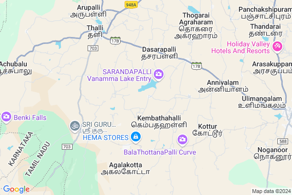
Neralatty
Neralatty Map
EDIT Map
Add Your House
 ..
..
Current Corona Virus Infected Patients Count in Krishnagiri District
| City Name | District Name | Total Covid cases |
|---|
Locality Name :
Neralatty
( நேரலாட்டி )
Block Name : Thally
District : Krishnagiri
State : Tamil Nadu
Language : Tamil and Telugu And Kannada
Current Time 11:58 AM
Date: Friday , Mar 14,2025 (IST)
Time zone: IST (UTC+5:30)
Elevation / Altitude: 804 meters. Above Seal level
Telephone Code / Std Code: 04347
Assembly constituency : Thalli assembly constituency
Assembly MLA : Ramachandran.T
Lok Sabha constituency : Krishnagiri parliamentary constituency
Parliament MP : Dr.A.CHELLAKUMAR
Serpanch Name :
Pin Code : 635107
Post Office Name : Denkanikotta
Main Village Name : Sarandapalli
Commodities Prices : Kanakapura Market / Mandi
National Highways Reachable To Neralatty
Nationa High Way :NH44
Nationa High Way :NH275
Nationa High Way :NH44
Nationa High Way :NH275
Rivers Near Neralatty
Chinnar
Hebballa :ಹೆಬ್ಬಳ್ಳ
Chinnar
Hebballa :ಹೆಬ್ಬಳ್ಳ
About Neralatty
Correct below Info and add more info about NeralattyNeralatty is a small Village/hamlet in Thally Block in Krishnagiri District of Tamil Nadu State, India. It comes under Sarandapalli Panchayath. It is located 67 KM towards west from District head quarters Krishnagiri. 2 KM from Thally. 331 KM from State capital Chennai
Neralatty Pin code is 635107 and postal head office is Denkanikotta .
Neralatty is surrounded by Kelamangalam Block towards East , Hosur Block towards North , Kanakapura Block towards west , Shoolagiri Block towards East .
Bangalore , Ramanagaram , Malur , Malavalli are the near by Cities to Neralatty.
Demographics of Neralatty
Tamil is the Local Language here.Politics in Neralatty
DMK , BJP , CPI , INC are the major political parties in this area.Polling Stations /Booths near Neralatty
1)Panchayat Union Primary School Sangepalli 635 118.2)Panchayat Union Primary School Bettamugalalam 636 806.
3)Panchayat Union Primary School Kelamangalam(telegu) - 635 113
4)Panchayat Union Primary School Mattiyur 635 102
5)Panchayat Union Primary School Sesurajapuram - 635 102.
HOW TO REACH Neralatty
By Rail
There is no railway station near to Neralatty in less than 10 km.Colleges near Neralatty
Sivagamiammal College Of Arts & Science
Address :
Gonzaga College Of Arts And Science For Women
Address :
New India Academy
Address :
Archina Instution Of Engineering College
Address :
Hits College Of Engineering
Address :
Schools near Neralatty
Govt.high School Alenatham
Address : Alenatham,Bennangur
Govt High School
Address : GOVT HIGH SCHOOL
BOOTHATTIKOTTAI.VILL
DENKANIKOTTAI TK
KRISHNAGIRI DT
PIN-635107.
Govt High School
Address : govt high school
Andevanapally p.o
denkanikottai t.k
krishnagiri d.t
St Joseph High School
Address : Sesurajapuram (po)
Denkanikottai (tk)
Krishnagiri (dt)
pin:635 102
Govt Health Centers near Neralatty
1) Kakkadasam , Primary Health Centre - Kakkadasam , Kakkadasam , Near proviousional store2) THALLI , Primary Health Centre -Thally , Thally ,
3) Doddauppanur , HSC Doddauppanoor , Doddauppanoor ,
Hospitals in Neralatty,Thally
Government Primary Health Centre
17; Hosur - Thally Rd; Shanthi Nagar West; Hosur; Tamil Nadu 635107; India
5.0 KM distance Detail
more ..
Petrol Bunks in Neralatty,Thally
HP Petrol Pump - Manjushree Service Station
Hpcl Dealers OLD S.no.884/1b AND NEW S.NO 884/1C Thalli Kothanur Village; Coimbatore; Tamil Nadu 635118; India
7.1 KM distance Detail
Hindustan Petroleum
17; Hosur - Thally Rd; Shanthi Nagar West; Hosur; Tamil Nadu 635118; India
7.2 KM distance Detail
more ..
Colleges in Neralatty,Thally
Taneja Aerospace and Aviation Limited.
Belagondapalli Village; Thally Road; Denkanikotta Taluk; Belagondapalli; Tamil Nadu 635114; India
18.7 KM distance Detail
Vishwa Chethana PU College
#36; 4th Cross; 1st Main; Opp Saptharshi Dyana Kendra; Hosur Road; Rajarajeshwari Layout; Anekal; Karnataka 562106; India
21.0 KM distance Detail
Asb Government Pre University College
Anekal Town; Bangalore; Karnataka 562106; India
22.2 KM distance Detail
more ..
Schools in Neralatty,Thally
Thooya Sagaya Madha Middle School; Dasarapally
Kuppatti; Tamil Nadu 635118; India
4.7 KM distance Detail
Governement Offices near Neralatty,Thally
Kuppatti Panchayath Office
Kuppatti Village; C.R.Palyam Post; Kuppatti Rd; Off Hosur-Thally Rd; Denkanikota Taluk; Krishnagiri District; Chinnappareddypalayam; Tamil Nadu 635114; India
7.8 KM distance Detail
About Neralatty &
History
How to reach Neralatty
Tourist Places Near By Neralatty
Schools in Neralatty
Colleges in Neralatty
Temperature & weather of Neralatty
places in Neralatty
Neralatty photos
More Information
How to reach Neralatty
Tourist Places Near By Neralatty
Schools in Neralatty
Colleges in Neralatty
Temperature & weather of Neralatty
places in Neralatty
Neralatty photos
More Information
Village Talk
Post News or Events about this Village
Near Cities
Bangalore 49 KM near
Ramanagaram 54 KM near
Malur 65 KM near
Malavalli 76 KM near
Bangalore 49 KM near
Ramanagaram 54 KM near
Malur 65 KM near
Malavalli 76 KM near
Near By Taluks
Thally 2 KM near
Kelamangalam 22 KM near
Hosur 30 KM near
Kanakapura 30 KM near
Thally 2 KM near
Kelamangalam 22 KM near
Hosur 30 KM near
Kanakapura 30 KM near
Near By Air Ports
Bengaluru International Airport 82 KM near
Salem Airport 125 KM near
Mysore Airport 129 KM near
Peelamedu Airport 203 KM near
Bengaluru International Airport 82 KM near
Salem Airport 125 KM near
Mysore Airport 129 KM near
Peelamedu Airport 203 KM near
Near By Tourist Places
Hogenakkal 51 KM near
Bangalore 54 KM near
Bheemeshwari 56 KM near
MM Hills 64 KM near
Savandurga 65 KM near
Hogenakkal 51 KM near
Bangalore 54 KM near
Bheemeshwari 56 KM near
MM Hills 64 KM near
Savandurga 65 KM near
Near By Districts
Bangalore 54 KM near
Ramanagara 54 KM near
Krishnagiri 64 KM near
Dharmapuri 77 KM near
Bangalore 54 KM near
Ramanagara 54 KM near
Krishnagiri 64 KM near
Dharmapuri 77 KM near
Near By RailWay Station
Hosur Rail Way Station 27 KM near
Bidadi Rail Way Station 48 KM near
Hosur Rail Way Station 27 KM near
Bidadi Rail Way Station 48 KM near