| Home | City Bus | Maps | Villages | Cities | Rail | Tourist Places | School | College | Pin Codes | Corona Cases Count |
| Distance Calculator Bus Services IFSC Codes Trace Mobile Number Weather Search Place Trace IP Available Cash ATM/Banks Locate Polling Booth Report an Error contact People |
Kerthur
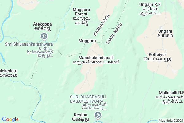
Kerthur Map
EDIT Map
Add Your House
 ..
..
Current Corona Virus Infected Patients Count in Krishnagiri District
| City Name | District Name | Total Covid cases |
|---|
Locality Name :
Kerthur
( கெர்துர் )
Block Name : Thally
District : Krishnagiri
State : Tamil Nadu
Language : Tamil and Telugu And Kannada
Current Time 11:43 AM
Date: Friday , Mar 14,2025 (IST)
Time zone: IST (UTC+5:30)
Elevation / Altitude: 804 meters. Above Seal level
Telephone Code / Std Code: 04347
Assembly constituency : Thalli assembly constituency
Assembly MLA : Ramachandran.T
Lok Sabha constituency : Krishnagiri parliamentary constituency
Parliament MP : Dr.A.CHELLAKUMAR
Serpanch Name :
Main Village Name : Manchigondapalli
Commodities Prices : Kolathur Market / Mandi
Kerthur Live Weather
Temperature: 33.9 °C
few clouds
Humidity: 24%
Wind : 2.86 mt/sec towards E
StationName : "KÄ\u0081nkÄ\u0081nhalli"
observed on Now
Temperature: 33.9 °C
few clouds
Humidity: 24%
Wind : 2.86 mt/sec towards E
StationName : "KÄ\u0081nkÄ\u0081nhalli"
observed on Now
Kerthur Weather Forecast for Next 5 days
15-03-2025
21.5°C to 34.7°C
few clouds, scattered clouds
21.5°C to 34.7°C
few clouds, scattered clouds
16-03-2025
20.0°C to 34.6°C
scattered clouds, clear sky, broken clouds
20.0°C to 34.6°C
scattered clouds, clear sky, broken clouds
17-03-2025
19.6°C to 35.0°C
scattered clouds, broken clouds, clear sky, few clouds, overcast clouds
19.6°C to 35.0°C
scattered clouds, broken clouds, clear sky, few clouds, overcast clouds
18-03-2025
20.3°C to 36.7°C
overcast clouds, broken clouds, scattered clouds
20.3°C to 36.7°C
overcast clouds, broken clouds, scattered clouds
19-03-2025
21.6°C to 36.3°C
broken clouds, scattered clouds, few clouds
21.6°C to 36.3°C
broken clouds, scattered clouds, few clouds
National Highways Reachable To Kerthur
Nationa High Way :NH44
Nationa High Way :NH275
Nationa High Way :NH44
Nationa High Way :NH275
Rivers Near Kerthur
Chinnar
Hebballa :ಹೆಬ್ಬಳ್ಳ
Chinnar
Hebballa :ಹೆಬ್ಬಳ್ಳ
About Kerthur
Correct below Info and add more info about KerthurKerthur is a small Village/hamlet in Thally Block in Krishnagiri District of Tamil Nadu State, India. It comes under Manchigondapalli Panchayath. It is located 92 KM towards west from District head quarters Krishnagiri. 42 KM from Thally. 358 KM from State capital Chennai
Kerthur is surrounded by Thally Block towards North , Kollegala Block towards west , Pennagaram Block towards East , Kelamangalam Block towards East .
Chamrajnagar , Malavalli , Ramanagaram , P.N.Patti are the near by Cities to Kerthur.
Demographics of Kerthur
Tamil is the Local Language here.Politics in Kerthur
DMK , BJP , CPI , INC are the major political parties in this area.Polling Stations /Booths near Kerthur
1)Panchayat Union Primary School Athikottai 635 107.2)Panchayat Union Primary School Kendikanapalli (telugu) 635107.
3)Panchayat Union Primary School Baiyareddythotti 635 118
4)Panchayat Union Primary School Bevanatham 635 107.
5)Panchayat Union Primary School Komaranapalli 635 114.
HOW TO REACH Kerthur
By Rail
There is no railway station near to Kerthur in less than 10 km.Pincodes near Kerthur
635102 ( Anchetty ) , 635107 ( Denkanikotta ) , 635118 ( Thally )Colleges near Kerthur
Sivagamiammal College Of Arts & Science
Address :
Gonzaga College Of Arts And Science For Women
Address :
New India Academy
Address :
Archina Instution Of Engineering College
Address :
Hits College Of Engineering
Address :
Schools near Kerthur
Govt.high School Alenatham
Address : Alenatham,Bennangur
Govt High School
Address : GOVT HIGH SCHOOL
BOOTHATTIKOTTAI.VILL
DENKANIKOTTAI TK
KRISHNAGIRI DT
PIN-635107.
Govt High School
Address : govt high school
Andevanapally p.o
denkanikottai t.k
krishnagiri d.t
St Joseph High School
Address : Sesurajapuram (po)
Denkanikottai (tk)
Krishnagiri (dt)
pin:635 102
Govt Health Centers near Kerthur
1) Urigam , Urigam-Phc , Urigam ,2) Amuthakondapalli , HSC-Amuthakondapalli , Amuthakondapalli , Near Telugu School
3) ANCHETTY , Community Health Center-Anchetti , Anchetti , Anjaneyar kvoil
Electronic Shops in Kerthur,Thally
Super Markets in Kerthur,Thally
Local Parks in Kerthur,Thally
Police Stations near Kerthur,Thally
Governement Offices near Kerthur,Thally
About Kerthur &
History
How to reach Kerthur
Tourist Places Near By Kerthur
Schools in Kerthur
Colleges in Kerthur
Temperature & weather of Kerthur
places in Kerthur
Kerthur photos
More Information
How to reach Kerthur
Tourist Places Near By Kerthur
Schools in Kerthur
Colleges in Kerthur
Temperature & weather of Kerthur
places in Kerthur
Kerthur photos
More Information
Village Talk
Post News or Events about this Village
Near Cities
Chamrajnagar 44 KM near
Malavalli 57 KM near
Ramanagaram 64 KM near
P.N.Patti 68 KM near
Chamrajnagar 44 KM near
Malavalli 57 KM near
Ramanagaram 64 KM near
P.N.Patti 68 KM near
Near By Taluks
Kanakapura 31 KM near
Thally 40 KM near
Kollegala 42 KM near
Pennagaram 50 KM near
Kanakapura 31 KM near
Thally 40 KM near
Kollegala 42 KM near
Pennagaram 50 KM near
Near By Air Ports
Mysore Airport 108 KM near
Salem Airport 108 KM near
Bengaluru International Airport 117 KM near
Peelamedu Airport 165 KM near
Mysore Airport 108 KM near
Salem Airport 108 KM near
Bengaluru International Airport 117 KM near
Peelamedu Airport 165 KM near
Near By Tourist Places
MM Hills 30 KM near
Bheemeshwari 32 KM near
Hogenakkal 32 KM near
Shivanasamundram 46 KM near
BR Hills 52 KM near
MM Hills 30 KM near
Bheemeshwari 32 KM near
Hogenakkal 32 KM near
Shivanasamundram 46 KM near
BR Hills 52 KM near
Near By Districts
Ramanagara 64 KM near
Dharmapuri 77 KM near
Chamarajanagar 83 KM near
Mandya 84 KM near
Ramanagara 64 KM near
Dharmapuri 77 KM near
Chamarajanagar 83 KM near
Mandya 84 KM near
Near By RailWay Station
Channapatna Rail Way Station 63 KM near
Ramanagaram Rail Way Station 64 KM near
Channapatna Rail Way Station 63 KM near
Ramanagaram Rail Way Station 64 KM near