| Home | City Bus | Maps | Villages | Cities | Rail | Tourist Places | School | College | Pin Codes | Corona Cases Count |
| Distance Calculator Bus Services IFSC Codes Trace Mobile Number Weather Search Place Trace IP Available Cash ATM/Banks Locate Polling Booth Report an Error contact People |
Elayasandram
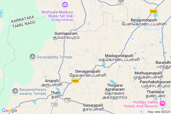
Elayasandram Map
EDIT Map
Add Your House
 ..
..
Current Corona Virus Infected Patients Count in Krishnagiri District
| City Name | District Name | Total Covid cases |
|---|
Locality Name :
Elayasandram
( எலெயாசான்றாம் )
Block Name : Thally
District : Krishnagiri
State : Tamil Nadu
Language : Tamil and Telugu And Kannada
Current Time 12:22 PM
Date: Friday , Mar 14,2025 (IST)
Time zone: IST (UTC+5:30)
Elevation / Altitude: 804 meters. Above Seal level
Telephone Code / Std Code: 04347
Assembly constituency : Thalli assembly constituency
Assembly MLA : Ramachandran.T
Lok Sabha constituency : Krishnagiri parliamentary constituency
Parliament MP : Dr.A.CHELLAKUMAR
Serpanch Name :
Pin Code : 635118
Post Office Name : Thally
Main Village Name : Binnamangalam
Commodities Prices : Kanakapura Market / Mandi
Elayasandram Live Weather
Temperature: 29.9 °C
few clouds
Humidity: 25%
Wind : 3.95 mt/sec towards E
StationName : "Anekal"
observed on 2 Hours Back
Temperature: 29.9 °C
few clouds
Humidity: 25%
Wind : 3.95 mt/sec towards E
StationName : "Anekal"
observed on 2 Hours Back
Elayasandram Weather Forecast for Next 5 days
15-03-2025
21.5°C to 33.4°C
few clouds, broken clouds, scattered clouds
21.5°C to 33.4°C
few clouds, broken clouds, scattered clouds
16-03-2025
20.3°C to 33.2°C
broken clouds, few clouds, scattered clouds, overcast clouds, clear sky
20.3°C to 33.2°C
broken clouds, few clouds, scattered clouds, overcast clouds, clear sky
17-03-2025
19.7°C to 33.9°C
clear sky, broken clouds, scattered clouds, few clouds, overcast clouds
19.7°C to 33.9°C
clear sky, broken clouds, scattered clouds, few clouds, overcast clouds
18-03-2025
20.0°C to 34.8°C
overcast clouds, broken clouds, scattered clouds
20.0°C to 34.8°C
overcast clouds, broken clouds, scattered clouds
19-03-2025
21.2°C to 35.1°C
broken clouds, scattered clouds, few clouds, clear sky
21.2°C to 35.1°C
broken clouds, scattered clouds, few clouds, clear sky
National Highways Reachable To Elayasandram
Nationa High Way :NH44
Nationa High Way :NH275
Nationa High Way :NH44
Nationa High Way :NH275
Rivers Near Elayasandram
Chinnar
Hebballa :ಹೆಬ್ಬಳ್ಳ
Chinnar
Hebballa :ಹೆಬ್ಬಳ್ಳ
About Elayasandram
Correct below Info and add more info about ElayasandramElayasandram is a small Village/hamlet in Thally Block in Krishnagiri District of Tamil Nadu State, India. It comes under Binnamangalam Panchayath. It is located 68 KM towards west from District head quarters Krishnagiri. 9 KM from Thally. 329 KM from State capital Chennai
Elayasandram Pin code is 635118 and postal head office is Thally .
Elayasandram is surrounded by Kelamangalam Block towards East , Hosur Block towards East , Kanakapura Block towards west , Shoolagiri Block towards East .
Bangalore , Ramanagaram , Malur , Magadi are the near by Cities to Elayasandram.
Demographics of Elayasandram
Tamil is the Local Language here.Politics in Elayasandram
DMK , BJP , CPI , INC are the major political parties in this area.Polling Stations /Booths near Elayasandram
1)Panchayat Union Middle School Akkondapalli (myrada Building).2)Panchayat Union Middle School Akkgondapalli 635112 South Facing West Wing Terraced Building .
3)Ourlady Primary Tamil School Mathgondapalli 635 114 North Facing East Wing Terraced Building
4)Panchayat Union Primary School Uchanapalli 635 107.
5)Panchayat Union Primary School Kakkathasam 635 107 South Facing East Wing Terraced Building
HOW TO REACH Elayasandram
By Rail
There is no railway station near to Elayasandram in less than 10 km.Colleges near Elayasandram
Sivagamiammal College Of Arts & Science
Address :
Gonzaga College Of Arts And Science For Women
Address :
New India Academy
Address :
Archina Instution Of Engineering College
Address :
Hits College Of Engineering
Address :
Schools near Elayasandram
Govt.high School Alenatham
Address : Alenatham,Bennangur
Govt High School
Address : GOVT HIGH SCHOOL
BOOTHATTIKOTTAI.VILL
DENKANIKOTTAI TK
KRISHNAGIRI DT
PIN-635107.
Govt High School
Address : govt high school
Andevanapally p.o
denkanikottai t.k
krishnagiri d.t
St Joseph High School
Address : Sesurajapuram (po)
Denkanikottai (tk)
Krishnagiri (dt)
pin:635 102
Govt Health Centers near Elayasandram
1) Doddauppanur , HSC Doddauppanoor , Doddauppanoor ,2) THALLI , Primary Health Centre -Thally , Thally ,
3) Kakkadasam , Primary Health Centre - Kakkadasam , Kakkadasam , Near proviousional store
Hospitals in Elayasandram,Thally
Government Primary Health Centre
17; Hosur - Thally Rd; Shanthi Nagar West; Hosur; Tamil Nadu 635107; India
9.4 KM distance Detail
Veterinary Hospital Anekal
Bayasabhi Layout; KSRTC Colony; Anekal; Karnataka 562106; India
10.3 KM distance Detail
more ..
Petrol Bunks in Elayasandram,Thally
HP Petrol Pump - Manjushree Service Station
Hpcl Dealers OLD S.no.884/1b AND NEW S.NO 884/1C Thalli Kothanur Village; Coimbatore; Tamil Nadu 635118; India
6.3 KM distance Detail
Hindustan Petroleum
17; Hosur - Thally Rd; Shanthi Nagar West; Hosur; Tamil Nadu 635118; India
6.3 KM distance Detail
SPT AUTO FUELS
Chandapura - Anekal Rd; Weaver Colony; Anekal; Karnataka 562106; India
9.9 KM distance Detail
more ..
Colleges in Elayasandram,Thally
Vishwa Chethana PU College
#36; 4th Cross; 1st Main; Opp Saptharshi Dyana Kendra; Hosur Road; Rajarajeshwari Layout; Anekal; Karnataka 562106; India
9.4 KM distance Detail
Taneja Aerospace and Aviation Limited.
Belagondapalli Village; Thally Road; Denkanikotta Taluk; Belagondapalli; Tamil Nadu 635114; India
10.3 KM distance Detail
Asb Government Pre University College
Anekal Town; Bangalore; Karnataka 562106; India
10.5 KM distance Detail
KUSHAL TOURS & TRAVELS ENTERPRISES
Shop #2; Near Raghavendra Bhavan Mirza Road; Anekal;; Bangalore; Karnataka 562106; India
10.5 KM distance Detail
more ..
Schools in Elayasandram,Thally
Shree Annapoorneshwari Nursery and Primary School
17; Hosur - Thally Rd; Shanthi Nagar West; Hosur; Tamil Nadu 635118; India
2.7 KM distance Detail
SHEMFORD Futuristic School-Hosur
Sy.no:99/3A;3B Near Madagondapally Edu. Center; Denkanikottai Taluk Devaganapally; Sanaboganapalli road; Hosur - Thally Rd; Tamil Nadu 635114; India
3.8 KM distance Detail
Panchayat Union Middle School
17; Hosur - Thally Rd; Shanthi Nagar West; Hosur; Tamil Nadu 635118; India
4.0 KM distance Detail
Super Markets in Elayasandram,Thally
Sri Chowdeshwari Provision Store
Kuvempu Rd; Bayasabhi Layout; KSRTC Colony; Anekal; Karnataka 562106; India
10.3 KM distance Detail
DHAVANAM SUPER MARKET
N.R.Road; Near Sri Rama utter; Anekal;; Bangalore;; Karnataka 562106; India
10.5 KM distance Detail
Governement Offices near Elayasandram,Thally
Kuppatti Panchayath Office
Kuppatti Village; C.R.Palyam Post; Kuppatti Rd; Off Hosur-Thally Rd; Denkanikota Taluk; Krishnagiri District; Chinnappareddypalayam; Tamil Nadu 635114; India
4.3 KM distance Detail
About Elayasandram &
History
How to reach Elayasandram
Tourist Places Near By Elayasandram
Schools in Elayasandram
Colleges in Elayasandram
Temperature & weather of Elayasandram
places in Elayasandram
Elayasandram photos
More Information
How to reach Elayasandram
Tourist Places Near By Elayasandram
Schools in Elayasandram
Colleges in Elayasandram
Temperature & weather of Elayasandram
places in Elayasandram
Elayasandram photos
More Information
Village Talk
Post News or Events about this Village
Near Cities
Bangalore 38 KM near
Ramanagaram 51 KM near
Malur 55 KM near
Magadi 70 KM near
Bangalore 38 KM near
Ramanagaram 51 KM near
Malur 55 KM near
Magadi 70 KM near
Near By Taluks
Thally 9 KM near
Kelamangalam 22 KM near
Hosur 22 KM near
Kanakapura 34 KM near
Thally 9 KM near
Kelamangalam 22 KM near
Hosur 22 KM near
Kanakapura 34 KM near
Near By Air Ports
Bengaluru International Airport 70 KM near
Mysore Airport 132 KM near
Salem Airport 135 KM near
Peelamedu Airport 214 KM near
Bengaluru International Airport 70 KM near
Mysore Airport 132 KM near
Salem Airport 135 KM near
Peelamedu Airport 214 KM near
Near By Tourist Places
Bangalore 44 KM near
Savandurga 57 KM near
Bheemeshwari 62 KM near
Hogenakkal 63 KM near
MM Hills 75 KM near
Bangalore 44 KM near
Savandurga 57 KM near
Bheemeshwari 62 KM near
Hogenakkal 63 KM near
MM Hills 75 KM near
Near By Districts
Bangalore 43 KM near
Ramanagara 51 KM near
Krishnagiri 65 KM near
Bangalore Rural 76 KM near
Bangalore 43 KM near
Ramanagara 51 KM near
Krishnagiri 65 KM near
Bangalore Rural 76 KM near
Near By RailWay Station
Hosur Rail Way Station 19 KM near
Bidadi Rail Way Station 42 KM near
Hosur Rail Way Station 19 KM near
Bidadi Rail Way Station 42 KM near