| Home | City Bus | Maps | Villages | Cities | Rail | Tourist Places | School | College | Pin Codes | Corona Cases Count |
| Distance Calculator Bus Services IFSC Codes Trace Mobile Number Weather Search Place Trace IP Available Cash ATM/Banks Locate Polling Booth Report an Error contact People |
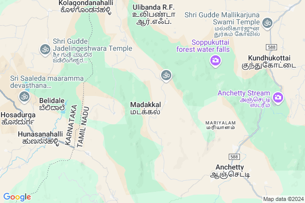
Belalam
Belalam Map
EDIT Map
Add Your House
 ..
..
Current Corona Virus Infected Patients Count in Krishnagiri District
| City Name | District Name | Total Covid cases |
|---|
Locality Name :
Belalam
( பெறலாம் )
Block Name : Thally
District : Krishnagiri
State : Tamil Nadu
Language : Tamil and Telugu And Kannada
Current Time 07:00 AM
Date: Saturday , Apr 26,2025 (IST)
Time zone: IST (UTC+5:30)
Elevation / Altitude: 804 meters. Above Seal level
Telephone Code / Std Code: 04347
Assembly constituency : Thalli assembly constituency
Assembly MLA : Ramachandran.T
Lok Sabha constituency : Krishnagiri parliamentary constituency
Parliament MP : Dr.A.CHELLAKUMAR
Serpanch Name :
Pin Code : 635102
Post Office Name : Anchetty
Main Village Name : Madakkal
Commodities Prices : Kolathur Market / Mandi
Belalam Live Weather
Temperature: 23.3 °C
overcast clouds
Humidity: 76%
Wind : 2 mt/sec towards SE
StationName : "Denkanikota"
observed on Now
Temperature: 23.3 °C
overcast clouds
Humidity: 76%
Wind : 2 mt/sec towards SE
StationName : "Denkanikota"
observed on Now
Belalam Weather Forecast for Next 5 days
27-04-2025
22.0°C to 33.4°C
overcast clouds
22.0°C to 33.4°C
overcast clouds
28-04-2025
21.9°C to 35.4°C
overcast clouds, broken clouds, few clouds, light rain
21.9°C to 35.4°C
overcast clouds, broken clouds, few clouds, light rain
29-04-2025
21.4°C to 33.5°C
broken clouds, scattered clouds, few clouds, light rain
21.4°C to 33.5°C
broken clouds, scattered clouds, few clouds, light rain
30-04-2025
22.1°C to 34.2°C
broken clouds, scattered clouds, light rain, overcast clouds
22.1°C to 34.2°C
broken clouds, scattered clouds, light rain, overcast clouds
01-05-2025
21.7°C to 35.4°C
overcast clouds, scattered clouds, few clouds, broken clouds, light rain
21.7°C to 35.4°C
overcast clouds, scattered clouds, few clouds, broken clouds, light rain
National Highways Reachable To Belalam
Nationa High Way :NH44
Nationa High Way :NH275
Nationa High Way :NH44
Nationa High Way :NH275
Rivers Near Belalam
Chinnar
Hebballa :ಹೆಬ್ಬಳ್ಳ
Chinnar
Hebballa :ಹೆಬ್ಬಳ್ಳ
About Belalam
Correct below Info and add more info about BelalamBelalam is a small Village/hamlet in Thally Block in Krishnagiri District of Tamil Nadu State, India. It comes under Madakkal Panchayath. It is located 72 KM towards west from District head quarters Krishnagiri. 21 KM from Thally. 339 KM from State capital Chennai
Belalam Pin code is 635102 and postal head office is Anchetty .
Belalam is surrounded by Kanakapura Block towards west , Kelamangalam Block towards East , Pennagaram Block towards South , Hosur Block towards North .
Ramanagaram , Chamrajnagar , Bangalore , Dharmapuri are the near by Cities to Belalam.
Demographics of Belalam
Tamil is the Local Language here.Politics in Belalam
DMK , BJP , CPI , INC are the major political parties in this area.Polling Stations /Booths near Belalam
1)Panchayat Union Primary School Arthakkal 635 102 West Facing South Wing Mangalore Tiled Building.2)Govt High School Jawalagiri 635 118.
3)Panchayat Union Middle School Thalli Kothanur 635118 West Facing South Wing Terraced Building.
4)Panchayat Union Primary School Erudukottai 635 107.
5)Panchayat Union Primary School Seerthimmanatti 635 107.
HOW TO REACH Belalam
By Rail
There is no railway station near to Belalam in less than 10 km.Colleges near Belalam
Sivagamiammal College Of Arts & Science
Address :
Gonzaga College Of Arts And Science For Women
Address :
New India Academy
Address :
Archina Instution Of Engineering College
Address :
Hits College Of Engineering
Address :
Schools near Belalam
Govt.high School Alenatham
Address : Alenatham,Bennangur
Govt High School
Address : GOVT HIGH SCHOOL
BOOTHATTIKOTTAI.VILL
DENKANIKOTTAI TK
KRISHNAGIRI DT
PIN-635107.
Govt High School
Address : govt high school
Andevanapally p.o
denkanikottai t.k
krishnagiri d.t
St Joseph High School
Address : Sesurajapuram (po)
Denkanikottai (tk)
Krishnagiri (dt)
pin:635 102
Govt Health Centers near Belalam
1) ANCHETTY , Community Health Center-Anchetti , Anchetti , Anjaneyar kvoil2) Urigam , Urigam-Phc , Urigam ,
3) Doddamanju , HSC Doddamanchi , Doddamanchi , Near Panchayat office
Hospitals in Belalam,Thally
Government Primary Health Centre
17; Hosur - Thally Rd; Shanthi Nagar West; Hosur; Tamil Nadu 635107; India
22.3 KM distance Detail
more ..
Electronic Shops in Belalam,Thally
SRI Krishna Rewinding &ele Works
Thally-Denkanikottai Road; Denkanikottai; Tamil Nadu 635107; India
22.2 KM distance Detail
Police Stations near Belalam,Thally
About Belalam &
History
How to reach Belalam
Tourist Places Near By Belalam
Schools in Belalam
Colleges in Belalam
Temperature & weather of Belalam
places in Belalam
Belalam photos
More Information
How to reach Belalam
Tourist Places Near By Belalam
Schools in Belalam
Colleges in Belalam
Temperature & weather of Belalam
places in Belalam
Belalam photos
More Information
Village Talk
Post News or Events about this Village
Near Cities
Ramanagaram 62 KM near
Chamrajnagar 67 KM near
Bangalore 67 KM near
Dharmapuri 68 KM near
Ramanagaram 62 KM near
Chamrajnagar 67 KM near
Bangalore 67 KM near
Dharmapuri 68 KM near
Near By Taluks
Thally 19 KM near
Kanakapura 30 KM near
Kelamangalam 33 KM near
Hosur 46 KM near
Thally 19 KM near
Kanakapura 30 KM near
Kelamangalam 33 KM near
Hosur 46 KM near
Near By Air Ports
Bengaluru International Airport 99 KM near
Salem Airport 111 KM near
Mysore Airport 124 KM near
Peelamedu Airport 187 KM near
Bengaluru International Airport 99 KM near
Salem Airport 111 KM near
Mysore Airport 124 KM near
Peelamedu Airport 187 KM near
Near By Tourist Places
Hogenakkal 35 KM near
MM Hills 46 KM near
Bheemeshwari 48 KM near
Shivanasamundram 63 KM near
Bangalore 71 KM near
Hogenakkal 35 KM near
MM Hills 46 KM near
Bheemeshwari 48 KM near
Shivanasamundram 63 KM near
Bangalore 71 KM near
Near By Districts
Ramanagara 62 KM near
Dharmapuri 68 KM near
Krishnagiri 68 KM near
Bangalore 71 KM near
Ramanagara 62 KM near
Dharmapuri 68 KM near
Krishnagiri 68 KM near
Bangalore 71 KM near
Near By RailWay Station
Hosur Rail Way Station 43 KM near
Bidadi Rail Way Station 60 KM near
Hosur Rail Way Station 43 KM near
Bidadi Rail Way Station 60 KM near