| Home | City Bus | Maps | Villages | Cities | Rail | Tourist Places | School | College | Pin Codes | Corona Cases Count |
| Distance Calculator Bus Services IFSC Codes Trace Mobile Number Weather Search Place Trace IP Available Cash ATM/Banks Locate Polling Booth Report an Error contact People |
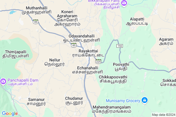
Rayakotta
Rayakotta Map
EDIT Map
Add Your House
 ..
..
Current Corona Virus Infected Patients Count in Krishnagiri District
| City Name | District Name | Total Covid cases |
|---|
Locality Name :
Rayakotta
( ராயக்கோட்டை )
Block Name : Kelamangalam
District : Krishnagiri
State : Tamil Nadu
Language : Tamil and Telugu And Kannada
Current Time 12:42 PM
Date: Friday , Apr 25,2025 (IST)
Time zone: IST (UTC+5:30)
Elevation / Altitude: 804 meters. Above Seal level
Telephone Code / Std Code: 04347
Assembly constituency : Veppanahalli assembly constituency
Assembly MLA : K.P.Munusamy
Lok Sabha constituency : Krishnagiri parliamentary constituency
Parliament MP : Dr.A.CHELLAKUMAR
Serpanch Name :
Pin Code : 635116
Post Office Name : Royakottah
Alternate Village Name : Rayakottai
Commodities Prices : Malur Market / Mandi
National Highways Reachable To Rayakotta
Nationa High Way :NH844
Nationa High Way :NH44;NH48
Nationa High Way :NH844
Nationa High Way :NH44;NH48
Rivers Near Rayakotta
Vrishabhavati :ವೃಶಭಾವತಿ
Vrishabhavati :ವೃಶಭಾವತಿ
Vrishabhavati :ವೃಶಭಾವತಿ
Vrishabhavati :ವೃಶಭಾವತಿ
About Rayakotta
Correct below Info and add more info about RayakottaRayakotta is a Village in Kelamangalam Block in Krishnagiri District of Tamil Nadu State, India. It is located 24 KM towards west from District head quarters Krishnagiri. 22 KM from Kelamangalam. 290 KM from State capital Chennai
Rayakotta Pin code is 635116 and postal head office is Royakottah .
Koppagarai ( 5 KM ) , Karukkanahalli ( 7 KM ) , Alapatti ( 7 KM ) , Bellampalli ( 8 KM ) , Ayaranapalli ( 12 KM ) are the nearby Villages to Rayakotta. Rayakotta is surrounded by Kelamangalam Block towards west , Shoolagiri Block towards North , Palakkodu Block towards South , Veppanapalli Block towards North .
Dharmapuri , Malur , Robertson Pet , Tirupathur are the near by Cities to Rayakotta.
Rayakotta 2011 Census Details
Rayakotta Local Language is Tamil. Rayakotta Village Total population is 8593 and number of houses are 2043. Female Population is 50.2%. Village literacy rate is 66.5% and the Female Literacy rate is 30.7%.
Population
| Census Parameter | Census Data |
| Total Population | 8593 |
| Total No of Houses | 2043 |
| Female Population % | 50.2 % ( 4311) |
| Total Literacy rate % | 66.5 % ( 5717) |
| Female Literacy rate | 30.7 % ( 2641) |
| Scheduled Tribes Population % | 0.2 % ( 15) |
| Scheduled Caste Population % | 5.4 % ( 466) |
| Working Population % | 46.4 % |
| Child(0 -6) Population by 2011 | 1043 |
| Girl Child(0 -6) Population % by 2011 | 47.6 % ( 496) |
Rayakotta Census More Deatils.
Politics in Rayakotta
DMDK , DMK are the major political parties in this area.Polling Stations /Booths near Rayakotta
1)Govt Hr. Sec. School Haleseebam 6351192)Govt. Boys Hr. Sec. School Rayakottai - 635 116
3)Govt. Boys Hr. Sec. School Rayakottai - 635 116
4)Govt. Boys Hr. Sec. School Rayakottai - 635 116
5)Govt Girls Hr Sec Shool Rayakottai 635116.
HOW TO REACH Rayakotta
By Rail
Rayakkottai Rail Way Station is the very nearby railway stations to Rayakotta.Colleges near Rayakotta
Government Polytechnic College, Bodichipalli Village, Kelamangalam.
Address :
Schools near Rayakotta
Anganvadi Sinthalagunga
Address : Sinthalagunga
Govt Health Centers near Rayakotta
1) Ullukurukki , Ullu kurukki-Phc , Ullu kurukki ,2) Poovathi , , Chikkapoovathi , Rayakottai road right side
3) Gummanur , , Gerigepalli ,
Sub Villages in Rayakotta
Hospitals in Rayakotta,Kelamangalam
Rajendran Hospital
Rayakottai;(P.o; Krishnagiri - Royakottai Rd; Rahamath Colony; Rayakottai; Tamil Nadu 635116; India
0.6 KM distance Detail
Primary Health Center
Rayakottai; Krishnagiri; SH-17; Krishnagiri Rayakotta Road; Krishnagiri; Krishnagiri; 635116; India
0.9 KM distance Detail
more ..
Petrol Bunks in Rayakotta,Kelamangalam
HP PETROL PUMP - UR FUELS
Rahamath Colony; Echanahalli; Tamil Nadu 635116; India
0.3 KM distance Detail
Hindustan Petroleum
Rayakottai; Dharmapuri; SH-17; Malur Hosur Adiyamancottah Road; Dharmapuri; Dharmapuri; 635116; India
1.8 KM distance Detail
UR FUELS
HOSUR BYE PASS; Rayakottai Rd; Echanahalli; Tamil Nadu 635116; India
1.8 KM distance Detail
more ..
Colleges in Rayakotta,Kelamangalam
Sri Venkateswara Institute of Engineering
NH 7 Hosur - Krishnagiri Road; Balagondarayanadurgam; Tamil Nadu 635121; India
15.6 KM distance Detail
Jeeva College of Nursing
NH 7 Hosur - Krishnagiri Road; Beemandapalli; Tamil Nadu 635121; India
16.8 KM distance Detail
Arignar Anna college Of Arts & Science
Krishnagiri; Tamil Nadu 635115; India
18.7 KM distance Detail
Arignar Anna College of Arts and Science
Chennekothapalli Rd; Kurubarapalli; Tamil Nadu 635115; India
18.7 KM distance Detail
more ..
Schools in Rayakotta,Kelamangalam
Govt Boys Higher Secondary School; Rayakottai
SH 17; Rahamath Colony; Rayakottai; Tamil Nadu 635116; India
0.3 KM distance Detail
Rayakottai Bustand
SH 17; Rahamath Colony; Rayakottai; Tamil Nadu 635116; India
0.5 KM distance Detail
Government Union Primary School
Rayakottai; Krishnagiri; SH-17; Krishnagiri Rayakotta Road; Krishnagiri; Krishnagiri; 635116; India
0.7 KM distance Detail
Mother Theresa Eci School
Krishnagiri - Royakottai Rd; Rayakottai; Tamil Nadu 635116; India
0.9 KM distance Detail
Electronic Shops in Rayakotta,Kelamangalam
Sri Balaji Traders
SH 17; Rahamath Colony; Rayakottai; Tamil Nadu 635116; India
0.5 KM distance Detail
SRI BALAANJANEYA MOBILES
Krishnagiri Main Road Near Anna Silai; Rayakottai; Tamil Nadu 635116; India
0.6 KM distance Detail
Star Communications Rayakottai
Ramunaiyudu Complex; Near Rayakottai Bus Stand; Hosur Road; Rayakottai; Tamil Nadu 635116; India
0.6 KM distance Detail
Super Markets in Rayakotta,Kelamangalam
BABA two wheeler stand
Jakkasamudram-Rayakottai Rd; Rahamath Colony; Rayakottai; Tamil Nadu 635116; India
0.3 KM distance Detail
Police Stations near Rayakotta,Kelamangalam
Police Station
Hosur Mani Road; post;Krishanagiri Dt;; Uddanapalli; Tamil Nadu 635119; India
17.0 KM distance Detail
Police Quarters
post;; Denkanikottai-Shoolagiri Rd; Uddanapalli; Tamil Nadu; India
17.4 KM distance Detail
Shoolagiri Police Station
Chennekothapalli Rd; Shoolagiri; Tamil Nadu 635117; India
20.0 KM distance Detail
Governement Offices near Rayakotta,Kelamangalam
Sub Registrar Office; Rayakottai
4/633-A ; Bharathi school back side; Rayakottai;(P.o);; Krishnagiri - Royakottai Road; Rayakottai; Tamil Nadu 635116; India
0.7 KM distance Detail
Assistant Engineer Office
Alapatti; Krishnagiri; NH-7; Krishnagiri Rayakottai Road; Krishnagiri; Krishnagiri; 635122; India
8.6 KM distance Detail
About Rayakotta &
History
How to reach Rayakotta
Tourist Places Near By Rayakotta
Schools in Rayakotta
Colleges in Rayakotta
Temperature & weather of Rayakotta
places in Rayakotta
Rayakotta photos
More Information
How to reach Rayakotta
Tourist Places Near By Rayakotta
Schools in Rayakotta
Colleges in Rayakotta
Temperature & weather of Rayakotta
places in Rayakotta
Rayakotta photos
More Information
Village Talk
Post News or Events about this Village
Near Cities
Dharmapuri 50 KM near
Malur 62 KM near
Robertson Pet 62 KM near
Tirupathur 69 KM near
Dharmapuri 50 KM near
Malur 62 KM near
Robertson Pet 62 KM near
Tirupathur 69 KM near
Near By Taluks
Krishnagiri 21 KM near
Kelamangalam 21 KM near
Shoolagiri 22 KM near
Palakkodu 25 KM near
Krishnagiri 21 KM near
Kelamangalam 21 KM near
Shoolagiri 22 KM near
Palakkodu 25 KM near
Near By Air Ports
Bengaluru International Airport 94 KM near
Salem Airport 108 KM near
Mysore Airport 169 KM near
Peelamedu Airport 220 KM near
Bengaluru International Airport 94 KM near
Salem Airport 108 KM near
Mysore Airport 169 KM near
Peelamedu Airport 220 KM near
Near By Tourist Places
Hogenakkal 57 KM near
Yelagiri 75 KM near
Bangalore 78 KM near
MM Hills 80 KM near
Bheemeshwari 94 KM near
Hogenakkal 57 KM near
Yelagiri 75 KM near
Bangalore 78 KM near
MM Hills 80 KM near
Bheemeshwari 94 KM near
Near By Districts
Krishnagiri 23 KM near
Dharmapuri 50 KM near
Bangalore 77 KM near
Kolar 78 KM near
Krishnagiri 23 KM near
Dharmapuri 50 KM near
Bangalore 77 KM near
Kolar 78 KM near
Near By RailWay Station
Rayakkottai Rail Way Station 0.2 KM near
Hosur Rail Way Station 36 KM near
Kuppam Rail Way Station 47 KM near
Rayakkottai Rail Way Station 0.2 KM near
Hosur Rail Way Station 36 KM near
Kuppam Rail Way Station 47 KM near