| Home | City Bus | Maps | Villages | Cities | Rail | Tourist Places | School | College | Pin Codes | Corona Cases Count |
| Distance Calculator Bus Services IFSC Codes Trace Mobile Number Weather Search Place Trace IP Available Cash ATM/Banks Locate Polling Booth Report an Error contact People |
Kothagondapalli
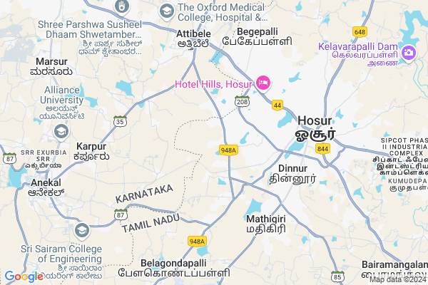
Kothagondapalli Map
EDIT Map
Add Your House
 ..
..
Current Corona Virus Infected Patients Count in Krishnagiri District
| City Name | District Name | Total Covid cases |
|---|
Locality Name :
Kothagondapalli
( கொத்தகொண்டப்பள்ளி )
Block Name : Hosur
District : Krishnagiri
State : Tamil Nadu
Language : Tamil and Telugu And Kannada
Current Time 08:45 AM
Date: Wednesday , Apr 30,2025 (IST)
Time zone: IST (UTC+5:30)
Elevation / Altitude: 895 meters. Above Seal level
Telephone Code / Std Code: 04344
Assembly constituency : Hosur assembly constituency
Assembly MLA : Prakaash Y
Lok Sabha constituency : Krishnagiri parliamentary constituency
Parliament MP : Dr.A.CHELLAKUMAR
Serpanch Name :
Pin Code : 635126
Post Office Name : Hosur Indl. Complex
Commodities Prices : Channapatana Market / Mandi
Kothagondapalli Live Weather
Temperature: 24.1 °C
overcast clouds
Humidity: 69%
Wind : 2.29 mt/sec towards S
StationName : "Hosūr"
observed on 1 Hours Back
Temperature: 24.1 °C
overcast clouds
Humidity: 69%
Wind : 2.29 mt/sec towards S
StationName : "Hosūr"
observed on 1 Hours Back
Kothagondapalli Weather Forecast for Next 5 days
01-05-2025
23.9°C to 35.2°C
overcast clouds, broken clouds, light rain
23.9°C to 35.2°C
overcast clouds, broken clouds, light rain
02-05-2025
23.0°C to 34.2°C
overcast clouds
23.0°C to 34.2°C
overcast clouds
03-05-2025
22.7°C to 34.6°C
overcast clouds, broken clouds, scattered clouds, light rain
22.7°C to 34.6°C
overcast clouds, broken clouds, scattered clouds, light rain
04-05-2025
21.4°C to 33.6°C
overcast clouds, broken clouds, light rain
21.4°C to 33.6°C
overcast clouds, broken clouds, light rain
05-05-2025
22.4°C to 35.7°C
overcast clouds, broken clouds, scattered clouds, light rain, moderate rain
22.4°C to 35.7°C
overcast clouds, broken clouds, scattered clouds, light rain, moderate rain
National Highways Reachable To Kothagondapalli
Nationa High Way :NH844
Nationa High Way :NH44;NH48
Nationa High Way :NH844
Nationa High Way :NH44;NH48
Rivers Near Kothagondapalli
Vrishabhavati :ವೃಶಭಾವತಿ
Vrishabhavati :ವೃಶಭಾವತಿ
Vrishabhavati :ವೃಶಭಾವತಿ
Vrishabhavati :ವೃಶಭಾವತಿ
About Kothagondapalli
Correct below Info and add more info about KothagondapalliKothagondapalli is a Village in Hosur Block in Krishnagiri District of Tamil Nadu State, India. It is located 61 KM towards west from District head quarters Krishnagiri. 7 KM from Hosur. 315 KM from State capital Chennai
Kothagondapalli Pin code is 635126 and postal head office is Hosur Indl. Complex .
Nathan Nagar ( 2 KM ) , Pooncholai Nagar ( 2 KM ) , Dwaraka Nagar ( 2 KM ) , Mgr Nagar ( 2 KM ) , Teja Sri Nagar ( 2 KM ) are the nearby Villages to Kothagondapalli. Kothagondapalli is surrounded by Bangalore Rural Block towards North , Kelamangalam Block towards South , Thally Block towards South , Shoolagiri Block towards East .
Bangalore , Malur , Ramanagaram , Kolar are the near by Cities to Kothagondapalli.
This Place is in the border of the Krishnagiri District and Bangalore Rural District. Bangalore Rural District Bangalore Rural is North towards this place . It is near to the Karnataka State Border.
Kothagondapalli 2011 Census Details
Kothagondapalli Local Language is Tamil. Kothagondapalli Village Total population is 4706 and number of houses are 1087. Female Population is 50.1%. Village literacy rate is 62.7% and the Female Literacy rate is 28.5%.
Population
| Census Parameter | Census Data |
| Total Population | 4706 |
| Total No of Houses | 1087 |
| Female Population % | 50.1 % ( 2360) |
| Total Literacy rate % | 62.7 % ( 2953) |
| Female Literacy rate | 28.5 % ( 1339) |
| Scheduled Tribes Population % | 0.2 % ( 11) |
| Scheduled Caste Population % | 38.1 % ( 1795) |
| Working Population % | 42.0 % |
| Child(0 -6) Population by 2011 | 552 |
| Girl Child(0 -6) Population % by 2011 | 49.8 % ( 275) |
Kothagondapalli Census More Deatils.
Politics in Kothagondapalli
DMDK , AIADMK , BJP , TMC(M) , JD , INC are the major political parties in this area.Polling Stations /Booths near Kothagondapalli
1)Panchayat Union Primary School (telegu) Singasadhanapalli2)Panchayat Union Primary School (telugu) Kothagondapalli 635 126
3)Panchayat Union Primary School (telugu) Kothakondapalli 635 126
4)Panchayat Union Middle School (tamil) Kamaraj Colony Hosur 635 109
5)Panchayat Union Primary School Chinna Ealasagiri 635109
HOW TO REACH Kothagondapalli
By Rail
Hosur Rail Way Station , Anekal Road Rail Way Station are the very nearby railway stations to Kothagondapalli.Colleges near Kothagondapalli
Iti Clg
Address :
Rajiv Gandhi College Of Education
Address : Kattinayanpali Post.krishnagiri, Hosur - 635001
Jai Sri Vankateswara Educational College
Address : Aatukarempatty, Pennagaram Main Road, Dharmapuri,
Thalapathy College Of Education
Address : 10/21, Indian Bank Back Side, B N Sowdappachetty S
Uts(p) Ltd., Computer Research & Application Center (p) Ltd.,
Address : Uts(p) Ltd., Computer Research & Application Cente
Schools near Kothagondapalli
Sri Krishna Nursery & Primary School
Address : 4/90,NGGO'S Colony
IInd Cross
Bagalur road
Hosur
Open Arms International School
Address : 1/154 6th km, Bagaluru Road, Innappasandra, Nallur post, Hosur
High School Mathigiri
Address :
David Siromani Metriculation School
Address : Near anjaneya temple
Govt Health Centers near Kothagondapalli
1) Kothakondapalli , Kothakondapalli , Kothakondapalli ,2) VASAN EYE CARE HOSPITAL , 80FEET , Vaishnavi Nagar ,
3) AGARWALS HOSPITAL , , Bangalore Road , Hosur
Sub Villages in Kothagondapalli
Hospitals in Kothagondapalli,Hosur
Jp Winka Pharma
42; 635109; Manjushree Nagar Phase 2; SBM Colony; Anthivadi; Hosur; Tamil Nadu 635126; India
3.3 KM distance Detail
Salam Manipalla Hospital
635126; Kanakadasa Layout; Mookandapalli; Hosur; Tamil Nadu 635126; India
3.5 KM distance Detail
Annai Sathya Nager 2cross
3; 2nd Cross; Rajaji Nagar; Bharathi Nagar; Mookandapalli; Hosur; Tamil Nadu 635126; India
3.5 KM distance Detail
more ..
Petrol Bunks in Kothagondapalli,Hosur
BPCL: Nandini Service Station
529-1A; TVS Road; Kothagondapalli; Krishnagiri; Hosur; Tamil Nadu 635109; India
2.7 KM distance Detail
HP PETROL PUMP - SAPTHAGIRI FUEL STATION
S.NO 531;TVS Road;nr Andivadi Check Post Kothagondapally Post Hosur; Coimbatore; Tamil Nadu 635109; India
2.8 KM distance Detail
more ..
Colleges in Kothagondapalli,Hosur
Gurukul College
I Floor; Pandurangi Building; P B Road; Hosur; Hosur; Hubli; Karnataka 580021; India
3.6 KM distance Detail
St.Joseph’s College Of Arts and Science for Women
Gandhi Nagar Rd; Mookandapalli; Hosur; Tamil Nadu 635126; India
4.0 KM distance Detail
more ..
Schools in Kothagondapalli,Hosur
Cuemath center
Anugraha plot 14&15 1st cross SUN BEAM Layout Nanjapuram; Hosur; Tamil Nadu 635109; India
1.4 KM distance Detail
Jamiya Madeenathul Arabic School (Madrasa)
Hazrath Tippu Sultan Circle; Kothur; Hosur; ESI Ring Rd; Muneeswara Nagar; Hosur; Tamil Nadu 635109; India
2.9 KM distance Detail
LAKSHMI SAGAR BRAINOBRAIN
sapthaswara;#21; 22nd cross;annai Nagar; extn; Muneeswara Nagar; Hosur; Tamil Nadu 635109; India
3.1 KM distance Detail
v.srinivas kumar Balvikas school
extn;; Muneeswara Nagar; Hosur; Tamil Nadu 635110; India
3.2 KM distance Detail
Electronic Shops in Kothagondapalli,Hosur
Rahul Industries
701; Kothur road; Kothakonda palli; Hosur; Tamil Nadu 635109; India
1.3 KM distance Detail
STAR COMPUTERS
No: 1/295-4; Santhi Nilayam Esi Hospital; MGR Ngar; Hosur; Tamil Nadu 635126; India
2.4 KM distance Detail
Super Markets in Kothagondapalli,Hosur
Vishnu Arun Supermarket
344; ESI Ring Rd; VOC Nagar; Muneeswara Nagar; Hosur; Tamil Nadu 635109; India
3.3 KM distance Detail
Pavan Super Market
Hosur - Thally Rd; Manjushree Nagar Phase 2; SBM Colony; Anthivadi; Hosur; Tamil Nadu 635110; India
3.3 KM distance Detail
Mohan Store
635126; MGR Nagar; Bharathi Nagar; Mookandapalli; Hosur; Tamil Nadu 635126; India
3.5 KM distance Detail
Local Parks in Kothagondapalli,Hosur
Vikas Nagar - Children's Park
Vikas Nagar; SBM Colony; Anthivadi; Hosur; Tamil Nadu 635110; India
3.6 KM distance Detail
Classic Homes Park
Classic Homes; New ASTC Hudco; Appavu Nagar; Hosur; Tamil Nadu 635109; India
3.8 KM distance Detail
Police Stations near Kothagondapalli,Hosur
Hosur Traffic Police Station
Denkanikotta Rd; SBM Colony; Anthivadi; Hosur; Tamil Nadu 635109; India
5.3 KM distance Detail
Governement Offices near Kothagondapalli,Hosur
SRI B.M.INDUSTRIES
Gandhinagar 1st Cross; MM Nagar; Amirtha Nagar; Hosur; Tamil Nadu 635126; India
3.8 KM distance Detail
Anandha Mahal
Thaly Road; Eden Garden; Anthivadi; Hosur; Tamil Nadu 635109; India
4.0 KM distance Detail
About Kothagondapalli &
History
How to reach Kothagondapalli
Tourist Places Near By Kothagondapalli
Schools in Kothagondapalli
Colleges in Kothagondapalli
Temperature & weather of Kothagondapalli
places in Kothagondapalli
Kothagondapalli photos
More Information
How to reach Kothagondapalli
Tourist Places Near By Kothagondapalli
Schools in Kothagondapalli
Colleges in Kothagondapalli
Temperature & weather of Kothagondapalli
places in Kothagondapalli
Kothagondapalli photos
More Information
Village Talk
Post News or Events about this Village
Near Cities
Bangalore 29 KM near
Malur 39 KM near
Ramanagaram 60 KM near
Kolar 66 KM near
Bangalore 29 KM near
Malur 39 KM near
Ramanagaram 60 KM near
Kolar 66 KM near
Near By Taluks
Hosur 7 KM near
Bangalore Rural 20 KM near
Kelamangalam 20 KM near
Thally 23 KM near
Hosur 7 KM near
Bangalore Rural 20 KM near
Kelamangalam 20 KM near
Thally 23 KM near
Near By Air Ports
Bengaluru International Airport 59 KM near
Salem Airport 142 KM near
Mysore Airport 147 KM near
Peelamedu Airport 230 KM near
Bengaluru International Airport 59 KM near
Salem Airport 142 KM near
Mysore Airport 147 KM near
Peelamedu Airport 230 KM near
Near By Tourist Places
Bangalore 37 KM near
Savandurga 61 KM near
Hogenakkal 74 KM near
Bheemeshwari 78 KM near
Nandi Hills 80 KM near
Bangalore 37 KM near
Savandurga 61 KM near
Hogenakkal 74 KM near
Bheemeshwari 78 KM near
Nandi Hills 80 KM near
Near By Districts
Bangalore 36 KM near
Krishnagiri 59 KM near
Ramanagara 60 KM near
Bangalore Rural 64 KM near
Bangalore 36 KM near
Krishnagiri 59 KM near
Ramanagara 60 KM near
Bangalore Rural 64 KM near
Near By RailWay Station
Hosur Rail Way Station 5.7 KM near
Anekal Road Rail Way Station 8.9 KM near
Whitefield Rail Way Station 33 KM near
Hosur Rail Way Station 5.7 KM near
Anekal Road Rail Way Station 8.9 KM near
Whitefield Rail Way Station 33 KM near