| Home | City Bus | Maps | Villages | Cities | Rail | Tourist Places | School | College | Pin Codes | Corona Cases Count |
| Distance Calculator Bus Services IFSC Codes Trace Mobile Number Weather Search Place Trace IP Available Cash ATM/Banks Locate Polling Booth Report an Error contact People |
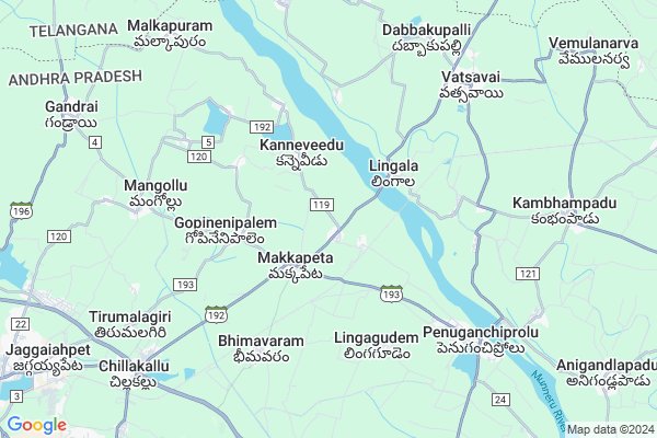
Chityala
Chityala Map
EDIT Map
Add Your House
 ..
..
Current Corona Virus Infected Patients Count in Krishna District
| City Name | District Name | Total Covid cases |
|---|---|---|
| Krishna District | Krishna | 159 |
| Vijayawada | Krishna | 18 |
| Machilipatnam | Krishna | 1 |
| Ranihari Thotta | Krishna | 1 |
| Payakapuram | Krishna | 1 |
Locality Name :
Chityala
( చిట్యాల )
Mandal Name : Vatsavai
District : Krishna
State : Andhra Pradesh
Region : Andhra
Language : Telugu
Current Time 12:27 PM
Date: Sunday , Apr 27,2025 (IST)
Time zone: IST (UTC+5:30)
Elevation / Altitude: 97 meters. Above Seal level
Telephone Code / Std Code: 08749
Assembly constituency : assembly constituency
Assembly MLA : UDAYABHANU SAMINENI
Lok Sabha constituency : parliamentary constituency
Parliament MP : KESINENI SRINIVAS (NANI)
Serpanch Name :
Pin Code : 521190
Post Office Name : Penuganchiprolu
Alternate Village Name : Chittela
Commodities Prices : Kodad Market / Mandi
Chityala Live Weather
Temperature: 38.3 °C
broken clouds
Humidity: 28%
Wind : 3.49 mt/sec towards SE
StationName : "Jaggayyapeta"
observed on Now
Temperature: 38.3 °C
broken clouds
Humidity: 28%
Wind : 3.49 mt/sec towards SE
StationName : "Jaggayyapeta"
observed on Now
Chityala Weather Forecast for Next 5 days
28-04-2025
27.9°C to 40.2°C
scattered clouds, broken clouds, light rain, clear sky
27.9°C to 40.2°C
scattered clouds, broken clouds, light rain, clear sky
29-04-2025
26.9°C to 40.6°C
clear sky, few clouds, scattered clouds
26.9°C to 40.6°C
clear sky, few clouds, scattered clouds
30-04-2025
27.0°C to 41.7°C
scattered clouds, clear sky, light rain
27.0°C to 41.7°C
scattered clouds, clear sky, light rain
01-05-2025
27.3°C to 42.7°C
few clouds, broken clouds, scattered clouds, clear sky, light rain
27.3°C to 42.7°C
few clouds, broken clouds, scattered clouds, clear sky, light rain
02-05-2025
28.2°C to 43.4°C
clear sky, few clouds, scattered clouds, light rain
28.2°C to 43.4°C
clear sky, few clouds, scattered clouds, light rain
National Highways Reachable To Chityala
Nationa High Way :NH365BB
Nationa High Way :NH16
Nationa High Way :NH365BB
Nationa High Way :NH16
About Chityala
Correct below Info and add more info about ChityalaChityala is a Village in Vatsavai Mandal in Krishna District of Andhra Pradesh State, India. It belongs to Andhra region . It is located 151 KM towards west from District head quarters Machilipatnam. 3 KM from Vatsavai. 221 KM from State capital Hyderabad
Chityala Pin code is 521190 and postal head office is Penuganchiprolu .
Lingala ( 3 KM ) , Kanneveedu ( 3 KM ) , Gopinenipalem ( 3 KM ) , Indugapalli ( 4 KM ) , Pochavaram ( 4 KM ) are the nearby Villages to Chityala. Chityala is surrounded by Jaggayyapeta Mandal towards west , Penuganchiprolu Mandal towards South , Bonakal Mandal towards North , Madhira Mandal towards East .
Jaggaiahpet , Kodad , Khammam , Palwancha are the near by Cities to Chityala.
This Place is in the border of the Krishna District and Khammam District. Khammam District Madhira is East towards this place . It is near to the Telangana State Border.
Demographics of Chityala
Telugu is the Local Language here. Total population of Chityala is 2916 .Males are 1496 and Females are 1,420 living in 674 Houses. Total area of Chityala is 926 hectares.HOW TO REACH Chityala
By Road
Jaggaiahpet is the Nearest Town to Chityala. Jaggaiahpet is 12 km from Chityala. Road connectivity is there from Jaggaiahpet to Chityala.By Rail
There is no railway station near to Chityala in less than 10 km.By Bus
Jgpt(Highway) APSRTC Bus Station , Jaggaihpet APSRTC Bus Station , Madhira APSRTC Bus Station are the nearby by Bus Stations to Chityala .APSRTC runs Number of busses from major cities to here.Colleges near Chityala
Sri Sai Narayana Degree College
Address : D.no.1/59, C/o. Sri Venkateshwara Jr. College, Ma
Gandhiji Institute Of Science & Technology
Address : Bhimavaram (v), Near Jaggayyapet, Vatsavi, Krishn
Schools in Chityala
Sri Sarada Vidayni Caten
Address : chittela , vatsavai , krishna , Andhra Pradesh . PIN- 521190 , Post - Penuganchiprolu
Mpups Chittela
Address : chittela , vatsavai , krishna , Andhra Pradesh . PIN- 521190 , Post - Penuganchiprolu
Govt Health Centers near Chityala
1) Makkapeta , SUB HEALTH CENTRE BUILDING , BHIMAVARAM ROAD , NEAR UP SCHOOL2) Bhimavaram , May-35 , PADMASALI BAZAR , BEHIND PANCHAYATI OFFICE
3) Lingala , MILK CENTRE , MILK CENTRE , BESIDE PANCHAYATI OFFICE
Hospitals in Chityala,Vatsavai
Harika Unani Speciality Hospital
Lingala Rd; Lingala; Andhra Pradesh 521402; India
4.1 KM distance Detail
more ..
Petrol Bunks in Chityala,Vatsavai
HP PETROL PUMP - SREE BALAJI FILLING STATION
HPC Dealers VIA Makkapeta Wyra Road; Vatsavai; Vijayawada; Andhra Pradesh 521402; India
6.5 KM distance Detail
more ..
Colleges in Chityala,Vatsavai
Gandhiji Institute Of Science And Technology
Near Kongara Mallaiah Gattu; Vatsavai; NH-65; Krishna; Bhimavaram; Andhra Pradesh 521178; India
5.7 KM distance Detail
Naveen Sai Drinking Water R.o@ Cooling Water Plant
MeeSeva Center; Bonakal; Telangana 507204; India
13.6 KM distance Detail
more ..
Schools in Chityala,Vatsavai
Zilla Parishat High School
Makkapeta Rd; Gopinenipalem; Andhra Pradesh 521178; India
3.3 KM distance Detail
Electronic Shops in Chityala,Vatsavai
Sri Lakshmi Ganesh Electricals & Communication
Bhimavaram( P.o) Vatsavai( Mdl) Dst) Andra Pradesh;; Vijayawada; Andhra Pradesh 520001; India
5.7 KM distance Detail
Super Markets in Chityala,Vatsavai
Vinayaka General Merchant
Bheemavaram Rd; Makkapeta; Andhra Pradesh 521190; India
2.3 KM distance Detail
Local Parks in Chityala,Vatsavai
Gandhi Park Center ;Vatsavai
Desineni Palem - Talluru Rd; Vatsavai; Andhra Pradesh 521402; India
7.6 KM distance Detail
Police Stations near Chityala,Vatsavai
Police Station ; Vatsavai
Jaggayyapeta Vatsavayi Rd; Vatsavai; Andhra Pradesh 521402; India
7.2 KM distance Detail
Governement Offices near Chityala,Vatsavai
MeeSeva Center
Penuganchiprolu - Makkapeta Rd; Makkapeta; Andhra Pradesh 521190; India
2.3 KM distance Detail
MeeSeva Center
P.Srinivasarao;S/o P.Venkateswarlu;HNO:-3-11;Main road ;Bheemavaram(p)(v);vatsavai(md); Andhra Pradesh 521178; India
5.8 KM distance Detail
MeeSeva Center
Siva Parvathi Internet Café; Main Road; Near Gandhipark Center;; 3-43; Desineni Palem - Talluru Rd; Vatsavai; Andhra Pradesh 521402; India
7.6 KM distance Detail
About Chityala &
History
How to reach Chityala
Tourist Places Near By Chityala
Schools in Chityala
Colleges in Chityala
Temperature & weather of Chityala
places in Chityala
Chityala photos
More Information
How to reach Chityala
Tourist Places Near By Chityala
Schools in Chityala
Colleges in Chityala
Temperature & weather of Chityala
places in Chityala
Chityala photos
More Information
Village Talk
Post News or Events about this Village
Near Cities
Jaggaiahpet 13 KM near
Kodad 29 KM near
Khammam 39 KM near
Palwancha 58 KM near
Jaggaiahpet 13 KM near
Kodad 29 KM near
Khammam 39 KM near
Palwancha 58 KM near
Near By Taluks
Vatsavai 2 KM near
Jaggayyapeta 8 KM near
Penuganchiprolu 12 KM near
Bonakal 17 KM near
Vatsavai 2 KM near
Jaggayyapeta 8 KM near
Penuganchiprolu 12 KM near
Bonakal 17 KM near
Near By Air Ports
Vijayawada Airport 87 KM near
Rajahmundry Airport 194 KM near
Rajiv Gandhi International Airport 214 KM near
Vishakhapatnam Airport 372 KM near
Vijayawada Airport 87 KM near
Rajahmundry Airport 194 KM near
Rajiv Gandhi International Airport 214 KM near
Vishakhapatnam Airport 372 KM near
Near By Tourist Places
Khammam 39 KM near
Nagarjunakonda 47 KM near
Amaravathi 50 KM near
Vijayawada 73 KM near
Guntur 83 KM near
Khammam 39 KM near
Nagarjunakonda 47 KM near
Amaravathi 50 KM near
Vijayawada 73 KM near
Guntur 83 KM near
Near By Districts
Khammam 39 KM near
Guntur 84 KM near
West Godavari 112 KM near
Nalgonda 112 KM near
Khammam 39 KM near
Guntur 84 KM near
West Godavari 112 KM near
Nalgonda 112 KM near
Near By RailWay Station
Madhira Rail Way Station 19 KM near
Khammam Rail Way Station 39 KM near
Madhira Rail Way Station 19 KM near
Khammam Rail Way Station 39 KM near