| Home | City Bus | Maps | Villages | Cities | Rail | Tourist Places | School | College | Pin Codes | Corona Cases Count |
| Distance Calculator Bus Services IFSC Codes Trace Mobile Number Weather Search Place Trace IP Available Cash ATM/Banks Locate Polling Booth Report an Error contact People |
Kothapet
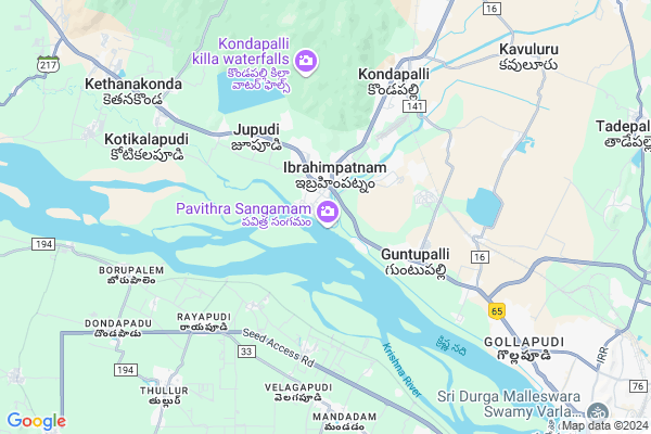
Kothapet Map
EDIT Map
Add Your House
 ..
..
Current Corona Virus Infected Patients Count in Krishna District
| City Name | District Name | Total Covid cases |
|---|---|---|
| Krishna District | Krishna | 159 |
| Vijayawada | Krishna | 18 |
| Ranihari Thotta | Krishna | 1 |
| Payakapuram | Krishna | 1 |
| Machilipatnam | Krishna | 1 |
Locality Name :
Kothapet
( కొత్తపేట )
Mandal Name : Kanchikacherla
District : Krishna
State : Andhra Pradesh
Region : Andhra
Language : Telugu
Current Time 12:27 PM
Date: Tuesday , Apr 29,2025 (IST)
Time zone: IST (UTC+5:30)
Elevation / Altitude: 69 meters. Above Seal level
Telephone Code / Std Code: 08678
Assembly constituency : assembly constituency
Assembly MLA : VASANTHA VENKATA KRISHNA PRASAD
Lok Sabha constituency : parliamentary constituency
Parliament MP : KESINENI SRINIVAS (NANI)
Serpanch Name :
Pin Code : 521456
Post Office Name : VTPS
Alternate Village Name : Kothapeta
Commodities Prices : Duggirala Market / Mandi
Kothapet Live Weather
Temperature: 34.2 °C
clear sky
Humidity: 44%
Wind : 3.96 mt/sec towards S
StationName : "Kondapalle"
observed on 2 Hours Back
Temperature: 34.2 °C
clear sky
Humidity: 44%
Wind : 3.96 mt/sec towards S
StationName : "Kondapalle"
observed on 2 Hours Back
Kothapet Weather Forecast for Next 5 days
30-04-2025
28.1°C to 41.6°C
clear sky, scattered clouds, broken clouds
28.1°C to 41.6°C
clear sky, scattered clouds, broken clouds
01-05-2025
27.5°C to 40.7°C
few clouds, clear sky, scattered clouds, light rain, broken clouds
27.5°C to 40.7°C
few clouds, clear sky, scattered clouds, light rain, broken clouds
02-05-2025
28.2°C to 42.1°C
scattered clouds, few clouds, clear sky, broken clouds
28.2°C to 42.1°C
scattered clouds, few clouds, clear sky, broken clouds
03-05-2025
28.7°C to 42.7°C
few clouds, broken clouds, scattered clouds, clear sky, light rain
28.7°C to 42.7°C
few clouds, broken clouds, scattered clouds, clear sky, light rain
04-05-2025
28.3°C to 43.2°C
clear sky, scattered clouds, few clouds, moderate rain, light rain, overcast clouds
28.3°C to 43.2°C
clear sky, scattered clouds, few clouds, moderate rain, light rain, overcast clouds
National Highways Reachable To Kothapet
Nationa High Way :NH65
Nationa High Way :NH65
Rivers Near Kothapet
Tammileru
Tammileru
About Kothapet
Correct below Info and add more info about KothapetKothapet is a Village in Kanchikacherla Mandal in Krishna District of Andhra Pradesh State, India. It belongs to Andhra region . It is located 92 KM towards west from District head quarters Machilipatnam. 21 KM from Kanchikacherla. 273 KM from State capital Hyderabad
Kothapet Pin code is 521456 and postal head office is VTPS .
Jupudi ( 3 KM ) , Guntupalli ( 4 KM ) , Battinapadu ( 5 KM ) , Kondapalli ( 5 KM ) , Elaprolu ( 5 KM ) are the nearby Villages to Kothapet. Kothapet is surrounded by Thullur Mandal towards South , G.Konduru Mandal towards North , Vijayawada Rural Mandal towards East , Vijayawada Mandal towards East .
Mangalagiri , Vijayawada , Guntur , Tenali are the near by Cities to Kothapet.
This Place is in the border of the Krishna District and Guntur District. Guntur District Amaravathi is west towards this place .
Demographics of Kothapet
Telugu is the Local Language here.HOW TO REACH Kothapet
By Rail
Rayanapadu Rail Way Station , Kondapalli Rail Way Station are the very nearby railway stations to Kothapet. Satya Narayanapuram Rail Way Station (near to Vijayawada) , Ramavarappadu Rail Way Station (near to Vijayawada) are the Rail way stations reachable from near by towns.By Road
Vijayawada are the nearby by towns to Kothapet having road connectivity to KothapetBy Bus
Ibrahimpatnam (Vja) APSRTC Bus Station , Kondapally APSRTC Bus Station , Gollapudi APSRTC Bus Station are the nearby by Bus Stations to Kothapet .APSRTC runs Number of busses from major cities to here.Colleges near Kothapet
Vidyanjali Degree College
Address : Vidyanjali Street, Kothapet, Kaikalur - 521333, K
Kbn Degree College
Address : Kothapet, Vijayawada, Krishna Dist. - 520001.
Potti Sriramulu College Of Engineering & Technology
Address : Kothapeta, Vijayawada, Krishna Dist. - 520 001.
Schools near Kothapet
Aravinda Concept School
Address : chevitikallu , kanchikacherla , krishna , Andhra Pradesh . PIN- 521180 , Post - Kanchikacharla
Bishop Joseph Thumma H
Address : kesara , kanchikacherla , krishna , Andhra Pradesh . PIN- 521185 , Post - Nandigama
Zphs Gottumukkala
Address : gottumukkala , kanchikacherla , krishna , Andhra Pradesh . PIN- 521180 , Post - Kanchikacharla
Lasalle Em Kesara
Address : kesara , kanchikacherla , krishna , Andhra Pradesh . PIN- 521185 , Post - Nandigama
Govt Health Centers near Kothapet
1) Ibrahimpatnam-2 , Apr-56 , Ganganamma Temple ,2) Ibrahimpatnam-4 , 23-16 , RCM Church Road ,
3) Bhimarajugutta , 124-105/2 , Zakirhussain College Street ,
Petrol Bunks in Kothapet,Kanchikacherla
Bharat Petrol Bunk
Kerala Hotel Center; Ibrahimpatnam; Andhra Pradesh 521456; India
0.8 KM distance Detail
Indian Oil Petroleum
Vijayawada - Hyderabad Hwy; Ibrahimpatnam; Andhra Pradesh 521456; India
0.8 KM distance Detail
HP Petrol Pump
HPC Dealers Ibrahimpatnam AP; Ibrahimpatnam; Andhra Pradesh 521456; India
1.0 KM distance Detail
more ..
Colleges in Kothapet,Kanchikacherla
SAIRAM INDUSTRIAL TRAINING INSTITUTE
Opp ganesh temple; ferry ;VTPS POST ; IBRAHIMPATNAM; ;KRISHNA DISTRICT; VIJAYAWADA; Andhra Pradesh 521456; India
0.4 KM distance Detail
Nova Engineering College Vijayawada
Vijayawada - Hyderabad Hwy; Ibrahimpatnam; Andhra Pradesh 521456; India
1.3 KM distance Detail
Sri Chaitanya Residential Junior College
Bhimaraju Gutta; Ibrahimpatnam; Andhra Pradesh 521456; India
1.5 KM distance Detail
more ..
Schools in Kothapet,Kanchikacherla
AP Mahila samatha Society
Ibrahimpatnam Circle; Ibrahimpatnam; Andhra Pradesh 521456; India
1.2 KM distance Detail
Directorate of Adult Education
Bhimaraju Gutta; Ibrahimpatnam; Andhra Pradesh 521456; India
1.5 KM distance Detail
Super Markets in Kothapet,Kanchikacherla
Ramavilas Fancy Store
24-125; Vijayawada - Mylavaram Rd; Bhimaraju Gutta; Ibrahimpatnam; Andhra Pradesh 521456; India
1.3 KM distance Detail
Local Parks in Kothapet,Kanchikacherla
Security Colony Park
Dr Narla Tata Rao Thermal Power Plant Rd; Ibrahimpatnam; Andhra Pradesh 521456; India
2.1 KM distance Detail
Police Stations near Kothapet,Kanchikacherla
Ibrahimpatnam Police Station
NH 221; Bhimaraju Gutta; Ibrahimpatnam; Andhra Pradesh 521456; India
1.4 KM distance Detail
Governement Offices near Kothapet,Kanchikacherla
Ibrahimpatnam Bus Depot
Bhimaraju Gutta; Ibrahimpatnam; Andhra Pradesh 521456; India
1.4 KM distance Detail
MeeSeva Center
G Venkateswara Rao;SHOP 5; Police Shopping Complex; Sbi Road; Near Ring Center; Ibrahimpatnam(V);; National Highway 221; Ibrahimpatnam; Andhra Pradesh 521456; India
1.4 KM distance Detail
Directorate Of Insurance; APGLI; govt Of A.P
Bhimaraju Gutta; Ibrahimpatnam; Andhra Pradesh 521456; India
1.5 KM distance Detail
About Kothapet &
History
How to reach Kothapet
Tourist Places Near By Kothapet
Schools in Kothapet
Colleges in Kothapet
Temperature & weather of Kothapet
places in Kothapet
Kothapet photos
More Information
How to reach Kothapet
Tourist Places Near By Kothapet
Schools in Kothapet
Colleges in Kothapet
Temperature & weather of Kothapet
places in Kothapet
Kothapet photos
More Information
Village Talk
Post News or Events about this Village
Near Cities
Mangalagiri 19 KM near
Vijayawada 20 KM near
Guntur 36 KM near
Tenali 44 KM near
Mangalagiri 19 KM near
Vijayawada 20 KM near
Guntur 36 KM near
Tenali 44 KM near
Near By Taluks
Ibrahimpatnam 4 KM near
Thullur 8 KM near
Vijayawada Rural 15 KM near
G.Konduru 15 KM near
Ibrahimpatnam 4 KM near
Thullur 8 KM near
Vijayawada Rural 15 KM near
G.Konduru 15 KM near
Near By Air Ports
Vijayawada Airport 33 KM near
Rajahmundry Airport 168 KM near
Rajiv Gandhi International Airport 262 KM near
Vishakhapatnam Airport 352 KM near
Vijayawada Airport 33 KM near
Rajahmundry Airport 168 KM near
Rajiv Gandhi International Airport 262 KM near
Vishakhapatnam Airport 352 KM near
Near By Tourist Places
Vijayawada 15 KM near
Amaravathi 18 KM near
Guntur 35 KM near
Nagarjunakonda 79 KM near
Machelipatnam 88 KM near
Vijayawada 15 KM near
Amaravathi 18 KM near
Guntur 35 KM near
Nagarjunakonda 79 KM near
Machelipatnam 88 KM near
Near By Districts
Guntur 36 KM near
West Godavari 72 KM near
Krishna 88 KM near
Khammam 94 KM near
Guntur 36 KM near
West Godavari 72 KM near
Krishna 88 KM near
Khammam 94 KM near
Near By RailWay Station
Rayanapadu Rail Way Station 5.3 KM near
Kondapalli Rail Way Station 6.6 KM near
Vijayawada Junction Rail Way Station 14 KM near
Mangalagiri Rail Way Station 18 KM near
Rayanapadu Rail Way Station 5.3 KM near
Kondapalli Rail Way Station 6.6 KM near
Vijayawada Junction Rail Way Station 14 KM near
Mangalagiri Rail Way Station 18 KM near