| Home | City Bus | Maps | Villages | Cities | Rail | Tourist Places | School | College | Pin Codes | Corona Cases Count |
| Distance Calculator Bus Services IFSC Codes Trace Mobile Number Weather Search Place Trace IP Available Cash ATM/Banks Locate Polling Booth Report an Error contact People |
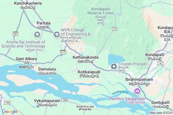
Ketanakonda
Ketanakonda Map
EDIT Map
Add Your House
 ..
..
Current Corona Virus Infected Patients Count in Krishna District
| City Name | District Name | Total Covid cases |
|---|---|---|
| Krishna District | Krishna | 159 |
| Vijayawada | Krishna | 18 |
| Machilipatnam | Krishna | 1 |
| Ranihari Thotta | Krishna | 1 |
| Payakapuram | Krishna | 1 |
Locality Name :
Ketanakonda
( కేతనకొండ )
Mandal Name : Ibrahimpatnam
District : Krishna
State : Andhra Pradesh
Region : Andhra
Language : Telugu
Current Time 10:46 AM
Date: Friday , Apr 25,2025 (IST)
Time zone: IST (UTC+5:30)
Elevation / Altitude: 35 meters. Above Seal level
Telephone Code / Std Code: 08645
Assembly constituency : assembly constituency
Assembly MLA : VASANTHA VENKATA KRISHNA PRASAD
Lok Sabha constituency : parliamentary constituency
Parliament MP : KESINENI SRINIVAS (NANI)
Serpanch Name :
Pin Code : 521456
Post Office Name : VTPS
Alternate Village Name : Kethanakonda
Commodities Prices : Duggirala Market / Mandi
Ketanakonda Live Weather
Temperature: 37.6 °C
few clouds
Humidity: 31%
Wind : 4.62 mt/sec towards S
StationName : "Kondapalle"
observed on 20 Mins Back
Temperature: 37.6 °C
few clouds
Humidity: 31%
Wind : 4.62 mt/sec towards S
StationName : "Kondapalle"
observed on 20 Mins Back
Ketanakonda Weather Forecast for Next 5 days
26-04-2025
27.7°C to 40.6°C
few clouds, clear sky
27.7°C to 40.6°C
few clouds, clear sky
27-04-2025
27.3°C to 39.7°C
few clouds, scattered clouds, broken clouds, clear sky
27.3°C to 39.7°C
few clouds, scattered clouds, broken clouds, clear sky
28-04-2025
26.9°C to 40.4°C
few clouds, scattered clouds, light rain, overcast clouds
26.9°C to 40.4°C
few clouds, scattered clouds, light rain, overcast clouds
29-04-2025
26.4°C to 40.8°C
broken clouds, clear sky, scattered clouds, few clouds
26.4°C to 40.8°C
broken clouds, clear sky, scattered clouds, few clouds
30-04-2025
27.7°C to 41.2°C
scattered clouds, few clouds, clear sky, light rain, broken clouds, overcast clouds
27.7°C to 41.2°C
scattered clouds, few clouds, clear sky, light rain, broken clouds, overcast clouds
Edit below overview about Ketanakonda
Edit below overview about Ketanakonda
OverView of Ketanakonda
kethanakonda is their is no village before independence of India . In 1950's Vijayawada named as Bejawada nearly 25kms there is small family living besides the krishna river these family was cames hindus kapu caste the river was flowing up of the earth those houses was gone they diceded to leave this they nearly the road nh9 then they have 15 members of people .Edit below overview about Ketanakonda
National Highways Reachable To Ketanakonda
Nationa High Way :NH65
Nationa High Way :NH65
Rivers Near Ketanakonda
Krishna :クリシュナ :ಕೃಷ್ಣಾ :कृष्णा :కృష్ణా
Krishna :クリシュナ :ಕೃಷ್ಣಾ :कृष्णा :కృష్ణా
About Ketanakonda
Ketanakonda is a Village in Ibrahimpatnam Mandal in Krishna District of Andhra Pradesh State, India. It belongs to Andhra region . It is located 101 KM towards west from District head quarters Machilipatnam. 4 KM from Ibrahimpatnam. 264 KM from State capital Hyderabad
Ketanakonda Pin code is 521456 and postal head office is VTPS .
Mulapadu ( 1 KM ) , Kotikalapudi ( 2 KM ) , Jupudi ( 5 KM ) , Damuluru ( 5 KM ) , Paritala ( 8 KM ) are the nearby Villages to Ketanakonda. Ketanakonda is surrounded by Thullur Mandal towards South , Kanchikacherla Mandal towards west , Amaravathi Mandal towards west , G.Konduru Mandal towards East .
Mangalagiri , Vijayawada , Guntur , Sattenapalle are the near by Cities to Ketanakonda.
This Place is in the border of the Krishna District and Guntur District. Guntur District Thullur is South towards this place .
Demographics of Ketanakonda
Telugu is the Local Language here. Total population of Ketanakonda is 4627 .Males are 2440 and Females are 2,187 living in 890 Houses. Total area of Ketanakonda is 246 hectares.HOW TO REACH Ketanakonda
By Road
Vijayawada is the Nearest Town to Ketanakonda. Vijayawada is 30 km from Ketanakonda. Road connectivity is there from Vijayawada to Ketanakonda.By Rail
Kondapalli Rail Way Station is the very nearby railway stations to Ketanakonda. Also you can consider railway Stations from Near By town Vijayawada. Ramavarappadu Rail Way Station , Satya Narayanapuram Rail Way Station are the railway Stations near to Vijayawada. You can reach from Vijayawada to Ketanakonda by road after .By Bus
Ibrahimpatnam (Vja) APSRTC Bus Station , Kondapally APSRTC Bus Station , Kanchikacherla APSRTC Bus Station are the nearby by Bus Stations to Ketanakonda .APSRTC runs Number of busses from major cities to here.Colleges near Ketanakonda
Sri Chaitanya Jr College, West Ibrahimpatnam
Address : West Ibrahimpatnam
Dkr &yvrmn Jr College Kondapalli
Address : Dkr &yvrmn Jr College Kondapalli
Sri Chaitanya [g] Jr Coll,west Ibrahimpatnam
Address : West Ibrahimpatnam
Satya Sai Jr College, Ibrahimpatnam
Address : Ibrahimpatnam
Andhra Junior? College Kondapalli
Address : Andhra Junior? College Kondapalli
Schools in Ketanakonda
Cbr School
Address : ketanakonda , ibrahimpatnam , krishna , Andhra Pradesh . PIN- 521456 , Post - VTPS
Emmanuel Hs Ketanakonda
Address : ketanakonda , ibrahimpatnam , krishna , Andhra Pradesh . PIN- 521456 , Post - VTPS
Svsurya M S Ketanakonda
Address : ketanakonda , ibrahimpatnam , krishna , Andhra Pradesh . PIN- 521456 , Post - VTPS
Jannet English Medium Ups Ketanakonda
Address : ketanakonda , ibrahimpatnam , krishna , Andhra Pradesh . PIN- 521456 , Post - VTPS
Govt Health Centers near Ketanakonda
1) Ketankonda , Mar-36 , Near AWC ,2) Mulapadu , 7-104 , Kotha Mulapadu , RCM Church
3) Jupudi , Apr-69 , Ramalayam Veedhi , Water Tank
Hospitals in Ketanakonda,Ibrahimpatnam
Om Sai Medical Fancy & General Stores
Main Road; Ketanakonda; Ibrahimpatnam; Vijayawada; Andhra Pradesh 521456; India
0.9 KM distance Detail
Sri Hanuman Medical & fancy
Main Road; Back Side Panchayati Office; Ketanakonda; Ibrahimpatnam; Vijayawada; Andhra Pradesh 521456; India
1.0 KM distance Detail
Sri naga sai medical & fancy stores
Main road; kethanakonda.; Vijayawada; Andhra Pradesh 521456; India
1.2 KM distance Detail
Karuna Health Centre
Kachavaram; Krishna; NH-9; Vijayawada Hyderabad Road; Ibrahimpatnam; Ibrahimpatnam; Andhra Pradesh 521456; India
1.7 KM distance Detail
more ..
Petrol Bunks in Ketanakonda,Ibrahimpatnam
HP Petrol Pump
Hpcl Dealers; Kachavaram Village Ibrahimpatnam Mandal; NH65; Vijayawada; Andhra Pradesh 520010; India
2.7 KM distance Detail
HP Petrol Pump
Jupudi Ibrahimpatnam Mandal; NH65; Vijayawada; Andhra Pradesh 521456; India
3.6 KM distance Detail
Paritala Filling Station Bharat Petroleum
Kachavaram; Krishna; NH-9; Vijayawada Hyderabad Road; Kanchikacharla; Kanchikacharla; Andhra Pradesh 521180; India
4.7 KM distance Detail
more ..
Colleges in Ketanakonda,Ibrahimpatnam
RK COLLEGE OF ENGINEERING: 9701543399
RKCE ROAD KETHANAKONDA V IBRAHIMPATNAM M); VIJAYAWADA; Vijayawada; Andhra Pradesh 521456; India
0.7 KM distance Detail
C B R Acdemy Sports And Educational society
Kachavaram; Andhra Pradesh 521181; India
2.1 KM distance Detail
more ..
Schools in Ketanakonda,Ibrahimpatnam
CBR gurukul valley school;residential
Kethanakonda; Andhra Pradesh 521456; India
0.3 KM distance Detail
Shree Swaminarayan Gurukul International School
NH 9; Near R.K College; Ketanakonda Grama Panchayati Krishna (D); Vijaywada; Ibrahimpatnam; Andhra Pradesh 521456; India
0.7 KM distance Detail
M P P School
Kachavaram; Krishna; NH-9; Vijayawada Hyderabad Road; Ibrahimpatnam; Ibrahimpatnam; Andhra Pradesh 521456; India
1.3 KM distance Detail
Electronic Shops in Ketanakonda,Ibrahimpatnam
Mulapadu Boddurai Center Ibrahimpatnam
MULAPADU; Andhra Pradesh 521456; India
1.7 KM distance Detail
Local Parks in Ketanakonda,Ibrahimpatnam
Security Colony Park
Dr Narla Tata Rao Thermal Power Plant Rd; Ibrahimpatnam; Andhra Pradesh 521456; India
9.1 KM distance Detail
Police Stations near Ketanakonda,Ibrahimpatnam
Ibrahimpatnam Police Station
NH 221; Bhimaraju Gutta; Ibrahimpatnam; Andhra Pradesh 521456; India
8.7 KM distance Detail
Police Station
11-86/4; NH65; Hanumanpet; Vasantha Colony; Kanchikacherla; Andhra Pradesh 521180; India
12.2 KM distance Detail
About Ketanakonda &
History
How to reach Ketanakonda
Tourist Places Near By Ketanakonda
Schools in Ketanakonda
Colleges in Ketanakonda
Temperature & weather of Ketanakonda
places in Ketanakonda
Ketanakonda photos
More Information
How to reach Ketanakonda
Tourist Places Near By Ketanakonda
Schools in Ketanakonda
Colleges in Ketanakonda
Temperature & weather of Ketanakonda
places in Ketanakonda
Ketanakonda photos
More Information
Village Talk
Post News or Events about this Village
Near Cities
Mangalagiri 26 KM near
Vijayawada 29 KM near
Guntur 40 KM near
Sattenapalle 46 KM near
Mangalagiri 26 KM near
Vijayawada 29 KM near
Guntur 40 KM near
Sattenapalle 46 KM near
Near By Taluks
Ibrahimpatnam 4 KM near
Thullur 11 KM near
Kanchikacherla 12 KM near
Amaravathi 16 KM near
Ibrahimpatnam 4 KM near
Thullur 11 KM near
Kanchikacherla 12 KM near
Amaravathi 16 KM near
Near By Air Ports
Vijayawada Airport 41 KM near
Rajahmundry Airport 173 KM near
Rajiv Gandhi International Airport 254 KM near
Vishakhapatnam Airport 356 KM near
Vijayawada Airport 41 KM near
Rajahmundry Airport 173 KM near
Rajiv Gandhi International Airport 254 KM near
Vishakhapatnam Airport 356 KM near
Near By Tourist Places
Amaravathi 12 KM near
Vijayawada 24 KM near
Guntur 39 KM near
Nagarjunakonda 71 KM near
Khammam 86 KM near
Amaravathi 12 KM near
Vijayawada 24 KM near
Guntur 39 KM near
Nagarjunakonda 71 KM near
Khammam 86 KM near
Near By Districts
Guntur 40 KM near
West Godavari 78 KM near
Khammam 86 KM near
Krishna 96 KM near
Guntur 40 KM near
West Godavari 78 KM near
Khammam 86 KM near
Krishna 96 KM near
Near By RailWay Station
Vijayawada Junction Rail Way Station 22 KM near
Mangalagiri Rail Way Station 25 KM near
Vijayawada Junction Rail Way Station 22 KM near
Mangalagiri Rail Way Station 25 KM near