| Home | City Bus | Maps | Villages | Cities | Rail | Tourist Places | School | College | Pin Codes | Corona Cases Count |
| Distance Calculator Bus Services IFSC Codes Trace Mobile Number Weather Search Place Trace IP Available Cash ATM/Banks Locate Polling Booth Report an Error contact People |
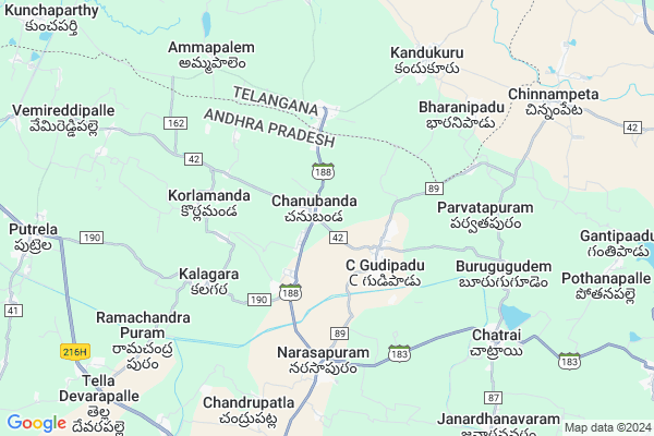
Chanubanda
Chanubanda Map
EDIT Map
Add Your House
 ..
..
Current Corona Virus Infected Patients Count in Krishna District
| City Name | District Name | Total Covid cases |
|---|---|---|
| Krishna District | Krishna | 159 |
| Vijayawada | Krishna | 18 |
| Ranihari Thotta | Krishna | 1 |
| Payakapuram | Krishna | 1 |
| Machilipatnam | Krishna | 1 |
Locality Name :
Chanubanda
( చనుబండ )
Mandal Name : Chatrai
District : Krishna
State : Andhra Pradesh
Region : Andhra
Language : Telugu
Current Time 10:02 AM
Date: Wednesday , Apr 30,2025 (IST)
Time zone: IST (UTC+5:30)
Elevation / Altitude: 16 meters. Above Seal level
Telephone Code / Std Code: 08598
Assembly constituency : assembly constituency
Assembly MLA : Meka Venkata Pratap Apparao
Lok Sabha constituency : parliamentary constituency
Parliament MP : KOTAGIRI SRIDHAR
Serpanch Name :
Pin Code : 521214
Post Office Name : Tsanubanda
Alternate Village Name : Chnubanda
Commodities Prices : Sattupalli Market / Mandi
Chanubanda Live Weather
Temperature: 35.9 °C
scattered clouds
Humidity: 39%
Wind : 4.69 mt/sec towards S
StationName : "Nūzvīd"
observed on Now
Temperature: 35.9 °C
scattered clouds
Humidity: 39%
Wind : 4.69 mt/sec towards S
StationName : "Nūzvīd"
observed on Now
Chanubanda Weather Forecast for Next 5 days
01-05-2025
27.2°C to 40.9°C
scattered clouds, broken clouds, few clouds
27.2°C to 40.9°C
scattered clouds, broken clouds, few clouds
02-05-2025
26.7°C to 40.3°C
scattered clouds, broken clouds, clear sky, few clouds
26.7°C to 40.3°C
scattered clouds, broken clouds, clear sky, few clouds
03-05-2025
27.4°C to 41.3°C
scattered clouds, broken clouds, clear sky, light rain, few clouds
27.4°C to 41.3°C
scattered clouds, broken clouds, clear sky, light rain, few clouds
04-05-2025
26.8°C to 40.2°C
few clouds, clear sky, light rain
26.8°C to 40.2°C
few clouds, clear sky, light rain
05-05-2025
27.2°C to 38.0°C
light rain, few clouds, clear sky, scattered clouds, broken clouds
27.2°C to 38.0°C
light rain, few clouds, clear sky, scattered clouds, broken clouds
Edit below overview about Chanubanda
Edit below overview about Chanubanda
OverView of Chanubanda
chanubanda ramalayam temple very famous and it is called second badhadri temple.sriram navami festival celebrate very famous.When I was a kid(around 2000-2006) people called this place as second badha chalam. This place have that much popularity.
Basic history of chanubanda was renamed by chaluvabanda means a rock under neem tree and which was so cool rock. People passing through this area and they will take some rest under this tree later on time around 1800-1910 people settled from venkatapurm and mustabad and some are from other locations. That was the history my ancestors told me.
Edit below overview about Chanubanda
National Highways Reachable To Chanubanda
Nationa High Way :NH365BG
Nationa High Way :NH365BG
Rivers Near Chanubanda
Yerrakaluva
Wyra River
Yerrakaluva
Wyra River
About Chanubanda
Chanubanda is a Village in Chatrai Mandal in Krishna District of Andhra Pradesh State, India. It belongs to Andhra region . It is located 118 KM towards North from District head quarters Machilipatnam. 9 KM from Chatrai. 291 KM from State capital Hyderabad
Chanubanda Pin code is 521214 and postal head office is Tsanubanda .
Korlamanda ( 4 KM ) , Kalagara ( 5 KM ) , Narsapuram ( 5 KM ) , Burugugudem ( 7 KM ) , Chandrupatla ( 8 KM ) are the nearby Villages to Chanubanda. Chanubanda is surrounded by Chatrai Mandal towards East , Vemsoor Mandal towards North , A.Konduru Mandal towards west , Reddigudem Mandal towards South .
Nuzvid , Hanuman Junction , Eluru , Palwancha are the near by Cities to Chanubanda.
This Place is in the border of the Krishna District and West Godavari District. West Godavari District Lingapalem is East towards this place . Also it is in the Border of other district Khammam . It is near to the Telangana State Border.
Demographics of Chanubanda
Telugu is the Local Language here. Total population of Chanubanda is 8902 .Males are 4514 and Females are 4,388 living in 2154 Houses. Total area of Chanubanda is 3445 hectares.HOW TO REACH Chanubanda
By Road
Nuzvid is the Nearest Town to Chanubanda. Nuzvid is 30 km from Chanubanda. Road connectivity is there from Nuzvid to Chanubanda.By Rail
There is no railway station near to Chanubanda in less than 10 km.By Bus
Marlapadu APSRTC Bus Station , Putrela APSRTC Bus Station , Vissannapet APSRTC Bus Station are the nearby by Bus Stations to Chanubanda .APSRTC runs Number of busses from major cities to here.Colleges near Chanubanda
Vivekananda Jr College, Chatrai
Address : Chatrai
Vikas Jr College Chatrai (incentive)
Address : Vikas Jr College Chatrai (incentive)
Schools in Chanubanda
Vivekananda Vidyalay
Address : chanubanda , chatrai , krishna , Andhra Pradesh . PIN- 521214 , Post - Tsanubanda
Ushodaya Pub Sch
Address : chanubanda , chatrai , krishna , Andhra Pradesh . PIN- 521214 , Post - Tsanubanda
Zphs C.gudipadu
Address : chanubanda , chatrai , krishna , Andhra Pradesh . PIN- 521214 , Post - Tsanubanda
Zphs C.gudipadu
Address : chanubanda , chatrai , krishna , Andhra Pradesh . PIN- 521214 , Post - Tsanubanda
Vivekananda Vidya Vihar
Address : chanubanda , chatrai , krishna , Andhra Pradesh . PIN- 521214 , Post - Tsanubanda
Govt Health Centers near Chanubanda
1) Narasapuram , 3-79/a , Geeatha mandiram , Near Centre2) Arugolanu , 4..43 , Main street , Near Saibaba temple
3) Putrela , 4-50/A , Nadimi Putrela , Near Rice Mill
Sub Villages in Chanubanda
Hospitals in Chanubanda,Chatrai
GOVT UNANI HOSPITAL
Chitthapur; Road 1; Chittapur Golla Gudem Rd; Chitthapur; Andhra Pradesh 521213; India
14.5 KM distance Detail
more ..
Petrol Bunks in Chanubanda,Chatrai
Girija Fuels Hpcl Petrol Station
Raghavapuram - Chintalapudi Rd; Raghavapuram; Andhra Pradesh 534460; India
15.1 KM distance Detail
HP PETROL PUMP - GIRIJA FUELS
RS. NO. 502/4B Raghavapuram Village Chintalpudi Mandal; Vijayawada; Andhra Pradesh 534460; India
15.2 KM distance Detail
more ..
Colleges in Chanubanda,Chatrai
Government Degree College
Chintalapudi - Eluru Rd; Andhra Pradesh 534460; India
21.9 KM distance Detail
Sri Vidya Degree College
Gangaram - Chintalapudi Rd; Chintalapudi; Andhra Pradesh 534460; India
22.9 KM distance Detail
more ..
Electronic Shops in Chanubanda,Chatrai
ALPHA Electronic
Chintalapoodi Road; Polavaram; Andhra Pradesh 521214; India
14.4 KM distance Detail
Super Markets in Chanubanda,Chatrai
Sri Satya Sai Kirana &Generals
N V N COLONY; Nagireddygudem road; Chintalapudi; Andhra Pradesh 534460; India
21.8 KM distance Detail
Governement Offices near Chanubanda,Chatrai
AMC Market Commitee office
Chintalapudi - Eluru Rd; Chintalapudi; Andhra Pradesh 534460; India
21.7 KM distance Detail
About Chanubanda &
History
How to reach Chanubanda
Tourist Places Near By Chanubanda
Schools in Chanubanda
Colleges in Chanubanda
Temperature & weather of Chanubanda
places in Chanubanda
Chanubanda photos
More Information
How to reach Chanubanda
Tourist Places Near By Chanubanda
Schools in Chanubanda
Colleges in Chanubanda
Temperature & weather of Chanubanda
places in Chanubanda
Chanubanda photos
More Information
Village Talk
Post News or Events about this Village
Near Cities
Nuzvid 30 KM near
Hanuman Junction 52 KM near
Eluru 54 KM near
Palwancha 61 KM near
Nuzvid 30 KM near
Hanuman Junction 52 KM near
Eluru 54 KM near
Palwancha 61 KM near
Near By Taluks
Vissannapet 5 KM near
Chatrai 9 KM near
Vemsoor 10 KM near
A.Konduru 19 KM near
Vissannapet 5 KM near
Chatrai 9 KM near
Vemsoor 10 KM near
A.Konduru 19 KM near
Near By Air Ports
Vijayawada Airport 62 KM near
Rajahmundry Airport 120 KM near
Rajiv Gandhi International Airport 284 KM near
Vishakhapatnam Airport 300 KM near
Vijayawada Airport 62 KM near
Rajahmundry Airport 120 KM near
Rajiv Gandhi International Airport 284 KM near
Vishakhapatnam Airport 300 KM near
Near By Tourist Places
Vijayawada 67 KM near
Amaravathi 78 KM near
Bhadrachalam 80 KM near
Khammam 82 KM near
Papi Kondalu 99 KM near
Vijayawada 67 KM near
Amaravathi 78 KM near
Bhadrachalam 80 KM near
Khammam 82 KM near
Papi Kondalu 99 KM near
Near By Districts
West Godavari 53 KM near
Khammam 82 KM near
Guntur 101 KM near
Krishna 112 KM near
West Godavari 53 KM near
Khammam 82 KM near
Guntur 101 KM near
Krishna 112 KM near
Near By RailWay Station
Nuzvid Rail Way Station 50 KM near
Eluru Rail Way Station 53 KM near
Nuzvid Rail Way Station 50 KM near
Eluru Rail Way Station 53 KM near