| Home | City Bus | Maps | Villages | Cities | Rail | Tourist Places | School | College | Pin Codes | Corona Cases Count |
| Distance Calculator Bus Services IFSC Codes Trace Mobile Number Weather Search Place Trace IP Available Cash ATM/Banks Locate Polling Booth Report an Error contact People |
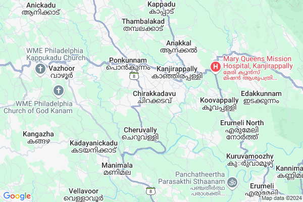
Hospitalpady Map
EDIT Map
Add Your House
 ..
..
Current Corona Virus Infected Patients Count in Kottayam District
| City Name | District Name | Total Covid cases |
|---|---|---|
| Kottayam District | Kottayam | 7 |
| Panachikkad | Kottayam | 2 |
| Chengalam | Kottayam | 2 |
| Manarcad | Kottayam | 1 |
| SankranthI | Kottayam | 1 |
| Nedumkandam | Kottayam | 1 |
Locality Name :
Hospitalpady
( ഹോസ്പിറ്റൽപ്പടി )
Block Name : Vazhoor
District : Kottayam
State : Kerala
Division : South Kerala
Language : Malayalam and English, Hindi
Current Time 03:10 PM
Date: Tuesday , Apr 29,2025 (IST)
Time zone: IST (UTC+5:30)
Elevation / Altitude: 15 meters. Above Seal level
Telephone Code / Std Code: 04828
Assembly constituency : Kanjirappally assembly constituency
Assembly MLA : Dr.N.Jayaraj
Lok Sabha constituency : Pathanamthitta parliamentary constituency
Parliament MP : ANTO ANTONY
Serpanch Name :
Pin Code : 686519
Post Office Name : Thekkethukavala
Main Village Name : Chirakkadavu
Commodities Prices : Kanjirappally Market / Mandi
Hospitalpady Live Weather
Temperature: 27.5 °C
light rain
Humidity: 91%
Wind : 0.89 mt/sec towards SW
Rain : null
StationName : "ErÄ\u0081ttupetta"
observed on Now
Temperature: 27.5 °C
light rain
Humidity: 91%
Wind : 0.89 mt/sec towards SW
Rain : null
StationName : "ErÄ\u0081ttupetta"
observed on Now
Hospitalpady Weather Forecast for Next 5 days
30-04-2025
24.3°C to 28.0°C
moderate rain, light rain, overcast clouds
24.3°C to 28.0°C
moderate rain, light rain, overcast clouds
01-05-2025
24.3°C to 32.6°C
light rain, overcast clouds, moderate rain
24.3°C to 32.6°C
light rain, overcast clouds, moderate rain
02-05-2025
24.0°C to 31.1°C
overcast clouds, light rain
24.0°C to 31.1°C
overcast clouds, light rain
03-05-2025
24.4°C to 29.9°C
overcast clouds, light rain
24.4°C to 29.9°C
overcast clouds, light rain
04-05-2025
23.3°C to 29.8°C
broken clouds, light rain
23.3°C to 29.8°C
broken clouds, light rain
National Highways Reachable To Hospitalpady
Nationa High Way :NH183A
Nationa High Way :NH183
Nationa High Way :NH183A
Nationa High Way :NH183
Rivers Near Hospitalpady
Varattar River
Varattar River
About Hospitalpady
Correct below Info and add more info about HospitalpadyHospitalpady is a small Village/hamlet in Vazhoor Block in Kottayam District of Kerala State, India. It comes under Chirakkadavu Panchayath. It belongs to South Kerala Division . It is located 33 KM towards East from District head quarters Kottayam. 6 KM from Vazhoor. 139 KM from State capital Thiruvananthapuram
Hospitalpady Pin code is 686519 and postal head office is Thekkethukavala .
Hospitalpady is surrounded by Kanjirappally Block towards East , Pampady Block towards west , Erattupetta Block towards North , Mallappally Block towards west .
Erattupetta , Palai , Changanassery , Thiruvalla are the near by Cities to Hospitalpady.
This Place is in the border of the Kottayam District and Pathanamthitta District. Pathanamthitta District Mallappally is west towards this place .
Demographics of Hospitalpady
Malayalam is the Local Language here.Politics in Hospitalpady
CPM , Indian National Congress , KEC(M) , CPI , INC are the major political parties in this area.Polling Stations /Booths near Hospitalpady
1)Govt. L.p. School Cheruvally (south Portion)2)Govt. L.p. School Chirakadavu (north Portion)
3)Sreenarayana U.p. School Vellavoor (south Portion)
4)Sreeramavilasam Nss High School Chirakadavu (east Portion)
5)N.s.s.u.p. School Thampalakadu (south Portion)
HOW TO REACH Hospitalpady
By Rail
There is no railway station near to Hospitalpady in less than 10 km.Colleges near Hospitalpady
St Stephens Collrge
Address :
Department Of Pharmaceutical Sciences,cpas Cheruvandoor Campus
Address : Ettumanoor (p.o)
kottayam, 686631
Department Of Pharmaceutical Sciences, Cheruvandoor
Address : Cheruvandoor
ettumanoor P.o
kottayam
686631
Canossa College Of Nursing
Address : Caritas Hospital, Thellakom P.o, Kottayam-16,keral
Cms College
Address : Kottayam - 686 001
Schools in Hospitalpady
Sctm Ups Cheruvally
Address : chirakkadavu , karukachal , kottayam , Kerala . PIN- 686543 , Post - Manimala
Govt Health Centers near Hospitalpady
1) PHC CHITTAR , Chittar Community health centre , Chittar Maniyar road , police stationHospitals in Hospitalpady,Vazhoor
Dr. B. Venugopal DHMS
19th Mile - Chirakkadavu Rd; Chirakkadavu; Kerala 686519; India
1.2 KM distance Detail
Mar Aprem Medical Centre
Mannamplavu; Kanjirappally Manimala Rd; Chirakkadavu; Kerala 686520; India
2.3 KM distance Detail
KVMS Hospital- IP Block
Ponkunnam - Mannamplavu Rd; Ponkunnam; Kerala 686506; India
2.4 KM distance Detail
more ..
Petrol Bunks in Hospitalpady,Vazhoor
New India Fuels
IndianOil Petrol Pump; N.H: 183 (KK Road); Ponkunnam; Kerala 686506; India
3.3 KM distance Detail
Punnamparampil Service Station
Kottayam-Kumily Rd; Ponkunnam; Kerala 686506; India
3.3 KM distance Detail
more ..
Colleges in Hospitalpady,Vazhoor
St. Antony's College Ponkunnam
Ponkunnam; KVMS Junction; Kottaym; Kerala 686506; India
3.3 KM distance Detail
St. Josephs College and Computer Center
Kanjirappalli Elikkulam Rd; Kokkappally; Kanjirappally; Kerala 686555; India
3.3 KM distance Detail
more ..
Schools in Hospitalpady,Vazhoor
vsup School Poonakal Kunnu
Pulimoodu Maakunnu Rd; Chirakkadavu; Kerala 686519; India
1.4 KM distance Detail
S.P.V NSS UP School
Manjappallykunnu-19th Mile Road; Manjappallykunnu; Ponkunnam; Kerala 686519; India
2.4 KM distance Detail
Government High School
Kanjirappally; Dominic Thomman Rd; Kanjirappally; Kerala 686507; India
2.4 KM distance Detail
Electronic Shops in Hospitalpady,Vazhoor
Opto Electronics
Ponkunnam Manimala Rd; near thekkethu kavala post office; Ponkunnam; Kerala 686506; India
1.3 KM distance Detail
Local Parks in Hospitalpady,Vazhoor
Bishop Kurialacherry Nature Cure & Yoga Center
Karukachal Manimala Rd; Edayarikkapuzha; Kadayanickadu; Kerala 686541; India
8.2 KM distance Detail
Police Stations near Hospitalpady,Vazhoor
Kanjirapally Police Station
Kollam -Theni Hwy; Kokkappally; Kanjirappally; Kerala 686555; India
3.5 KM distance Detail
Dysp Office
Police House; Valanchery - Nilambur Rd; Kolathur; Kerala 679338; India
3.9 KM distance Detail
Governement Offices near Hospitalpady,Vazhoor
സാമൂഹ്യക്ഷേമകേന്ദ്രം ചിറക്കടവ് ഈസ്റ്റ്
ഈസ്റ്റ് P. O.; Pin-686520; ഗ്രാമദീപം റോഡ്; Chirakkadavu; Kerala 686520; India
0.5 KM distance Detail
About Hospitalpady &
History
How to reach Hospitalpady
Tourist Places Near By Hospitalpady
Schools in Hospitalpady
Colleges in Hospitalpady
Temperature & weather of Hospitalpady
places in Hospitalpady
Hospitalpady photos
More Information
How to reach Hospitalpady
Tourist Places Near By Hospitalpady
Schools in Hospitalpady
Colleges in Hospitalpady
Temperature & weather of Hospitalpady
places in Hospitalpady
Hospitalpady photos
More Information
Village Talk
Post News or Events about this Village
Near Cities
Erattupetta 18 KM near
Palai 21 KM near
Changanassery 30 KM near
Thiruvalla 30 KM near
Erattupetta 18 KM near
Palai 21 KM near
Changanassery 30 KM near
Thiruvalla 30 KM near
Near By Taluks
Vazhoor 5 KM near
Kanjirappally 9 KM near
Pampady 16 KM near
Erattupetta 18 KM near
Vazhoor 5 KM near
Kanjirappally 9 KM near
Pampady 16 KM near
Erattupetta 18 KM near
Near By Air Ports
Kochi Airport 89 KM near
Trivandrum International Airport 133 KM near
Madurai Airport 166 KM near
Tuticorin Airport 186 KM near
Kochi Airport 89 KM near
Trivandrum International Airport 133 KM near
Madurai Airport 166 KM near
Tuticorin Airport 186 KM near
Near By Tourist Places
Vagamon 25 KM near
Kottayam 31 KM near
Sabarimala 39 KM near
Kumarakom 41 KM near
Painaw 43 KM near
Vagamon 25 KM near
Kottayam 31 KM near
Sabarimala 39 KM near
Kumarakom 41 KM near
Painaw 43 KM near
Near By Districts
Kottayam 31 KM near
Pathanamthitta 33 KM near
Idukki 45 KM near
Alappuzha 53 KM near
Kottayam 31 KM near
Pathanamthitta 33 KM near
Idukki 45 KM near
Alappuzha 53 KM near
Near By RailWay Station
Changanassery Rail Way Station 29 KM near
Tiruvalla Rail Way Station 29 KM near
Changanassery Rail Way Station 29 KM near
Tiruvalla Rail Way Station 29 KM near