| Home | City Bus | Maps | Villages | Cities | Rail | Tourist Places | School | College | Pin Codes | Corona Cases Count |
| Distance Calculator Bus Services IFSC Codes Trace Mobile Number Weather Search Place Trace IP Available Cash ATM/Banks Locate Polling Booth Report an Error contact People |
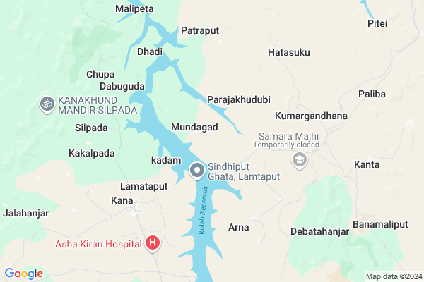
Durla Map
EDIT Map
Add Your House
 ..
..
Current Corona Virus Infected Patients Count in Koraput District
| City Name | District Name | Total Covid cases |
|---|
Locality Name :
Durla
( ଦୁର୍ଲା )
Tehsil Name : Lamtaput
District : Koraput
State : Odisha
Language : Oriya and Hindi
Current Time 08:22 PM
Date: Wednesday , Feb 05,2025 (IST)
Time zone: IST (UTC+5:30)
Elevation / Altitude: 911 meters. Above Seal level
Telephone Code / Std Code: 06868
Assembly constituency : Koraput assembly constituency
Assembly MLA : krishna chandra sagaria
Lok Sabha constituency : Koraput parliamentary constituency
Parliament MP : SAPTAGIRI SANKAR ULAKA
Serpanch Name :
Pin Code : 764037
Post Office Name : Nandapur
Commodities Prices : Koraput Market / Mandi
Durla Live Weather
Temperature: 23.5 °C
overcast clouds
Humidity: 36%
Wind : 2.55 mt/sec towards SE
StationName : "Jeypore"
observed on Now
Temperature: 23.5 °C
overcast clouds
Humidity: 36%
Wind : 2.55 mt/sec towards SE
StationName : "Jeypore"
observed on Now
Durla Weather Forecast for Next 5 days
06-02-2025
19.5°C to 22.8°C
overcast clouds, broken clouds
19.5°C to 22.8°C
overcast clouds, broken clouds
07-02-2025
18.1°C to 30.9°C
scattered clouds, few clouds, clear sky
18.1°C to 30.9°C
scattered clouds, few clouds, clear sky
08-02-2025
18.5°C to 31.9°C
clear sky, few clouds, scattered clouds
18.5°C to 31.9°C
clear sky, few clouds, scattered clouds
09-02-2025
17.7°C to 31.1°C
clear sky
17.7°C to 31.1°C
clear sky
10-02-2025
16.7°C to 31.7°C
clear sky
16.7°C to 31.7°C
clear sky
Rivers Near Durla
Boduru Gedda
Suvarnamukhi
Boduru Gedda
Suvarnamukhi
About Durla
Correct below Info and add more info about DurlaDurla is a small Village/hamlet in Lamtaput Tehsil in Koraput District of Odisha State, India. It is located 22 KM towards South from District head quarters Koraput. 6 KM from Lamtaput. 445 KM from State capital Bhubaneswar
Durla Pin code is 764037 and postal head office is Nandapur .
Jalahanjar ( 13 KM ) , Peta ( 14 KM ) , Lankaput ( 15 KM ) , Nandapur ( 17 KM ) , Umuri ( 17 KM ) are the nearby Villages to Durla. Durla is surrounded by Koraput Tehsil towards North , Nandapur Tehsil towards South , Sunabeda Tehsil towards East , Semiliguda Tehsil towards East .
Koraput , Sunabeda , Jeypur , Salur are the near by Cities to Durla.
Durla 2011 Census Details
Durla Local Language is Oriya. Durla Village Total population is 294 and number of houses are 83. Female Population is 50.0%. Village literacy rate is 12.9% and the Female Literacy rate is 5.1%.
Population
| Census Parameter | Census Data |
| Total Population | 294 |
| Total No of Houses | 83 |
| Female Population % | 50.0 % ( 147) |
| Total Literacy rate % | 12.9 % ( 38) |
| Female Literacy rate | 5.1 % ( 15) |
| Scheduled Tribes Population % | 31.3 % ( 92) |
| Scheduled Caste Population % | 40.1 % ( 118) |
| Working Population % | 57.1 % |
| Child(0 -6) Population by 2011 | 72 |
| Girl Child(0 -6) Population % by 2011 | 41.7 % ( 30) |
Durla Census More Deatils.
Politics in Durla
BJD , INC are the major political parties in this area.Polling Stations /Booths near Durla
1)U.p.school Dhaudapadar2)Primary School Panasput
3)U.p.school Puruna Koraput.
4)U.p.school Arna
5)U.p.school
HOW TO REACH Durla
By Rail
Paliba Rail Way Station is the very nearby railway stations to Durla.Colleges near Durla
Jeypore College Of Pharmacy(jcp)
Address :
Borigumma Mahavidyalaya , Borigumma
Address :
Gopal Krishna College Of Engineering & Technology
Address : Po- Raniput,jeypore-764005
Samanta Chandra Sekhar Institute Of Technology & Management
Address : Po-semiliguda, Distt-koraput Orissa
Gangeswari Mahavidyalaya
Address : Pottangi, Berhampur-760007.
Schools near Durla
Govt Health Centers near Durla
1) Kumuliput , , Kumuliput ,2) SC Kandiwada , SC Kandiwada , Kandiwada , Near Main Road
3) Hadia , , Jamunda ,
Petrol Bunks in Durla,Lamtaput
M/s. THEEDA RAMASWAMY HP Petrol Pump
NH 26; OPP SBI MAIN BRANCH; Koraput; Odisha 764020; India
22.8 KM distance Detail
Hindustan Petroleum
Koraput; NH-43; Chittivalasa Raipur Highway; Koraput; Koraput; Odisha 764020; India
22.9 KM distance Detail
HP PETROL PUMP - THEEDA RAMASWAMY KORAPUT
Main Road Koraput Orissa; Sambalpur; Odisha 764020; India
22.9 KM distance Detail
more ..
Super Markets in Durla,Lamtaput
About Durla &
History
How to reach Durla
Tourist Places Near By Durla
Schools in Durla
Colleges in Durla
Temperature & weather of Durla
places in Durla
Durla photos
More Information
How to reach Durla
Tourist Places Near By Durla
Schools in Durla
Colleges in Durla
Temperature & weather of Durla
places in Durla
Durla photos
More Information
Village Talk
Post News or Events about this Village
Near Cities
Koraput 23 KM near
Sunabeda 25 KM near
Jeypur 27 KM near
Salur 70 KM near
Koraput 23 KM near
Sunabeda 25 KM near
Jeypur 27 KM near
Salur 70 KM near
Near By Taluks
Lamtaput 5 KM near
Koraput 21 KM near
Nandapur 23 KM near
Sunabeda 25 KM near
Lamtaput 5 KM near
Koraput 21 KM near
Nandapur 23 KM near
Sunabeda 25 KM near
Near By Air Ports
Vishakhapatnam Airport 134 KM near
Rajahmundry Airport 214 KM near
Raipur Airport 332 KM near
Vijayawada Airport 342 KM near
Vishakhapatnam Airport 134 KM near
Rajahmundry Airport 214 KM near
Raipur Airport 332 KM near
Vijayawada Airport 342 KM near
Near By Tourist Places
Jeypore 28 KM near
Araku Valley 48 KM near
Ananthagiri 48 KM near
Jagdalpur 89 KM near
Bastar 95 KM near
Jeypore 28 KM near
Araku Valley 48 KM near
Ananthagiri 48 KM near
Jagdalpur 89 KM near
Bastar 95 KM near
Near By Districts
Koraput 22 KM near
Nabarangpur 72 KM near
Malkangiri 94 KM near
Bastar 107 KM near
Koraput 22 KM near
Nabarangpur 72 KM near
Malkangiri 94 KM near
Bastar 107 KM near
Near By RailWay Station
Paliba Rail Way Station 8.3 KM near
Koraput Junction Rail Way Station 20 KM near
Bobbili Junction Rail Way Station 85 KM near
Paliba Rail Way Station 8.3 KM near
Koraput Junction Rail Way Station 20 KM near
Bobbili Junction Rail Way Station 85 KM near