| Home | City Bus | Maps | Villages | Cities | Rail | Tourist Places | School | College | Pin Codes | Corona Cases Count |
| Distance Calculator Bus Services IFSC Codes Trace Mobile Number Weather Search Place Trace IP Available Cash ATM/Banks Locate Polling Booth Report an Error contact People |
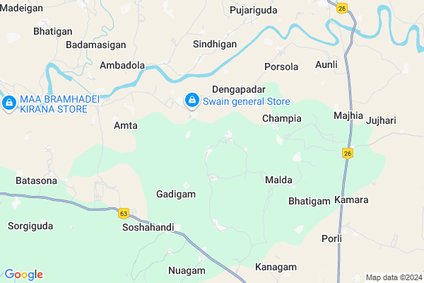
Kerkenda Map
EDIT Map
Add Your House
 ..
..
Current Corona Virus Infected Patients Count in Koraput District
| City Name | District Name | Total Covid cases |
|---|
Locality Name :
Kerkenda
( କେରକେନ୍ଦା )
Tehsil Name : Borigumma
District : Koraput
State : Odisha
Language : Oriya and Hindi
Current Time 08:29 PM
Date: Tuesday , Apr 29,2025 (IST)
Time zone: IST (UTC+5:30)
Elevation / Altitude: 559 meters. Above Seal level
Telephone Code / Std Code: 06860
Assembly constituency : Kotpad assembly constituency
Assembly MLA : chandra sekhar majhi
Lok Sabha constituency : Nabarangpur parliamentary constituency
Parliament MP : RAMESH CHANDRA MAJHI
Serpanch Name :
Pin Code : 764056
Post Office Name : Borigumma
Commodities Prices : Nawarangpur Market / Mandi
Rivers Near Kerkenda
Bhaskel
Chhabili
Bhaskel
Chhabili
About Kerkenda
Correct below Info and add more info about KerkendaKerkenda is a small Village/hamlet in Borigumma Tehsil in Koraput District of Odisha State, India. It is located 51 KM towards North from District head quarters Koraput. 11 KM from Borigumma. 434 KM from State capital Bhubaneswar
Kerkenda Pin code is 764056 and postal head office is Borigumma .
Aunli ( 7 KM ) , Kamara ( 8 KM ) , Jujhari ( 9 KM ) , Batasona ( 11 KM ) , Anchala ( 11 KM ) are the nearby Villages to Kerkenda. Kerkenda is surrounded by Nabarangpur Tehsil towards North , Kotpad Tehsil towards west , Nandahandi Tehsil towards East , Kosagumuda Tehsil towards west .
Nabarangapur , Jeypur , Koraput , Jagdalpur are the near by Cities to Kerkenda.
Kerkenda 2011 Census Details
Kerkenda Local Language is Oriya. Kerkenda Village Total population is 1500 and number of houses are 376. Female Population is 49.7%. Village literacy rate is 33.8% and the Female Literacy rate is 11.3%.
Population
| Census Parameter | Census Data |
| Total Population | 1500 |
| Total No of Houses | 376 |
| Female Population % | 49.7 % ( 745) |
| Total Literacy rate % | 33.8 % ( 507) |
| Female Literacy rate | 11.3 % ( 169) |
| Scheduled Tribes Population % | 53.2 % ( 798) |
| Scheduled Caste Population % | 17.3 % ( 260) |
| Working Population % | 59.9 % |
| Child(0 -6) Population by 2011 | 266 |
| Girl Child(0 -6) Population % by 2011 | 48.9 % ( 130) |
Kerkenda Census More Deatils.
Politics in Kerkenda
INC is the major political party in this area.Polling Stations /Booths near Kerkenda
1)Primary School Katriguda2)Sadaranga Up School
3)U.p.school Bhursi
4)Primary School Badapada
5)Primary School Badaparia
HOW TO REACH Kerkenda
By Rail
There is no railway station near to Kerkenda in less than 10 km.Colleges near Kerkenda
Borigumma Mahavidyalaya , Borigumma
Address :
Schools near Kerkenda
Upper Primary School, Badadubuli
Address : Badadubuli
Govt High School,kumuli
Address : AT/PO- KUMULI,VIA- B.SINGPUR,DIST- KORAPUT
Govt High School B.singpur
Address : At- B.singpur
Govt S.s.d High School Gumuda ..up Sebasram Bidylaya Gumuda
Address :
Govt Health Centers near Kerkenda
1) Kamta , , KUMULI ,2) Puruna Borigumma , , BORIGUMMA SECTOR , SRI BALAJI TEMPLE
3) SC Saruguda , SC Saruguda , Saruguda , Beside AWC
Colleges in Kerkenda,Borigumma
Jagatjanani +3 Scince College
Near LIC office;Nawarangpur Road; Jeypore; Odisha 764001; India
12.0 KM distance Detail
more ..
Schools in Kerkenda,Borigumma
UP SCHOOL; DENGAPADAR
764063; Dengapadar Rd; Dengapadar; Odisha 761146; India
3.4 KM distance Detail
Panchayat High School
764063; Dengapadar Rd; Dengapadar; Odisha 761146; India
3.9 KM distance Detail
Electronic Shops in Kerkenda,Borigumma
SRIBATSHA APPLIEANCES
Jeypore - Bhawanipatna - Balangir - Bargarh Hwy; LIC Colony; Nowrangpur; Odisha 764059; India
12.0 KM distance Detail
Local Parks in Kerkenda,Borigumma
Muncipal Children Park
National Highway 201; Nowrangpur; Odisha 764059; India
12.8 KM distance Detail
Governement Offices near Kerkenda,Borigumma
Adhikar Micro Finance Pvt. Ltd
back side of tripathy bullding; Odisha 764059; India
10.4 KM distance Detail
District Magistrate's Office
Revenue Colony Road; Bank Colony Rd; Nowrangpur; Odisha 764059; India
12.2 KM distance Detail
About Kerkenda &
History
How to reach Kerkenda
Tourist Places Near By Kerkenda
Schools in Kerkenda
Colleges in Kerkenda
Temperature & weather of Kerkenda
places in Kerkenda
Kerkenda photos
More Information
How to reach Kerkenda
Tourist Places Near By Kerkenda
Schools in Kerkenda
Colleges in Kerkenda
Temperature & weather of Kerkenda
places in Kerkenda
Kerkenda photos
More Information
Village Talk
Post News or Events about this Village
Near Cities
Nabarangapur 12 KM near
Jeypur 36 KM near
Koraput 48 KM near
Jagdalpur 54 KM near
Nabarangapur 12 KM near
Jeypur 36 KM near
Koraput 48 KM near
Jagdalpur 54 KM near
Near By Taluks
Borigumma 11 KM near
Nabarangpur 12 KM near
Kotpad 16 KM near
Nandahandi 22 KM near
Borigumma 11 KM near
Nabarangpur 12 KM near
Kotpad 16 KM near
Nandahandi 22 KM near
Near By Air Ports
Vishakhapatnam Airport 197 KM near
Rajahmundry Airport 266 KM near
Raipur Airport 268 KM near
Vijayawada Airport 383 KM near
Vishakhapatnam Airport 197 KM near
Rajahmundry Airport 266 KM near
Raipur Airport 268 KM near
Vijayawada Airport 383 KM near
Near By Tourist Places
Jeypore 36 KM near
Jagdalpur 55 KM near
Bastar 61 KM near
Araku Valley 110 KM near
Ananthagiri 111 KM near
Jeypore 36 KM near
Jagdalpur 55 KM near
Bastar 61 KM near
Araku Valley 110 KM near
Ananthagiri 111 KM near
Near By Districts
Nabarangpur 12 KM near
Koraput 49 KM near
Bastar 66 KM near
Rayagada 108 KM near
Nabarangpur 12 KM near
Koraput 49 KM near
Bastar 66 KM near
Rayagada 108 KM near
Near By RailWay Station
Koraput Junction Rail Way Station 52 KM near
Singapur Road Rail Way Station 108 KM near
Koraput Junction Rail Way Station 52 KM near
Singapur Road Rail Way Station 108 KM near