| Home | City Bus | Maps | Villages | Cities | Rail | Tourist Places | School | College | Pin Codes | Corona Cases Count |
| Distance Calculator Bus Services IFSC Codes Trace Mobile Number Weather Search Place Trace IP Available Cash ATM/Banks Locate Polling Booth Report an Error contact People |
Chikima
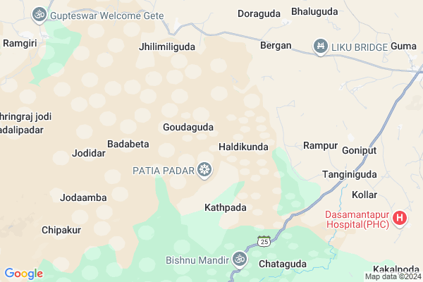
Chikima Map
EDIT Map
Add Your House
 ..
..
Current Corona Virus Infected Patients Count in Koraput District
| City Name | District Name | Total Covid cases |
|---|
Locality Name :
Chikima
( ଚିକିମ )
Tehsil Name : Boipariguda
District : Koraput
State : Odisha
Language : Oriya and Hindi
Current Time 11:06 AM
Date: Sunday , Apr 27,2025 (IST)
Time zone: IST (UTC+5:30)
Elevation / Altitude: 595 meters. Above Seal level
Telephone Code / Std Code: 06852
Assembly constituency : Kotpad assembly constituency
Assembly MLA : chandra sekhar majhi
Lok Sabha constituency : Nabarangpur parliamentary constituency
Parliament MP : RAMESH CHANDRA MAJHI
Serpanch Name :
Commodities Prices : Koraput Market / Mandi
Chikima Live Weather
Temperature: 32.1 °C
overcast clouds
Humidity: 34%
Wind : 2.95 mt/sec towards N
StationName : "Jeypore"
observed on Now
Temperature: 32.1 °C
overcast clouds
Humidity: 34%
Wind : 2.95 mt/sec towards N
StationName : "Jeypore"
observed on Now
Chikima Weather Forecast for Next 5 days
28-04-2025
21.9°C to 36.1°C
overcast clouds, broken clouds, light rain, moderate rain
21.9°C to 36.1°C
overcast clouds, broken clouds, light rain, moderate rain
29-04-2025
21.4°C to 36.2°C
broken clouds, clear sky, few clouds, scattered clouds
21.4°C to 36.2°C
broken clouds, clear sky, few clouds, scattered clouds
30-04-2025
24.0°C to 37.2°C
clear sky, light rain, scattered clouds
24.0°C to 37.2°C
clear sky, light rain, scattered clouds
01-05-2025
24.7°C to 37.9°C
clear sky, few clouds, scattered clouds
24.7°C to 37.9°C
clear sky, few clouds, scattered clouds
02-05-2025
24.9°C to 39.0°C
clear sky, few clouds, light rain
24.9°C to 39.0°C
clear sky, few clouds, light rain
Rivers Near Chikima
Sabari :శబరి
Sabari :శబరి
About Chikima
Correct below Info and add more info about ChikimaChikima is a small Village/hamlet in Boipariguda Tehsil in Koraput District of Odisha State, India. It is located 48 KM towards west from District head quarters Koraput. 474 KM from State capital Bhubaneswar
Chikima is surrounded by Kundura Tehsil towards North , Khairaput Tehsil towards South , Mathili Tehsil towards west , Jeypore Tehsil towards East .
Jeypur , Koraput , Jagdalpur , Sunabeda are the near by Cities to Chikima.
Chikima 2011 Census Details
Chikima Local Language is Oriya. Chikima Village Total population is 528 and number of houses are 120. Female Population is 50.2%. Village literacy rate is 56.8% and the Female Literacy rate is 20.5%.
Population
| Census Parameter | Census Data |
| Total Population | 528 |
| Total No of Houses | 120 |
| Female Population % | 50.2 % ( 265) |
| Total Literacy rate % | 56.8 % ( 300) |
| Female Literacy rate | 20.5 % ( 108) |
| Scheduled Tribes Population % | 22.2 % ( 117) |
| Scheduled Caste Population % | 1.5 % ( 8) |
| Working Population % | 37.3 % |
| Child(0 -6) Population by 2011 | 68 |
| Girl Child(0 -6) Population % by 2011 | 60.3 % ( 41) |
Chikima Census More Deatils.
Politics in Chikima
INC is the major political party in this area.Polling Stations /Booths near Chikima
1)Sevashram Batasana2)Kalinji Sahi N.u.p. School Kalinji Sahi
3)Mangali Sahi .pry.school Mangali Sahi
4)A.w.c. Center Podapadar
5)Upper Primary School Potroguda
HOW TO REACH Chikima
By Rail
There is no railway station near to Chikima in less than 10 km.Pincodes near Chikima
764043 ( Boipariguda ) , 764081 ( Lamtaput ) , 764005 ( Jayanagar (Koraput) )Colleges near Chikima
Jeypore College Of Pharmacy(jcp)
Address :
Borigumma Mahavidyalaya , Borigumma
Address :
Gopal Krishna College Of Engineering & Technology
Address : Po- Raniput,jeypore-764005
Samanta Chandra Sekhar Institute Of Technology & Management
Address : Po-semiliguda, Distt-koraput Orissa
Gangeswari Mahavidyalaya
Address : Pottangi, Berhampur-760007.
Schools near Chikima
Govt Health Centers near Chikima
1) SC Kandiwada , SC Kandiwada , Kandiwada , Near Main Road2) Jaugali , AWC , Jaugali , TUBEL
3) SC Kumarput , , , Kasthuraba Gandhi School and Field
Schools in Chikima,Boipariguda
Saheed Laxman Nayak Degree College; Boipariguda
Boipariguda - Kundra Rd; Guma; Odisha 764043; India
12.8 KM distance Detail
Electronic Shops in Chikima,Boipariguda
Sri Ram Digital Studio & Mobile Care
Ramgiri Rd; Katriguda; Odisha 764043; India
12.4 KM distance Detail
Local Parks in Chikima,Boipariguda
About Chikima &
History
How to reach Chikima
Tourist Places Near By Chikima
Schools in Chikima
Colleges in Chikima
Temperature & weather of Chikima
places in Chikima
Chikima photos
More Information
How to reach Chikima
Tourist Places Near By Chikima
Schools in Chikima
Colleges in Chikima
Temperature & weather of Chikima
places in Chikima
Chikima photos
More Information
Village Talk
Post News or Events about this Village
Near Cities
Jeypur 33 KM near
Koraput 46 KM near
Jagdalpur 56 KM near
Sunabeda 58 KM near
Jeypur 33 KM near
Koraput 46 KM near
Jagdalpur 56 KM near
Sunabeda 58 KM near
Near By Taluks
Boipariguda 0 KM near
Kundura 26 KM near
Khairaput 29 KM near
Mathili 29 KM near
Boipariguda 0 KM near
Kundura 26 KM near
Khairaput 29 KM near
Mathili 29 KM near
Near By Air Ports
Vishakhapatnam Airport 162 KM near
Rajahmundry Airport 209 KM near
Raipur Airport 314 KM near
Vijayawada Airport 327 KM near
Vishakhapatnam Airport 162 KM near
Rajahmundry Airport 209 KM near
Raipur Airport 314 KM near
Vijayawada Airport 327 KM near
Near By Tourist Places
Jeypore 33 KM near
Jagdalpur 57 KM near
Bastar 63 KM near
Araku Valley 79 KM near
Ananthagiri 79 KM near
Jeypore 33 KM near
Jagdalpur 57 KM near
Bastar 63 KM near
Araku Valley 79 KM near
Ananthagiri 79 KM near
Near By Districts
Koraput 46 KM near
Malkangiri 68 KM near
Nabarangpur 69 KM near
Bastar 76 KM near
Koraput 46 KM near
Malkangiri 68 KM near
Nabarangpur 69 KM near
Bastar 76 KM near
Near By RailWay Station
Koraput Junction Rail Way Station 46 KM near
Bobbili Junction Rail Way Station 121 KM near
Koraput Junction Rail Way Station 46 KM near
Bobbili Junction Rail Way Station 121 KM near