| Home | City Bus | Maps | Villages | Cities | Rail | Tourist Places | School | College | Pin Codes | Corona Cases Count |
| Distance Calculator Bus Services IFSC Codes Trace Mobile Number Weather Search Place Trace IP Available Cash ATM/Banks Locate Polling Booth Report an Error contact People |
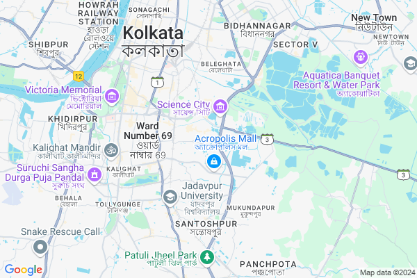
Tiljala Road, Topsia
Tiljala Road, Topsia Map
EDIT Map
Add Your House
 ..
..
Current Corona Virus Infected Patients Count in Kolkata District
| City Name | District Name | Total Covid cases |
|---|---|---|
| Kolkata | Kolkata | 4 |
| Beleghata | Kolkata | 3 |
| Kolkata District | Kolkata | 2 |
| Nayabad | Kolkata | 1 |
| Dum Dum | Kolkata | 1 |
Village Name :
Tiljala Road, Topsia
( তিলজলা রোড টোপসিয়া )
City Name : Kolkata
District : Kolkata
State : West Bengal
Division : Presidency
Language : Bengali and English, Hindi, Urdu, Marwari, Bihari
Current Time 03:01 PM
Date: Friday , Apr 25,2025 (IST)
Time zone: IST (UTC+5:30)
Elevation / Altitude: 8 meters. Above Seal level
Telephone Code / Std Code: 033
Ward : Ward
Assembly constituency : Kasba assembly constituency
Assembly MLA : Ahmed Javed Khan
Lok Sabha constituency : Kolkata Dakshin parliamentary constituency
Parliament MP : Mala Roy
Pin Code : 700046
Post Office Name : Gobinda Khatick Road
Commodities Prices : Sealdah Koley Market Market / Mandi
Tiljala Road, Topsia Live Weather
Temperature: 36.0 °C
haze
Humidity: 67%
Wind : 4.63 mt/sec towards S
StationName : "Kolkata"
observed on 46 Mins Back
Temperature: 36.0 °C
haze
Humidity: 67%
Wind : 4.63 mt/sec towards S
StationName : "Kolkata"
observed on 46 Mins Back
Tiljala Road, Topsia Weather Forecast for Next 5 days
26-04-2025
27.6°C to 38.9°C
scattered clouds, few clouds, clear sky
27.6°C to 38.9°C
scattered clouds, few clouds, clear sky
27-04-2025
27.3°C to 36.7°C
clear sky
27.3°C to 36.7°C
clear sky
28-04-2025
27.7°C to 36.1°C
few clouds, scattered clouds, overcast clouds, broken clouds, clear sky
27.7°C to 36.1°C
few clouds, scattered clouds, overcast clouds, broken clouds, clear sky
29-04-2025
24.2°C to 37.1°C
broken clouds, overcast clouds, light rain, moderate rain
24.2°C to 37.1°C
broken clouds, overcast clouds, light rain, moderate rain
30-04-2025
22.2°C to 35.3°C
overcast clouds, light rain, heavy intensity rain
22.2°C to 35.3°C
overcast clouds, light rain, heavy intensity rain
National Highways Reachable To Tiljala Road, Topsia
Nationa High Way :NH12
Nationa High Way :NH12
Rivers Near Tiljala Road, Topsia
Damodar
Damodar
About Tiljala Road, Topsia
Correct below Info and add more info about Tiljala Road, TopsiaTiljala Road, Topsia is a Locality in Kolkata City in West Bengal State, India. It is belongs to Presidency Division .
Tiljala Road, Topsia Pin code is 700046 and postal head office is Gobinda Khatick Road .
Kolkata , Bidhan Nagar , South Dumdum , Baranagar are the nearby Cities to Kolkata.
Demographics of Tiljala Road, Topsia
Bengali is the Local Language here.Politics in Tiljala Road, Topsia
CPM , AITC , BJP , All India Trinamool Congress are the major political parties in this area.Polling Stations /Booths near Tiljala Road, Topsia
1)C.n.roy Road Govt. Housing Kol-392)Central Collegiate School
3)K.m.c.pry. School
4)Kaji Nazrul Islam Institute
5)Kaji Nazrul Islam Institute
HOW TO REACH Tiljala Road, Topsia
By Rail
Park Circus Rail Way Station , Ballygunge Junction Rail Way Station are the very nearby railway station to Tiljala Road, Topsia.Local Bus
Topsia Bus Station , Topsia Rd Crossing Bus Station , Tiljala. Bus Station , Picnic Garden Bus Station , Rifle Range Rd Bus Station are the nearby by Local Bus Stops to Tiljala Road, Topsia . runs Number of busses from Tiljala Road, Topsia to different Places.Bus Stops near Tiljala Road, Topsia
Topsia Topsia Rd Crossing Tiljala. Picnic Garden Rifle Range RdLoacl Bus Routes Travel from Tiljala Road, Topsia
128 ( Picnic Garden - Howrah Station )15A ( Chetla - - B.B.D. Bag )
33 ( Chetla - Manicktala )
39 ( High Court - Picnic Garden )
39A ( Picnic Garden - Salt Lake )
More..
Govt Health Centers near Tiljala Road, Topsia
1) All India Institute of Hygiene and Public Health (A.I.I.H. & P.H.), Kolkata , Block-JC-27 & 27B, , Sector-III, , Bidhan Nagar (Salt Lake),2) Bhagabanpur , Bhagabanpur Health Sub Centre , Kheadaha Anandapur Road , Opposite of Kheadaha II GP Office
3) Ranabhutia , Ranabhutia Health Sub Centre , Ranabhutia Kantipota Road , Ranabhutia 1 no. Ala
Hospitals in Tiljala Road, Topsia,Kolkata
Dr Rakesh Roy
Shree R Hs; 662; Picnic Garden Road; Tiljala; Tiljala; Kolkata; West Bengal 700039; India
0.4 KM distance Detail
Dr Tuphan Kanti Dolai
ASRAY RESIDENCY; 791; Flat-2B; 731; TAGORE PARK (Near Auto Stand); Kolkata; West Bengal 700039; India
0.5 KM distance Detail
Sachetanata Bhavan(DAY)
12/1A; Bidhan Nagar; Tiljala; Kolkata; West Bengal 700039; India
0.5 KM distance Detail
Swastik Clinic
2nd Floor Tiljala; 209/1; Picnic Garden Road; Tiljala; Tiljala; Kolkata; West Bengal 700039; India
0.5 KM distance Detail
more ..
Petrol Bunks in Tiljala Road, Topsia,Kolkata
Indian Oil Petrol Pump
Bose Pukur Rd; Bosepukur; Kasba; Kolkata; West Bengal 700042; India
1.5 KM distance Detail
Xtra Care
Rajdanga Main Rd; Sector B; East Kolkata Twp; Kolkata; West Bengal 700107; India
2.1 KM distance Detail
Indian Oil Fuel Station
PLOT-3B;RASH BEHARI AV.CONNECT RAJDANGA NABAPALLY; Kolkata; West Bengal 700107; India
2.1 KM distance Detail
more ..
Colleges in Tiljala Road, Topsia,Kolkata
Indian Institute of Planing and Management
443; VIP Nagar Hesting Colony; E.M Bypass Near Sitala Mandir; Matongini Colony; VIP Nagar; Kolkata; West Bengal 700100; India
1.3 KM distance Detail
Institute Of Pharmaceutical And Healthcare Management And Research
318/B; Prantik Pally; (Off) Rashbehari Connector; Kolkata; West Bengal 700107; India
1.3 KM distance Detail
CRNN
Block II; 46/2; Bose Pukur Rd; JD Block; Bosepukur; Kasba; Kolkata; West Bengal 700042; India
1.4 KM distance Detail
Institute Of Business Management And Research
318A; Prantik Pally Road; Rajdanga; Kolkata; West Bengal 700107; India
1.4 KM distance Detail
more ..
Schools in Tiljala Road, Topsia,Kolkata
Trinita Society for Social and Health Research
32/3; 4th Floor; Dafodill Apartment; Topsia Road South; Topsia; Kolkata; West Bengal 700046; India
0.5 KM distance Detail
Tiljala High School
143; Picnic Garden Rd; Tiljala; Kolkata; West Bengal 700039; India
0.6 KM distance Detail
Global India Infotech
Vill-Uttar Panchanna Gram; PO-; VIP Nagar; Kolkata; West Bengal 700100; India
0.7 KM distance Detail
Marian Co Educational School
120M; DEB BANERJEE ROAD PICNIC GARDEN; Kolkata; West Bengal 700039; India
0.8 KM distance Detail
Electronic Shops in Tiljala Road, Topsia,Kolkata
Music Centre
Chandra Nath Roy Rd; Bidhan Nagar; Tiljala; Kolkata; West Bengal 700039; India
0.4 KM distance Detail
Shree Shyam Electrical.
143; 115; Picnic Garden Rd; Picnic Garden; Tiljala; Kolkata; West Bengal 700039; India
0.6 KM distance Detail
Computer World
Picnic Garden Road; Picnic Garden; Purba Sree Pally; Kasba; Kolkata; West Bengal 700039; India
0.7 KM distance Detail
Super Markets in Tiljala Road, Topsia,Kolkata
Ma Kali Bhandar
143/2; Bedlam Danga 2nd Ln; Tiljala; Kolkata; West Bengal 700039; India
0.9 KM distance Detail
BALAJEE GENRAL STORE
198; Picnic Garden Rd; Tiljala; Kolkata; West Bengal 700039; India
1.0 KM distance Detail
Local Parks in Tiljala Road, Topsia,Kolkata
39 Bus Stand Park
Picnic Garden Rd; Binay Singh Colony; Tiljala; Kolkata; West Bengal 700039; India
0.3 KM distance Detail
KMC Children Park
Panchanna Pally; Topsia; Kolkata; West Bengal 700039; India
0.5 KM distance Detail
Police Stations near Tiljala Road, Topsia,Kolkata
Tiljala Police Station
Chandra Nath Roy Rd; Picnic Garden; Tiljala; Kolkata; West Bengal 700039; India
0.9 KM distance Detail
AITMC Party Office
Ward No. 64; JBS Haldane Ave; Kolkata; West Bengal 700046; India
1.6 KM distance Detail
Kasba Police Station
27A; Bose Pukur Rd; Tal Bagan; Bosepukur; Kasba; Kolkata; West Bengal 700042; India
1.6 KM distance Detail
Governement Offices near Tiljala Road, Topsia,Kolkata
Govt. Housing Estate C. N. Roy Road
Chandra Nath Roy Rd; Tiljala; Kolkata; West Bengal 700039; India
0.3 KM distance Detail
E- FILLING & UPDATING
59C; G. J. KHAN ROAD Ashiyana Apartment; Ground Floor; Block F; Kolkata; West Bengal 700039; India
0.9 KM distance Detail
S.S. Medical Stroes
51B; Gulam Jilani Khan Rd; Topsia; Kolkata; West Bengal 700039; India
0.9 KM distance Detail
About Tiljala Road, Topsia &
History
How to reach Tiljala Road, Topsia
Tourist Places Near By Tiljala Road, Topsia
Schools in Tiljala Road, Topsia
Colleges in Tiljala Road, Topsia
Temperature & weather of Tiljala Road, Topsia
places in Tiljala Road, Topsia
Tiljala Road, Topsia photos
More Information
How to reach Tiljala Road, Topsia
Tourist Places Near By Tiljala Road, Topsia
Schools in Tiljala Road, Topsia
Colleges in Tiljala Road, Topsia
Temperature & weather of Tiljala Road, Topsia
places in Tiljala Road, Topsia
Tiljala Road, Topsia photos
More Information
Locality Talk
Post News or Events about this Locality
Near Cities
Kolkata 5 KM near
Bidhan Nagar 7 KM near
South Dumdum 10 KM near
Baranagar 13 KM near
Kolkata 5 KM near
Bidhan Nagar 7 KM near
South Dumdum 10 KM near
Baranagar 13 KM near
Near By Taluks
Kolkata 1 KM near
Alipore 7 KM near
Sonar Pur 12 KM near
Thakurpukur Mahestola 12 KM near
Kolkata 1 KM near
Alipore 7 KM near
Sonar Pur 12 KM near
Thakurpukur Mahestola 12 KM near
Near By Air Ports
Netaji Subhas Chandra Bose Airport 15 KM near
Ranchi Airport 365 KM near
Singerbhil Airport 368 KM near
Bhubaneswar Airport 411 KM near
Netaji Subhas Chandra Bose Airport 15 KM near
Ranchi Airport 365 KM near
Singerbhil Airport 368 KM near
Bhubaneswar Airport 411 KM near
Near By Tourist Places
Kolkata 6 KM near
Alipore 6 KM near
Howrah 16 KM near
Raichak 50 KM near
Haldia 66 KM near
Kolkata 6 KM near
Alipore 6 KM near
Howrah 16 KM near
Raichak 50 KM near
Haldia 66 KM near
Near By Districts
Kolkata 5 KM near
24 Paraganas South 7 KM near
Howrah 11 KM near
24 Paraganas North 25 KM near
Kolkata 5 KM near
24 Paraganas South 7 KM near
Howrah 11 KM near
24 Paraganas North 25 KM near
Near By RailWay Station
Park Circus Rail Way Station 2.4 KM near
Ballygunge Junction Rail Way Station 2.5 KM near
Dhakuria Rail Way Station 3.6 KM near
Sealdah Rail Way Station 4 KM near
Bidhan Nagar Road Rail Way Station 7 KM near
Park Circus Rail Way Station 2.4 KM near
Ballygunge Junction Rail Way Station 2.5 KM near
Dhakuria Rail Way Station 3.6 KM near
Sealdah Rail Way Station 4 KM near
Bidhan Nagar Road Rail Way Station 7 KM near