| Home | City Bus | Maps | Villages | Cities | Rail | Tourist Places | School | College | Pin Codes | Corona Cases Count |
| Distance Calculator Bus Services IFSC Codes Trace Mobile Number Weather Search Place Trace IP Available Cash ATM/Banks Locate Polling Booth Report an Error contact People |
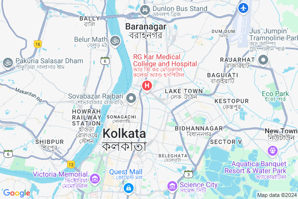
Daspara
Daspara Map
EDIT Map
Add Your House
 ..
..
Current Corona Virus Infected Patients Count in Kolkata District
| City Name | District Name | Total Covid cases |
|---|---|---|
| Kolkata | Kolkata | 4 |
| Beleghata | Kolkata | 3 |
| Kolkata District | Kolkata | 2 |
| Nayabad | Kolkata | 1 |
| Dum Dum | Kolkata | 1 |
Village Name :
Daspara
( দাসপাড়া )
City Name : Kolkata
District : Kolkata
State : West Bengal
Division : Presidency
Language : Bengali and English, Hindi, Urdu, Marwari, Bihari
Current Time 11:22 AM
Date: Friday , Mar 14,2025 (IST)
Time zone: IST (UTC+5:30)
Elevation / Altitude: 8 meters. Above Seal level
Telephone Code / Std Code: 033
Ward : Ward
Assembly constituency : Maniktala assembly constituency
Assembly MLA : Sadhan Pande
Lok Sabha constituency : Kolkata Uttar parliamentary constituency
Parliament MP : BANDYOPADHYAY SUDIP
Pin Code : 700094
Post Office Name : S.R.F.T.I.
Main Village Name : Nayabad
Commodities Prices : Mechua Market / Mandi
Daspara Live Weather
Temperature: 32.3 °C
clear sky
Humidity: 38%
Wind : 2.52 mt/sec towards SW
StationName : "Dum Dum"
observed on 1 Hours Back
Temperature: 32.3 °C
clear sky
Humidity: 38%
Wind : 2.52 mt/sec towards SW
StationName : "Dum Dum"
observed on 1 Hours Back
Daspara Weather Forecast for Next 5 days
15-03-2025
24.4°C to 39.3°C
clear sky
24.4°C to 39.3°C
clear sky
16-03-2025
24.0°C to 40.5°C
clear sky
24.0°C to 40.5°C
clear sky
17-03-2025
23.8°C to 38.5°C
clear sky, few clouds
23.8°C to 38.5°C
clear sky, few clouds
18-03-2025
24.2°C to 40.2°C
clear sky, few clouds
24.2°C to 40.2°C
clear sky, few clouds
19-03-2025
24.9°C to 40.9°C
clear sky, scattered clouds, few clouds
24.9°C to 40.9°C
clear sky, scattered clouds, few clouds
Edit below overview about Daspara
Edit below overview about Daspara
OverView of Daspara
The roads here have been very poorly constructed.There are broken roads throughout the area.Its nearby locality Khudirabad also suffers the Lack of proper roads and communication.Edit below overview about Daspara
National Highways Reachable To Daspara
Nationa High Way :NH12
Nationa High Way :NH12
Rivers Near Daspara
Damodar
Damodar
About Daspara
Daspara is a in Kolkata City in West Bengal State, India. It is belongs to Presidency Division .
Daspara Pin code is 700094 and postal head office is S.R.F.T.I. .
Belgachia , Bidhan Sarani , Bagmari , Shyambazar , Maniktala are the nearby Localities to Daspara.
South Dumdum , Kolkata , Baranagar , Bidhan Nagar are the nearby Cities to Kolkata.
Demographics of Daspara
Bengali is the Local Language here.Politics in Daspara
CPM , CPI(M) , AITC , BJP , All India Trinamool Congress are the major political parties in this area.Polling Stations /Booths near Daspara
1)Sishumahal Girlsu0027 High School Room No.-52)Sitala Sangha Prathamik Vidyalaya Room No.-1
3)New National High School (hindi Medium) Room No.-4
4)New St. Thomas Public School (old Name Sri Shikha Niketan) Room No.-1
5)New St. Thomas Public School (old Name Sri Shikha Niketan) Room No.-2
HOW TO REACH Daspara
By Rail
Kolkata Rail Way Station , Tala Rail Way Station are the very nearby railway station to Daspara.Local Bus
Ultadanga Main Rd Bus Station , Ultadanga Rd Bus Station , Ultadanga Bridge Bus Station , Aurobinda Setu Bus Station , Arabindo Setu Bus Station are the nearby by Local Bus Stops to Daspara . runs Number of busses from Daspara to different Places.Bus Stops near Daspara
Ultadanga Main Rd Ultadanga Rd Ultadanga Bridge Aurobinda Setu Arabindo SetuLoacl Bus Routes Travel from Daspara
15 ( Ultadanga Stn. - - Howrah Stn. )201 ( Salt Lake Karunamayee - Belgharia )
211 ( Ahiritola - Khoribari )
211A ( Ahiritola - - Patharghata )
215A ( Salt Lake (Karunamayee) - Howrah Stn. )
More..
Govt Health Centers near Daspara
1) Satya Bala Devi ID Hospital , 199, , G. T. Road, Ghusuri , SATYABALA TELEPHONE EXCHANGE2) All India Institute of Hygiene and Public Health (A.I.I.H. & P.H.), Kolkata , Block-JC-27 & 27B, , Sector-III, , Bidhan Nagar (Salt Lake),
3) Haora District Hospital , 10 , Biplabi Haren Ghosh Sarani , District Hospital, Howrah
Sub Localities in Daspara
Hospitals in Daspara,Kolkata
THE SPANDAN DIAGNOSTICS
3A Raicharan Sadhukhan Road Opposite R.G.kar Medical College & Hospital On the way to Kolkata Railway Station; West Bengal 700004; India
0.3 KM distance Detail
J.B. Roy State Ayurvedic Medical College And Hospital
170-172; Raja Dinendra St; Near Deshbandhu Park; Kolkata; West Bengal 700004; India
0.4 KM distance Detail
Paul's Clinic
149; Ultadanga Main Rd; Daspara; Ultadanga; Kolkata; West Bengal 700067; India
0.5 KM distance Detail
R.G. Kar Medical College Emergency Building
100/1; R G Kar Rd; Bidhan Sarani; Belgachia; Kolkata; West Bengal 700004; India
0.5 KM distance Detail
more ..
Petrol Bunks in Daspara,Kolkata
HP PETROL PUMP - M. M. BISWAS
229; Acharya Prafulla Chandra Rd; Shyambazar; Fariapukur; Kolkata; West Bengal 700004; India
0.7 KM distance Detail
HP PETROL PUMP - THE INDIA TRADING CO.
Calcutta 700067; 1; Ultadanga Rd; Calcutta University; Shyam Bazar; Kolkata; West Bengal 700004; India
0.7 KM distance Detail
Bharat Petroleum; PUC certificate
228; Acharya Prafulla Chandra Rd; Fariapukur; Shyam Bazar; Kolkata; West Bengal 700004; India
0.7 KM distance Detail
Bharat Petroleum Bunk
No. 1-28; Barrackpore Trunk Road; Mohendra Bose Ln; Bidhan Sarani; Shyam Bazar; Kolkata; West Bengal 700004; India
0.8 KM distance Detail
more ..
Colleges in Daspara,Kolkata
R.G. Kar Medical College and Hospital
1; Khudiram Bose Sarani; Kolkata; West Bengal 700004; India
0.6 KM distance Detail
State Bank Of India R.G. Kar Medical College
25; Manmatha Nath Ganguly Rd; RG Kar Rd; Shyam Bazar; Bidhan Sarani; Kolkata; West Bengal 700004; India
0.6 KM distance Detail
Shyambazar Law College
7/1A; Mohanlal St; Shyambazar; Kolkata; West Bengal 700004; India
0.7 KM distance Detail
Banichakra
191; Acharya Prafulla Chandra Road; Fariapukur; Shyambazar; Kolkata; West Bengal 700004; India
0.7 KM distance Detail
more ..
Schools in Daspara,Kolkata
NIIT Kolkata Shyambazar Centre
123 ; Bidhan Sarani ; NIIT Building 3rd Floor; Beside Bag Bazaar Bata; Kolkata; West Bengal 700004; India
0.9 KM distance Detail
IIFM - Imperial Institute of Financial Management
12H; Canal W Rd; Fariapukur; Shyam Bazar; Kolkata; West Bengal 700004; India
1.0 KM distance Detail
Iqra Assembly School
83A/H/16; Belgachia Road; Kolkata; West Bengal 700037; India
1.1 KM distance Detail
Sahaja Yoga Meditation Centre (Non-profitable)
139/2 Indra Biswas Road; Near Tala Tank; Kolkata; West Bengal 700037; India
1.2 KM distance Detail
Electronic Shops in Daspara,Kolkata
laxmi mobile stors
19; Mohan Lal St; Fariapukur; Shyam Bazar; Kolkata; West Bengal 700004; India
0.6 KM distance Detail
Intex Corporation
22b; Mohanlal Street; Shyambazar; Kolkata; West Bengal 700004; India
0.7 KM distance Detail
Raipur Electronics Pvt. Ltd.
205; Acharya Prafulla Chandra Rd; Fariapukur; Shyam Bazar; Kolkata; West Bengal 700004; India
0.8 KM distance Detail
Super Markets in Daspara,Kolkata
Baghbazar Sakher Haat Byabasayee Welfare Samity.
Ghosh Bagan; Chitpur; Kolkata; West Bengal 700003; India
1.0 KM distance Detail
Ultadanga Crossing
D20/1; Surir Bagan; Ultadanga; Kolkata; West Bengal 700067; India
1.1 KM distance Detail
Fancy Hat
155/5; Acharya Prafulla Chandra Rd; Manicktala; Khanna; Kolkata; West Bengal 700006; India
1.1 KM distance Detail
Local Parks in Daspara,Kolkata
Kolkata Station Park
Raicharan Sadhukhan Rd; Belgachia; Kolkata; West Bengal 700004; India
0.3 KM distance Detail
Deshbandhu Park
165b; Raja Dinendra Street; Kolkata; West Bengal 700004; India
0.4 KM distance Detail
Deshbandhu Ladies Park
Raja Dinendra St; Fariapukur; Shyam Bazar; Kolkata; West Bengal 700004; India
0.4 KM distance Detail
Police Stations near Daspara,Kolkata
Kolkata Police barack(K.P)
125; Bagbazar St; Shyam Bazar; Bidhan Sarani; Baghbazar; Kolkata; West Bengal 700004; India
0.9 KM distance Detail
Kolkata Traffic Police
242b; Acharya Prafulla Chandra Rd; Manicktala; Fariapukur; Kolkata; West Bengal 700004; India
0.9 KM distance Detail
Tala Police Station
4; Indra Biswas Road; Tala; Kolkata; West Bengal 700037; India
1.0 KM distance Detail
Governement Offices near Daspara,Kolkata
Marriage Registration Office
1/C; Ultadanga Main Road; Ultadanga; Kolkata; West Bengal 700067; India
0.5 KM distance Detail
Deflame (India)
11 M; Paul Street (Shyambazar); Shyambazar; Shyambazar; Kolkata; West Bengal 700004; India
0.9 KM distance Detail
About Daspara &
History
How to reach Daspara
Tourist Places Near By Daspara
Schools in Daspara
Colleges in Daspara
Temperature & weather of Daspara
places in Daspara
Daspara photos
More Information
How to reach Daspara
Tourist Places Near By Daspara
Schools in Daspara
Colleges in Daspara
Temperature & weather of Daspara
places in Daspara
Daspara photos
More Information
Locality Talk
Post News or Events about this Locality
Near Cities
South Dumdum 2 KM near
Kolkata 3 KM near
Baranagar 5 KM near
Bidhan Nagar 5 KM near
South Dumdum 2 KM near
Kolkata 3 KM near
Baranagar 5 KM near
Bidhan Nagar 5 KM near
Near By Taluks
Bally-Jagacha 9 KM near
Kolkata 9 KM near
Howrah 10 KM near
Konnagar 12 KM near
Bally-Jagacha 9 KM near
Kolkata 9 KM near
Howrah 10 KM near
Konnagar 12 KM near
Near By Air Ports
Netaji Subhas Chandra Bose Airport 8 KM near
Ranchi Airport 361 KM near
Singerbhil Airport 365 KM near
Bhubaneswar Airport 416 KM near
Netaji Subhas Chandra Bose Airport 8 KM near
Ranchi Airport 361 KM near
Singerbhil Airport 365 KM near
Bhubaneswar Airport 416 KM near
Near By Tourist Places
Kolkata 3 KM near
Alipore 10 KM near
Howrah 13 KM near
Raichak 57 KM near
Shankarpur 69 KM near
Kolkata 3 KM near
Alipore 10 KM near
Howrah 13 KM near
Raichak 57 KM near
Shankarpur 69 KM near
Near By Districts
Howrah 8 KM near
Kolkata 9 KM near
24 Paraganas South 15 KM near
24 Paraganas North 18 KM near
Howrah 8 KM near
Kolkata 9 KM near
24 Paraganas South 15 KM near
24 Paraganas North 18 KM near
Near By RailWay Station
Kolkata Rail Way Station 0.5 KM near
Tala Rail Way Station 0.8 KM near
Bidhan Nagar Road Rail Way Station 1.7 KM near
Kolkata Rail Way Station 0.5 KM near
Tala Rail Way Station 0.8 KM near
Bidhan Nagar Road Rail Way Station 1.7 KM near