| Home | City Bus | Maps | Villages | Cities | Rail | Tourist Places | School | College | Pin Codes | Corona Cases Count |
| Distance Calculator Bus Services IFSC Codes Trace Mobile Number Weather Search Place Trace IP Available Cash ATM/Banks Locate Polling Booth Report an Error contact People |
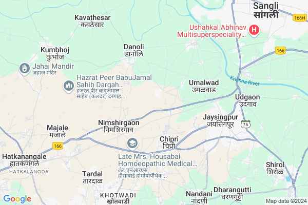
Jainapur
Jainapur Map
EDIT Map
Add Your House
 ..
..
Current Corona Virus Infected Patients Count in Kolhapur District
| City Name | District Name | Total Covid cases |
|---|---|---|
| Kolhapur District | Kolhapur | 8 |
| Kolhapur Rural | Kolhapur | 1 |
Locality Name :
Jainapur
( जैनापूर )
Taluka Name : Shirol
District : Kolhapur
State : Maharashtra
Region : Desh or Paschim Maharashtra
Division : Pune
Language : Marathi and Kannada
Current Time 05:07 PM
Date: Friday , Apr 25,2025 (IST)
Time zone: IST (UTC+5:30)
Elevation / Altitude: 550 meters. Above Seal level
Telephone Code / Std Code: 02322
Assembly constituency : Shirol assembly constituency
Assembly MLA : Ulhas Sambhaji Patil
Lok Sabha constituency : Hatkanangle parliamentary constituency
Parliament MP : Dhairyasheel Sambhajirao Mane
Serpanch Name :
Pin Code : 416101
Post Office Name : Jaysingpur
Alternate Village Name : Jainaopur
Commodities Prices : Sangli(Phale, Bhajipura Market) Market / Mandi
Edit below overview about Jainapur
Edit below overview about Jainapur
OverView of Jainapur
Basically the village is occupied with jain peoples hence name is jainapur, But presently all cast population is settled here.Edit below overview about Jainapur
National Highways Reachable To Jainapur
Nationa High Way :NH166
Nationa High Way :NH166
Rivers Near Jainapur
Krishna :クリシュナ :ಕೃಷ್ಣಾ :कृष्णा
Krishna :クリシュナ :ಕೃಷ್ಣಾ :कृष्णा
Krishna :クリシュナ :ಕೃಷ್ಣಾ :कृष्णा
Krishna :クリシュナ :ಕೃಷ್ಣಾ :कृष्णा
About Jainapur
Jainapur is a Village in Shirol Taluka in Kolhapur District of Maharashtra State, India. It belongs to Desh or Paschim Maharashtra region . It belongs to Pune Division . It is located 34 KM towards East from District head quarters Kolhapur. 15 KM from Shirol. 355 KM from State capital Mumbai
Jainapur Pin code is 416101 and postal head office is Jaysingpur .
Nimshirgaon ( 3 KM ) , Umalwad ( 4 KM ) , Danoli ( 5 KM ) , Kondigre ( 5 KM ) , Kothali ( 6 KM ) are the nearby Villages to Jainapur. Jainapur is surrounded by Ichalkaranji Taluka towards South , Shirol Taluka towards South , Hatkanangale Taluka towards west , Miraj Taluka towards East .
Sangli , Ichalkaranji , Miraj , Vadgaon Kasba are the near by Cities to Jainapur.
This Place is in the border of the Kolhapur District and Sangli District. Sangli District Miraj is East towards this place .
Jainapur 2011 Census Details
Jainapur Local Language is Marathi. Jainapur Village Total population is 2358 and number of houses are 506. Female Population is 47.2%. Village literacy rate is 76.8% and the Female Literacy rate is 33.8%.
Population
| Census Parameter | Census Data |
| Total Population | 2358 |
| Total No of Houses | 506 |
| Female Population % | 47.2 % ( 1114) |
| Total Literacy rate % | 76.8 % ( 1810) |
| Female Literacy rate | 33.8 % ( 797) |
| Scheduled Tribes Population % | 1.3 % ( 30) |
| Scheduled Caste Population % | 20.1 % ( 475) |
| Working Population % | 36.7 % |
| Child(0 -6) Population by 2011 | 225 |
| Girl Child(0 -6) Population % by 2011 | 44.4 % ( 100) |
Jainapur Census More Deatils.
Politics in Jainapur
NCP , Shivsena , SWP , INC , SHS are the major political parties in this area.Polling Stations /Booths near Jainapur
1)Herwad Kumar Vidyamandir Purvekadil Kholi No. 32)Jainapur Kumar Vidyamandir Jainapur Uttar Bajuchi Kholi No. 1
3)Chinchwad Vidyamandir Chinchwad Juni Imarat Purv Bajuchi Kholi
4)Chipari Kanya Vidyamandir Navin Purv Paschim Imarat Kholi No. 2
5)Chipari Kumar Vidyamandir Dakshinottar Imarat Uttarekadun Kholi No. 1
HOW TO REACH Jainapur
By Rail
Nimshirgaon Tamdalge Rail Way Station , Jayasingpur Rail Way Station are the very nearby railway stations to Jainapur. Jayasingpur Rail Way Station (near to Jaysingpur) , Vishrambag Rail Way Station (near to Jaysingpur) , Nimshirgaon Tamdalge Rail Way Station (near to Ichalkaranji) , Hatkanagale Rail Way Station (near to Ichalkaranji) are the Rail way stations reachable from near by towns.By Road
Kurundvad , Jaysingpur , Ichalkaranji are the nearby by towns to Jainapur having road connectivity to JainapurColleges near Jainapur
Sharad Institute Of Technology College Of Engg,yadrav
Address : Near Jay Sangli Naka,yadrav
Schools in Jainapur
Kumar Vidya Mandir Jainapur
Address : jainapur , shirol , kolhapur , Maharashtra . PIN- 416101 , Post - Jaysingpur
Govt Health Centers near Jainapur
1) Chipari , , , Near bus stand2) Umalwad , , ,
3) Nimshirgaon , , , near gram panchayt
Petrol Bunks in Jainapur,Shirol
HP PETROL PUMP - MANGAVE PETROLINKS
MDR NO.84 Kolhapur Sangli By-pass RD; Tah.-shirol; Vasco; Maharashtra 416101; India
0.8 KM distance Detail
HP PETROL PUMP - MANGAVE AUTOMOBILES
Kolhapur Road Jaisingpur Dist Kolhapur; Vasco; Maharashtra 416101; India
4.0 KM distance Detail
more ..
Colleges in Jainapur,Shirol
Sharad College of Agriculture; Jainapur
Road; Jainapur;; Kolhapur - Sangli Hwy; Maharashtra 416101; India
0.0 KM distance Detail
College of Naturopathy & Yoga
Gat No.149/150; Sangli Kolhapur Bypass Road; Tamdalge Tal- Shirol Dist -; Kolhapur; 416101; India
4.9 KM distance Detail
more ..
Electronic Shops in Jainapur,Shirol
SatyaSai Service Ststion.
26; Miraj Rd; Herwade Colony; Shahunagar; Jaysingpur; Maharashtra 416101; India
5.0 KM distance Detail
Lenovo Store- Creative Systems
B-1 Urmila Complex; Civil Hospital Road; Jaysingpur; Maharashtra 416101; India
5.4 KM distance Detail
Super Markets in Jainapur,Shirol
Nadaf Enterprises
Star Factarie Road; Malbhag Rd; Chipri; Maharashtra 416121; India
3.5 KM distance Detail
Karyappa Kirana Stores ( Shop )
Patil Mala; Jaysingpur; Maharashtra 416101; India
5.7 KM distance Detail
Police Stations near Jainapur,Shirol
DYSP Office; Jaysingpur
MAHER HOSPITAL JAYSINGPUR; Sambhaji Nagar; Jaysingpur; Maharashtra 416101; India
5.8 KM distance Detail
Governement Offices near Jainapur,Shirol
World Of Shaadi
Lane No.9; Subhash Road;; Ratnatray Building; Jaysingpur; Maharashtra 416101; India
5.5 KM distance Detail
About Jainapur &
History
How to reach Jainapur
Tourist Places Near By Jainapur
Schools in Jainapur
Colleges in Jainapur
Temperature & weather of Jainapur
places in Jainapur
Jainapur photos
More Information
How to reach Jainapur
Tourist Places Near By Jainapur
Schools in Jainapur
Colleges in Jainapur
Temperature & weather of Jainapur
places in Jainapur
Jainapur photos
More Information
Village Talk
Post News or Events about this Village
Near Cities
Sangli 11 KM near
Ichalkaranji 12 KM near
Miraj 17 KM near
Vadgaon Kasba 24 KM near
Sangli 11 KM near
Ichalkaranji 12 KM near
Miraj 17 KM near
Vadgaon Kasba 24 KM near
Near By Taluks
Sangli 12 KM near
Ichalkaranji 13 KM near
Shirol 15 KM near
Hatkanangale 17 KM near
Sangli 12 KM near
Ichalkaranji 13 KM near
Shirol 15 KM near
Hatkanangale 17 KM near
Near By Air Ports
Kolhapur Airport 26 KM near
Sambre Airport 116 KM near
Hubli Airport 191 KM near
Dabolim Airport 192 KM near
Kolhapur Airport 26 KM near
Sambre Airport 116 KM near
Hubli Airport 191 KM near
Dabolim Airport 192 KM near
Near By Tourist Places
Kolhapur 33 KM near
Panhala 46 KM near
Dajipur Wildlife Sanctuary 90 KM near
Mandwa 113 KM near
Amboli 119 KM near
Kolhapur 33 KM near
Panhala 46 KM near
Dajipur Wildlife Sanctuary 90 KM near
Mandwa 113 KM near
Amboli 119 KM near
Near By Districts
Sangli 11 KM near
Kolhapur 33 KM near
Belgaum 116 KM near
Satara 127 KM near
Sangli 11 KM near
Kolhapur 33 KM near
Belgaum 116 KM near
Satara 127 KM near
Near By RailWay Station
Nimshirgaon Tamdalge Rail Way Station 4.1 KM near
Jayasingpur Rail Way Station 5.1 KM near
Hatkanagale Rail Way Station 11 KM near
Nimshirgaon Tamdalge Rail Way Station 4.1 KM near
Jayasingpur Rail Way Station 5.1 KM near
Hatkanagale Rail Way Station 11 KM near