| Home | City Bus | Maps | Villages | Cities | Rail | Tourist Places | School | College | Pin Codes | Corona Cases Count |
| Distance Calculator Bus Services IFSC Codes Trace Mobile Number Weather Search Place Trace IP Available Cash ATM/Banks Locate Polling Booth Report an Error contact People |
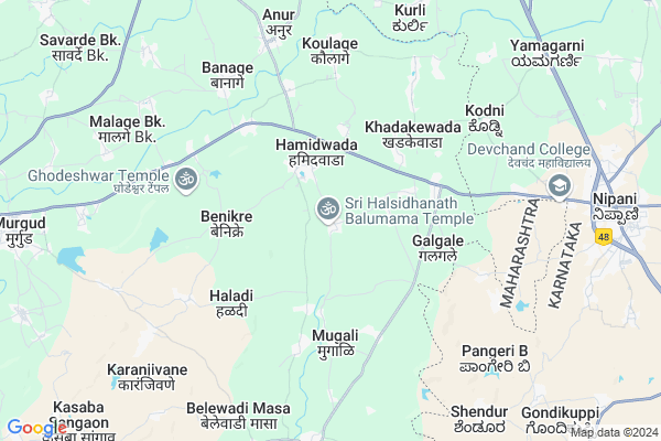
Metake
Metake Map
EDIT Map
Add Your House
 ..
..
Current Corona Virus Infected Patients Count in Kolhapur District
| City Name | District Name | Total Covid cases |
|---|---|---|
| Kolhapur District | Kolhapur | 8 |
| Kolhapur Rural | Kolhapur | 1 |
Locality Name :
Metake
( नेटके )
Taluka Name : Kagal
District : Kolhapur
State : Maharashtra
Region : Desh or Paschim Maharashtra
Division : Pune
Language : Marathi and Kannada
Current Time 09:26 AM
Date: Wednesday , Apr 30,2025 (IST)
Time zone: IST (UTC+5:30)
Elevation / Altitude: 554 meters. Above Seal level
Telephone Code / Std Code: 02325
Assembly constituency : Kagal assembly constituency
Assembly MLA : Mushrif Hasan Miyalal
Lok Sabha constituency : Kolhapur parliamentary constituency
Parliament MP : Sanjay Sadashivrao Mandlik
Serpanch Name :
Pin Code : 416235
Post Office Name : Sadashivnagar
Commodities Prices : Nippani Market / Mandi
Metake Live Weather
Temperature: 32.9 °C
clear sky
Humidity: 28%
Wind : 1.19 mt/sec towards NW
StationName : "NipÄ\u0081ni"
observed on 7 Mins Back
Temperature: 32.9 °C
clear sky
Humidity: 28%
Wind : 1.19 mt/sec towards NW
StationName : "NipÄ\u0081ni"
observed on 7 Mins Back
Metake Weather Forecast for Next 5 days
01-05-2025
23.0°C to 40.1°C
clear sky, scattered clouds, few clouds
23.0°C to 40.1°C
clear sky, scattered clouds, few clouds
02-05-2025
22.3°C to 40.2°C
clear sky, few clouds, overcast clouds
22.3°C to 40.2°C
clear sky, few clouds, overcast clouds
03-05-2025
21.9°C to 38.9°C
broken clouds, few clouds, scattered clouds, clear sky
21.9°C to 38.9°C
broken clouds, few clouds, scattered clouds, clear sky
04-05-2025
21.8°C to 38.8°C
few clouds, clear sky
21.8°C to 38.8°C
few clouds, clear sky
05-05-2025
21.8°C to 37.8°C
scattered clouds, overcast clouds, broken clouds, few clouds, clear sky
21.8°C to 37.8°C
scattered clouds, overcast clouds, broken clouds, few clouds, clear sky
Edit below overview about Metake
Edit below overview about Metake
OverView of Metake
metake is a historical place of balumama. Centre of metake is krushnai nivas metake . Metake is a small villageEdit below overview about Metake
National Highways Reachable To Metake
Nationa High Way :NH48
Nationa High Way :NH548H
Nationa High Way :NH48
Nationa High Way :NH548H
Rivers Near Metake
Krishna :クリシュナ :ಕೃಷ್ಣಾ :कृष्णा
Krishna :クリシュナ :ಕೃಷ್ಣಾ :कृष्णा
Krishna :クリシュナ :ಕೃಷ್ಣಾ :कृष्णा
Krishna :クリシュナ :ಕೃಷ್ಣಾ :कृष्णा
About Metake
Metake is a Village in Kagal Taluka in Kolhapur District of Maharashtra State, India. It belongs to Desh or Paschim Maharashtra region . It belongs to Pune Division . It is located 40 KM towards South from District head quarters Kolhapur. 6 KM from Kagal. 384 KM from State capital Mumbai
Metake Pin code is 416235 and postal head office is Sadashivnagar .
Kardyal ( 3 KM ) , Galgale ( 3 KM ) , Benikre ( 4 KM ) , Mugali ( 4 KM ) , Nandyal ( 4 KM ) are the nearby Villages to Metake. Metake is surrounded by Bhudargad Taluka towards west , Chikodi Taluka towards East , Gadhinglaj Taluka towards South , Radhanagari Taluka towards west .
Nipani , Sankeshwar , Uchgaon , Sadalgi are the near by Cities to Metake.
Demographics of Metake
Marathi is the Local Language here.Politics in Metake
NCP , SHS , INC are the major political parties in this area.Polling Stations /Booths near Metake
1)Vidya Mandir Choundal East Side Room No.12)Central School Vidya Mandir Yamage New Primary School East Side Room No.1
3)Shrimant Sir Pirajirao Ghatge Kanya Vidya Mandir Kagal South Side Room No 1
4)Shriram Vidya Mandir Shindewadi New Building East Side Room No.1
5)Jeevan Shikshan Vidya Mandir East-west Building East Side Room No.3
HOW TO REACH Metake
By Rail
There is no railway station near to Metake in less than 10 km. Gur Market Rail Way Station (near to Kolhapur) , Kolhapur Scsmt Rail Way Station (near to Kolhapur) are the Rail way stations reachable from near by towns.By Road
Murgud , Nipani , Kagal , Gadhinglaj , Kolhapur are the nearby by towns to Metake having road connectivity to MetakeColleges near Metake
Devchand College Arjunnagar
Address : Arjunnagar Near Nippani Tal Kagal Dist Kolhapur Maharashtra
Schools in Metake
Vidya Mandir Metake
Address : metake , kagal , kolhapur , Maharashtra . PIN- 416235 , Post - Sadashivnagar
Govt Health Centers near Metake
1) Karnur , 663 , Ramkushn Nagar , Near Anganwadi2) Chinchwad , Sub Centre Chinchwad , , Near Grampachyat
3) Lignur Dumala , KUH 58 , Jadhav Mala , Davari Galli
Hospitals in Metake,Kagal
Kshitij Medical
At Lingnur (Ka); Po Arjuni; Tal Kagal; Dist Kolhapur; Lingnur (Kapashi); Maharashtra 416235; India
3.2 KM distance Detail
more ..
Petrol Bunks in Metake,Kagal
HP PETROL PUMP - S.P. PETROLEUM
Hpcl Dealer; GAT. NO. 808 & 809; Murgud Nipani Road; SH-121; Khadkewada; Vasco; Maharashtra 416235; India
2.7 KM distance Detail
more ..
Colleges in Metake,Kagal
Devchand College; Arjunnagar
Arjunnagar; Kagal Taluk; Nipani Murgud Road; Kolhapur; Maharashtra 591269; India
8.9 KM distance Detail
Sadashivrao Mandlik Mahavidyalay; Murgud
Kolhapur; Maharashtra 416219; India
11.1 KM distance Detail
Chatrapati Shivaji Maharaj College
Shripewadi Rd; Nipani; Karnataka 591237; India
11.7 KM distance Detail
more ..
Schools in Metake,Kagal
Sadashivrao Mandlik Junior College and English Medium School
Devgad - Nipani Hwy; Hamidwada; Maharashtra 416235; India
3.2 KM distance Detail
Shri Mahalaxmi Highschool Lingnoor Kapashi
Lingnoor Kapshi; Maharashtra 416235; India
3.5 KM distance Detail
Shri Mahalaxmi Highschool And Junior Collage Lingnoor ( Kapashi)
Lingnoor Kapshi; Maharashtra 416235; India
3.5 KM distance Detail
Electronic Shops in Metake,Kagal
Trimurti Electronics And Services
Main road; Lingnoor (Kashi); Lingnoor Kapshi; Maharashtra 416235; India
4.5 KM distance Detail
Super Markets in Metake,Kagal
Nidhi Tyer And Automobile
Madyal - Kapashi - Gargoti Rd; Senapati Kapshi; Maharashtra 416218; India
8.8 KM distance Detail
Police Stations near Metake,Kagal
Police Station; Lingnoor
Madyal - Kapashi - Nipanni Rd; Lingnoor Kapshi; Maharashtra 416235; India
4.5 KM distance Detail
C.P.I. Police Station
NH Service Rd; Andolan Nagar; Nipani; Karnataka 591237; India
10.6 KM distance Detail
About Metake &
History
How to reach Metake
Tourist Places Near By Metake
Schools in Metake
Colleges in Metake
Temperature & weather of Metake
places in Metake
Metake photos
More Information
How to reach Metake
Tourist Places Near By Metake
Schools in Metake
Colleges in Metake
Temperature & weather of Metake
places in Metake
Metake photos
More Information
Village Talk
Post News or Events about this Village
Near Cities
Nipani 11 KM near
Sankeshwar 27 KM near
Uchgaon 37 KM near
Sadalgi 37 KM near
Nipani 11 KM near
Sankeshwar 27 KM near
Uchgaon 37 KM near
Sadalgi 37 KM near
Near By Taluks
Kagal 6 KM near
Bhudargad 26 KM near
Chikodi 28 KM near
Gadhinglaj 29 KM near
Kagal 6 KM near
Bhudargad 26 KM near
Chikodi 28 KM near
Gadhinglaj 29 KM near
Near By Air Ports
Kolhapur Airport 33 KM near
Sambre Airport 78 KM near
Dabolim Airport 137 KM near
Hubli Airport 160 KM near
Kolhapur Airport 33 KM near
Sambre Airport 78 KM near
Dabolim Airport 137 KM near
Hubli Airport 160 KM near
Near By Tourist Places
Kolhapur 36 KM near
Dajipur Wildlife Sanctuary 51 KM near
Panhala 56 KM near
Amboli 64 KM near
Sindhudurg 81 KM near
Kolhapur 36 KM near
Dajipur Wildlife Sanctuary 51 KM near
Panhala 56 KM near
Amboli 64 KM near
Sindhudurg 81 KM near
Near By Districts
Kolhapur 37 KM near
Sangli 66 KM near
Belgaum 73 KM near
Sindhudurg 81 KM near
Kolhapur 37 KM near
Sangli 66 KM near
Belgaum 73 KM near
Sindhudurg 81 KM near
Near By RailWay Station
Valivade Rail Way Station 37 KM near
Kolhapur Scsmt Rail Way Station 38 KM near
Valivade Rail Way Station 37 KM near
Kolhapur Scsmt Rail Way Station 38 KM near