| Home | City Bus | Maps | Villages | Cities | Rail | Tourist Places | School | College | Pin Codes | Corona Cases Count |
| Distance Calculator Bus Services IFSC Codes Trace Mobile Number Weather Search Place Trace IP Available Cash ATM/Banks Locate Polling Booth Report an Error contact People |
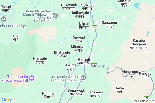
Mhasave
Mhasave Map
EDIT Map
Add Your House
 ..
..
Current Corona Virus Infected Patients Count in Kolhapur District
| City Name | District Name | Total Covid cases |
|---|---|---|
| Kolhapur District | Kolhapur | 8 |
| Kolhapur Rural | Kolhapur | 1 |
Locality Name :
Mhasave
( म्हसवे )
Taluka Name : Bhudargad
District : Kolhapur
State : Maharashtra
Region : Desh or Paschim Maharashtra
Division : Pune
Language : Marathi and Kannada
Current Time 12:27 PM
Date: Sunday , Apr 27,2025 (IST)
Time zone: IST (UTC+5:30)
Elevation / Altitude: 563 meters. Above Seal level
Telephone Code / Std Code: 02599
Assembly constituency : Radhanagari assembly constituency
Assembly MLA : Abitkar Prakash Anandrao
Lok Sabha constituency : Kolhapur parliamentary constituency
Parliament MP : Sanjay Sadashivrao Mandlik
Serpanch Name :
Pin Code : 416223
Post Office Name : Mhasve
Alternate Village Name : Masave
Commodities Prices : Gadhinglaj Market / Mandi
Mhasave Live Weather
Temperature: 34.9 °C
scattered clouds
Humidity: 25%
Wind : 0.74 mt/sec towards SE
StationName : "Murgūd"
observed on 1 Hours Back
Temperature: 34.9 °C
scattered clouds
Humidity: 25%
Wind : 0.74 mt/sec towards SE
StationName : "Murgūd"
observed on 1 Hours Back
Mhasave Weather Forecast for Next 5 days
28-04-2025
23.4°C to 38.0°C
scattered clouds, broken clouds
23.4°C to 38.0°C
scattered clouds, broken clouds
29-04-2025
21.7°C to 38.3°C
scattered clouds, broken clouds, clear sky, few clouds
21.7°C to 38.3°C
scattered clouds, broken clouds, clear sky, few clouds
30-04-2025
21.3°C to 38.1°C
scattered clouds, broken clouds, clear sky
21.3°C to 38.1°C
scattered clouds, broken clouds, clear sky
01-05-2025
21.5°C to 36.9°C
scattered clouds, few clouds, clear sky
21.5°C to 36.9°C
scattered clouds, few clouds, clear sky
02-05-2025
21.1°C to 38.3°C
scattered clouds, clear sky
21.1°C to 38.3°C
scattered clouds, clear sky
National Highways Reachable To Mhasave
Nationa High Way :NH548H
Nationa High Way :NH548H
Rivers Near Mhasave
Ghataprabha
Gad
Ghataprabha
Gad
About Mhasave
Correct below Info and add more info about MhasaveMhasave is a Village in Bhudargad Taluka in Kolhapur District of Maharashtra State, India. It belongs to Desh or Paschim Maharashtra region . It belongs to Pune Division . It is located 49 KM towards South from District head quarters Kolhapur. 8 KM from Bhudargad. 383 KM from State capital Mumbai
Mhasave Pin code is 416223 and postal head office is Mhasve .
Basarewadi ( 2 KM ) , Gargoti ( 2 KM ) , Khanapur ( 2 KM ) , Minache Budruk ( 2 KM ) , Kalnakwadi ( 3 KM ) are the nearby Villages to Mhasave. Mhasave is surrounded by Radhanagari Taluka towards North , Kagal Taluka towards East , Ajara Taluka towards South , Gadhinglaj Taluka towards East .
Nipani , Sankeshwar , Kolhapur , Uchgaon are the near by Cities to Mhasave.
Mhasave 2011 Census Details
Mhasave Local Language is Marathi. Mhasave Village Total population is 2891 and number of houses are 615. Female Population is 49.0%. Village literacy rate is 75.9% and the Female Literacy rate is 33.2%.
Population
| Census Parameter | Census Data |
| Total Population | 2891 |
| Total No of Houses | 615 |
| Female Population % | 49.0 % ( 1418) |
| Total Literacy rate % | 75.9 % ( 2193) |
| Female Literacy rate | 33.2 % ( 961) |
| Scheduled Tribes Population % | 0.0 % ( 0) |
| Scheduled Caste Population % | 11.6 % ( 334) |
| Working Population % | 46.4 % |
| Child(0 -6) Population by 2011 | 266 |
| Girl Child(0 -6) Population % by 2011 | 45.9 % ( 122) |
Mhasave Census More Deatils.
Politics in Mhasave
NCP , SHS , INC are the major political parties in this area.Polling Stations /Booths near Mhasave
1)Vidyamandir Piral South Side Room No.22)Vidyamandir Pushpanagar North Side Room No 1
3)Vidyamandir Pacharde East Side Room No 1
4)Vidyamandir Kalammawadi East Side Room No 1
5)Vidyalankar Bhavan Jr.collage Of Arts Shelewadi East Side Room No.4
HOW TO REACH Mhasave
By Rail
There is no railway station near to Mhasave in less than 10 km. are the Rail way stations reachable from near by towns.By Road
Murgud , Gadhinglaj are the nearby by towns to Mhasave having road connectivity to MhasaveColleges near Mhasave
Chh.shivaji Highschool And Juniour College,tirawade
Address :
Mouni Vidyapith
Address :
Shree Mouni Maharaj Highschool & Junior College Patgaon
Address :
Schools in Mhasave
S D Highscool Mhasave
Address : mhasave , bhudargad , kolhapur , Maharashtra . PIN- 416223 , Post - Mhasve
Govt Health Centers near Mhasave
1) RH GARGOTI , PATGAON ROAD , PATGAON ROAD , JOTIBA TEMPLE2) Siddhanerli , 1128 , Main Road , Near Shidnerli Vidyal
3) RH MURGUD , , , NEAR S.T. STAND
Hospitals in Mhasave,Bhudargad
Hira Pediatric Hospital
Shri Mouni Vidyapeeth Rd; Gargoti; Maharashtra 416209; India
2.0 KM distance Detail
more ..
Petrol Bunks in Mhasave,Bhudargad
Ghotane Auto Centre; Bharat Petroleum Corp. Ltd.
opposite of injubai temple; Gadhinglaj - Gargoti Rd; Gargoti; Maharashtra 416209; India
2.6 KM distance Detail
Ghotane Petrol Pump
Gadhinglaj - Gargoti Rd; Gargoti; Maharashtra 416209; India
2.7 KM distance Detail
more ..
Colleges in Mhasave,Bhudargad
Shri. Karmaveer Hire Arts; Science; Commerce & Education college
Gargoti; Kolhapur; Maharashtra 416209; India
1.7 KM distance Detail
Karmveer Hire College; Gargoti
K.H. college Rd; Gargoti; Maharashtra 416209; India
1.7 KM distance Detail
Shree Mouni Vidyapeeth
Shri Mouni Vidyapeeth Road; Gargoti; Kolhapur; Maharashtra 416209; India
1.8 KM distance Detail
Department Of Computer Engineering (Aided)
ICRE Campus Rd; Gargoti; Maharashtra 416209; India
2.0 KM distance Detail
more ..
Schools in Mhasave,Bhudargad
Jawahar Bal Bhavan; Gargoti
Shri Mouni Vidyapeeth Rd; Gargoti; Maharashtra 416209; India
1.9 KM distance Detail
Shri Shahu Kumar Bhavan; Gargoti
K.H. college Rd; Gargoti; Maharashtra 416209; India
1.9 KM distance Detail
Electronic Shops in Mhasave,Bhudargad
magic mobile & ripear shop gargoti
Gramin Rugnalay Rd; Gargoti; Maharashtra 416209; India
2.0 KM distance Detail
Magic Mobile & Digitl World
dhumal corner;patgaon road; Kolhapur; Maharashtra 416209; India
2.0 KM distance Detail
About Mhasave &
History
How to reach Mhasave
Tourist Places Near By Mhasave
Schools in Mhasave
Colleges in Mhasave
Temperature & weather of Mhasave
places in Mhasave
Mhasave photos
More Information
How to reach Mhasave
Tourist Places Near By Mhasave
Schools in Mhasave
Colleges in Mhasave
Temperature & weather of Mhasave
places in Mhasave
Mhasave photos
More Information
Village Talk
Post News or Events about this Village
Near Cities
Nipani 31 KM near
Sankeshwar 42 KM near
Kolhapur 47 KM near
Uchgaon 49 KM near
Nipani 31 KM near
Sankeshwar 42 KM near
Kolhapur 47 KM near
Uchgaon 49 KM near
Near By Taluks
Bhudargad 7 KM near
Radhanagari 18 KM near
Kagal 19 KM near
Ajara 27 KM near
Bhudargad 7 KM near
Radhanagari 18 KM near
Kagal 19 KM near
Ajara 27 KM near
Near By Air Ports
Kolhapur Airport 48 KM near
Sambre Airport 82 KM near
Dabolim Airport 122 KM near
Hubli Airport 166 KM near
Kolhapur Airport 48 KM near
Sambre Airport 82 KM near
Dabolim Airport 122 KM near
Hubli Airport 166 KM near
Near By Tourist Places
Dajipur Wildlife Sanctuary 33 KM near
Kolhapur 47 KM near
Amboli 47 KM near
Sindhudurg 60 KM near
Panhala 61 KM near
Dajipur Wildlife Sanctuary 33 KM near
Kolhapur 47 KM near
Amboli 47 KM near
Sindhudurg 60 KM near
Panhala 61 KM near
Near By Districts
Kolhapur 48 KM near
Sindhudurg 60 KM near
Belgaum 75 KM near
Sangli 84 KM near
Kolhapur 48 KM near
Sindhudurg 60 KM near
Belgaum 75 KM near
Sangli 84 KM near
Near By RailWay Station
Kolhapur Scsmt Rail Way Station 48 KM near
Kankavali Rail Way Station 49 KM near
Kolhapur Scsmt Rail Way Station 48 KM near
Kankavali Rail Way Station 49 KM near