| Home | City Bus | Maps | Villages | Cities | Rail | Tourist Places | School | College | Pin Codes | Corona Cases Count |
| Distance Calculator Bus Services IFSC Codes Trace Mobile Number Weather Search Place Trace IP Available Cash ATM/Banks Locate Polling Booth Report an Error contact People |
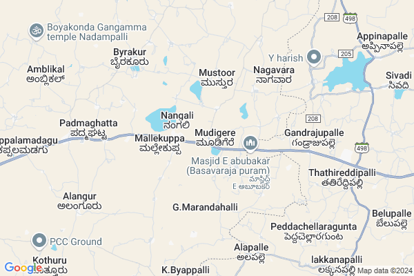
Mudigere Map
EDIT Map
Add Your House
 ..
..
Current Corona Virus Infected Patients Count in Kolar District
| City Name | District Name | Total Covid cases |
|---|
Locality Name :
Mudigere
( ಮೂಡಿಗೆರೆ )
Taluk Name : Mulbagal
District : Kolar
State : Karnataka
Division : Bangalore
Language : Kannada and Urdu, Telugu, Tamil
Current Time 11:17 PM
Date: Thursday , Mar 13,2025 (IST)
Time zone: IST (UTC+5:30)
Elevation / Altitude: 864 meters. Above Seal level
Telephone Code / Std Code: 08159
Assembly constituency : Mulbagal assembly constituency
Assembly MLA : Samruddhi V. Manjunath
Lok Sabha constituency : Kolar parliamentary constituency
Parliament MP : S. MUNISWAMY
Serpanch Name :
Pin Code : 563132
Post Office Name : Nangli
Commodities Prices : Mulabagilu Market / Mandi
Mudigere Live Weather
Temperature: 23.8 °C
scattered clouds
Humidity: 50%
Wind : 3.95 mt/sec towards E
StationName : "MulbÄ\u0081gal"
observed on 2 Hours Back
Temperature: 23.8 °C
scattered clouds
Humidity: 50%
Wind : 3.95 mt/sec towards E
StationName : "MulbÄ\u0081gal"
observed on 2 Hours Back
Mudigere Weather Forecast for Next 5 days
14-03-2025
20.1°C to 23.5°C
scattered clouds, broken clouds
20.1°C to 23.5°C
scattered clouds, broken clouds
15-03-2025
20.2°C to 34.6°C
overcast clouds, broken clouds, scattered clouds, clear sky
20.2°C to 34.6°C
overcast clouds, broken clouds, scattered clouds, clear sky
16-03-2025
20.4°C to 34.5°C
clear sky, few clouds, broken clouds, overcast clouds
20.4°C to 34.5°C
clear sky, few clouds, broken clouds, overcast clouds
17-03-2025
19.7°C to 35.0°C
overcast clouds, broken clouds, scattered clouds
19.7°C to 35.0°C
overcast clouds, broken clouds, scattered clouds
18-03-2025
19.5°C to 36.0°C
scattered clouds, clear sky, few clouds
19.5°C to 36.0°C
scattered clouds, clear sky, few clouds
National Highways Reachable To Mudigere
Nationa High Way :NH69
Nationa High Way :NH42;NH69
Nationa High Way :NH69
Nationa High Way :NH42;NH69
Rivers Near Mudigere
Palar :ಪಾಲಾರ್ :பாலா
Palar :ಪಾಲಾರ್ :பாலா
About Mudigere
Correct below Info and add more info about MudigereMudigere is a Village in Mulbagal Taluk in Kolar District of Karnataka State, India. It belongs to Bangalore Division . It is located 51 KM towards East from District head quarters Kolar. 12 KM from Mulbagal. 122 KM from State capital Bangalore
Mudigere Pin code is 563132 and postal head office is Nangli .
Gummakal ( 5 KM ) , Byrakur ( 7 KM ) , Alangur ( 9 KM ) , H.gollahalli ( 10 KM ) , Hebbani ( 11 KM ) are the nearby Villages to Mudigere. Mudigere is surrounded by Baireddipalle Taluk towards South , Gangavaram Taluk towards East , Punganur Taluk towards North , Peddapanjani Taluk towards East .
Mulbagal , Punganur , Srinivaspur , Pernampattu are the near by Cities to Mudigere.
This Place is in the border of the Kolar District and Chittoor District. Chittoor District Baireddipalle is South towards this place . It is near to the Andhra Pradesh State Border.
Mudigere 2011 Census Details
Mudigere Local Language is Kannada. Mudigere Village Total population is 1434 and number of houses are 302. Female Population is 48.9%. Village literacy rate is 61.3% and the Female Literacy rate is 25.1%.
Population
| Census Parameter | Census Data |
| Total Population | 1434 |
| Total No of Houses | 302 |
| Female Population % | 48.9 % ( 701) |
| Total Literacy rate % | 61.3 % ( 879) |
| Female Literacy rate | 25.1 % ( 360) |
| Scheduled Tribes Population % | 5.6 % ( 81) |
| Scheduled Caste Population % | 67.7 % ( 971) |
| Working Population % | 59.8 % |
| Child(0 -6) Population by 2011 | 150 |
| Girl Child(0 -6) Population % by 2011 | 48.0 % ( 72) |
Mudigere Census More Deatils.
Politics in Mudigere
Bharatiya Janata Party , JD(S) , BJP , Independent (IND) , INC are the major political parties in this area.Polling Stations /Booths near Mudigere
1)Governament Higher Primary School Mothakapalli2)Governament Urdu Lower Primary School Khadripura
3)Governament Higher Primary School Majara Venkatapura
4)Governament Higher Primary School Mudiyanur
5)Governament Lower Primary School Majara Hydalapura
HOW TO REACH Mudigere
By Rail
There is no railway station near to Mudigere in less than 10 km. are the Rail way stations reachable from near by towns.By Road
Mulbagal , Punganur are the nearby by towns to Mudigere having road connectivity to MudigereColleges near Mudigere
Jj Para Medical College Mulbagal
Address : Mc Road Mbs Building Mulbagal
Jj Para Medical College
Address : Mc Road Mbs Building Mulbagal
Sri Varasiddhi Vinayaka College
Address :
Schools in Mudigere
Glps R Gaddur
Address : mudigere , mulbagal , kolar , Karnataka . PIN- 563132 , Post - Nangli
Glps Mudigere
Address : mudigere , mulbagal , kolar , Karnataka . PIN- 563132 , Post - Nangli
Govt Health Centers near Mudigere
1) Byarakur (24X7) , phc byrakur , temple street , near hostel2) Mulbagal Town-A , Muthyalapete , Alangoor main road , Bjane mane
3) Mulbagal Town-F , ramsandra main road , noogala bande , noogala bande main roade
Sub Villages in Mudigere
Hospitals in Mudigere,Mulbagal
Ravi Medicales & Ganeral Stores.
NH 4;Road Nangli; Mulbagal; Banglore; Karnataka 563132; India
2.4 KM distance Detail
more ..
Petrol Bunks in Mudigere,Mulbagal
Indian Oil Petrol Pump Karnataka
Bengaluru - Tirupati Highway; Venkatapura; Karnataka 563132; India
0.7 KM distance Detail
IOC : Chowdeshwari Fuels
NH - 75; Kolar District; Byrakur; Karnataka 563101; India
6.7 KM distance Detail
more ..
Colleges in Mudigere,Mulbagal
K J T E T Polytechnic
NH 4; Narasimhatheertha; Kolar District; Mulbagal; Karnataka 563131; India
15.4 KM distance Detail
more ..
Electronic Shops in Mudigere,Mulbagal
Chowdeshwari Woodworks
Bengaluru - Tirupati Hwy; Mallekuppa; Karnataka 563132; India
2.1 KM distance Detail
Super Markets in Mudigere,Mulbagal
Bus Stand Nangali
Bengaluru - Tirupati Hwy; Mallekuppa; Karnataka 563132; India
1.9 KM distance Detail
Local Parks in Mudigere,Mulbagal
sreenivasulureddy mango garden
Punganur-Baireddipalle Rd; Settipalle; Andhra Pradesh 517506; India
12.9 KM distance Detail
Governement Offices near Mudigere,Mulbagal
Sri lakshmi venkateshwara Earth movers
Puliobareddyhalli; Gummakallu post. Mulbagal.; Bangalore; Karnataka 563131; India
8.1 KM distance Detail
Thathireddipalli
sandeep bredar forms; thathireddipalli(village); Gandrajupalli(post) Baireddipalli;; Chittoor; Andhra Pradesh; India
8.5 KM distance Detail
About Mudigere &
History
How to reach Mudigere
Tourist Places Near By Mudigere
Schools in Mudigere
Colleges in Mudigere
Temperature & weather of Mudigere
places in Mudigere
Mudigere photos
More Information
How to reach Mudigere
Tourist Places Near By Mudigere
Schools in Mudigere
Colleges in Mudigere
Temperature & weather of Mudigere
places in Mudigere
Mudigere photos
More Information
Village Talk
Post News or Events about this Village
Near Cities
Mulbagal 17 KM near
Punganur 21 KM near
Srinivaspur 39 KM near
Pernampattu 40 KM near
Mulbagal 17 KM near
Punganur 21 KM near
Srinivaspur 39 KM near
Pernampattu 40 KM near
Near By Taluks
Mulbagal 11 KM near
Baireddipalle 15 KM near
Gangavaram 20 KM near
Punganur 20 KM near
Mulbagal 11 KM near
Baireddipalle 15 KM near
Gangavaram 20 KM near
Punganur 20 KM near
Near By Air Ports
Bengaluru International Airport 99 KM near
Tirupati Airport 134 KM near
Salem Airport 198 KM near
Chennai Airport 200 KM near
Bengaluru International Airport 99 KM near
Tirupati Airport 134 KM near
Salem Airport 198 KM near
Chennai Airport 200 KM near
Near By Tourist Places
Horsley Hills 58 KM near
Chittoor 69 KM near
Yelagiri 79 KM near
vellore 81 KM near
Nandi Hills 105 KM near
Horsley Hills 58 KM near
Chittoor 69 KM near
Yelagiri 79 KM near
vellore 81 KM near
Nandi Hills 105 KM near
Near By Districts
Kolar 48 KM near
Chittoor 67 KM near
Vellore 81 KM near
Krishnagiri 91 KM near
Kolar 48 KM near
Chittoor 67 KM near
Vellore 81 KM near
Krishnagiri 91 KM near
Near By RailWay Station
Bangarapet Junction Rail Way Station 50 KM near
Gudiyattam Rail Way Station 55 KM near
Bangarapet Junction Rail Way Station 50 KM near
Gudiyattam Rail Way Station 55 KM near