| Home | City Bus | Maps | Villages | Cities | Rail | Tourist Places | School | College | Pin Codes | Corona Cases Count |
| Distance Calculator Bus Services IFSC Codes Trace Mobile Number Weather Search Place Trace IP Available Cash ATM/Banks Locate Polling Booth Report an Error contact People |
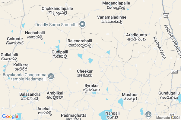
C Gundlahalli Map
EDIT Map
Add Your House
 ..
..
Current Corona Virus Infected Patients Count in Kolar District
| City Name | District Name | Total Covid cases |
|---|
Locality Name :
C Gundlahalli
( ಸಿ ಗುಂಡ್ಲಹಳ್ಳಿ )
Taluk Name : Mulbagal
District : Kolar
State : Karnataka
Division : Bangalore
Language : Kannada and Urdu, Telugu, Tamil
Current Time 11:15 PM
Date: Thursday , Mar 13,2025 (IST)
Time zone: IST (UTC+5:30)
Elevation / Altitude: 864 meters. Above Seal level
Telephone Code / Std Code: 08159
Assembly constituency : Mulbagal assembly constituency
Assembly MLA : Samruddhi V. Manjunath
Lok Sabha constituency : Kolar parliamentary constituency
Parliament MP : S. MUNISWAMY
Serpanch Name :
Main Village Name : Cheekurgundlahalli
Commodities Prices : Mulabagilu Market / Mandi
C Gundlahalli Live Weather
Temperature: 21.5 °C
broken clouds
Humidity: 82%
Wind : 2.61 mt/sec towards SE
StationName : "Punganūru"
observed on 2 Mins Back
Temperature: 21.5 °C
broken clouds
Humidity: 82%
Wind : 2.61 mt/sec towards SE
StationName : "Punganūru"
observed on 2 Mins Back
C Gundlahalli Weather Forecast for Next 5 days
14-03-2025
20.0°C to 21.3°C
broken clouds
20.0°C to 21.3°C
broken clouds
15-03-2025
20.1°C to 34.3°C
overcast clouds, broken clouds, scattered clouds, few clouds, clear sky
20.1°C to 34.3°C
overcast clouds, broken clouds, scattered clouds, few clouds, clear sky
16-03-2025
20.1°C to 34.3°C
clear sky, few clouds, broken clouds, scattered clouds, overcast clouds
20.1°C to 34.3°C
clear sky, few clouds, broken clouds, scattered clouds, overcast clouds
17-03-2025
19.5°C to 34.8°C
overcast clouds, broken clouds, scattered clouds
19.5°C to 34.8°C
overcast clouds, broken clouds, scattered clouds
18-03-2025
19.3°C to 35.7°C
scattered clouds, few clouds, clear sky
19.3°C to 35.7°C
scattered clouds, few clouds, clear sky
National Highways Reachable To C Gundlahalli
Nationa High Way :NH69
Nationa High Way :NH42;NH69
Nationa High Way :NH69
Nationa High Way :NH42;NH69
Rivers Near C Gundlahalli
Palar :ಪಾಲಾರ್ :பாலா
Palar :ಪಾಲಾರ್ :பாலா
About C Gundlahalli
Correct below Info and add more info about C GundlahalliC Gundlahalli is a small Village/hamlet in Mulbagal Taluk in Kolar District of Karnataka State, India. It comes under Cheekurgundlahalli Panchayath. It belongs to Bangalore Division . It is located 49 KM towards East from District head quarters Kolar. 15 KM from Mulbagal. 120 KM from State capital Bangalore
C Gundlahalli is surrounded by Mulbagal Taluk towards South , Ramasamudram Taluk towards North , Peddapanjani Taluk towards East , Gangavaram Taluk towards East .
Punganur , Mulbagal , Srinivaspur , Madanapalle are the near by Cities to C Gundlahalli.
This Place is in the border of the Kolar District and Chittoor District. Chittoor District Baireddipalle is South towards this place . It is near to the Andhra Pradesh State Border.
Demographics of C Gundlahalli
Kannada is the Local Language here.Politics in C Gundlahalli
Bharatiya Janata Party , JD(S) , BJP , Independent (IND) , INC are the major political parties in this area.Polling Stations /Booths near C Gundlahalli
1)Governament Lower Primary School Cheekur Hosahalli2)Governament Lower Primary School Nachahalli
3)Governament Lower Primary School Channapura
4)Governament Higher Primary School Puttenahalli
5)Governament Higher Primary School Doddagutahalli
HOW TO REACH C Gundlahalli
By Rail
There is no railway station near to C Gundlahalli in less than 10 km. are the Rail way stations reachable from near by towns.By Road
Mulbagal , Punganur are the nearby by towns to C Gundlahalli having road connectivity to C GundlahalliPincodes near C Gundlahalli
563132 ( Nangli ) , 563131 ( Mulbagal ) , 563138 ( Yeldur )Colleges near C Gundlahalli
Jj Para Medical College Mulbagal
Address : Mc Road Mbs Building Mulbagal
Jj Para Medical College
Address : Mc Road Mbs Building Mulbagal
Sri Varasiddhi Vinayaka College
Address :
Schools near C Gundlahalli
Janaa Jyothi Hps
Address : avani , mulbagal , kolar , Karnataka . PIN- 563131 , Post - Mulbagal
Muraji Desai Recidencial Sch
Address : bettagerahalli , mulbagal , kolar , Karnataka . PIN- 563132 , Post - Nangli
Murarji Rsid Mulbagal
Address : mulbagal , mulbagal , kolar , Karnataka . PIN- 563131 , Post - Mulbagal
Jnana Jyothi Hps
Address : yalagondahalli , mulbagal , kolar , Karnataka . PIN- 563131 , Post - Mulbagal
Govt Health Centers near C Gundlahalli
1) Byarakur (24X7) , phc byrakur , temple street , near hostel2) Mulbagal Town-F , ramsandra main road , noogala bande , noogala bande main roade
3) Mulbagal Town-A , Muthyalapete , Alangoor main road , Bjane mane
Hospitals in C Gundlahalli,Mulbagal
Ravi Medicales & Ganeral Stores.
NH 4;Road Nangli; Mulbagal; Banglore; Karnataka 563132; India
9.3 KM distance Detail
more ..
Petrol Bunks in C Gundlahalli,Mulbagal
IOC : Chowdeshwari Fuels
NH - 75; Kolar District; Byrakur; Karnataka 563101; India
4.1 KM distance Detail
Indian Oil Petrol Pump Karnataka
Bengaluru - Tirupati Highway; Venkatapura; Karnataka 563132; India
10.4 KM distance Detail
Sri Munivel Filling Station.IOCL BUNK
Karasanapalle; Andhra Pradesh 517247; India
12.5 KM distance Detail
more ..
Schools in C Gundlahalli,Mulbagal
Govenament Primary School
Sri Choudeshwari Temple Rd; Kadenahalli; Karnataka 563132; India
4.1 KM distance Detail
ನೆಹರೂ ಕೆನಡಿ ಹೈ ಸ್ಕೂಲ್
byrakur mulbagal taluk; Kolar dist; Karnataka 563132; India
4.2 KM distance Detail
Electronic Shops in C Gundlahalli,Mulbagal
Chowdeshwari Woodworks
Bengaluru - Tirupati Hwy; Mallekuppa; Karnataka 563132; India
9.7 KM distance Detail
Super Markets in C Gundlahalli,Mulbagal
Bus Stand Nangali
Bengaluru - Tirupati Hwy; Mallekuppa; Karnataka 563132; India
9.8 KM distance Detail
Governement Offices near C Gundlahalli,Mulbagal
Sri lakshmi venkateshwara Earth movers
Puliobareddyhalli; Gummakallu post. Mulbagal.; Bangalore; Karnataka 563131; India
2.9 KM distance Detail
MeeSeva Center
Balaji Meeseva Center; Akula Bazar Street; Ramasamudram(M); 5-116; Ramasamudram; Andhra Pradesh 517417; India
15.0 KM distance Detail
Vinayaka Suppliers
14-14; komitti street; Punganur; Andhra Pradesh 517247; India
15.5 KM distance Detail
About C Gundlahalli &
History
How to reach C Gundlahalli
Tourist Places Near By C Gundlahalli
Schools in C Gundlahalli
Colleges in C Gundlahalli
Temperature & weather of C Gundlahalli
places in C Gundlahalli
C Gundlahalli photos
More Information
How to reach C Gundlahalli
Tourist Places Near By C Gundlahalli
Schools in C Gundlahalli
Colleges in C Gundlahalli
Temperature & weather of C Gundlahalli
places in C Gundlahalli
C Gundlahalli photos
More Information
Village Talk
Post News or Events about this Village
Near Cities
Punganur 15 KM near
Mulbagal 17 KM near
Srinivaspur 32 KM near
Madanapalle 35 KM near
Punganur 15 KM near
Mulbagal 17 KM near
Srinivaspur 32 KM near
Madanapalle 35 KM near
Near By Taluks
Mulbagal 13 KM near
Punganur 14 KM near
Ramasamudram 15 KM near
Peddapanjani 23 KM near
Mulbagal 13 KM near
Punganur 14 KM near
Ramasamudram 15 KM near
Peddapanjani 23 KM near
Near By Air Ports
Bengaluru International Airport 95 KM near
Tirupati Airport 135 KM near
Salem Airport 205 KM near
Chennai Airport 206 KM near
Bengaluru International Airport 95 KM near
Tirupati Airport 135 KM near
Salem Airport 205 KM near
Chennai Airport 206 KM near
Near By Tourist Places
Horsley Hills 48 KM near
Chittoor 74 KM near
Yelagiri 88 KM near
vellore 89 KM near
Nandi Hills 99 KM near
Horsley Hills 48 KM near
Chittoor 74 KM near
Yelagiri 88 KM near
vellore 89 KM near
Nandi Hills 99 KM near
Near By Districts
Kolar 46 KM near
Chittoor 73 KM near
Vellore 89 KM near
Bangalore Rural 94 KM near
Kolar 46 KM near
Chittoor 73 KM near
Vellore 89 KM near
Bangalore Rural 94 KM near
Near By RailWay Station
Madanapalle Road Rail Way Station 47 KM near
Bangarapet Junction Rail Way Station 51 KM near
Madanapalle Road Rail Way Station 47 KM near
Bangarapet Junction Rail Way Station 51 KM near