| Home | City Bus | Maps | Villages | Cities | Rail | Tourist Places | School | College | Pin Codes | Corona Cases Count |
| Distance Calculator Bus Services IFSC Codes Trace Mobile Number Weather Search Place Trace IP Available Cash ATM/Banks Locate Polling Booth Report an Error contact People |
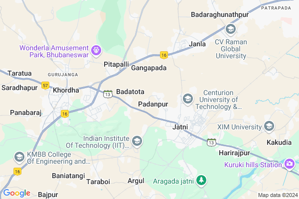
Madanapur Map
EDIT Map
Add Your House
 ..
..
Current Corona Virus Infected Patients Count in Khordha District
| City Name | District Name | Total Covid cases |
|---|---|---|
| Bhubaneswar | Khordha | 19 |
| Khordha District | Khordha | 12 |
| Bomikhal | Khordha | 6 |
| Jharpada | Khordha | 4 |
| Madhusudan | Khordha | 2 |
| Bhubaneshwar | Khordha | 1 |
| Bomikhal, Bhubaneswar | Khordha | 1 |
| Bhimatangi, Bhubaneswar | Khordha | 1 |
Locality Name :
Madanapur
( ମଦନପୁର )
Tehsil Name : Jatni
District : Khordha
State : Odisha
Language : Oriya and Hindi
Current Time 11:51 AM
Date: Monday , Apr 28,2025 (IST)
Time zone: IST (UTC+5:30)
Elevation / Altitude: 25 meters. Above Seal level
Telephone Code / Std Code: 06755
Assembly constituency : Jatni assembly constituency
Assembly MLA : bhagirathi badajena
Lok Sabha constituency : Bhubaneswar parliamentary constituency
Parliament MP : APARAJITA SARANGI
Serpanch Name :
Pin Code : 752054
Post Office Name : Janla
Alternate Village Name : Madanpur
Commodities Prices : Banki Market / Mandi
National Highways Reachable To Madanapur
Nationa High Way :NH316
Nationa High Way :NH16
Nationa High Way :NH316
Nationa High Way :NH16
Rivers Near Madanapur
Kusumi
Kusumi
About Madanapur
Correct below Info and add more info about MadanapurMadanapur is a Village in Jatni Tehsil in Khordha District of Odisha State, India. It is located 21 KM towards west from District head quarters Khurda. 22 KM from State capital Bhubaneswar
Madanapur Pin code is 752054 and postal head office is Janla .
Madanapur is surrounded by Khordha Tehsil towards west , Delanga Tehsil towards South , Bhubaneswar Tehsil towards East , Pipili Tehsil towards East .
Jatani , Khordha , Bhubaneswar , Cuttack are the near by Cities to Madanapur.
This Place is in the border of the Khordha District and Puri District. Puri District Delanga is South towards this place .
Madanpur 2011 Census Details
Madanapur Local Language is Oriya. Madanpur Village Total population is 1257 and number of houses are 241. Female Population is 49.6%. Village literacy rate is 80.7% and the Female Literacy rate is 38.6%.
Population
| Census Parameter | Census Data |
| Total Population | 1257 |
| Total No of Houses | 241 |
| Female Population % | 49.6 % ( 623) |
| Total Literacy rate % | 80.7 % ( 1015) |
| Female Literacy rate | 38.6 % ( 485) |
| Scheduled Tribes Population % | 18.1 % ( 227) |
| Scheduled Caste Population % | 10.5 % ( 132) |
| Working Population % | 38.5 % |
| Child(0 -6) Population by 2011 | 122 |
| Girl Child(0 -6) Population % by 2011 | 42.6 % ( 52) |
Madanpur Census More Deatils.
Politics in Madanapur
BJD , INC are the major political parties in this area.Polling Stations /Booths near Madanapur
1)Bhatakhuri Pry.school (r-2)2)Ogalsuan Pry.school
3)Trutiyapada Pry.school
4)Uparabasta U.g.u.p.school
5)Badaraghunathpur U.p.school
HOW TO REACH Madanapur
By Rail
Khurda Road Junction Rail Way Station , Haripur Gram Rail Way Station are the very nearby railway stations to Madanapur.Colleges near Madanapur
Iiet
Address :
Vivekananda Institute Of Technology
Address : Bhubaneswardist- Khurda ,pin- 752054state- Orissa
C.v. Raman College Of Engineering
Address : Bidyanagar, Mahura, Janlabhubaneswar - 752 054 (or
Bhubaneswar Institute Of Technology
Address : P.o - Janla, Pin - 752054dist - Khurda, Orissaph
Centurion Institute Of Technology
Address : Po : Jatni,bhubaneswar,dist : Khurda, Pin : 75205
Schools in Madanapur
Madanpur Hs
Address : madanpur , jatni , khordha , Sikkim . PIN- 752054 , Post - Janla
Madanpur Nodal Ups
Address : madanpur , jatni , khordha , Sikkim . PIN- 752054 , Post - Janla
Govt Health Centers near Madanapur
1) Badatota , BADATOTA SC , BADATOTA , BADATOTA2) Jatani MC , JATANI MC , JATANI , JATANI
3) JATANI , Jatani CHC , Hari Bhaina Chaka , Jatani
Petrol Bunks in Madanapur,Jatni
HP Petrol Pump Jatni Service Station
Ramchandrapur Bazar; Khurdha - Jatni Road; Jatni; Bhubaneshwar; 752050; India
3.0 KM distance Detail
more ..
Colleges in Madanapur,Jatni
Jatni Degree College;Jatani;KHURDA
Jatni Gate to Jatni Town (Khurda Road Stn); Jatni; Odisha 752050; India
2.9 KM distance Detail
Zenith Institute of Science & Technology
Pitapalli; Bhubaneswar; Odisha 760002; India
3.3 KM distance Detail
more ..
Schools in Madanapur,Jatni
Carmel English Medium School
खुर्दा - जतनी - पिपिली मार्ग; Khurdha; Odisha 752050; India
2.5 KM distance Detail
Police Stations near Madanapur,Jatni
Railway Protection Force; Khurda Road Junction
East Coast Railway Complex; Khurdha; Odisha 752050; India
4.8 KM distance Detail
About Madanapur &
History
How to reach Madanapur
Tourist Places Near By Madanapur
Schools in Madanapur
Colleges in Madanapur
Temperature & weather of Madanapur
places in Madanapur
Madanapur photos
More Information
How to reach Madanapur
Tourist Places Near By Madanapur
Schools in Madanapur
Colleges in Madanapur
Temperature & weather of Madanapur
places in Madanapur
Madanapur photos
More Information
Village Talk
Post News or Events about this Village
Near Cities
Jatani 2 KM near
Khordha 7 KM near
Bhubaneswar 20 KM near
Cuttack 41 KM near
Jatani 2 KM near
Khordha 7 KM near
Bhubaneswar 20 KM near
Cuttack 41 KM near
Near By Taluks
Jatni 0 KM near
Khordha 11 KM near
Delanga 17 KM near
Bhubaneswar 20 KM near
Jatni 0 KM near
Khordha 11 KM near
Delanga 17 KM near
Bhubaneswar 20 KM near
Near By Air Ports
Bhubaneswar Airport 18 KM near
Ranchi Airport 392 KM near
Vishakhapatnam Airport 420 KM near
Netaji Subhas Chandra Bose Airport 443 KM near
Bhubaneswar Airport 18 KM near
Ranchi Airport 392 KM near
Vishakhapatnam Airport 420 KM near
Netaji Subhas Chandra Bose Airport 443 KM near
Near By Tourist Places
Bhubaneswar 22 KM near
Nandan Kanan National Park 31 KM near
Cuttack 42 KM near
Puri 48 KM near
Konark 60 KM near
Bhubaneswar 22 KM near
Nandan Kanan National Park 31 KM near
Cuttack 42 KM near
Puri 48 KM near
Konark 60 KM near
Near By Districts
Khordha 20 KM near
Cuttack 43 KM near
Puri 48 KM near
Jagatsinghapur 58 KM near
Khordha 20 KM near
Cuttack 43 KM near
Puri 48 KM near
Jagatsinghapur 58 KM near
Near By RailWay Station
Khurda Road Junction Rail Way Station 4.9 KM near
Haripur Gram Rail Way Station 7.0 KM near
Argul P.h. Rail Way Station 7.3 KM near
Bhubaneswar Rail Way Station 21 KM near
Khurda Road Junction Rail Way Station 4.9 KM near
Haripur Gram Rail Way Station 7.0 KM near
Argul P.h. Rail Way Station 7.3 KM near
Bhubaneswar Rail Way Station 21 KM near