| Home | City Bus | Maps | Villages | Cities | Rail | Tourist Places | School | College | Pin Codes | Corona Cases Count |
| Distance Calculator Bus Services IFSC Codes Trace Mobile Number Weather Search Place Trace IP Available Cash ATM/Banks Locate Polling Booth Report an Error contact People |
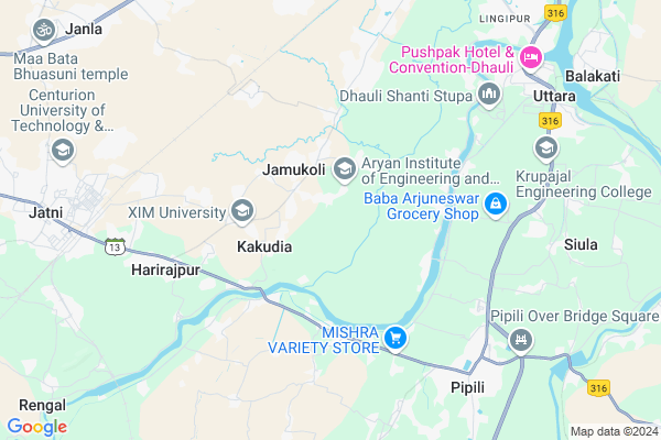
Barakuda Map
EDIT Map
Add Your House
 ..
..
Current Corona Virus Infected Patients Count in Khordha District
| City Name | District Name | Total Covid cases |
|---|---|---|
| Bhubaneswar | Khordha | 19 |
| Khordha District | Khordha | 12 |
| Bomikhal | Khordha | 6 |
| Jharpada | Khordha | 4 |
| Madhusudan | Khordha | 2 |
| Bhubaneshwar | Khordha | 1 |
| Bomikhal, Bhubaneswar | Khordha | 1 |
| Bhimatangi, Bhubaneswar | Khordha | 1 |
Locality Name :
Barakuda
( ବରାକୁଦ )
Tehsil Name : Jatni
District : Khordha
State : Odisha
Language : Oriya and Hindi
Current Time 09:46 PM
Date: Sunday , Apr 27,2025 (IST)
Time zone: IST (UTC+5:30)
Elevation / Altitude: 25 meters. Above Seal level
Telephone Code / Std Code: 06755
Assembly constituency : Jatni assembly constituency
Assembly MLA : bhagirathi badajena
Lok Sabha constituency : Bhubaneswar parliamentary constituency
Parliament MP : APARAJITA SARANGI
Serpanch Name :
Pin Code : 751002
Post Office Name : Santarapur
Commodities Prices : Nimapara Market / Mandi
Barakuda Live Weather
Temperature: 29.2 °C
haze
Humidity: 70%
Wind : 2.57 mt/sec towards S
StationName : "Bhubaneswar"
observed on 1 Hours Back
Temperature: 29.2 °C
haze
Humidity: 70%
Wind : 2.57 mt/sec towards S
StationName : "Bhubaneswar"
observed on 1 Hours Back
Barakuda Weather Forecast for Next 5 days
28-04-2025
27.4°C to 28.7°C
broken clouds, scattered clouds
27.4°C to 28.7°C
broken clouds, scattered clouds
29-04-2025
24.7°C to 39.1°C
light rain, scattered clouds, few clouds, broken clouds
24.7°C to 39.1°C
light rain, scattered clouds, few clouds, broken clouds
30-04-2025
23.9°C to 37.2°C
scattered clouds, clear sky, light rain, broken clouds
23.9°C to 37.2°C
scattered clouds, clear sky, light rain, broken clouds
01-05-2025
24.8°C to 36.2°C
clear sky, scattered clouds, light rain, broken clouds
24.8°C to 36.2°C
clear sky, scattered clouds, light rain, broken clouds
02-05-2025
23.7°C to 36.7°C
clear sky, few clouds, moderate rain, light rain, scattered clouds
23.7°C to 36.7°C
clear sky, few clouds, moderate rain, light rain, scattered clouds
Edit below overview about Barakuda
Edit below overview about Barakuda
OverView of Barakuda
VILLAGE BARAKUDA IS SITUATED IN JATNI TAHASIL OF KHORDHA DISTRICT.ITS ABOUT 8 KILOMETERS FROM CAPITAL CITY.IS A VERY BEAUTIFUL AND PEACEFUL VILLAGE.AROUND 1500 PEOPLES ARE LIVING WITHIN THIS.THE HISTORICAL MOUNTAIN LABANAGIRI IS IN THE NORTH OF THIS AND HOLY RIVER GANGOTRI ( CURRENTLY GANGUA ) IS FLOWING IN ITS SOUTH.ITS BEING DEVELOPING BY DAY TO DAY AS ITS SITUATED VERY CLOSE TO BHUBANESWAR.THERE ARE ALSO TWO ENGINEERING COLLEGE NAMELY ARYAN AND INDUS ARE ESTABLISHED IN THIS VILLAGE,Edit below overview about Barakuda
National Highways Reachable To Barakuda
Nationa High Way :NH316
Nationa High Way :NH16
Nationa High Way :NH316
Nationa High Way :NH16
Rivers Near Barakuda
Kusumi
Kusumi
About Barakuda
Barakuda is a small Village/hamlet in Jatni Tehsil in Khordha District of Odisha State, India. It is located 17 KM towards South from District head quarters Khurda. 14 KM from Jatni. 15 KM from State capital Bhubaneswar
Barakuda Pin code is 751002 and postal head office is Santarapur .
Kantia ( 6 KM ) , Itipur ( 6 KM ) , Dhauli ( 7 KM ) , Nanput ( 8 KM ) , Sundarpada ( 9 KM ) are the nearby Villages to Barakuda. Barakuda is surrounded by Jatni Tehsil towards west , Delanga Tehsil towards South , Bhubaneswar Tehsil towards North , Balianta Tehsil towards East .
Jatani , Bhubaneswar , Khordha , Cuttack are the near by Cities to Barakuda.
This Place is in the border of the Khordha District and Puri District. Puri District Delanga is South towards this place .
Barakuda 2011 Census Details
Barakuda Local Language is Oriya. Barakuda Village Total population is 1139 and number of houses are 220. Female Population is 50.0%. Village literacy rate is 77.2% and the Female Literacy rate is 35.9%.
Population
| Census Parameter | Census Data |
| Total Population | 1139 |
| Total No of Houses | 220 |
| Female Population % | 50.0 % ( 569) |
| Total Literacy rate % | 77.2 % ( 879) |
| Female Literacy rate | 35.9 % ( 409) |
| Scheduled Tribes Population % | 0.0 % ( 0) |
| Scheduled Caste Population % | 39.9 % ( 454) |
| Working Population % | 34.9 % |
| Child(0 -6) Population by 2011 | 133 |
| Girl Child(0 -6) Population % by 2011 | 49.6 % ( 66) |
Barakuda Census More Deatils.
Politics in Barakuda
BJD , INC are the major political parties in this area.Polling Stations /Booths near Barakuda
1)Bantala Pry.school2)Palaspur Pry.school
3)Panchagaon Up.school Panchagaon
4)Padanpur Proj. U.p.school
5)Jamujhari Pry. School Jamujhari
HOW TO REACH Barakuda
By Rail
Retang Rail Way Station , Sarkantra Rail Way Station are the very nearby railway stations to Barakuda.Colleges near Barakuda
Iiet
Address :
Vivekananda Institute Of Technology
Address : Bhubaneswardist- Khurda ,pin- 752054state- Orissa
C.v. Raman College Of Engineering
Address : Bidyanagar, Mahura, Janlabhubaneswar - 752 054 (or
Bhubaneswar Institute Of Technology
Address : P.o - Janla, Pin - 752054dist - Khurda, Orissaph
Centurion Institute Of Technology
Address : Po : Jatni,bhubaneswar,dist : Khurda, Pin : 75205
Schools in Barakuda
Uashapadar P S
Address : barakuda , jatni , khordha , Sikkim . PIN- 752050 , Post - Retang Colony
Govt Health Centers near Barakuda
1) Pradhansahi , Pradhansahi , Pradhansahi , Pradhansahi2) Kantia , KANTIA SC , KANTIA , KANTIA
3) Brahmakundala , BRAHMAKUNDALA SC , BRAHMAKUNDALA , BRAHMAKUNDALA
Hospitals in Barakuda,Jatni
Dazzle Dental Clinic
Padmabati Market Complex;Plot no-364;365; Orakal; Bhubaneswar; Odisha 751002; India
6.0 KM distance Detail
more ..
Petrol Bunks in Barakuda,Jatni
Bharat Petroleum Anjana Filling Station
Kantilo; Bhubaneswar; Odisha 751002; India
5.3 KM distance Detail
more ..
Colleges in Barakuda,Jatni
Orissa Engineering College
Nabajyoti Vihar; Nijigarh Kurki; Post Harirajpur; Jatni; Bhubaneswar; Odisha 752050; India
2.4 KM distance Detail
Xavier University Hostels
Sundarapada - Jatani Rd; Kakudia; Odisha 752050; India
3.1 KM distance Detail
more ..
Electronic Shops in Barakuda,Jatni
TECHNO WORLD
Basantpur sasan;Po-Iti pur;Dist-khurdha;PS-Dhauli; Bhubaneswar; Odisha 751002; India
5.3 KM distance Detail
Police Stations near Barakuda,Jatni
Dhauli Police Station
Near Gopinath School; Dhauli; Bhubaneswar; Odisha 751002; India
8.5 KM distance Detail
About Barakuda &
History
How to reach Barakuda
Tourist Places Near By Barakuda
Schools in Barakuda
Colleges in Barakuda
Temperature & weather of Barakuda
places in Barakuda
Barakuda photos
More Information
How to reach Barakuda
Tourist Places Near By Barakuda
Schools in Barakuda
Colleges in Barakuda
Temperature & weather of Barakuda
places in Barakuda
Barakuda photos
More Information
Village Talk
Post News or Events about this Village
Near Cities
Jatani 10 KM near
Bhubaneswar 16 KM near
Khordha 20 KM near
Cuttack 38 KM near
Jatani 10 KM near
Bhubaneswar 16 KM near
Khordha 20 KM near
Cuttack 38 KM near
Near By Taluks
Pipili 10 KM near
Jatni 13 KM near
Delanga 14 KM near
Bhubaneswar 15 KM near
Pipili 10 KM near
Jatni 13 KM near
Delanga 14 KM near
Bhubaneswar 15 KM near
Near By Air Ports
Bhubaneswar Airport 11 KM near
Ranchi Airport 396 KM near
Vishakhapatnam Airport 427 KM near
Netaji Subhas Chandra Bose Airport 436 KM near
Bhubaneswar Airport 11 KM near
Ranchi Airport 396 KM near
Vishakhapatnam Airport 427 KM near
Netaji Subhas Chandra Bose Airport 436 KM near
Near By Tourist Places
Bhubaneswar 17 KM near
Nandan Kanan National Park 29 KM near
Cuttack 39 KM near
Puri 43 KM near
Konark 48 KM near
Bhubaneswar 17 KM near
Nandan Kanan National Park 29 KM near
Cuttack 39 KM near
Puri 43 KM near
Konark 48 KM near
Near By Districts
Khordha 16 KM near
Cuttack 40 KM near
Puri 43 KM near
Jagatsinghapur 46 KM near
Khordha 16 KM near
Cuttack 40 KM near
Puri 43 KM near
Jagatsinghapur 46 KM near
Near By RailWay Station
Retang Rail Way Station 6.3 KM near
Sarkantra Rail Way Station 8.8 KM near
Khurda Road Junction Rail Way Station 9 KM near
Bhubaneswar Rail Way Station 14 KM near
Retang Rail Way Station 6.3 KM near
Sarkantra Rail Way Station 8.8 KM near
Khurda Road Junction Rail Way Station 9 KM near
Bhubaneswar Rail Way Station 14 KM near