| Home | City Bus | Maps | Villages | Cities | Rail | Tourist Places | School | College | Pin Codes | Corona Cases Count |
| Distance Calculator Bus Services IFSC Codes Trace Mobile Number Weather Search Place Trace IP Available Cash ATM/Banks Locate Polling Booth Report an Error contact People |
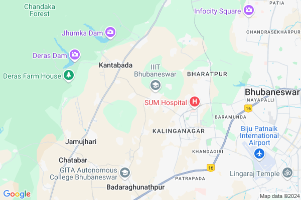
Hostel Road, Gothapatna
Hostel Road, Gothapatna Map
EDIT Map
Add Your House
 ..
..
Current Corona Virus Infected Patients Count in Khordha District
| City Name | District Name | Total Covid cases |
|---|---|---|
| Bhubaneswar | Khordha | 19 |
| Khordha District | Khordha | 12 |
| Bomikhal | Khordha | 6 |
| Jharpada | Khordha | 4 |
| Madhusudan | Khordha | 2 |
| Bhubaneshwar | Khordha | 1 |
| Bomikhal, Bhubaneswar | Khordha | 1 |
| Bhimatangi, Bhubaneswar | Khordha | 1 |
Village Name :
Hostel Road, Gothapatna
( ହଷ୍ଟେଲ ରୋଡ ଗୋଠପାଟଣା )
City Name : Bhubaneswar
District : Khordha
State : Odisha
Language : Oriya and Hindi
Current Time 03:28 PM
Date: Tuesday , Apr 29,2025 (IST)
Time zone: IST (UTC+5:30)
Elevation / Altitude: 40 meters. Above Seal level
Telephone Code / Std Code: 0674
Ward : Ward
Assembly constituency : Jatni assembly constituency
Assembly MLA : bhagirathi badajena
Lok Sabha constituency : Bhubaneswar parliamentary constituency
Parliament MP : APARAJITA SARANGI
Pin Code : 751003
Post Office Name : Suryanagar (Khorda)
Commodities Prices : Chatta Krushak Bazar Market / Mandi
National Highways Reachable To Hostel Road, Gothapatna
Nationa High Way :NH316
Nationa High Way :NH57
Nationa High Way :NH316
Nationa High Way :NH57
Rivers Near Hostel Road, Gothapatna
Rana
Mahanadi
Rana
Mahanadi
About Hostel Road, Gothapatna
Correct below Info and add more info about Hostel Road, GothapatnaHostel Road, Gothapatna is a Locality in Bhubaneswar City in Odisha State, India.
Hostel Road, Gothapatna Pin code is 751003 and postal head office is Suryanagar (Khorda).
Bhubaneswar , Jatani , Khordha , Cuttack are the nearby Cities to Bhubaneswar.
Demographics of Hostel Road, Gothapatna
Oriya is the Local Language here.Politics in Hostel Road, Gothapatna
BJD , INC are the major political parties in this area.Polling Stations /Booths near Hostel Road, Gothapatna
1)Majana Pry.school2)Malipada Pry.school
3)Gangapada Pry.school(r-1)
4)Gopapuria Patapur Pry.school
5)Niranjanpur Pry.school
HOW TO REACH Hostel Road, Gothapatna
By Rail
Sarkantra Rail Way Station , Lingaraj Temple Road Rail Way Station are the very nearby railway station to Hostel Road, Gothapatna.Local Bus
Sum Hospital Bus Station , Kalinga Studio Bus Station are the nearby by Local Bus Stops to Hostel Road, Gothapatna . runs Number of busses from Hostel Road, Gothapatna to different Places.Bus Stops near Hostel Road, Gothapatna
Sum Hospital Kalinga StudioLoacl Bus Routes Travel from Hostel Road, Gothapatna
504 ( Nuagaon - East College )More..
Govt Health Centers near Hostel Road, Gothapatna
1) Paikarapur , PAIKARAPUR SC , PAIKARAPUR , PAIKARAPUR2) Kantabad , KANTABAD SC , KANTABAD , KANTABAD
3) Ghatakia , GHATIKIA SC , GHATIKIA , GHATIKIA
Hospitals in Hostel Road, Gothapatna,Bhubaneswar
Morden Pathology & Clinic
Near Phool Palace; Ghatika; Bhubaneswar; Odisha 751003; India
2.8 KM distance Detail
Dev Enclave
K8 Lane 1; K8 Kalinga Nagar; Shampur; Bhubaneswar; Odisha 751003; India
3.2 KM distance Detail
B C MOHANTY
317; K/8/1084; K/8 Middle Ln; K8 Kalinga Nagar; Shampur; Bhubaneswar; Odisha 751003; India
3.3 KM distance Detail
more ..
Petrol Bunks in Hostel Road, Gothapatna,Bhubaneswar
Subham Gas Repairing Shop
Sum Hospital Road; Shyampur; Bhubaneswar; Odisha; India
4.9 KM distance Detail
Bhujabala Petrol Pump
Ghatikia; Khandagiri; Bhubaneswar; Odisha 751030; India
5.6 KM distance Detail
Indian Oil
Near Bank of India ATM; Ghatikia; Bhubaneswar; Odisha 751003; India
5.6 KM distance Detail
more ..
Colleges in Hostel Road, Gothapatna,Bhubaneswar
Birla Global University
IDCO Plot No. 2; Institutional Area; Gothapatna; Bhubaneswar; Odisha 751029; India
0.7 KM distance Detail
BIMTECH( Birla Global University)
Gothapatana Road; Shampur; Bhubaneswar; Odisha 751003; India
0.7 KM distance Detail
International Management Institute
IDCO Plot No 1; Village-Gothapatna; PO-Malipada; PS-Chandaka; Dist-Khurda; Bhubaneswar; Odisha 751003; India
0.9 KM distance Detail
more ..
Schools in Hostel Road, Gothapatna,Bhubaneswar
Times Scholars Gurukul
444; Gothapatana Road; Malipada; Khandagiri; Bhubaneswar; Odisha 751003; India
1.2 KM distance Detail
Tree House Play Group
Plot No.mdl-7; Shanti Vihar; HB Colony;; Baramunda; Bhubaneswar; Odisha 751003; India
2.0 KM distance Detail
Kendriya Vidyalaya
No.5; Kalinga Nagar; Mahalaxmi Vihar Post; Bhubaneswar; Odisha 751029; India
3.1 KM distance Detail
Electronic Shops in Hostel Road, Gothapatna,Bhubaneswar
Itechlance
Plot No. 329; Mahalaxmi Bhawan; Behind Dasarathi Enclave; Bhubaneswar; Odisha 751013; India
2.0 KM distance Detail
Super Markets in Hostel Road, Gothapatna,Bhubaneswar
MANJUSHREE ENGINEERING
MANJUSHREE ESTATE;PlotNo-811;EcoParkRoad; Bhubaneswar; Odisha 751002; India
3.6 KM distance Detail
Mani NagaDurga Verity Store
980; K8 Lane 1; K8 Kalinga Nagar; Shampur; Bhubaneswar; Odisha 751003; India
3.8 KM distance Detail
Local Parks in Hostel Road, Gothapatna,Bhubaneswar
BDA Park
S Park Ln; K8 Kalinga Nagar; Shampur; Bhubaneswar; Odisha 751003; India
3.4 KM distance Detail
BDA Children's Park; K-1 Kalinga Nagar
K1; K8 Kalinga Nagar; Kalinga Nagar; Ghatikhiya; Odisha 751003; India
3.5 KM distance Detail
Governement Offices near Hostel Road, Gothapatna,Bhubaneswar
Ghatikia Bus Stop
Ghatikia Main Rd; Kalinga Nagar; Bhubaneswar; Odisha 751003; India
3.5 KM distance Detail
Office of The State Silviculturist
Kalinga Nagar; Bhubaneswar; Odisha 751003; India
5.1 KM distance Detail
About Hostel Road, Gothapatna &
History
How to reach Hostel Road, Gothapatna
Tourist Places Near By Hostel Road, Gothapatna
Schools in Hostel Road, Gothapatna
Colleges in Hostel Road, Gothapatna
Temperature & weather of Hostel Road, Gothapatna
places in Hostel Road, Gothapatna
Hostel Road, Gothapatna photos
More Information
How to reach Hostel Road, Gothapatna
Tourist Places Near By Hostel Road, Gothapatna
Schools in Hostel Road, Gothapatna
Colleges in Hostel Road, Gothapatna
Temperature & weather of Hostel Road, Gothapatna
places in Hostel Road, Gothapatna
Hostel Road, Gothapatna photos
More Information
Locality Talk
Post News or Events about this Locality
Near Cities
Bhubaneswar 8 KM near
Jatani 15 KM near
Khordha 19 KM near
Cuttack 26 KM near
Bhubaneswar 8 KM near
Jatani 15 KM near
Khordha 19 KM near
Cuttack 26 KM near
Near By Taluks
Bhubaneswar 9 KM near
Jatni 15 KM near
Banki- Dampara 19 KM near
Balianta 21 KM near
Bhubaneswar 9 KM near
Jatni 15 KM near
Banki- Dampara 19 KM near
Balianta 21 KM near
Near By Air Ports
Bhubaneswar Airport 10 KM near
Ranchi Airport 380 KM near
Netaji Subhas Chandra Bose Airport 428 KM near
Vishakhapatnam Airport 435 KM near
Bhubaneswar Airport 10 KM near
Ranchi Airport 380 KM near
Netaji Subhas Chandra Bose Airport 428 KM near
Vishakhapatnam Airport 435 KM near
Near By Tourist Places
Bhubaneswar 9 KM near
Nandan Kanan National Park 15 KM near
Cuttack 27 KM near
Puri 60 KM near
Konark 64 KM near
Bhubaneswar 9 KM near
Nandan Kanan National Park 15 KM near
Cuttack 27 KM near
Puri 60 KM near
Konark 64 KM near
Near By Districts
Khordha 8 KM near
Cuttack 28 KM near
Dhenkanal 48 KM near
Jagatsinghapur 50 KM near
Khordha 8 KM near
Cuttack 28 KM near
Dhenkanal 48 KM near
Jagatsinghapur 50 KM near
Near By RailWay Station
Bhubaneswar Rail Way Station 12 KM near
Mancheswar Rail Way Station 12 KM near
Bhubaneswar Rail Way Station 12 KM near
Mancheswar Rail Way Station 12 KM near