| Home | City Bus | Maps | Villages | Cities | Rail | Tourist Places | School | College | Pin Codes | Corona Cases Count |
| Distance Calculator Bus Services IFSC Codes Trace Mobile Number Weather Search Place Trace IP Available Cash ATM/Banks Locate Polling Booth Report an Error contact People |
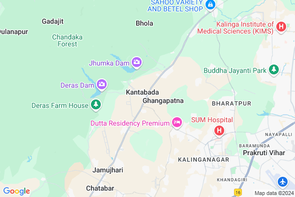
Kantabada Map
EDIT Map
Add Your House
 ..
..
Current Corona Virus Infected Patients Count in Khordha District
| City Name | District Name | Total Covid cases |
|---|---|---|
| Bhubaneswar | Khordha | 19 |
| Khordha District | Khordha | 12 |
| Bomikhal | Khordha | 6 |
| Jharpada | Khordha | 4 |
| Madhusudan | Khordha | 2 |
| Bomikhal, Bhubaneswar | Khordha | 1 |
| Bhimatangi, Bhubaneswar | Khordha | 1 |
| Bhubaneshwar | Khordha | 1 |
Locality Name :
Kantabada
( କଣ୍ଟାବାଡ )
Tehsil Name : Begunia
District : Khordha
State : Odisha
Language : Oriya and Hindi
Current Time 11:54 AM
Date: Sunday , Apr 27,2025 (IST)
Time zone: IST (UTC+5:30)
Elevation / Altitude: 21 meters. Above Seal level
Telephone Code / Std Code: 06755
Assembly constituency : Jatni assembly constituency
Assembly MLA : bhagirathi badajena
Lok Sabha constituency : Bhubaneswar parliamentary constituency
Parliament MP : APARAJITA SARANGI
Serpanch Name :
Pin Code : 752054
Post Office Name : Janla
Alternate Village Name : Kantabad
Commodities Prices : Banki Market / Mandi
Kantabada Live Weather
Temperature: 33.9 °C
haze
Humidity: 46%
Wind : 2.06 mt/sec towards SW
StationName : "Jatani"
observed on 21 Mins Back
Temperature: 33.9 °C
haze
Humidity: 46%
Wind : 2.06 mt/sec towards SW
StationName : "Jatani"
observed on 21 Mins Back
Kantabada Weather Forecast for Next 5 days
28-04-2025
27.0°C to 41.3°C
scattered clouds, light rain, overcast clouds, broken clouds
27.0°C to 41.3°C
scattered clouds, light rain, overcast clouds, broken clouds
29-04-2025
26.2°C to 37.4°C
scattered clouds, overcast clouds, broken clouds, light rain, few clouds
26.2°C to 37.4°C
scattered clouds, overcast clouds, broken clouds, light rain, few clouds
30-04-2025
25.5°C to 37.4°C
light rain, few clouds, clear sky, moderate rain, scattered clouds
25.5°C to 37.4°C
light rain, few clouds, clear sky, moderate rain, scattered clouds
01-05-2025
24.0°C to 35.6°C
few clouds, clear sky, scattered clouds, moderate rain, light rain, overcast clouds
24.0°C to 35.6°C
few clouds, clear sky, scattered clouds, moderate rain, light rain, overcast clouds
02-05-2025
22.4°C to 35.8°C
few clouds, clear sky, broken clouds, heavy intensity rain, moderate rain, overcast clouds
22.4°C to 35.8°C
few clouds, clear sky, broken clouds, heavy intensity rain, moderate rain, overcast clouds
National Highways Reachable To Kantabada
Nationa High Way :NH316
Nationa High Way :NH57
Nationa High Way :NH316
Nationa High Way :NH57
Rivers Near Kantabada
Rana
Dauka
Rana
Dauka
About Kantabada
Correct below Info and add more info about KantabadaKantabada is a Village in Begunia Tehsil in Khordha District of Odisha State, India. It is located 12 KM towards west from District head quarters Khurda. 32 KM from Begunia. 16 KM from State capital Bhubaneswar
Kantabada Pin code is 752054 and postal head office is Janla .
Mendhasala ( 6 KM ) , Andharua ( 6 KM ) , Shyampur ( 7 KM ) , Lords Valley ( 7 KM ) , K8 Kalinga Nagar ( 7 KM ) are the nearby Villages to Kantabada. Kantabada is surrounded by Banki- Dampara Tehsil towards west , Jatni Tehsil towards South , Balianta Tehsil towards East , Khordha Tehsil towards South .
Bhubaneswar , Jatani , Khordha , Cuttack are the near by Cities to Kantabada.
This Place is in the border of the Khordha District and Cuttack District. Cuttack District Banki- Dampara is west towards this place . Also it is in the Border of other district Nayagarh .
Kantabad 2011 Census Details
Kantabada Local Language is Oriya. Kantabad Village Total population is 893 and number of houses are 238. Female Population is 49.5%. Village literacy rate is 66.5% and the Female Literacy rate is 28.7%.
Population
| Census Parameter | Census Data |
| Total Population | 893 |
| Total No of Houses | 238 |
| Female Population % | 49.5 % ( 442) |
| Total Literacy rate % | 66.5 % ( 594) |
| Female Literacy rate | 28.7 % ( 256) |
| Scheduled Tribes Population % | 39.0 % ( 348) |
| Scheduled Caste Population % | 1.6 % ( 14) |
| Working Population % | 38.0 % |
| Child(0 -6) Population by 2011 | 111 |
| Girl Child(0 -6) Population % by 2011 | 47.7 % ( 53) |
Kantabad Census More Deatils.
Politics in Kantabada
BJD , INC are the major political parties in this area.Polling Stations /Booths near Kantabada
1)Kantabada High School2)Kaimatiapatna Pry.school
3)Bhagabanpur Project Pry. School (r-2)
4)Gangapada Pry.school(r-1)
5)Gaudaput Pry.school
HOW TO REACH Kantabada
By Rail
There is no railway station near to Kantabada in less than 10 km.Colleges near Kantabada
Begunia College,begunia
Address :
Schools in Kantabada
Jayanti Devi Girls Hs
Address : kantabada , begunia , khordha , Sikkim . PIN- 752061 , Post - Baghamari
Kantabad Hs
Address : kantabada , begunia , khordha , Sikkim . PIN- 752061 , Post - Baghamari
Kantabad Up(me)s
Address : kantabada , begunia , khordha , Sikkim . PIN- 752061 , Post - Baghamari
Govt Health Centers near Kantabada
1) Kantabad , KANTABAD SC , KANTABAD , KANTABAD2) MENDHASALA , Mendasal CHC , Pitapalli to Mendasal Road , Chatabara
3) Paikarapur , PAIKARAPUR SC , PAIKARAPUR , PAIKARAPUR
Hospitals in Kantabada,Begunia
Government Ayurvedic Dispensary
Jayanath Temple; Andharua; Bhubaneswar; Odisha 751003; India
6.1 KM distance Detail
Morden Pathology & Clinic
Near Phool Palace; Ghatika; Bhubaneswar; Odisha 751003; India
6.3 KM distance Detail
B C MOHANTY
317; K/8/1084; K/8 Middle Ln; K8 Kalinga Nagar; Shampur; Bhubaneswar; Odisha 751003; India
6.7 KM distance Detail
more ..
Petrol Bunks in Kantabada,Begunia
Subham Gas Repairing Shop
Sum Hospital Road; Shyampur; Bhubaneswar; Odisha; India
7.9 KM distance Detail
Bhujabala Petrol Pump
Ghatikia; Khandagiri; Bhubaneswar; Odisha 751030; India
9.0 KM distance Detail
more ..
Colleges in Kantabada,Begunia
BIMTECH( Birla Global University)
Gothapatana Road; Shampur; Bhubaneswar; Odisha 751003; India
3.9 KM distance Detail
International Management Institute
IDCO Plot No 1; Village-Gothapatna; PO-Malipada; PS-Chandaka; Dist-Khurda; Bhubaneswar; Odisha 751003; India
3.9 KM distance Detail
Birla Global University
IDCO Plot No. 2; Institutional Area; Gothapatna; Bhubaneswar; Odisha 751029; India
4.0 KM distance Detail
more ..
Schools in Kantabada,Begunia
Giringaput School (Govt.)
Khurdha - Chandaka Rd; Giringaput; Odisha 752054; India
3.2 KM distance Detail
Haridamada SC/ST Ashram School
400 KV Mendhashal Grid; Haridamada; Odisha 752054; India
4.3 KM distance Detail
Electronic Shops in Kantabada,Begunia
Biometric Attendance Dealer in Bhubaneswar Odisha
5002/1626;Malipada; Bhubaneswar; Odisha 751003; India
4.9 KM distance Detail
Local Parks in Kantabada,Begunia
Bisudhananda Park
751003; Bisudhananda Nagar; Bharatpur; Bhubaneswar; Odisha 751003; India
6.7 KM distance Detail
Governement Offices near Kantabada,Begunia
Ghatikia Bus Stop
Ghatikia Main Rd; Kalinga Nagar; Bhubaneswar; Odisha 751003; India
7.1 KM distance Detail
Office of The State Silviculturist
Kalinga Nagar; Bhubaneswar; Odisha 751003; India
8.4 KM distance Detail
About Kantabada &
History
How to reach Kantabada
Tourist Places Near By Kantabada
Schools in Kantabada
Colleges in Kantabada
Temperature & weather of Kantabada
places in Kantabada
Kantabada photos
More Information
How to reach Kantabada
Tourist Places Near By Kantabada
Schools in Kantabada
Colleges in Kantabada
Temperature & weather of Kantabada
places in Kantabada
Kantabada photos
More Information
Village Talk
Post News or Events about this Village
Near Cities
Bhubaneswar 11 KM near
Jatani 17 KM near
Khordha 19 KM near
Cuttack 26 KM near
Bhubaneswar 11 KM near
Jatani 17 KM near
Khordha 19 KM near
Cuttack 26 KM near
Near By Taluks
Bhubaneswar 12 KM near
Banki- Dampara 16 KM near
Jatni 16 KM near
Balianta 24 KM near
Bhubaneswar 12 KM near
Banki- Dampara 16 KM near
Jatni 16 KM near
Balianta 24 KM near
Near By Air Ports
Bhubaneswar Airport 13 KM near
Ranchi Airport 377 KM near
Netaji Subhas Chandra Bose Airport 428 KM near
Vishakhapatnam Airport 435 KM near
Bhubaneswar Airport 13 KM near
Ranchi Airport 377 KM near
Netaji Subhas Chandra Bose Airport 428 KM near
Vishakhapatnam Airport 435 KM near
Near By Tourist Places
Bhubaneswar 12 KM near
Nandan Kanan National Park 15 KM near
Cuttack 26 KM near
Puri 63 KM near
Konark 67 KM near
Bhubaneswar 12 KM near
Nandan Kanan National Park 15 KM near
Cuttack 26 KM near
Puri 63 KM near
Konark 67 KM near
Near By Districts
Khordha 11 KM near
Cuttack 27 KM near
Dhenkanal 45 KM near
Jagatsinghapur 53 KM near
Khordha 11 KM near
Cuttack 27 KM near
Dhenkanal 45 KM near
Jagatsinghapur 53 KM near
Near By RailWay Station
Mancheswar Rail Way Station 14 KM near
Bhubaneswar Rail Way Station 15 KM near
Mancheswar Rail Way Station 14 KM near
Bhubaneswar Rail Way Station 15 KM near