| Home | City Bus | Maps | Villages | Cities | Rail | Tourist Places | School | College | Pin Codes | Corona Cases Count |
| Distance Calculator Bus Services IFSC Codes Trace Mobile Number Weather Search Place Trace IP Available Cash ATM/Banks Locate Polling Booth Report an Error contact People |
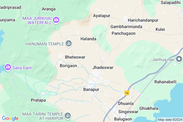
Dolamundai Map
EDIT Map
Add Your House
 ..
..
Current Corona Virus Infected Patients Count in Khordha District
| City Name | District Name | Total Covid cases |
|---|---|---|
| Bhubaneswar | Khordha | 19 |
| Khordha District | Khordha | 12 |
| Bomikhal | Khordha | 6 |
| Jharpada | Khordha | 4 |
| Madhusudan | Khordha | 2 |
| Bomikhal, Bhubaneswar | Khordha | 1 |
| Bhimatangi, Bhubaneswar | Khordha | 1 |
| Bhubaneshwar | Khordha | 1 |
Locality Name :
Dolamundai
( ଦୋଳମୁଣ୍ଡାଇ )
Tehsil Name : Banapur
District : Khordha
State : Odisha
Language : Oriya and Hindi
Current Time 11:03 AM
Date: Friday , Apr 25,2025 (IST)
Time zone: IST (UTC+5:30)
Elevation / Altitude: 11 meters. Above Seal level
Telephone Code / Std Code: 06810
Assembly constituency : Chilika assembly constituency
Assembly MLA : bibhutibhusan harichandan
Lok Sabha constituency : Puri parliamentary constituency
Parliament MP : PINAKI MISRA
Serpanch Name :
Commodities Prices : Balugaon Market / Mandi
National Highways Reachable To Dolamundai
Nationa High Way :NH16
Nationa High Way :NH16
About Dolamundai
Correct below Info and add more info about DolamundaiDolamundai is a small Village/hamlet in Banapur Tehsil in Khordha District of Odisha State, India. It is located 100 KM towards west from District head quarters Khurda. 101 KM from State capital Bhubaneswar
Dolamundai is surrounded by Chilika Tehsil towards East , Beguniapada Tehsil towards west , Khallikote Tehsil towards South , Krushnaprasad Tehsil towards South .
Ganjam , Hinjilicut , Asika , Khordha are the near by Cities to Dolamundai.
It is near to bay of bengal. There is a chance of humidity in the weather.
Demographics of Dolamundai
Oriya is the Local Language here.Politics in Dolamundai
BJP , BJD are the major political parties in this area.Polling Stations /Booths near Dolamundai
1)Kimbhiripada Pry School2)Gambharimunda Me School Gambharimunda
3)Beruanbadi Pry. School
4)Abhaya Upme School Bheteswar
5)Uasapadara Pry School Uasapadar
HOW TO REACH Dolamundai
By Rail
Balugaon Rail Way Station , Solari Rail Way Station are the very nearby railway stations to Dolamundai.Pincodes near Dolamundai
752031 ( Banpur (Khorda) ) , 752034 ( Gangadharpur ) , 752035 ( Gambharimunda )Colleges near Dolamundai
Godavarish Mahavidyalaya
Address :
Schools near Dolamundai
Bauribandhu Vidyapitha
Address : jagabandhupur sasan , banapur , khordha , Sikkim . PIN- 752034 , Post - Gangadharpur
Kharavela Hs, Torasingh
Address : torasingh , banapur , khordha , Sikkim . PIN- 752035 , Post - Gambharimunda
Kulei Hs
Address : kulei , banapur , khordha , Sikkim . PIN- 752034 , Post - Gangadharpur
Narayani Vidyapitha
Address : aranga , banapur , khordha , Sikkim . PIN- 752035 , Post - Gambharimunda
Govt Health Centers near Dolamundai
1) Veteswar , Veteswar , Veteswar , Vetinath Dev Temple2) Halanda , Halanda , Halanda , Halanda PHC
3) Narendrapur , Narendrapur , Narendrapur , G.P Upendrabidyapith
Petrol Bunks in Dolamundai,Banapur
Ms Maa Ugratara Filling Station Bharat Petroleum
Khurdha; Khordha; NH-5; Baharagora Chennai Highway; Khordha; Khordha; Odisha 752027; India
22.2 KM distance Detail
Bharat Petrol Pump
Bhubaneswar - Khurdha - Brahmapur Rd; Kuhudi; Odisha 752027; India
22.3 KM distance Detail
more ..
Electronic Shops in Dolamundai,Banapur
Super Markets in Dolamundai,Banapur
Local Parks in Dolamundai,Banapur
Governement Offices near Dolamundai,Banapur
About Dolamundai &
History
How to reach Dolamundai
Tourist Places Near By Dolamundai
Schools in Dolamundai
Colleges in Dolamundai
Temperature & weather of Dolamundai
places in Dolamundai
Dolamundai photos
More Information
How to reach Dolamundai
Tourist Places Near By Dolamundai
Schools in Dolamundai
Colleges in Dolamundai
Temperature & weather of Dolamundai
places in Dolamundai
Dolamundai photos
More Information
Village Talk
Post News or Events about this Village
Near Cities
Ganjam 54 KM near
Hinjilicut 64 KM near
Asika 66 KM near
Khordha 69 KM near
Ganjam 54 KM near
Hinjilicut 64 KM near
Asika 66 KM near
Khordha 69 KM near
Near By Taluks
Banapur 0 KM near
Chilika 13 KM near
Beguniapada 27 KM near
Khallikote 28 KM near
Banapur 0 KM near
Chilika 13 KM near
Beguniapada 27 KM near
Khallikote 28 KM near
Near By Air Ports
Bhubaneswar Airport 93 KM near
Vishakhapatnam Airport 345 KM near
Raipur Airport 435 KM near
Ranchi Airport 437 KM near
Bhubaneswar Airport 93 KM near
Vishakhapatnam Airport 345 KM near
Raipur Airport 435 KM near
Ranchi Airport 437 KM near
Near By Tourist Places
Chilika 9 KM near
Gopalpur 75 KM near
Berhampur 75 KM near
Puri 77 KM near
Bhubaneswar 97 KM near
Chilika 9 KM near
Gopalpur 75 KM near
Berhampur 75 KM near
Puri 77 KM near
Bhubaneswar 97 KM near
Near By Districts
Nayagarh 39 KM near
Ganjam 61 KM near
Puri 76 KM near
Khordha 96 KM near
Nayagarh 39 KM near
Ganjam 61 KM near
Puri 76 KM near
Khordha 96 KM near
Near By RailWay Station
Balugaon Rail Way Station 8.9 KM near
Chilka Rail Way Station 15 KM near
Balugaon Rail Way Station 8.9 KM near
Chilka Rail Way Station 15 KM near