| Home | City Bus | Maps | Villages | Cities | Rail | Tourist Places | School | College | Pin Codes | Corona Cases Count |
| Distance Calculator Bus Services IFSC Codes Trace Mobile Number Weather Search Place Trace IP Available Cash ATM/Banks Locate Polling Booth Report an Error contact People |
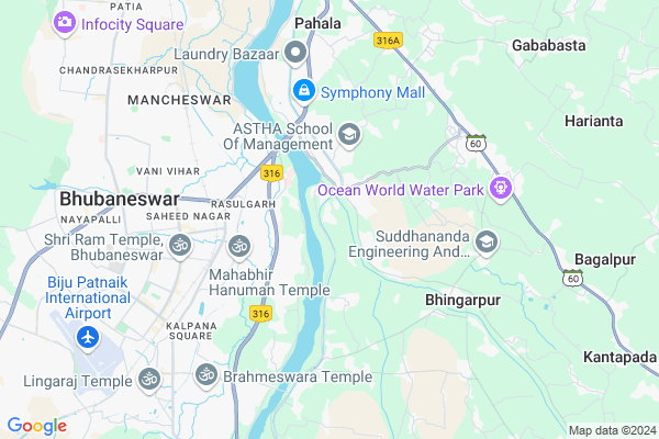
Bhubanpur Map
EDIT Map
Add Your House
 ..
..
Current Corona Virus Infected Patients Count in Khordha District
| City Name | District Name | Total Covid cases |
|---|---|---|
| Bhubaneswar | Khordha | 19 |
| Khordha District | Khordha | 12 |
| Bomikhal | Khordha | 6 |
| Jharpada | Khordha | 4 |
| Madhusudan | Khordha | 2 |
| Bhubaneshwar | Khordha | 1 |
| Bomikhal, Bhubaneswar | Khordha | 1 |
| Bhimatangi, Bhubaneswar | Khordha | 1 |
Locality Name :
Bhubanpur
( ଭୁବନପୁର )
City Name : Balianta
District : Khordha
State : Odisha
Language : Oriya and Hindi
Current Time 09:36 AM
Date: Wednesday , Apr 30,2025 (IST)
Time zone: IST (UTC+5:30)
Elevation / Altitude: 27 meters. Above Seal level
Telephone Code / Std Code: 0674
Assembly constituency : Jayadev assembly constituency
Assembly MLA : sashi bhusan behera
Lok Sabha constituency : Puri parliamentary constituency
Parliament MP : PINAKI MISRA
Commodities Prices : Chatta Krushak Bazar Market / Mandi
Bhubanpur Live Weather
Temperature: 25.2 °C
mist
Humidity: 78%
Wind : 1.03 mt/sec towards SW
StationName : "Bhubaneswar"
observed on 1 Hours Back
Temperature: 25.2 °C
mist
Humidity: 78%
Wind : 1.03 mt/sec towards SW
StationName : "Bhubaneswar"
observed on 1 Hours Back
Bhubanpur Weather Forecast for Next 5 days
01-05-2025
24.0°C to 36.3°C
broken clouds, scattered clouds, moderate rain, light rain, clear sky
24.0°C to 36.3°C
broken clouds, scattered clouds, moderate rain, light rain, clear sky
02-05-2025
22.0°C to 33.2°C
few clouds, scattered clouds, light rain, moderate rain, broken clouds
22.0°C to 33.2°C
few clouds, scattered clouds, light rain, moderate rain, broken clouds
03-05-2025
24.2°C to 35.6°C
clear sky, few clouds, light rain, broken clouds, scattered clouds
24.2°C to 35.6°C
clear sky, few clouds, light rain, broken clouds, scattered clouds
04-05-2025
26.2°C to 35.3°C
scattered clouds, clear sky, light rain, broken clouds
26.2°C to 35.3°C
scattered clouds, clear sky, light rain, broken clouds
05-05-2025
27.5°C to 38.7°C
broken clouds, few clouds, clear sky, scattered clouds
27.5°C to 38.7°C
broken clouds, few clouds, clear sky, scattered clouds
Edit below overview about Bhubanpur
Edit below overview about Bhubanpur
OverView of Bhubanpur
There are three temples in Bhubanpur Maa Uttarmukhi, Shiv Temple and The historical temple LAXMI NRUSINGH TEMPLE.A peaceful village of Balianta Panchayat, there are more green jungles surrounding the village and The river Kuakhai, Kusabhadra are nearest from the village. It's a natural village for picnic.Edit below overview about Bhubanpur
National Highways Reachable To Bhubanpur
Nationa High Way :NH316
Nationa High Way :NH57
Nationa High Way :NH316
Nationa High Way :NH57
Rivers Near Bhubanpur
Rana
Mahanadi
Rana
Mahanadi
About Bhubanpur
Bhubanpur is a in Balianta City in Odisha State, India.
Rasulgarh , Bainchua , Palasuni , Jharpada , Bomikhal are the nearby Localities to Bhubanpur.
Bhubaneswar , Cuttack , Jatani , Jagatsinghapur are the nearby Cities to Balianta.
Demographics of Bhubanpur
Oriya is the Local Language here.Politics in Bhubanpur
BJD is the major political party in this area.Polling Stations /Booths near Bhubanpur
1)Bhingarpur U.p.school(r-1)2)Balianta High School
3)Balianta Pry.school(r-1)
4)Balianta Pry.school(r-2)
5)Amrutamanohipatna Pry.school(r-1)
HOW TO REACH Bhubanpur
By Rail
Vani Vihar Rail Way Station , Mancheswar Rail Way Station are the very nearby railway station to Bhubanpur.Pincodes near Bhubanpur
751010 ( Rasulgarh ) , 752101 ( Balianta ) , 751007 ( V S S Nagar )Govt Health Centers near Bhubanpur
1) BENUPUR , BENUPUR , BENUPUR , BENUPUR2) Balianta , BALIANTA , BALIANTA , BALIANTA
3) Benupur , BENUPUR , BENUPUR , BENUPUR
Hospitals in Bhubanpur,Balianta
Balianta Benupur PHC
Balianta Bazar; Balianta; Khurda; Bhubaneswar; Odisha 752101; India
1.1 KM distance Detail
Hi-Tech Medical College and Hospital
High Tech Hospital Road; Pandara; Rasulgarh; Bhubaneswar; Odisha 751025; India
2.2 KM distance Detail
more ..
Colleges in Bhubanpur,Balianta
Jawaharlal Nehru Kanishtha Mahabidyalaya
Near Balianta High School; Balianta; khorda; Bhubaneswar; Odisha 752101; India
1.1 KM distance Detail
Hi-Tech College of Engineering
Rasulgarh; Pandra; Bhubaneswar; Odisha 751025; India
1.7 KM distance Detail
Hi-Tech College of Physiotherapy
High Tech Hospital Rd; Pandra; Bhubaneswar; Odisha 751007; India
2.1 KM distance Detail
Hi-Tech College of Nursing
High Tech Hospital Road; Pandara; Rasulgarh; Bhubaneswar; Odisha 751025; India
2.2 KM distance Detail
more ..
Schools in Bhubanpur,Balianta
Koradakanta Primary School
Koradakanta;Near Cuttack Puri Bypass Road; Bhubaneswar; Odisha 751006; India
1.6 KM distance Detail
Sri Jagannath uchha Vidayala
Near Cuttack-Puri Bypass Rd; Koradakanta; Khurdha; Bhubaneswar; Odisha 751006; India
1.9 KM distance Detail
Royal Public School
Near Cuttack Puri Bypass Road; Koradakanta; Kesura; Bhubaneswar; Odisha 751006; India
1.9 KM distance Detail
Electronic Shops in Bhubanpur,Balianta
Dell Exclusive Store & service center bhubaneswar
Badshahi Road; Rasulgarh; Bhubaneswar; Odisha 751010; India
2.1 KM distance Detail
Super Markets in Bhubanpur,Balianta
Japan Market Complex
Prachi Vihar; Nuasahi; Rasulgarh; Bhubaneswar; Odisha 751010; India
2.8 KM distance Detail
Priya Bazaar
Plot No. 1451/2416; Road No-8; Jagannath Nagar; Rasulgarh; Bhubaneswar; Odisha 751006; India
3.0 KM distance Detail
Local Parks in Bhubanpur,Balianta
GGP Colony Park
GGP Colony; Nayapalli; Rasulgarh; Bhubaneswar; Odisha 751025; India
2.9 KM distance Detail
Police Stations near Bhubanpur,Balianta
Mancheswar Police Station
Mancheswar Industrial Estate; Bhubaneshwar; Bhubaneswar; Odisha 751007; India
4.4 KM distance Detail
Commisionerate police;Jharpada
Laxmisagar Rd; Laxmi Sagar; Bhubaneswar; Odisha 751006; India
4.6 KM distance Detail
Governement Offices near Bhubanpur,Balianta
Ongo Swipe Machine Distributors
; Rasulgarh; Bhubaneswar; Odisha 751010; India
2.9 KM distance Detail
UNO MINDA
296; Canal Rd; GGP Colony; Canal Rd; GGP Colony; Rasulgarh; Bhubaneswar; Odisha 751010; India
3.3 KM distance Detail
Jeevansathi.com
D-5; 5th Flr; Metro House; Bani Vihar Square; Bhubaneswar; Odisha 751007; India
3.3 KM distance Detail
About Bhubanpur &
History
How to reach Bhubanpur
Tourist Places Near By Bhubanpur
Schools in Bhubanpur
Colleges in Bhubanpur
Temperature & weather of Bhubanpur
places in Bhubanpur
Bhubanpur photos
More Information
How to reach Bhubanpur
Tourist Places Near By Bhubanpur
Schools in Bhubanpur
Colleges in Bhubanpur
Temperature & weather of Bhubanpur
places in Bhubanpur
Bhubanpur photos
More Information
Locality Talk
Post News or Events about this Locality
Near Cities
Bhubaneswar 9 KM near
Cuttack 20 KM near
Jatani 26 KM near
Jagatsinghapur 32 KM near
Bhubaneswar 9 KM near
Cuttack 20 KM near
Jatani 26 KM near
Jagatsinghapur 32 KM near
Near By Taluks
Balianta 6 KM near
Bhubaneswar 7 KM near
Baranga 8 KM near
Kantapada 15 KM near
Balianta 6 KM near
Bhubaneswar 7 KM near
Baranga 8 KM near
Kantapada 15 KM near
Near By Air Ports
Bhubaneswar Airport 9 KM near
Ranchi Airport 382 KM near
Netaji Subhas Chandra Bose Airport 416 KM near
Vishakhapatnam Airport 447 KM near
Bhubaneswar Airport 9 KM near
Ranchi Airport 382 KM near
Netaji Subhas Chandra Bose Airport 416 KM near
Vishakhapatnam Airport 447 KM near
Near By Tourist Places
Bhubaneswar 7 KM near
Nandan Kanan National Park 15 KM near
Cuttack 21 KM near
Konark 54 KM near
Puri 59 KM near
Bhubaneswar 7 KM near
Nandan Kanan National Park 15 KM near
Cuttack 21 KM near
Konark 54 KM near
Puri 59 KM near
Near By Districts
Khordha 8 KM near
Cuttack 22 KM near
Jagatsinghapur 33 KM near
Dhenkanal 57 KM near
Khordha 8 KM near
Cuttack 22 KM near
Jagatsinghapur 33 KM near
Dhenkanal 57 KM near
Near By RailWay Station
Vani Vihar Rail Way Station 4.5 KM near
Bhubaneswar Rail Way Station 6.5 KM near
Mancheswar Rail Way Station 6.9 KM near
Vani Vihar Rail Way Station 4.5 KM near
Bhubaneswar Rail Way Station 6.5 KM near
Mancheswar Rail Way Station 6.9 KM near