| Home | City Bus | Maps | Villages | Cities | Rail | Tourist Places | School | College | Pin Codes | Corona Cases Count |
| Distance Calculator Bus Services IFSC Codes Trace Mobile Number Weather Search Place Trace IP Available Cash ATM/Banks Locate Polling Booth Report an Error contact People |
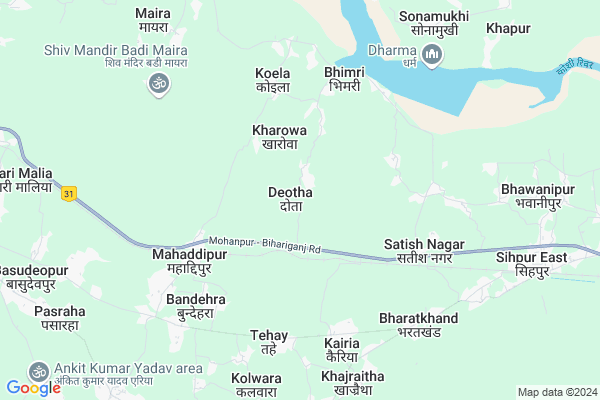
Deotha Map
EDIT Map
Add Your House
 ..
..
Current Corona Virus Infected Patients Count in Khagaria District
| City Name | District Name | Total Covid cases |
|---|
Locality Name :
Deotha
( डॉठा )
Block Name : Gogri
District : Khagaria
State : Bihar
Division : Munger
Language : Maithili and Hindi, Urdu, Angika
Current Time 11:22 AM
Date: Tuesday , Apr 29,2025 (IST)
Time zone: IST (UTC+5:30)
Elevation / Altitude: 37 meters. Above Seal level
Telephone Code / Std Code: 06245
Assembly constituency : Beldaur assembly constituency
Assembly MLA : Panna Lal Singh Patel
Lok Sabha constituency : Khagaria parliamentary constituency
Parliament MP : Choudhary Mehboob Ali Kaiser
Serpanch Name :
Pin Code : 851202
Post Office Name : Gogri
National Highways Reachable To Deotha
Nationa High Way :NH33
Nationa High Way :NH333B
Nationa High Way :NH33
Nationa High Way :NH333B
Rivers Near Deotha
Gerua
Koshi :Koshi River :कोसी नदी :सप्तकोशी
Gerua
Koshi :Koshi River :कोसी नदी :सप्तकोशी
About Deotha
Correct below Info and add more info about DeothaDeotha is a Village in Gogri Block in Khagaria District of Bihar State, India. It belongs to Munger Division . It is located 37 KM towards East from District head quarters Khagaria. 12 KM from Gogri. 195 KM from State capital Patna
Deotha Pin code is 851202 and postal head office is Gogri .
Sherchakla ( 7 KM ) , Khajraitha ( 8 KM ) , Paura ( 8 KM ) , Gogri ( 9 KM ) , Maira ( 9 KM ) are the nearby Villages to Deotha. Deotha is surrounded by Narayanpur Block towards East , Gogri Block towards west , Mansi Block towards west , Beldaur Block towards North .
Gogri Jamalpur , Sultanganj , Bhagalpur , Munger are the near by Cities to Deotha.
This Place is in the border of the Khagaria District and Munger District. Munger District Munger is west towards this place .
Deotha 2011 Census Details
Deotha Local Language is Maithili. Deotha Village Total population is 5641 and number of houses are 1186. Female Population is 47.4%. Village literacy rate is 45.9% and the Female Literacy rate is 18.7%.
Population
| Census Parameter | Census Data |
| Total Population | 5641 |
| Total No of Houses | 1186 |
| Female Population % | 47.4 % ( 2676) |
| Total Literacy rate % | 45.9 % ( 2589) |
| Female Literacy rate | 18.7 % ( 1053) |
| Scheduled Tribes Population % | 0.0 % ( 0) |
| Scheduled Caste Population % | 4.6 % ( 258) |
| Working Population % | 39.6 % |
| Child(0 -6) Population by 2011 | 1139 |
| Girl Child(0 -6) Population % by 2011 | 49.5 % ( 564) |
Deotha Census More Deatils.
Politics in Deotha
JD(U) , LJP , Lok Jan Shakti Party , RJD are the major political parties in this area.Polling Stations /Booths near Deotha
1)Co-operative Bhavan Rajdham2)Middle School Kanjri North Part
3)Middle School Jorabarpur Pahchath East Part
4)Primary School Tirasi
5)Middle School Kanjri Middle Part
HOW TO REACH Deotha
By Rail
Pasraha Rail Way Station , Narayanpur Rail Way Station are the very nearby railway stations to Deotha. Maheshkhunt Rail Way Station (near to Gogri Jamalpur) , Gauchhari Rail Way Station (near to Gogri Jamalpur) are the Rail way stations reachable from near by towns.By Road
Gogri Jamalpur are the nearby by towns to Deotha having road connectivity to DeothaColleges near Deotha
Khublal Devchand Sahu College Gogri Khagaria
Address :
Schools near Deotha
P.s. Koyla
Address : koyla , gogari , khagaria , Bihar . PIN- 851212 , Post - Mohaddipur (Khagaria)
M.v. Dina Chakala
Address : sondiha , gogari , khagaria , Bihar . PIN- 851212 , Post - Mohaddipur (Khagaria)
M.v.maira
Address : rabari nagar (pora) , gogari , khagaria , Bihar . PIN- 851201 , Post - Chautham
Ps Nawtolia Gwochari
Address : gwochari , gogari , khagaria , Bihar . PIN- 851203 , Post - Jamalpur Gogri
Govt Health Centers near Deotha
1) Araria , , ,2) Karna , , ,
3) Salarpur parbatta , , ,
Hospitals in Deotha,Gogri
Kiran Hospital
Maraiya - Bandehra - Pasraha Rd; Mahaddipur; Bihar 851212; India
6.6 KM distance Detail
Up-Swasthya Kendra;Pasraha
Maraiya - Bandehra - Pasraha Rd; Sher chakla; Bihar 851212; India
9.9 KM distance Detail
more ..
Petrol Bunks in Deotha,Gogri
Hindustan Petroleum
Pasraha; Khagaria; NH-31; Khagaria; Khagaria; Bihar 851203; India
4.3 KM distance Detail
HP PETROL PUMP - PATBANDHU
Near Pasraha PS NH-31 Pasraha P.o-pasraha; Jhajhra; Bihar 851212; India
4.3 KM distance Detail
more ..
Schools in Deotha,Gogri
Harihar Sharma Memorial Public School Deotha Khagaria
Deotha; Bihar 851202; India
2.4 KM distance Detail
Police Stations near Deotha,Gogri
Police Station Narayanpur
Bhawanipur; Narayanpur; Bhagalpur; NH-31; Bhagalpur; Bhagalpur; Bihar 853203; India
10.0 KM distance Detail
About Deotha &
History
How to reach Deotha
Tourist Places Near By Deotha
Schools in Deotha
Colleges in Deotha
Temperature & weather of Deotha
places in Deotha
Deotha photos
More Information
How to reach Deotha
Tourist Places Near By Deotha
Schools in Deotha
Colleges in Deotha
Temperature & weather of Deotha
places in Deotha
Deotha photos
More Information
Village Talk
Post News or Events about this Village
Near Cities
Gogri Jamalpur 15 KM near
Sultanganj 22 KM near
Bhagalpur 31 KM near
Munger 32 KM near
Gogri Jamalpur 15 KM near
Sultanganj 22 KM near
Bhagalpur 31 KM near
Munger 32 KM near
Near By Taluks
Narayanpur 11 KM near
Parbatta 11 KM near
Gogri 12 KM near
Mansi 12 KM near
Narayanpur 11 KM near
Parbatta 11 KM near
Gogri 12 KM near
Mansi 12 KM near
Near By Air Ports
Patna Airport 191 KM near
Gaya Airport 223 KM near
Bagdogra Airport 233 KM near
Ranchi Airport 309 KM near
Patna Airport 191 KM near
Gaya Airport 223 KM near
Bagdogra Airport 233 KM near
Ranchi Airport 309 KM near
Near By Tourist Places
Bhagalpur 32 KM near
Munger 33 KM near
Sahibganj 98 KM near
Deoghar 116 KM near
Samastipur 124 KM near
Bhagalpur 32 KM near
Munger 33 KM near
Sahibganj 98 KM near
Deoghar 116 KM near
Samastipur 124 KM near
Near By Districts
Bhagalpur 31 KM near
Munger 34 KM near
Khagaria 36 KM near
Saharsa 59 KM near
Bhagalpur 31 KM near
Munger 34 KM near
Khagaria 36 KM near
Saharsa 59 KM near
Near By RailWay Station
Pasraha Rail Way Station 4.8 KM near
Narayanpur Rail Way Station 9 KM near
Maheshkhunt Rail Way Station 16 KM near
Pasraha Rail Way Station 4.8 KM near
Narayanpur Rail Way Station 9 KM near
Maheshkhunt Rail Way Station 16 KM near