| Home | City Bus | Maps | Villages | Cities | Rail | Tourist Places | School | College | Pin Codes | Corona Cases Count |
| Distance Calculator Bus Services IFSC Codes Trace Mobile Number Weather Search Place Trace IP Available Cash ATM/Banks Locate Polling Booth Report an Error contact People |
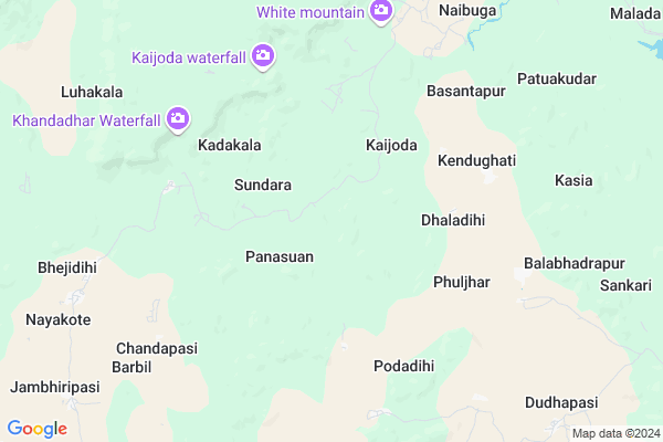
Phuljhar Map
EDIT Map
Add Your House
 ..
..
Current Corona Virus Infected Patients Count in Kendujhar District
| City Name | District Name | Total Covid cases |
|---|
Locality Name :
Phuljhar
( ଫୁଲଝର )
Tehsil Name : Bansapal
District : Kendujhar
State : Odisha
Language : Oriya and Hindi
Current Time 12:37 PM
Date: Sunday , Apr 27,2025 (IST)
Time zone: IST (UTC+5:30)
Elevation / Altitude: 500 meters. Above Seal level
Telephone Code / Std Code: 06765
Assembly constituency : Telkoi assembly constituency
Assembly MLA : bedabyasa nayak
Lok Sabha constituency : Keonjhar parliamentary constituency
Parliament MP : Chandrani Murmu
Serpanch Name :
Pin Code : 758014
Post Office Name : Naranpur
Commodities Prices : Keonjhar Market / Mandi
Phuljhar Live Weather
Temperature: 32.2 °C
overcast clouds
Humidity: 26%
Wind : 2.82 mt/sec towards SW
StationName : "Keonjhargarh"
observed on Now
Temperature: 32.2 °C
overcast clouds
Humidity: 26%
Wind : 2.82 mt/sec towards SW
StationName : "Keonjhargarh"
observed on Now
Phuljhar Weather Forecast for Next 5 days
28-04-2025
24.3°C to 35.6°C
overcast clouds, broken clouds
24.3°C to 35.6°C
overcast clouds, broken clouds
29-04-2025
21.7°C to 36.6°C
overcast clouds, clear sky, broken clouds, light rain
21.7°C to 36.6°C
overcast clouds, clear sky, broken clouds, light rain
30-04-2025
21.0°C to 37.0°C
clear sky, light rain, broken clouds
21.0°C to 37.0°C
clear sky, light rain, broken clouds
01-05-2025
20.7°C to 39.2°C
scattered clouds, few clouds, moderate rain, clear sky
20.7°C to 39.2°C
scattered clouds, few clouds, moderate rain, clear sky
02-05-2025
20.3°C to 37.1°C
clear sky, few clouds, moderate rain, overcast clouds
20.3°C to 37.1°C
clear sky, few clouds, moderate rain, overcast clouds
Rivers Near Phuljhar
Korapani
Brahmani :Brahmani :Брагмані
Korapani
Brahmani :Brahmani :Брагмані
About Phuljhar
Correct below Info and add more info about PhuljharPhuljhar is a Village in Bansapal Tehsil in Kendujhar District of Odisha State, India. It is located 27 KM towards west from District head quarters Kendujhar. 15 KM from Bansapal. 200 KM from State capital Bhubaneswar
Phuljhar Pin code is 758014 and postal head office is Naranpur .
Nayakote ( 11 KM ) , Jatra ( 13 KM ) , Singhpur ( 14 KM ) , Saharpur ( 15 KM ) , Kumundi ( 15 KM ) are the nearby Villages to Phuljhar. Phuljhar is surrounded by Kendujhar Tehsil towards East , Jhumpura Tehsil towards East , Joda Tehsil towards North , Koida Tehsil towards west .
Kendujhar , Joda , Barbil , Karanjia are the near by Cities to Phuljhar.
Phuljhar 2011 Census Details
Phuljhar Local Language is Oriya. Phuljhar Village Total population is 2122 and number of houses are 407. Female Population is 53.3%. Village literacy rate is 35.9% and the Female Literacy rate is 16.2%.
Population
| Census Parameter | Census Data |
| Total Population | 2122 |
| Total No of Houses | 407 |
| Female Population % | 53.3 % ( 1130) |
| Total Literacy rate % | 35.9 % ( 761) |
| Female Literacy rate | 16.2 % ( 344) |
| Scheduled Tribes Population % | 81.5 % ( 1730) |
| Scheduled Caste Population % | 2.3 % ( 48) |
| Working Population % | 51.6 % |
| Child(0 -6) Population by 2011 | 389 |
| Girl Child(0 -6) Population % by 2011 | 49.9 % ( 194) |
Phuljhar Census More Deatils.
Politics in Phuljhar
BJD is the major political party in this area.Polling Stations /Booths near Phuljhar
1)Dumuria Pry. School2)Dhagoth Pry. School
3)Sunapenth Ugup. School
4)Etapokhari Pry. School
5)Panasia Up School
HOW TO REACH Phuljhar
By Rail
There is no railway station near to Phuljhar in less than 10 km.Colleges near Phuljhar
Anchalika Bigyan Maha Bidyalaya
Address :
Gopaljew Mahavidyalaya
Address :
Beleswar Mahabidyalaya Belabahali
Address :
Patita Pabana Mahabidyalaya
Address : Sainkul, Barapada, Anandapur, Keonjhar
Bhimkund Higher Secondary School
Address : At/po- Dumuria , Via- Swampatna District
Schools in Phuljhar
Gopabandhu H S, Fuljhar
Address : phuljhar , banspal , keonjhar , Sikkim . PIN- 758018 , Post - Suakati
Fuljhar Ugme School
Address : phuljhar , banspal , keonjhar , Sikkim . PIN- 758018 , Post - Suakati
Govt Health Centers near Phuljhar
1) JAMUKESWAR , Jamukeswar CHC , Jamukeswar , Near Shiva Temple2) Daitari B , , , Daitari Panchet Office
Petrol Bunks in Phuljhar,Bansapal
HP PETROL PUMP - BAMBARI FILLEX
At/po Bambari Bambari Bambari; Odisha 758034; India
20.9 KM distance Detail
HP PETROL PUMP - JAI HANUMAN FILLING STATION
Aharposi Palaspanga; Odisha 758031; India
23.3 KM distance Detail
more ..
Super Markets in Phuljhar,Bansapal
Local Parks in Phuljhar,Bansapal
National Geological Monument
Nomira; Banspani Rd; Bandhuabeda; Odisha 758034; India
21.7 KM distance Detail
Police Stations near Phuljhar,Bansapal
Governement Offices near Phuljhar,Bansapal
About Phuljhar &
History
How to reach Phuljhar
Tourist Places Near By Phuljhar
Schools in Phuljhar
Colleges in Phuljhar
Temperature & weather of Phuljhar
places in Phuljhar
Phuljhar photos
More Information
How to reach Phuljhar
Tourist Places Near By Phuljhar
Schools in Phuljhar
Colleges in Phuljhar
Temperature & weather of Phuljhar
places in Phuljhar
Phuljhar photos
More Information
Village Talk
Post News or Events about this Village
Near Cities
Kendujhar 27 KM near
Joda 33 KM near
Barbil 46 KM near
Karanjia 70 KM near
Kendujhar 27 KM near
Joda 33 KM near
Barbil 46 KM near
Karanjia 70 KM near
Near By Taluks
Bansapal 15 KM near
Kendujhar 28 KM near
Jhumpura 28 KM near
Joda 30 KM near
Bansapal 15 KM near
Kendujhar 28 KM near
Jhumpura 28 KM near
Joda 30 KM near
Near By Air Ports
Bhubaneswar Airport 193 KM near
Ranchi Airport 195 KM near
Netaji Subhas Chandra Bose Airport 371 KM near
Gaya Airport 376 KM near
Bhubaneswar Airport 193 KM near
Ranchi Airport 195 KM near
Netaji Subhas Chandra Bose Airport 371 KM near
Gaya Airport 376 KM near
Near By Tourist Places
Rourkela 83 KM near
Barehipani & Joranda Barehipani & Joranda Falls 111 KM near
Seraikela 134 KM near
Simdega 146 KM near
Baripada 159 KM near
Rourkela 83 KM near
Barehipani & Joranda Barehipani & Joranda Falls 111 KM near
Seraikela 134 KM near
Simdega 146 KM near
Baripada 159 KM near
Near By Districts
Kendujhar 27 KM near
Deogarh 79 KM near
West Singhbhum 111 KM near
Anugul 116 KM near
Kendujhar 27 KM near
Deogarh 79 KM near
West Singhbhum 111 KM near
Anugul 116 KM near
Near By RailWay Station
Dangoaposi Rail Way Station 57 KM near
Bondamunda Rail Way Station 79 KM near
Dangoaposi Rail Way Station 57 KM near
Bondamunda Rail Way Station 79 KM near