| Home | City Bus | Maps | Villages | Cities | Rail | Tourist Places | School | College | Pin Codes | Corona Cases Count |
| Distance Calculator Bus Services IFSC Codes Trace Mobile Number Weather Search Place Trace IP Available Cash ATM/Banks Locate Polling Booth Report an Error contact People |
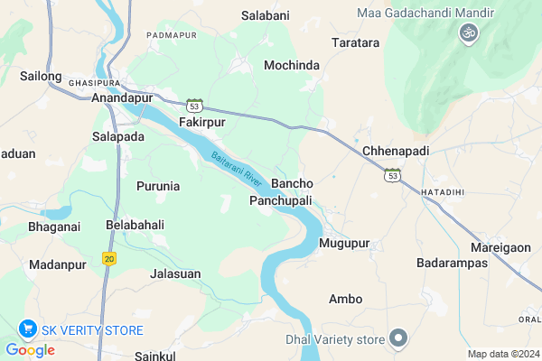
Panchupalli Map
EDIT Map
Add Your House
 ..
..
Current Corona Virus Infected Patients Count in Kendujhar District
| City Name | District Name | Total Covid cases |
|---|
Locality Name :
Panchupalli
( ପଂଚୁପଲ୍ଲୀ )
Tehsil Name : Anandapur
District : Kendujhar
State : Odisha
Language : Oriya and Hindi
Current Time 12:20 PM
Date: Friday , Mar 14,2025 (IST)
Time zone: IST (UTC+5:30)
Elevation / Altitude: 92 meters. Above Seal level
Telephone Code / Std Code: 06731
Assembly constituency : Anandapur assembly constituency
Assembly MLA : mayadhar jena
Lok Sabha constituency : Keonjhar parliamentary constituency
Parliament MP : Chandrani Murmu
Serpanch Name :
Pin Code : 758020
Post Office Name : Salapada
Alternate Village Name : Panchupalli , Panchupali
Commodities Prices : Anandapur Market / Mandi
Panchupalli Live Weather
Temperature: 36.3 °C
clear sky
Humidity: 23%
Wind : 3.64 mt/sec towards SW
StationName : "Bhadrakh"
observed on 2 Hours Back
Temperature: 36.3 °C
clear sky
Humidity: 23%
Wind : 3.64 mt/sec towards SW
StationName : "Bhadrakh"
observed on 2 Hours Back
Panchupalli Weather Forecast for Next 5 days
15-03-2025
22.7°C to 41.9°C
clear sky
22.7°C to 41.9°C
clear sky
16-03-2025
22.3°C to 42.3°C
clear sky
22.3°C to 42.3°C
clear sky
17-03-2025
22.4°C to 42.7°C
clear sky, few clouds, scattered clouds
22.4°C to 42.7°C
clear sky, few clouds, scattered clouds
18-03-2025
22.3°C to 42.9°C
few clouds, clear sky, scattered clouds, broken clouds
22.3°C to 42.9°C
few clouds, clear sky, scattered clouds, broken clouds
19-03-2025
23.5°C to 43.7°C
clear sky, few clouds, broken clouds
23.5°C to 43.7°C
clear sky, few clouds, broken clouds
Edit below overview about Panchupalli
Edit below overview about Panchupalli
OverView of Panchupalli
The village Panchupalli is estabilshed when Aryans used to live near bank of river. As Baitarani is one of the holly river they preferred to live near by the area. Later Jain and Buddhist had come to the village and resided. It is said that 5 small habitants were there whichi was called Pallis. Following the 5 Pallis the village was named as Palli. It is also called Panchupalli Gada. Two rivers namely Baitarini and Kushei are sorruounded by the village. During king's rulling the village was comming under Kendujhar kingdom. One Gada Nayak was appointed by the king as the representative to oporate the village's administrations. Before Independence the Gada Nayak system had been abolished. The last Gada Nayak was Natabara Sawain. People of the village are living depend upon cultivation and other professional activities. The last Now it is a village of 600 families.The village is crowed with temples, schools ,1 hospitals and many others.Edit below overview about Panchupalli
National Highways Reachable To Panchupalli
Nationa High Way :NH16
Nationa High Way :NH16
Rivers Near Panchupalli
Ketanga
Ramlala
Ketanga
Ramlala
About Panchupalli
Panchupalli is a Village in Anandapur Tehsil in Kendujhar District of Odisha State, India. It is located 95 KM towards East from District head quarters Kendujhar. 13 KM from Anandapur. 124 KM from State capital Bhubaneswar
Panchupalli Pin code is 758020 and postal head office is Salapada .
Sulana ( 3 KM ) , Haridapal ( 3 KM ) , Panchugochia ( 3 KM ) , Sasanga ( 5 KM ) , Bailo ( 5 KM ) are the nearby Villages to Panchupalli. Panchupalli is surrounded by Ghasipura Tehsil towards west , Anandapur Tehsil towards North , Bonth Tehsil towards East , Korei Tehsil towards South .
Anandapur , Byasanagar , Bhadrak , Jajapur are the near by Cities to Panchupalli.
Panchupali 2011 Census Details
Panchupalli Local Language is Oriya. Panchupali Village Total population is 5415 and number of houses are 1309. Female Population is 48.7%. Village literacy rate is 67.3% and the Female Literacy rate is 29.4%.
Population
| Census Parameter | Census Data |
| Total Population | 5415 |
| Total No of Houses | 1309 |
| Female Population % | 48.7 % ( 2637) |
| Total Literacy rate % | 67.3 % ( 3645) |
| Female Literacy rate | 29.4 % ( 1594) |
| Scheduled Tribes Population % | 29.3 % ( 1585) |
| Scheduled Caste Population % | 21.3 % ( 1153) |
| Working Population % | 30.3 % |
| Child(0 -6) Population by 2011 | 616 |
| Girl Child(0 -6) Population % by 2011 | 48.1 % ( 296) |
Panchupali Census More Deatils.
Politics in Panchupalli
BJP , BJD , INC are the major political parties in this area.Polling Stations /Booths near Panchupalli
1)Panchugochhiaprimary School (north)2)Panchupalli Primary School
3)Niudani Primary School
4)Nayagarh Primary School
5)Bancho Barahi Primary School
HOW TO REACH Panchupalli
By Rail
There is no railway station near to Panchupalli in less than 10 km.Colleges near Panchupalli
Beleswar Mahabidyalaya Belabahali
Address :
Schools in Panchupalli
Panchupalli H.s.
Address : panchupali , anandapur , keonjhar , Sikkim . PIN- 758020 , Post - Salapada
Murusuan P.s.
Address : panchupali , anandapur , keonjhar , Sikkim . PIN- 758020 , Post - Salapada
Mahendra Nodal Up School
Address : panchupali , anandapur , keonjhar , Sikkim . PIN- 758020 , Post - Salapada
Govt Health Centers near Panchupalli
1) Sarasada SC , , , AFTER SARSADA HIGH SCHOOL,NATIONAL HIGHWAY 5 SIDE2) Kabatabandha SC , Upaswasthya kendra Kabatbandha , 44 , PHC N Campous
3) Biruhan SC , Gadadhar Panda , Biruhan , Near Biruhan AWC
Petrol Bunks in Panchupalli,Anandapur
Chenapadi Petrol Pump
758022; Choragadia Chhenapadi Canal Rd; Chhenapadi; Odisha 758083; India
6.4 KM distance Detail
more ..
Police Stations near Panchupalli,Anandapur
Anandapur Police Station
Anandapur Bada Danda; Anandapur; Odisha 758021; India
7.9 KM distance Detail
Governement Offices near Panchupalli,Anandapur
Dimond study center
AT - GAUDA SAHI ; PO /PS - ANANDAPUR; NEAR BRIGE CHOCK; Anandapur; Odisha 758021; India
7.1 KM distance Detail
Office Of The Chief Construction Engineer; Anandapur Barrage Project; Salapa
Salapada; Odisha 758020; India
7.2 KM distance Detail
Baitarani Irrigation Division; Water Resources Department
National Highway 215; Salapada; Odisha 758020; India
7.3 KM distance Detail
About Panchupalli &
History
How to reach Panchupalli
Tourist Places Near By Panchupalli
Schools in Panchupalli
Colleges in Panchupalli
Temperature & weather of Panchupalli
places in Panchupalli
Panchupalli photos
More Information
How to reach Panchupalli
Tourist Places Near By Panchupalli
Schools in Panchupalli
Colleges in Panchupalli
Temperature & weather of Panchupalli
places in Panchupalli
Panchupalli photos
More Information
Village Talk
Post News or Events about this Village
Near Cities
Anandapur 8 KM near
Byasanagar 29 KM near
Bhadrak 39 KM near
Jajapur 44 KM near
Anandapur 8 KM near
Byasanagar 29 KM near
Bhadrak 39 KM near
Jajapur 44 KM near
Near By Taluks
Hatadihi 9 KM near
Ghasipura 11 KM near
Anandapur 12 KM near
Bonth 22 KM near
Hatadihi 9 KM near
Ghasipura 11 KM near
Anandapur 12 KM near
Bonth 22 KM near
Near By Air Ports
Bhubaneswar Airport 122 KM near
Ranchi Airport 284 KM near
Netaji Subhas Chandra Bose Airport 318 KM near
Gaya Airport 466 KM near
Bhubaneswar Airport 122 KM near
Ranchi Airport 284 KM near
Netaji Subhas Chandra Bose Airport 318 KM near
Gaya Airport 466 KM near
Near By Tourist Places
Barehipani & Joranda Barehipani & Joranda Falls 73 KM near
Cuttack 95 KM near
Chandipur 103 KM near
Nandan Kanan National Park 106 KM near
Baripada 113 KM near
Barehipani & Joranda Barehipani & Joranda Falls 73 KM near
Cuttack 95 KM near
Chandipur 103 KM near
Nandan Kanan National Park 106 KM near
Baripada 113 KM near
Near By Districts
Bhadrak 39 KM near
Jajapur 44 KM near
Kendrapara 88 KM near
Kendujhar 91 KM near
Bhadrak 39 KM near
Jajapur 44 KM near
Kendrapara 88 KM near
Kendujhar 91 KM near
Near By RailWay Station
Jajpur Keonjhar Road Rail Way Station 30 KM near
Bhadrak Rail Way Station 40 KM near
Jajpur Keonjhar Road Rail Way Station 30 KM near
Bhadrak Rail Way Station 40 KM near