| Home | City Bus | Maps | Villages | Cities | Rail | Tourist Places | School | College | Pin Codes | Corona Cases Count |
| Distance Calculator Bus Services IFSC Codes Trace Mobile Number Weather Search Place Trace IP Available Cash ATM/Banks Locate Polling Booth Report an Error contact People |
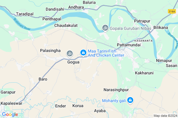
Panduhata
Panduhata Map
EDIT Map
Add Your House
 ..
..
Current Corona Virus Infected Patients Count in Kendrapara District
| City Name | District Name | Total Covid cases |
|---|---|---|
| Kendrapara District | Kendrapara | 2 |
Locality Name :
Panduhata
( ପାଣ୍ଡୁହାତ )
Tehsil Name : Pattamundai
District : Kendrapara
State : Odisha
Language : Oriya and Hindi
Current Time 12:14 PM
Date: Wednesday , Apr 30,2025 (IST)
Time zone: IST (UTC+5:30)
Elevation / Altitude: 6 meters. Above Seal level
Telephone Code / Std Code: 06729
Assembly constituency : Kendrapara assembly constituency
Assembly MLA : kishore chandra tarai
Lok Sabha constituency : Kendrapara parliamentary constituency
Parliament MP : Anubhav Mohanty
Serpanch Name :
Pin Code : 754215
Post Office Name : Pattamundai
Alternate Village Name : Panduhota
Commodities Prices : Pattamundai Market / Mandi
Panduhata Live Weather
Temperature: 36.3 °C
clear sky
Humidity: 37%
Wind : 1.24 mt/sec towards S
StationName : "PatÄ\u0081mundai"
observed on Now
Temperature: 36.3 °C
clear sky
Humidity: 37%
Wind : 1.24 mt/sec towards S
StationName : "PatÄ\u0081mundai"
observed on Now
Panduhata Weather Forecast for Next 5 days
01-05-2025
27.3°C to 34.6°C
clear sky, scattered clouds, few clouds
27.3°C to 34.6°C
clear sky, scattered clouds, few clouds
02-05-2025
22.9°C to 35.6°C
clear sky, few clouds, heavy intensity rain, overcast clouds
22.9°C to 35.6°C
clear sky, few clouds, heavy intensity rain, overcast clouds
03-05-2025
25.1°C to 31.8°C
broken clouds, clear sky, light rain, scattered clouds
25.1°C to 31.8°C
broken clouds, clear sky, light rain, scattered clouds
04-05-2025
25.5°C to 36.3°C
scattered clouds, clear sky, broken clouds, light rain, overcast clouds
25.5°C to 36.3°C
scattered clouds, clear sky, broken clouds, light rain, overcast clouds
05-05-2025
26.1°C to 38.1°C
overcast clouds, clear sky
26.1°C to 38.1°C
overcast clouds, clear sky
National Highways Reachable To Panduhata
Nationa High Way :NH53
Nationa High Way :NH55
Nationa High Way :NH53
Nationa High Way :NH55
Rivers Near Panduhata
Brahmani :Брагмані
Salandi
Brahmani :Брагмані
Salandi
About Panduhata
Correct below Info and add more info about PanduhataPanduhata is a small Village/hamlet in Pattamundai Tehsil in Kendrapara District of Odisha State, India. It is located 14 KM towards East from District head quarters Kendrapara. 7 KM from Pattamundai. 91 KM from State capital Bhubaneswar
Panduhata Pin code is 754215 and postal head office is Pattamundai .
Nilakanthapur ( 4 KM ) , Keshpur ( 4 KM ) , Dihapada ( 5 KM ) , Palasingha ( 5 KM ) , Narasinghpur ( 5 KM ) are the nearby Villages to Panduhata. Panduhata is surrounded by Kendrapada Tehsil towards west , Aul Tehsil towards East , Marsaghai Tehsil towards South , Mahakalapada Tehsil towards South .
Pattamundai , Kendrapara , Paradip , Jajapur are the near by Cities to Panduhata.
Panduhata 2011 Census Details
Panduhata Local Language is Oriya. Panduhata Village Total population is 371 and number of houses are 72. Female Population is 47.2%. Village literacy rate is 86.3% and the Female Literacy rate is 39.9%.
Population
| Census Parameter | Census Data |
| Total Population | 371 |
| Total No of Houses | 72 |
| Female Population % | 47.2 % ( 175) |
| Total Literacy rate % | 86.3 % ( 320) |
| Female Literacy rate | 39.9 % ( 148) |
| Scheduled Tribes Population % | 0.0 % ( 0) |
| Scheduled Caste Population % | 3.8 % ( 14) |
| Working Population % | 31.0 % |
| Child(0 -6) Population by 2011 | 32 |
| Girl Child(0 -6) Population % by 2011 | 40.6 % ( 13) |
Panduhata Census More Deatils.
Politics in Panduhata
OGP , BJP , BJD are the major political parties in this area.Polling Stations /Booths near Panduhata
1)Debala Pry. School Musadiha2)Narilo Pry. School
3)Badamantia Pry. School
4)Upper Ghagara Pry. School
5)Gobindpur Pry. School
HOW TO REACH Panduhata
By Rail
There is no railway station near to Panduhata in less than 10 km.Colleges near Panduhata
Usha Devi Mahila Mahabidyalaya
Address :
Brahmani College
Address : At Po Dandisahi
Utikana Kereda Mohabir College
Address : At- Sansarfal, Po-sansarfal,kendrapara
Schools near Panduhata
Chidananda Girls H.s
Address : sanamohanpur , pattamundai , kendrapara , Sikkim . PIN- 754245 , Post - Barpada
Anchalika Bidyapitha
Address : nuapara , pattamundai , kendrapara , Sikkim . PIN- 754211 , Post - Kendrapara
Maa Chhualia Panchayat H.s
Address : gangarampur , pattamundai , kendrapara , Sikkim . PIN- 754216 , Post - Jaria (Kendrapara)
Maa Dhanakhai Girls High School
Address : singhagaon , pattamundai , kendrapara , Sikkim . PIN- 755061 , Post - Govindpur Kutchery
Govt Health Centers near Panduhata
1) SC Bandhapad , , HQ Sector , Near Block Colony2) Pattamundai MC , , HQ Sector , CHC Campus
3) Alaba SC , , Alava Sector , NearAlava Primery School
Schools in Panduhata,Pattamundai
Bada Mula Basanta Primary School
Badamula Basanta; Kendrapara; SH-9A; Aul Kendrapada Jagatpur Road; Patamundai; Pattamundai; Odisha 754215; India
1.2 KM distance Detail
Electronic Shops in Panduhata,Pattamundai
OM ELECTRONICS ELECTRICALS. Gajanan Market Complex
Cuttack - Kendrapada Rd; Beltal; Pattamundai; Odisha 754215; India
4.7 KM distance Detail
Police Stations near Panduhata,Pattamundai
The Superintendent of Police Office
Garapur; Kendrapara; SH-9A; Aul Kendrapada Jagatpur Road; Kendrapara; Kendrapara; Odisha 754213; India
14.1 KM distance Detail
About Panduhata &
History
How to reach Panduhata
Tourist Places Near By Panduhata
Schools in Panduhata
Colleges in Panduhata
Temperature & weather of Panduhata
places in Panduhata
Panduhata photos
More Information
How to reach Panduhata
Tourist Places Near By Panduhata
Schools in Panduhata
Colleges in Panduhata
Temperature & weather of Panduhata
places in Panduhata
Panduhata photos
More Information
Village Talk
Post News or Events about this Village
Near Cities
Pattamundai 5 KM near
Kendrapara 14 KM near
Paradip 33 KM near
Jajapur 41 KM near
Pattamundai 5 KM near
Kendrapara 14 KM near
Paradip 33 KM near
Jajapur 41 KM near
Near By Taluks
Pattamundai 7 KM near
Kendrapada 12 KM near
Aul 16 KM near
Marsaghai 18 KM near
Pattamundai 7 KM near
Kendrapada 12 KM near
Aul 16 KM near
Marsaghai 18 KM near
Near By Air Ports
Bhubaneswar Airport 91 KM near
Netaji Subhas Chandra Bose Airport 340 KM near
Ranchi Airport 369 KM near
Vishakhapatnam Airport 524 KM near
Bhubaneswar Airport 91 KM near
Netaji Subhas Chandra Bose Airport 340 KM near
Ranchi Airport 369 KM near
Vishakhapatnam Airport 524 KM near
Near By Tourist Places
Paradeep Beach 33 KM near
Cuttack 76 KM near
Nandan Kanan National Park 84 KM near
Bhubaneswar 88 KM near
Konark 98 KM near
Paradeep Beach 33 KM near
Cuttack 76 KM near
Nandan Kanan National Park 84 KM near
Bhubaneswar 88 KM near
Konark 98 KM near
Near By Districts
Kendrapara 14 KM near
Jajapur 40 KM near
Jagatsinghapur 55 KM near
Bhadrak 62 KM near
Kendrapara 14 KM near
Jajapur 40 KM near
Jagatsinghapur 55 KM near
Bhadrak 62 KM near
Near By RailWay Station
Jajpur Keonjhar Road Rail Way Station 64 KM near
Bhadrak Rail Way Station 64 KM near
Jajpur Keonjhar Road Rail Way Station 64 KM near
Bhadrak Rail Way Station 64 KM near