| Home | City Bus | Maps | Villages | Cities | Rail | Tourist Places | School | College | Pin Codes | Corona Cases Count |
| Distance Calculator Bus Services IFSC Codes Trace Mobile Number Weather Search Place Trace IP Available Cash ATM/Banks Locate Polling Booth Report an Error contact People |
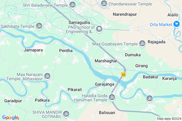
Padampur
Padampur Map
EDIT Map
Add Your House
 ..
..
Current Corona Virus Infected Patients Count in Kendrapara District
| City Name | District Name | Total Covid cases |
|---|---|---|
| Kendrapara District | Kendrapara | 2 |
Locality Name :
Padampur
( ପଦ୍ମପୁର )
Tehsil Name : Marsaghai
District : Kendrapara
State : Odisha
Language : Oriya and Hindi
Current Time 05:49 AM
Date: Saturday , Apr 26,2025 (IST)
Time zone: IST (UTC+5:30)
Elevation / Altitude: 9 meters. Above Seal level
Telephone Code / Std Code: 06725
Assembly constituency : Mahakalapada assembly constituency
Assembly MLA : atanu sabyasachi nayak
Lok Sabha constituency : Kendrapara parliamentary constituency
Parliament MP : Anubhav Mohanty
Serpanch Name :
Pin Code : 754253
Post Office Name : Bedari
Commodities Prices : Kendrapara(Marshaghai) Market / Mandi
Padampur Live Weather
Temperature: 26.9 °C
clear sky
Humidity: 87%
Wind : 5.86 mt/sec towards SW
StationName : "KendrÄ\u0081parha"
observed on 2 Hours Back
Temperature: 26.9 °C
clear sky
Humidity: 87%
Wind : 5.86 mt/sec towards SW
StationName : "KendrÄ\u0081parha"
observed on 2 Hours Back
Padampur Weather Forecast for Next 5 days
27-04-2025
26.9°C to 38.8°C
clear sky, broken clouds
26.9°C to 38.8°C
clear sky, broken clouds
28-04-2025
27.6°C to 40.6°C
scattered clouds, clear sky, broken clouds, few clouds
27.6°C to 40.6°C
scattered clouds, clear sky, broken clouds, few clouds
29-04-2025
27.4°C to 38.8°C
broken clouds, clear sky, scattered clouds
27.4°C to 38.8°C
broken clouds, clear sky, scattered clouds
30-04-2025
24.3°C to 36.8°C
few clouds, clear sky, light rain, moderate rain, scattered clouds
24.3°C to 36.8°C
few clouds, clear sky, light rain, moderate rain, scattered clouds
National Highways Reachable To Padampur
Nationa High Way :NH53
Nationa High Way :NH16
Nationa High Way :NH53
Nationa High Way :NH16
Rivers Near Padampur
Brahmani :Брагмані
Salandi
Brahmani :Брагмані
Salandi
About Padampur
Correct below Info and add more info about PadampurPadampur is a small Village/hamlet in Marsaghai Tehsil in Kendrapara District of Odisha State, India. It is located 11 KM towards South from District head quarters Kendrapara. 78 KM from State capital Bhubaneswar
Padampur Pin code is 754253 and postal head office is Bedari .
Padampur is surrounded by Kendrapada Tehsil towards North , Garadapur Tehsil towards west , Kujang Tehsil towards South , Mahakalapada Tehsil towards East .
Kendrapara , Pattamundai , Paradip , Jagatsinghapur are the near by Cities to Padampur.
This Place is in the border of the Kendrapara District and Jagatsinghapur District. Jagatsinghapur District Kujang is South towards this place .
Demographics of Padampur
Oriya is the Local Language here.Politics in Padampur
BJD is the major political party in this area.Polling Stations /Booths near Padampur
1)Danarmunda Ugup School2)Karanja Up School(w) Karanja
3)Mangarajpur Ugup School
4)Kasoti Primary School
5)Manikunda Primary School
HOW TO REACH Padampur
By Rail
There is no railway station near to Padampur in less than 10 km.Colleges near Padampur
Dayanidhi Sanskrit Degree College Potari
Address : At Potari ,po Batira Pin_ 754140
Chitrotppala Collage Akhua
Address :
Biju Pattanaik College
Address :
Schools near Padampur
Budhi Kendulai High School
Address : mangarajpur , marshaghai , kendrapara , Sikkim . PIN- 754140 , Post - Rahama
Maa Narayani High School
Address : balana , marshaghai , kendrapara , Sikkim . PIN- 754213 , Post - Marsaghai
Bajrasuna Bidyapitha
Address : balighai , marshaghai , kendrapara , Sikkim . PIN- 754162 , Post - Kolar
Ishaneswar High Scool
Address : podana , marshaghai , kendrapara , Sikkim . PIN- 754213 , Post - Marsaghai
Govt Health Centers near Padampur
1) Tikhiri , , Patalipank Sector , Near Tikhiri Primary School2) Jaichandrapur , , Jadupur Sector , Near Panchayat High School Jayachandrapur
3) Rajgarh , , HQ Sector , Near Rajagarh Primary School
Petrol Bunks in Padampur,Marsaghai
HP PETROL PUMP - BALDEVJEW FUEL CENTRE
HPC Dealer NH5A; Marshaghai Dist.; Bhubaneshwar; Odisha 754213; India
2.2 KM distance Detail
HP PETROL PUMP - MARSHAGHAI FILLING STATION
NH 5 A At/po: Marshaghai PS Marsaghai; Bhubaneshwar; Odisha 754213; India
2.6 KM distance Detail
more ..
Colleges in Padampur,Marsaghai
Odisha Computer Education
Marshaghai College Rd; Marshaghai; Odisha 754213; India
2.0 KM distance Detail
more ..
Electronic Shops in Padampur,Marsaghai
Chandan kumar Behera Chandau
Post Office (IACT); Juna; Marshaghai; Odisha; India
2.5 KM distance Detail
About Padampur &
History
How to reach Padampur
Tourist Places Near By Padampur
Schools in Padampur
Colleges in Padampur
Temperature & weather of Padampur
places in Padampur
Padampur photos
More Information
How to reach Padampur
Tourist Places Near By Padampur
Schools in Padampur
Colleges in Padampur
Temperature & weather of Padampur
places in Padampur
Padampur photos
More Information
Village Talk
Post News or Events about this Village
Near Cities
Kendrapara 9 KM near
Pattamundai 22 KM near
Paradip 23 KM near
Jagatsinghapur 39 KM near
Kendrapara 9 KM near
Pattamundai 22 KM near
Paradip 23 KM near
Jagatsinghapur 39 KM near
Near By Taluks
Marsaghai 0 KM near
Kendrapada 11 KM near
Garadapur 14 KM near
Kujang 15 KM near
Marsaghai 0 KM near
Kendrapada 11 KM near
Garadapur 14 KM near
Kujang 15 KM near
Near By Air Ports
Bhubaneswar Airport 78 KM near
Netaji Subhas Chandra Bose Airport 358 KM near
Ranchi Airport 382 KM near
Vishakhapatnam Airport 507 KM near
Bhubaneswar Airport 78 KM near
Netaji Subhas Chandra Bose Airport 358 KM near
Ranchi Airport 382 KM near
Vishakhapatnam Airport 507 KM near
Near By Tourist Places
Paradeep Beach 23 KM near
Cuttack 68 KM near
Nandan Kanan National Park 75 KM near
Bhubaneswar 76 KM near
Konark 79 KM near
Paradeep Beach 23 KM near
Cuttack 68 KM near
Nandan Kanan National Park 75 KM near
Bhubaneswar 76 KM near
Konark 79 KM near
Near By Districts
Kendrapara 10 KM near
Jagatsinghapur 39 KM near
Jajapur 54 KM near
Cuttack 67 KM near
Kendrapara 10 KM near
Jagatsinghapur 39 KM near
Jajapur 54 KM near
Cuttack 67 KM near
Near By RailWay Station
Cuttack Junction Rail Way Station 65 KM near
Mancheswar Rail Way Station 72 KM near
Cuttack Junction Rail Way Station 65 KM near
Mancheswar Rail Way Station 72 KM near