| Home | City Bus | Maps | Villages | Cities | Rail | Tourist Places | School | College | Pin Codes | Corona Cases Count |
| Distance Calculator Bus Services IFSC Codes Trace Mobile Number Weather Search Place Trace IP Available Cash ATM/Banks Locate Polling Booth Report an Error contact People |
Pandiri
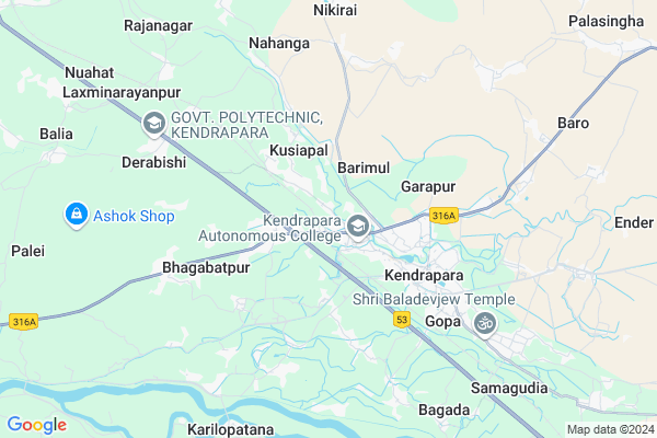
Pandiri Map
EDIT Map
Add Your House
 ..
..
Current Corona Virus Infected Patients Count in Kendrapara District
| City Name | District Name | Total Covid cases |
|---|---|---|
| Kendrapara District | Kendrapara | 2 |
Locality Name :
Pandiri
( ପାଣ୍ଡିରି )
Tehsil Name : Kendrapada
District : Kendrapara
State : Odisha
Language : Oriya and Hindi
Current Time 12:24 PM
Date: Sunday , Apr 27,2025 (IST)
Time zone: IST (UTC+5:30)
Elevation / Altitude: 9 meters. Above Seal level
Telephone Code / Std Code: 06725
Assembly constituency : Patkura assembly constituency
Assembly MLA : bed prakash agarwalla
Lok Sabha constituency : Kendrapara parliamentary constituency
Parliament MP : Anubhav Mohanty
Serpanch Name :
Pin Code : 754211
Post Office Name : Kendrapara
Commodities Prices : Kendrapara Market / Mandi
National Highways Reachable To Pandiri
Nationa High Way :NH316
Nationa High Way :NH53
Nationa High Way :NH316
Nationa High Way :NH53
Rivers Near Pandiri
Brahmani :Брагмані
:কাঁসাই নদী :Cossye River Kangsabati :কংসাবতী নদী
Brahmani :Брагмані
:কাঁসাই নদী :Cossye River Kangsabati :কংসাবতী নদী
About Pandiri
Correct below Info and add more info about PandiriPandiri is a small Village/hamlet in Kendrapada Tehsil in Kendrapara District of Odisha State, India. It is located 4 KM towards west from District head quarters Kendrapara. 5 KM from Kendrapada. 74 KM from State capital Bhubaneswar
Pandiri Pin code is 754211 and postal head office is Kendrapara .
Kusiapal ( 2 KM ) , Jamdhar ( 3 KM ) , Gulnagar ( 3 KM ) , Akhua-dakhini ( 3 KM ) , Badahat ( 3 KM ) are the nearby Villages to Pandiri. Pandiri is surrounded by Derabish Tehsil towards west , Marsaghai Tehsil towards South , Garadapur Tehsil towards South , Bari Tehsil towards North .
Kendrapara , Pattamundai , Paradip , Jagatsinghapur are the near by Cities to Pandiri.
Pandiri 2011 Census Details
Pandiri Local Language is Oriya. Pandiri Village Total population is 367 and number of houses are 83. Female Population is 47.1%. Village literacy rate is 81.7% and the Female Literacy rate is 37.3%.
Population
| Census Parameter | Census Data |
| Total Population | 367 |
| Total No of Houses | 83 |
| Female Population % | 47.1 % ( 173) |
| Total Literacy rate % | 81.7 % ( 300) |
| Female Literacy rate | 37.3 % ( 137) |
| Scheduled Tribes Population % | 0.0 % ( 0) |
| Scheduled Caste Population % | 2.5 % ( 9) |
| Working Population % | 28.3 % |
| Child(0 -6) Population by 2011 | 45 |
| Girl Child(0 -6) Population % by 2011 | 48.9 % ( 22) |
Pandiri Census More Deatils.
Politics in Pandiri
AITC , BJD are the major political parties in this area.Polling Stations /Booths near Pandiri
1)Srrutipur Primary School2)Subhadrapur Pry.school Gual Singh
3)Tentol Pry School
4)Garam Pry.school
5)Mehendinagar Primary School
HOW TO REACH Pandiri
By Rail
There is no railway station near to Pandiri in less than 10 km.Colleges near Pandiri
Birupa College, Indupur
Address :
Kendrapara Autonomous College
Address :
Keshpur College
Address : Keshpur, Berhampur-760007.
Schools in Pandiri
Endar U.g.u.p.
Address : pandiri , kendrapara , kendrapara , Sikkim . PIN- 754250 , Post - Thakurpatna
Govt Health Centers near Pandiri
1) Penthapal SC , , Andhara Sector , Near Andhara PHC(N)2) Gardapur PHC(N) , , Patkura , Near Patkura Block Office
3) ORTI , , , Orti PHC (New)
Petrol Bunks in Pandiri,Kendrapada
Bijoya Service Center Bharat Petroleum
College Square; Tinimuhani; Chandabali Kendrapada Jagatpur Road; Kendrapada; Odisha 754211; India
0.9 KM distance Detail
more ..
Colleges in Pandiri,Kendrapada
Dinabandhu Sahu Law College
Kendrapara; SH-9A; Aul Kendrapada Jagatpur Road; Pattamundai; Pattamundai; Odisha 754250; India
0.3 KM distance Detail
more ..
Schools in Pandiri,Kendrapada
Quivan Skill Empowerment Pvt.ltd
Cuttack - Kendrapada Rd; Kendrapara; Odisha 754211; India
0.8 KM distance Detail
Super Markets in Pandiri,Kendrapada
Babamani Communication
Kendrapara Bypass Road; Kendrapara; Odisha 754211; India
2.5 KM distance Detail
Local Parks in Pandiri,Kendrapada
Botanical Garden Kendrapara Autonomous College
Maradpur; Odisha 754211; India
1.2 KM distance Detail
Police Stations near Pandiri,Kendrapada
The Superintendent of Police Office
Garapur; Kendrapara; SH-9A; Aul Kendrapada Jagatpur Road; Kendrapara; Kendrapara; Odisha 754213; India
3.4 KM distance Detail
About Pandiri &
History
How to reach Pandiri
Tourist Places Near By Pandiri
Schools in Pandiri
Colleges in Pandiri
Temperature & weather of Pandiri
places in Pandiri
Pandiri photos
More Information
How to reach Pandiri
Tourist Places Near By Pandiri
Schools in Pandiri
Colleges in Pandiri
Temperature & weather of Pandiri
places in Pandiri
Pandiri photos
More Information
Village Talk
Post News or Events about this Village
Near Cities
Kendrapara 4 KM near
Pattamundai 21 KM near
Paradip 36 KM near
Jagatsinghapur 40 KM near
Kendrapara 4 KM near
Pattamundai 21 KM near
Paradip 36 KM near
Jagatsinghapur 40 KM near
Near By Taluks
Kendrapada 4 KM near
Derabish 8 KM near
Marsaghai 14 KM near
Garadapur 16 KM near
Kendrapada 4 KM near
Derabish 8 KM near
Marsaghai 14 KM near
Garadapur 16 KM near
Near By Air Ports
Bhubaneswar Airport 74 KM near
Netaji Subhas Chandra Bose Airport 355 KM near
Ranchi Airport 369 KM near
Vishakhapatnam Airport 509 KM near
Bhubaneswar Airport 74 KM near
Netaji Subhas Chandra Bose Airport 355 KM near
Ranchi Airport 369 KM near
Vishakhapatnam Airport 509 KM near
Near By Tourist Places
Paradeep Beach 36 KM near
Cuttack 60 KM near
Nandan Kanan National Park 68 KM near
Bhubaneswar 71 KM near
Konark 85 KM near
Paradeep Beach 36 KM near
Cuttack 60 KM near
Nandan Kanan National Park 68 KM near
Bhubaneswar 71 KM near
Konark 85 KM near
Near By Districts
Kendrapara 3 KM near
Jagatsinghapur 40 KM near
Jajapur 41 KM near
Cuttack 59 KM near
Kendrapara 3 KM near
Jagatsinghapur 40 KM near
Jajapur 41 KM near
Cuttack 59 KM near
Near By RailWay Station
Cuttack Junction Rail Way Station 57 KM near
Jajpur Keonjhar Road Rail Way Station 60 KM near
Cuttack Junction Rail Way Station 57 KM near
Jajpur Keonjhar Road Rail Way Station 60 KM near