| Home | City Bus | Maps | Villages | Cities | Rail | Tourist Places | School | College | Pin Codes | Corona Cases Count |
| Distance Calculator Bus Services IFSC Codes Trace Mobile Number Weather Search Place Trace IP Available Cash ATM/Banks Locate Polling Booth Report an Error contact People |
Haridaspur
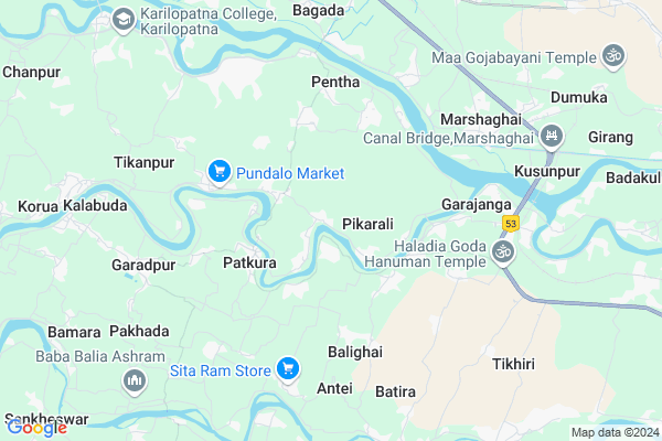
Haridaspur Map
EDIT Map
Add Your House
 ..
..
Current Corona Virus Infected Patients Count in Kendrapara District
| City Name | District Name | Total Covid cases |
|---|---|---|
| Kendrapara District | Kendrapara | 2 |
Locality Name :
Haridaspur
( ହରିଦାସପୁର )
Tehsil Name : Garadapur
District : Kendrapara
State : Odisha
Language : Oriya and Hindi
Current Time 12:44 PM
Date: Tuesday , Apr 29,2025 (IST)
Time zone: IST (UTC+5:30)
Elevation / Altitude: 9 meters. Above Seal level
Telephone Code / Std Code: 06725
Assembly constituency : Mahakalapada assembly constituency
Assembly MLA : atanu sabyasachi nayak
Lok Sabha constituency : Kendrapara parliamentary constituency
Parliament MP : Anubhav Mohanty
Serpanch Name :
Pin Code : 754213
Post Office Name : Marsaghai
Commodities Prices : Kendrapara(Marshaghai) Market / Mandi
Haridaspur Live Weather
Temperature: 35.1 °C
clear sky
Humidity: 43%
Wind : 4.36 mt/sec towards S
StationName : "KendrÄ\u0081parha"
observed on 2 Hours Back
Temperature: 35.1 °C
clear sky
Humidity: 43%
Wind : 4.36 mt/sec towards S
StationName : "KendrÄ\u0081parha"
observed on 2 Hours Back
Haridaspur Weather Forecast for Next 5 days
30-04-2025
25.9°C to 36.2°C
clear sky, moderate rain, light rain, broken clouds
25.9°C to 36.2°C
clear sky, moderate rain, light rain, broken clouds
01-05-2025
22.6°C to 36.4°C
scattered clouds, clear sky, light rain, moderate rain
22.6°C to 36.4°C
scattered clouds, clear sky, light rain, moderate rain
02-05-2025
22.9°C to 32.2°C
few clouds, light rain, moderate rain, broken clouds
22.9°C to 32.2°C
few clouds, light rain, moderate rain, broken clouds
03-05-2025
23.0°C to 33.5°C
scattered clouds, clear sky, light rain, moderate rain, overcast clouds
23.0°C to 33.5°C
scattered clouds, clear sky, light rain, moderate rain, overcast clouds
04-05-2025
23.2°C to 35.7°C
broken clouds, clear sky, few clouds, light rain, overcast clouds
23.2°C to 35.7°C
broken clouds, clear sky, few clouds, light rain, overcast clouds
National Highways Reachable To Haridaspur
Nationa High Way :NH316
Nationa High Way :NH53
Nationa High Way :NH316
Nationa High Way :NH53
Rivers Near Haridaspur
Brahmani :Брагмані
Ramlala
Brahmani :Брагмані
Ramlala
About Haridaspur
Correct below Info and add more info about HaridaspurHaridaspur is a small Village/hamlet in Garadapur Tehsil in Kendrapara District of Odisha State, India. It is located 14 KM towards South from District head quarters Kendrapara. 11 KM from Garadapur. 73 KM from State capital Bhubaneswar
Haridaspur Pin code is 754213 and postal head office is Marsaghai .
Parakula ( 2 KM ) , Patakura ( 3 KM ) , Talasanga ( 3 KM ) , Bandhakata ( 4 KM ) , Bhagabanpur ( 5 KM ) are the nearby Villages to Haridaspur. Haridaspur is surrounded by Garadapur Tehsil towards west , Kujang Tehsil towards South , Kendrapada Tehsil towards North , Tirtol Tehsil towards South .
Kendrapara , Paradip , Pattamundai , Jagatsinghapur are the near by Cities to Haridaspur.
This Place is in the border of the Kendrapara District and Jagatsinghapur District. Jagatsinghapur District Tirtol is South towards this place .
Haridaspur 2011 Census Details
Haridaspur Local Language is Oriya. Haridaspur Village Total population is 1296 and number of houses are 309. Female Population is 51.0%. Village literacy rate is 75.8% and the Female Literacy rate is 36.7%.
Population
| Census Parameter | Census Data |
| Total Population | 1296 |
| Total No of Houses | 309 |
| Female Population % | 51.0 % ( 661) |
| Total Literacy rate % | 75.8 % ( 982) |
| Female Literacy rate | 36.7 % ( 476) |
| Scheduled Tribes Population % | 0.0 % ( 0) |
| Scheduled Caste Population % | 12.2 % ( 158) |
| Working Population % | 41.3 % |
| Child(0 -6) Population by 2011 | 126 |
| Girl Child(0 -6) Population % by 2011 | 43.7 % ( 55) |
Haridaspur Census More Deatils.
Politics in Haridaspur
BJD is the major political party in this area.Polling Stations /Booths near Haridaspur
1)Hindulia Primary School2)Pikarali Primary School
3)Mandia Primary School
4)Petchhela Pry School Petchhela
5)Kansar Pry School Kansar
HOW TO REACH Haridaspur
By Rail
There is no railway station near to Haridaspur in less than 10 km.Colleges near Haridaspur
Laxmi Barah College, Ayatpur, Aul, Kendrapara
Address :
B.r. Science College
Address :
Birupa College, Indupur
Address :
Dayanidhi Sanskrit Degree College Potari
Address : At Potari ,po Batira Pin_ 754140
Sri Sri Jagannath Mohavidyalaya
Address :
Schools in Haridaspur
Panchayat Nagamani H.s
Address : haridaspur , garadapur , kendrapara , Sikkim . PIN- 754213 , Post - Marsaghai
Saraswati Sishu Mandir
Address : haridaspur , garadapur , kendrapara , Sikkim . PIN- 754213 , Post - Marsaghai
Mahanga P.s.
Address : haridaspur , garadapur , kendrapara , Sikkim . PIN- 754213 , Post - Marsaghai
Govt Health Centers near Haridaspur
1) Gardapur PHC(N) , , Patkura , Near Patkura Block Office2) Tikhiri , , Patalipank Sector , Near Tikhiri Primary School
3) Jaichandrapur , , Jadupur Sector , Near Panchayat High School Jayachandrapur
Petrol Bunks in Haridaspur,Garadapur
HP PETROL PUMP - BALDEVJEW FUEL CENTRE
HPC Dealer NH5A; Marshaghai Dist.; Bhubaneshwar; Odisha 754213; India
7.5 KM distance Detail
HP PETROL PUMP - MARSHAGHAI FILLING STATION
NH 5 A At/po: Marshaghai PS Marsaghai; Bhubaneshwar; Odisha 754213; India
7.6 KM distance Detail
more ..
Colleges in Haridaspur,Garadapur
TITC
At/Post - Garajanga Near Haladiagada; Via - Marshaghai; Dist. - Kendrapara; Garajanga; Odisha 754213; India
5.6 KM distance Detail
Odisha Computer Education
Marshaghai College Rd; Marshaghai; Odisha 754213; India
6.3 KM distance Detail
more ..
Schools in Haridaspur,Garadapur
Ishaneswar High School; Podana Narasinghpur @ IACT
Raghabapur; Odisha 754244; India
0.5 KM distance Detail
P.N.HIGH SCHOOL HARIDASPUR;KENDRAPARA
AT-HARIDASPUR;PO-NUAPARA;VIA-MARSHAGHAI;DIST-KENDRAPARA.; Haridaspur; Odisha 754213; India
1.5 KM distance Detail
saraswoti sishu vidya mandir ;haridaspur;kendrapara
Bedari; Odisha 754253; India
1.6 KM distance Detail
About Haridaspur &
History
How to reach Haridaspur
Tourist Places Near By Haridaspur
Schools in Haridaspur
Colleges in Haridaspur
Temperature & weather of Haridaspur
places in Haridaspur
Haridaspur photos
More Information
How to reach Haridaspur
Tourist Places Near By Haridaspur
Schools in Haridaspur
Colleges in Haridaspur
Temperature & weather of Haridaspur
places in Haridaspur
Haridaspur photos
More Information
Village Talk
Post News or Events about this Village
Near Cities
Kendrapara 12 KM near
Paradip 24 KM near
Pattamundai 27 KM near
Jagatsinghapur 34 KM near
Kendrapara 12 KM near
Paradip 24 KM near
Pattamundai 27 KM near
Jagatsinghapur 34 KM near
Near By Taluks
Marsaghai 5 KM near
Garadapur 10 KM near
Kujang 13 KM near
Kendrapada 14 KM near
Marsaghai 5 KM near
Garadapur 10 KM near
Kujang 13 KM near
Kendrapada 14 KM near
Near By Air Ports
Bhubaneswar Airport 73 KM near
Netaji Subhas Chandra Bose Airport 363 KM near
Ranchi Airport 385 KM near
Vishakhapatnam Airport 502 KM near
Bhubaneswar Airport 73 KM near
Netaji Subhas Chandra Bose Airport 363 KM near
Ranchi Airport 385 KM near
Vishakhapatnam Airport 502 KM near
Near By Tourist Places
Paradeep Beach 24 KM near
Cuttack 64 KM near
Nandan Kanan National Park 71 KM near
Bhubaneswar 71 KM near
Konark 74 KM near
Paradeep Beach 24 KM near
Cuttack 64 KM near
Nandan Kanan National Park 71 KM near
Bhubaneswar 71 KM near
Konark 74 KM near
Near By Districts
Kendrapara 13 KM near
Jagatsinghapur 34 KM near
Jajapur 57 KM near
Cuttack 64 KM near
Kendrapara 13 KM near
Jagatsinghapur 34 KM near
Jajapur 57 KM near
Cuttack 64 KM near
Near By RailWay Station
Cuttack Junction Rail Way Station 62 KM near
Mancheswar Rail Way Station 68 KM near
Cuttack Junction Rail Way Station 62 KM near
Mancheswar Rail Way Station 68 KM near