| Home | City Bus | Maps | Villages | Cities | Rail | Tourist Places | School | College | Pin Codes | Corona Cases Count |
| Distance Calculator Bus Services IFSC Codes Trace Mobile Number Weather Search Place Trace IP Available Cash ATM/Banks Locate Polling Booth Report an Error contact People |
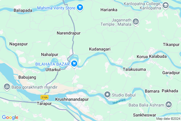
Banakunda
Banakunda Map
EDIT Map
Add Your House
 ..
..
Current Corona Virus Infected Patients Count in Kendrapara District
| City Name | District Name | Total Covid cases |
|---|---|---|
| Kendrapara District | Kendrapara | 2 |
Locality Name :
Banakunda
( ବାଣ୍ଣକୁଣ୍ଡ )
Tehsil Name : Garadapur
District : Kendrapara
State : Odisha
Language : Oriya and Hindi
Current Time 06:00 PM
Date: Thursday , Apr 24,2025 (IST)
Time zone: IST (UTC+5:30)
Elevation / Altitude: 9 meters. Above Seal level
Telephone Code / Std Code: 06725
Assembly constituency : Patkura assembly constituency
Assembly MLA : bed prakash agarwalla
Lok Sabha constituency : Kendrapara parliamentary constituency
Parliament MP : Anubhav Mohanty
Serpanch Name :
Pin Code : 754134
Post Office Name : Tyandakura
Commodities Prices : Kendupatna Market / Mandi
Banakunda Live Weather
Temperature: 32.5 °C
clear sky
Humidity: 55%
Wind : 7.47 mt/sec towards S
StationName : "KendrÄ\u0081parha"
observed on 19 Mins Back
Temperature: 32.5 °C
clear sky
Humidity: 55%
Wind : 7.47 mt/sec towards S
StationName : "KendrÄ\u0081parha"
observed on 19 Mins Back
Banakunda Weather Forecast for Next 5 days
25-04-2025
28.2°C to 31.2°C
clear sky
28.2°C to 31.2°C
clear sky
26-04-2025
27.5°C to 40.4°C
clear sky
27.5°C to 40.4°C
clear sky
27-04-2025
27.4°C to 37.3°C
few clouds, clear sky, scattered clouds
27.4°C to 37.3°C
few clouds, clear sky, scattered clouds
28-04-2025
27.8°C to 39.2°C
scattered clouds, few clouds, light rain
27.8°C to 39.2°C
scattered clouds, few clouds, light rain
29-04-2025
26.6°C to 38.0°C
broken clouds, overcast clouds, light rain
26.6°C to 38.0°C
broken clouds, overcast clouds, light rain
National Highways Reachable To Banakunda
Nationa High Way :NH316
Nationa High Way :NH53
Nationa High Way :NH316
Nationa High Way :NH53
Rivers Near Banakunda
Brahmani :Брагмані
Ramlala
Brahmani :Брагмані
Ramlala
About Banakunda
Correct below Info and add more info about BanakundaBanakunda is a small Village/hamlet in Garadapur Tehsil in Kendrapara District of Odisha State, India. It is located 22 KM towards west from District head quarters Kendrapara. 7 KM from Garadapur. 56 KM from State capital Bhubaneswar
Banakunda Pin code is 754134 and postal head office is Tyandakura .
Bantala ( 5 KM ) , Talakusuma ( 6 KM ) , Palasudha ( 6 KM ) , Gobindapur ( 6 KM ) , Harianka ( 7 KM ) are the nearby Villages to Banakunda. Banakunda is surrounded by Raghunathpur Tehsil towards west , Nischinta Koili Tehsil towards west , Tirtol Tehsil towards South , Derabish Tehsil towards North .
Kendrapara , Jagatsinghapur , Pattamundai , Paradip are the near by Cities to Banakunda.
This Place is in the border of the Kendrapara District and Jagatsinghapur District. Jagatsinghapur District Tirtol is South towards this place .
Demographics of Banakunda
Oriya is the Local Language here.Politics in Banakunda
AITC , BJD are the major political parties in this area.Polling Stations /Booths near Banakunda
1)Mirzapur Pry School2)Kanipada Urdu Pry. School
3)Chasakhanda Pry.school
4)Madanmohan Pry.school Maheshpur
5)Madhusasan Pry School
HOW TO REACH Banakunda
By Rail
There is no railway station near to Banakunda in less than 10 km.Colleges near Banakunda
Laxmi Barah College, Ayatpur, Aul, Kendrapara
Address :
B.r. Science College
Address :
Birupa College, Indupur
Address :
Dayanidhi Sanskrit Degree College Potari
Address : At Potari ,po Batira Pin_ 754140
Sri Sri Jagannath Mohavidyalaya
Address :
Schools near Banakunda
Netaji High School
Address : pundilo , garadapur , kendrapara , Sikkim . PIN- 754134 , Post - Tyandakura
Kaliaghai Natabar H.s.
Address : mahamuda , garadapur , kendrapara , Sikkim . PIN- 754253 , Post - Bedari
Mahammadpur Mirzapur H.s
Address : mahammadpur , garadapur , kendrapara , Sikkim . PIN- 754209 , Post - Asureswar
Panchayat High School
Address : kalabuda , garadapur , kendrapara , Sikkim . PIN- 754153 , Post - Garadpur
Govt Health Centers near Banakunda
1) ORTI , , , Orti PHC (New)2) NAGASPUR , , , Nagaspur Chhak
3) Gardapur PHC(N) , , Patkura , Near Patkura Block Office
Petrol Bunks in Banakunda,Garadapur
Padma Sundari Filling Station
AT- MOHAMMADPUR; BILAHATA; PO -TYANDAKURA; Odisha 754134; India
2.5 KM distance Detail
more ..
Schools in Banakunda,Garadapur
Kalabuda; Dihasahi
Maa BudhiJagulai Mandir; Madhushasan; Odisha 754134; India
1.2 KM distance Detail
Local Parks in Banakunda,Garadapur
Pingaleswari Udyan
Lalitagiri Road; Rout Sahi; Tilanga; Odisha 754207; India
18.8 KM distance Detail
About Banakunda &
History
How to reach Banakunda
Tourist Places Near By Banakunda
Schools in Banakunda
Colleges in Banakunda
Temperature & weather of Banakunda
places in Banakunda
Banakunda photos
More Information
How to reach Banakunda
Tourist Places Near By Banakunda
Schools in Banakunda
Colleges in Banakunda
Temperature & weather of Banakunda
places in Banakunda
Banakunda photos
More Information
Village Talk
Post News or Events about this Village
Near Cities
Kendrapara 20 KM near
Jagatsinghapur 20 KM near
Pattamundai 39 KM near
Paradip 40 KM near
Kendrapara 20 KM near
Jagatsinghapur 20 KM near
Pattamundai 39 KM near
Paradip 40 KM near
Near By Taluks
Garadapur 6 KM near
Raghunathpur 11 KM near
Nischinta Koili 11 KM near
Tirtol 15 KM near
Garadapur 6 KM near
Raghunathpur 11 KM near
Nischinta Koili 11 KM near
Tirtol 15 KM near
Near By Air Ports
Bhubaneswar Airport 57 KM near
Netaji Subhas Chandra Bose Airport 375 KM near
Ranchi Airport 379 KM near
Vishakhapatnam Airport 489 KM near
Bhubaneswar Airport 57 KM near
Netaji Subhas Chandra Bose Airport 375 KM near
Ranchi Airport 379 KM near
Vishakhapatnam Airport 489 KM near
Near By Tourist Places
Paradeep Beach 40 KM near
Cuttack 47 KM near
Nandan Kanan National Park 54 KM near
Bhubaneswar 54 KM near
Konark 66 KM near
Paradeep Beach 40 KM near
Cuttack 47 KM near
Nandan Kanan National Park 54 KM near
Bhubaneswar 54 KM near
Konark 66 KM near
Near By Districts
Kendrapara 21 KM near
Jagatsinghapur 21 KM near
Cuttack 46 KM near
Khordha 55 KM near
Kendrapara 21 KM near
Jagatsinghapur 21 KM near
Cuttack 46 KM near
Khordha 55 KM near
Near By RailWay Station
Cuttack Junction Rail Way Station 45 KM near
Mancheswar Rail Way Station 51 KM near
Cuttack Junction Rail Way Station 45 KM near
Mancheswar Rail Way Station 51 KM near