| Home | City Bus | Maps | Villages | Cities | Rail | Tourist Places | School | College | Pin Codes | Corona Cases Count |
| Distance Calculator Bus Services IFSC Codes Trace Mobile Number Weather Search Place Trace IP Available Cash ATM/Banks Locate Polling Booth Report an Error contact People |
Deehe
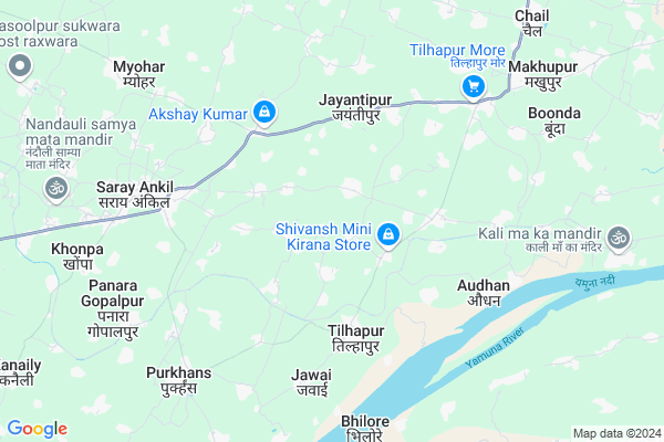
Deehe Map
EDIT Map
Add Your House
 ..
..
Current Corona Virus Infected Patients Count in Kaushambi District
| City Name | District Name | Total Covid cases |
|---|---|---|
| Kaushambi District | Kaushambi | 2 |
Locality Name :
Deehe
( दीहे )
Block Name : Nevada
District : Kaushambi
State : Uttar Pradesh
Division : Allahabad
Language : Hindi and Urdu
Current Time 11:33 PM
Date: Wednesday , Feb 05,2025 (IST)
Time zone: IST (UTC+5:30)
Elevation / Altitude: 160 meters. Above Seal level
Telephone Code / Std Code: 05331
Assembly constituency : Chail assembly constituency
Assembly MLA : Pooja Pal
Lok Sabha constituency : Kaushambi parliamentary constituency
Parliament MP : VINOD KUMAR SONKAR
Serpanch Name :
Pin Code : 212218
Post Office Name : Tilhapur
Main Village Name : Fareedpur
Commodities Prices : Bharwari Market / Mandi
Deehe Live Weather
Temperature: 18.3 °C
clear sky
Humidity: 38%
Wind : 5.88 mt/sec towards NW
StationName : "Chail"
observed on 10 Mins Back
Temperature: 18.3 °C
clear sky
Humidity: 38%
Wind : 5.88 mt/sec towards NW
StationName : "Chail"
observed on 10 Mins Back
Deehe Weather Forecast for Next 5 days
06-02-2025
14.1°C to 18.3°C
clear sky
14.1°C to 18.3°C
clear sky
07-02-2025
11.2°C to 27.5°C
clear sky
11.2°C to 27.5°C
clear sky
08-02-2025
10.5°C to 27.5°C
clear sky
10.5°C to 27.5°C
clear sky
09-02-2025
11.4°C to 28.7°C
clear sky, scattered clouds, broken clouds, few clouds
11.4°C to 28.7°C
clear sky, scattered clouds, broken clouds, few clouds
10-02-2025
14.0°C to 31.2°C
clear sky, few clouds
14.0°C to 31.2°C
clear sky, few clouds
National Highways Reachable To Deehe
Nationa High Way :NH30
Nationa High Way :NH19
Nationa High Way :NH30
Nationa High Way :NH19
Rivers Near Deehe
Paisuni
Yamuna River :যমুনা :यमुना :ಯಮುನಾ :Ямуна :https://1drv.ms/b/s!Ar-WXIFaX7UdgQuO6WpVrTr6YYsQ
Paisuni
Yamuna River :যমুনা :यमुना :ಯಮುನಾ :Ямуна :https://1drv.ms/b/s!Ar-WXIFaX7UdgQuO6WpVrTr6YYsQ
About Deehe
Correct below Info and add more info about DeeheDeehe is a small Village/hamlet in Nevada Block in Kaushambi District of Uttar Pradesh State, India. It comes under Fareedpur Panchayath. It belongs to Allahabad Division . It is located 26 KM towards South from District head quarters Manjhanpur. 205 KM from State capital Lucknow
Deehe Pin code is 212218 and postal head office is Tilhapur .
Deehe is surrounded by Chail Block towards North , Kaushambi Block towards west , Mooratganj Block towards North , Manjhanpur Block towards west .
Allahabad , Lal Gopalganj Nindaura , Phulpur , Chitrakoot are the near by Cities to Deehe.
This Place is in the border of the Kaushambi District and Chitrakoot District. Chitrakoot District Mau is west towards this place .
Demographics of Deehe
Hindi is the Local Language here.Politics in Deehe
SP , BSP , INC are the major political parties in this area.Polling Stations /Booths near Deehe
1)P.s. Khijirpur Kailai East Part2)P.s. Khijirpur Kailai East Part First
3)P.s. Gauhani Kala West Part
4)Bramhachari I C Tilhapur West Part
5)P.s. Giriya Khalsa West Part
HOW TO REACH Deehe
By Rail
There is no railway station near to Deehe in less than 10 km.Colleges near Deehe
Sri Brahmchari Inter College Tilhapur Kaushambi
Address :
Schools in Deehe
P.s.fareedpur
Address : fareedpur , newada , kaushambi , Uttar Pradesh . PIN- 212218 , Post - Tilhapur
Govt Health Centers near Deehe
1) Bhikhanapur. , Gaura , Gaura , Gaura2) Kaulapur Nandpatti , Gaura , Gaura , Gaura
3) Harduwa , , Harduwa , Harduwa
Hospitals in Deehe,Nevada
प्राथमिक स्वास्थ केंद्र नेवादा
नेवादा; Kaushambi; Uttar Pradesh 212202; India
3.4 KM distance Detail
more ..
Petrol Bunks in Deehe,Nevada
Shri Ganga Dharam Kanta
Beni ram katra chauraha; Allahabad Road; Saray Ankil; Uttar Pradesh; India
3.5 KM distance Detail
HP PETROL PUMP - G SINGH & BROTHERS
HPC Petrol Pump Village-basuhar; Post-sarai Akil; SH 95; Kanpur; Uttar Pradesh 212216; India
3.8 KM distance Detail
HP PETROL PUMP - CHEDALAL & SONS
HP Dealers Station Road DT UP; Khanpur; Uttar Pradesh 210001; India
3.8 KM distance Detail
more ..
Colleges in Deehe,Nevada
Chaudhari Hasan Girls Inter College
Road; Rasoolpur Tappa; Uttar Pradesh 212216; India
5.0 KM distance Detail
more ..
Local Parks in Deehe,Nevada
Om Vatika Kanaili
212216; RD Complex; U-3; Unnamed Rd; Sector 3; Avas Vikas Colony; Sikandra; Agra; Uttar Pradesh 282004; India
13.6 KM distance Detail
Governement Offices near Deehe,Nevada
Samudayik Bhwan Vikaskhand Rasoolpur
Rasoolpur Shukrawara; Uttar Pradesh 212206; India
12.4 KM distance Detail
About Deehe &
History
How to reach Deehe
Tourist Places Near By Deehe
Schools in Deehe
Colleges in Deehe
Temperature & weather of Deehe
places in Deehe
Deehe photos
More Information
How to reach Deehe
Tourist Places Near By Deehe
Schools in Deehe
Colleges in Deehe
Temperature & weather of Deehe
places in Deehe
Deehe photos
More Information
Village Talk
Post News or Events about this Village
Near Cities
Allahabad 32 KM near
Lal Gopalganj Nindaura 35 KM near
Phulpur 63 KM near
Chitrakoot 82 KM near
Allahabad 32 KM near
Lal Gopalganj Nindaura 35 KM near
Phulpur 63 KM near
Chitrakoot 82 KM near
Near By Taluks
Nevada 0 KM near
Chail 10 KM near
Kaushambi 15 KM near
Mooratganj 20 KM near
Nevada 0 KM near
Chail 10 KM near
Kaushambi 15 KM near
Mooratganj 20 KM near
Near By Air Ports
Bamrauli Airport 20 KM near
Varanasi Airport 144 KM near
Kanpur Airport 182 KM near
Amausi Airport 189 KM near
Bamrauli Airport 20 KM near
Varanasi Airport 144 KM near
Kanpur Airport 182 KM near
Amausi Airport 189 KM near
Near By Tourist Places
Kaushambi 18 KM near
Allahabad 30 KM near
Shringverpur 56 KM near
Pratapgarh 84 KM near
Vindhyachal 108 KM near
Kaushambi 18 KM near
Allahabad 30 KM near
Shringverpur 56 KM near
Pratapgarh 84 KM near
Vindhyachal 108 KM near
Near By Districts
Kaushambi 25 KM near
Allahabad 32 KM near
Chitrakoot 53 KM near
Pratapgarh District 77 KM near
Kaushambi 25 KM near
Allahabad 32 KM near
Chitrakoot 53 KM near
Pratapgarh District 77 KM near
Near By RailWay Station
Shankargarh Rail Way Station 21 KM near
Bharwari Rail Way Station 25 KM near
Shankargarh Rail Way Station 21 KM near
Bharwari Rail Way Station 25 KM near