| Home | City Bus | Maps | Villages | Cities | Rail | Tourist Places | School | College | Pin Codes | Corona Cases Count |
| Distance Calculator Bus Services IFSC Codes Trace Mobile Number Weather Search Place Trace IP Available Cash ATM/Banks Locate Polling Booth Report an Error contact People |
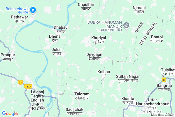
Bamhangawan Map
EDIT Map
Add Your House
 ..
..
Current Corona Virus Infected Patients Count in Katihar District
| City Name | District Name | Total Covid cases |
|---|
Locality Name :
Bamhangawan
( बम्हनगवां )
Block Name : Azamnagar
District : Katihar
State : Bihar
Division : Purnia
Language : Maithili and Hindi, Urdu, Bengali And Surjapuri
Current Time 07:16 PM
Date: Thursday , Apr 24,2025 (IST)
Time zone: IST (UTC+5:30)
Elevation / Altitude: 32 meters. Above Seal level
Telephone Code / Std Code: 06451
Assembly constituency : Pranpur assembly constituency
Assembly MLA : Nisha Singh
Lok Sabha constituency : Katihar parliamentary constituency
Parliament MP : DULAL CHANDRA GOSWAMI
Serpanch Name :
Pin Code : 855113
Post Office Name : Salmari
Main Village Name : BAMHANGAWAN
Commodities Prices : Samsi Market / Mandi
Bamhangawan Live Weather
Temperature: 37.6 °C
clear sky
Humidity: 8%
Wind : 3.59 mt/sec towards NE
StationName : "RaghunÄ\u0081thpur"
observed on 2 Hours Back
Temperature: 37.6 °C
clear sky
Humidity: 8%
Wind : 3.59 mt/sec towards NE
StationName : "RaghunÄ\u0081thpur"
observed on 2 Hours Back
Bamhangawan Weather Forecast for Next 5 days
25-04-2025
25.8°C to 37.4°C
clear sky
25.8°C to 37.4°C
clear sky
26-04-2025
25.3°C to 40.9°C
clear sky
25.3°C to 40.9°C
clear sky
27-04-2025
26.4°C to 40.6°C
clear sky
26.4°C to 40.6°C
clear sky
28-04-2025
20.4°C to 37.9°C
clear sky, few clouds, broken clouds, heavy intensity rain, moderate rain
20.4°C to 37.9°C
clear sky, few clouds, broken clouds, heavy intensity rain, moderate rain
29-04-2025
22.1°C to 33.0°C
overcast clouds, light rain, clear sky
22.1°C to 33.0°C
overcast clouds, light rain, clear sky
Rivers Near Bamhangawan
Fulahar
Nagri
Fulahar
Nagri
About Bamhangawan
Correct below Info and add more info about BamhangawanBamhangawan is a small Village/hamlet in Azamnagar Block in Katihar District of Bihar State, India. It comes under BAMHANGAWAN Panchayath. It belongs to Purnia Division . It is located 30 KM towards East from District head quarters Katihar. 11 KM from Azamnagar. 314 KM from State capital Patna
Bamhangawan Pin code is 855113 and postal head office is Salmari .
Kelabari ( 6 KM ) , Chaulhar ( 6 KM ) , Amarsinghpur ( 7 KM ) , Gauripur ( 8 KM ) , Singhaul ( 9 KM ) are the nearby Villages to Bamhangawan. Bamhangawan is surrounded by Harishchandrapur-Ii Block towards South , Azamnagar Block towards North , Pranpur Block towards west , Amdabad Block towards South .
Manihari , Katihar , Sahibganj , Raiganj are the near by Cities to Bamhangawan.
This Place is in the border of the Katihar District and Maldah District. Maldah District Harishchandrapur-i is South towards this place . It is near to the West Bengal State Border.
Bamhangawan 2011 Census Details
Bamhangawan Local Language is Maithili. Bamhangawan Village Total population is 544 and number of houses are 119. Female Population is 47.6%. Village literacy rate is 33.6% and the Female Literacy rate is 15.3%.
Population
| Census Parameter | Census Data |
| Total Population | 544 |
| Total No of Houses | 119 |
| Female Population % | 47.6 % ( 259) |
| Total Literacy rate % | 33.6 % ( 183) |
| Female Literacy rate | 15.3 % ( 83) |
| Scheduled Tribes Population % | 2.9 % ( 16) |
| Scheduled Caste Population % | 0.0 % ( 0) |
| Working Population % | 44.7 % |
| Child(0 -6) Population by 2011 | 91 |
| Girl Child(0 -6) Population % by 2011 | 48.4 % ( 44) |
Bamhangawan Census More Deatils.
Politics in Bamhangawan
Nationalist Congress Party , BJP , NCP , Janata Dal (United) are the major political parties in this area.Polling Stations /Booths near Bamhangawan
1)Uccha Madhyamik Vidyalay Rohiya2)Prathamik Vidyalay Satare Purab Bhag
3)Madhya Vidyalay Dhumanagar Uttar Bhag
4)Prathamik Vidyalay Jitavarapur
5)Utkramit Madhya Vidyalay Nimaul
HOW TO REACH Bamhangawan
By Rail
Babhabgaon Halt Rail Way Station , Kamalpur Halt Rail Way Station are the very nearby railway stations to Bamhangawan. Katihar Junction Rail Way Station (near to Katihar) , Nayatola Rail Way Station (near to Katihar) are the Rail way stations reachable from near by towns.By Road
Katihar are the nearby by towns to Bamhangawan having road connectivity to BamhangawanColleges near Bamhangawan
R. D. S. College, Salmari
Address : R. D. S. College, Salmari, Katihar
Schools near Bamhangawan
Ps Ghoghriya
Address : ghoghriya , ajamnagar , katihar , Bihar . PIN- 855113 , Post - Salmari
Ps Dhogariya
Address : dhogariya , ajamnagar , katihar , Bihar . PIN- 855113 , Post - Salmari
Ps Miyatoli Imamnager
Address : imam nager , ajamnagar , katihar , Bihar . PIN- 854116 , Post - Mahadevpur (Katihar)
Ps Mangatpur
Address : amar singh pur , ajamnagar , katihar , Bihar . PIN- 855113 , Post - Salmari
Govt Health Centers near Bamhangawan
1) Kharsota , Kharsouta , Kharsouta ,2) Palsa , Palsa , Palsa ,
3) Bieriya , Beriya , Beriya ,
Petrol Bunks in Bamhangawan,Azamnagar
Nowapara Kisan Seva Kandra
vill- Nowapara. p.o- Khopakati. p.s- pin- dist- (W.B); Harishchandrapur; West Bengal 732125; India
10.5 KM distance Detail
more ..
Schools in Bamhangawan,Azamnagar
DEVGANW
855113; Chhatauni Rd; Tulsi Nagar; Kukudakhandi; Odisha 761100; India
1.9 KM distance Detail
PRIMARY SCHOOL MANDAL TOLI DHUMNAGAR KHURIYAL AZAMNAGAR
Khuriyal; Bihar 855113; India
2.5 KM distance Detail
About Bamhangawan &
History
How to reach Bamhangawan
Tourist Places Near By Bamhangawan
Schools in Bamhangawan
Colleges in Bamhangawan
Temperature & weather of Bamhangawan
places in Bamhangawan
Bamhangawan photos
More Information
How to reach Bamhangawan
Tourist Places Near By Bamhangawan
Schools in Bamhangawan
Colleges in Bamhangawan
Temperature & weather of Bamhangawan
places in Bamhangawan
Bamhangawan photos
More Information
Village Talk
Post News or Events about this Village
Near Cities
Manihari 27 KM near
Katihar 29 KM near
Sahibganj 33 KM near
Raiganj 41 KM near
Manihari 27 KM near
Katihar 29 KM near
Sahibganj 33 KM near
Raiganj 41 KM near
Near By Taluks
Harishchandrapur-I 7 KM near
Harishchandrapur-Ii 10 KM near
Azamnagar 11 KM near
Amdabad 13 KM near
Harishchandrapur-I 7 KM near
Harishchandrapur-Ii 10 KM near
Azamnagar 11 KM near
Amdabad 13 KM near
Near By Air Ports
Bagdogra Airport 161 KM near
Rupsi Airport 250 KM near
Patna Airport 305 KM near
Gaya Airport 335 KM near
Bagdogra Airport 161 KM near
Rupsi Airport 250 KM near
Patna Airport 305 KM near
Gaya Airport 335 KM near
Near By Tourist Places
Sahibganj 34 KM near
Malda 68 KM near
English-Bazar 69 KM near
Bhagalpur 97 KM near
Pakur 104 KM near
Sahibganj 34 KM near
Malda 68 KM near
English-Bazar 69 KM near
Bhagalpur 97 KM near
Pakur 104 KM near
Near By Districts
Katihar 29 KM near
Sahebganj 34 KM near
Dinajpur Uttar 40 KM near
Purnia 53 KM near
Katihar 29 KM near
Sahebganj 34 KM near
Dinajpur Uttar 40 KM near
Purnia 53 KM near
Near By RailWay Station
Babhabgaon Halt Rail Way Station 1.5 KM near
Kamalpur Halt Rail Way Station 6.7 KM near
Harischandrapur Rail Way Station 9 KM near
Azamnagar Road Rail Way Station 11 KM near
Babhabgaon Halt Rail Way Station 1.5 KM near
Kamalpur Halt Rail Way Station 6.7 KM near
Harischandrapur Rail Way Station 9 KM near
Azamnagar Road Rail Way Station 11 KM near