| Home | City Bus | Maps | Villages | Cities | Rail | Tourist Places | School | College | Pin Codes | Corona Cases Count |
| Distance Calculator Bus Services IFSC Codes Trace Mobile Number Weather Search Place Trace IP Available Cash ATM/Banks Locate Polling Booth Report an Error contact People |
 ..
..
Current Corona Virus Infected Patients Count in Kathua District
| City Name | District Name | Total Covid cases |
|---|---|---|
| Kathua District | Kathua | 1 |
Block Name : Billawar
District : Kathua
State : Jammu & Kashmir
Language : Dogri and English, Hindi, And Urdu.
Current Time 02:19 PM
Date: Monday , Apr 28,2025 (IST)
Time zone: IST (UTC+5:30)
Elevation / Altitude: 363 meters. Above Seal level
Telephone Code / Std Code: 01921
Assembly constituency : assembly constituency
Assembly MLA :
Lok Sabha constituency : parliamentary constituency
Parliament MP :
Serpanch Name :
Pin Code : 184205
Post Office Name : Ramkot (Kathua)
Commodities Prices : Samba Market / Mandi
Temperature: 38.2 °C
clear sky
Humidity: 9%
Wind : 3.29 mt/sec towards SW
StationName : "HirÄ\u0081nagar"
observed on 44 Mins Back
25.8°C to 39.4°C
clear sky
24.8°C to 41.0°C
clear sky
25.7°C to 41.3°C
clear sky
26.0°C to 41.0°C
clear sky, overcast clouds, light rain
24.2°C to 38.3°C
light rain, broken clouds, overcast clouds, few clouds, scattered clouds
OverView of Ramkote
Bari garh is the branch of ramkota royal family temple mahamaya mata ancient murti of mahamaya mata or mankotia temple. Now they live in near in temple one family of mankotia royal family memberThe chain of rulers who ruled ramkote descended from Raja Sarbahladhar(765-801 AD).He was a religious ruler and a great devotee of sadhus and saints. According to Nargis, a Peer Roshan Shah Vali reached Jammu and told this king that he will have to face mohammaden invaders but finally he will remain unhurt and safe.Therefore upon his death Raja built a tomb for the Peer. One of his descendants, Raja Bajjrala Dhar found this venerth town in northeast of Jammu. At that time it was part of Jasrota Kingdome founded by Raja Jasdev and handed it over to Raja Karandev. However Karandev's eldest son Raja Bhuj Dev extended his rule upto Surinsar and established a new kingdom of Babbarhgar known as Bhabbapur in Rajtrangani.This place is known as Bhabore in moderen times.Raja karan dev gifted this kingdom to his grandson Raja Manak Dev in the name of Manipur who built a fort on the bank of Basanter Nallah and named this capital as Mankote. After the death of Raja Bhoj Dev in the battle with Nasar- ul-Din I Bikrami 1032, his eldest son Bhrorak became Raja of Mankot and his descendants sobriquet as Mankotia Rajputs. The 2nd son Raja Avtar Dev sat on the throne of Jammu kingdom. The 3rd son was given Jasrota kingdom. In the olden times Jasrota had been a very flourishing town and the Jasrota was named after the name of his son Jas Dev and the descendants of Raja Karan Dev established their capital in Jasrota. The descendants of this clan sobriquet as Jasrotia Rajputs.In the times of Maharaja Ranjeeet Singh of Punjab, Jasrota was given to Raja Hira Singh, a one time very close confidante of the Maharaja. With the killing of Raja Hira Singh, Jasrota turned into ruins and became a jungle. The palaces of repute in the past were demolished.His descendants are known as Mankotias. It was renamed by Raja Suchet Singh (1822-43) as Ramkote.
Edit below overview about Ramkote
Nationa High Way :NH154A
Nationa High Way :NH44
Ravi
Degh
About Ramkote
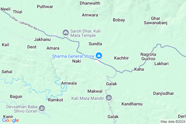
Ramkote is a Village in Billawar Block in Kathua District of Jammu & Kashmir State, India. It is located 40 KM towards North from District head quarters Kathua. 20 KM from Billawar Rural. 196 KM from State capital Srinagar, Jammu
Ramkote Pin code is 184205 and postal head office is Ramkot (Kathua).
Dinga Amb-a ( 7 KM ) , Dinga Amb-b ( 7 KM ) , Mangloor East Hq Jumble ( 11 KM ) , Mangloor West ( 11 KM ) , Rajwalta ( 11 KM ) are the nearby Villages to Ramkote. Ramkote is surrounded by Hiranagar Block towards South , Billawar Block towards East , Ghagwal Block towards South , Ramnagar Block towards North .
Kathua , Udhampur , Sujanpur , Jammu are the near by Cities to Ramkote.
Demographics of Ramkote
Dogri is the Local Language here.HOW TO REACH Ramkote
By Rail
There is no railway station near to Ramkote in less than 10 km.Colleges near Ramkote
Govt Degree College BillawarSchools in Ramkote
Higher Secondry School RamkoteGovt Health Centers near Ramkote
1) SUNDLA , MEDICAL AID CENTRE SUNDLA , SUNDLA , GOVT. HIGH SCHOOL2) Nakki , SUB-CENTRE NAKKI , VILLAGE - NAKKI , P.O KHOON
3) Neeli , SC Neeli , Neeli , Middle School Neeli
Hospitals in Ramkote,Billawar
MULTISPECIALITY DIAGNOSTIC AND HEALTH CARE CENTRE DINGISIMBLI BILLAWAR
Dingi Simbli; Billawar; Jammu and Kashmir
20.8 KM distance Detail
Jai Data Laboratory and Diagnostic Centre
Billawar Road; Near Railway Bridge; Dayala Chak; Dayala Chak; Hiranagar; Kathua; Jammu and Kashmir 184144
21.1 KM distance Detail
Shree Narsingh Dev Accidental Hospital (Trauma Centre) Ghagwal; Samba; J&K
near narsingh dev temple; ghagwal; Jammu and Kashmir 184141
21.2 KM distance Detail
Government Accidental Hospital Ghagwal
Near Narsingh Dev Temple; District Samba; Ghagwal; Jammu and Kashmir 184141
21.2 KM distance Detail
more ..
Petrol Bunks in Ramkote,Billawar
HP PETROL PUMP - CHOUDHARY FILLING STATION
HPC Dealers Tapyal Raimorh Gagwal; TEH. Hiranagar; Jammu; Jammu and Kashmir 184143
21.0 KM distance Detail
KARAM CHAND SARAF & SONS
DAYALACHAK ON SAMBA-KATHU; Kathua; Jammu and Kashmir 184144
21.4 KM distance Detail
HP PETROL PUMP - SHASUM FLG STN JATWAL
Jammu Pathankot RD.; NH-1 A Vill: Sungwali Jatwal; Jammu; Jammu and Kashmir 184141
22.2 KM distance Detail
SAHIL FILLING STATION
NUD;ON SAMBA-UDHMPUR RD; Samba; Jammu and Kashmir 184121
22.4 KM distance Detail
more ..
Colleges in Ramkote,Billawar
Hiranagar College Auditorium
Hiranagar; Srinagar - Kanyakumari Hwy; Inter State Bus Terminal; Kashmere Gate; New Delhi; Delhi 110006
22.1 KM distance Detail
more ..
Schools in Ramkote,Billawar
KUSHAL DRIVING INSTITUTE
Udhampur Road; brar billawar; Billawar; Jammu and Kashmir 184205
12.1 KM distance Detail
Kendriya Vidyalaya Kathua
Near Head Post Office; Kathua; Jammu and Kashmir 184101
20.8 KM distance Detail
Governement Offices near Ramkote,Billawar
How to reach Ramkote
Tourist Places Near By Ramkote
Schools in Ramkote
Colleges in Ramkote
Temperature & weather of Ramkote
places in Ramkote
Ramkote photos
More Information
Village Talk
Post News or Events about this Village
Kathua 38 KM near
Udhampur 47 KM near
Sujanpur 48 KM near
Jammu 50 KM near
Majalta 12 KM near
Hiranagar 16 KM near
Billawar 19 KM near
Ramnagar 21 KM near
Satwari Airport 51 KM near
Pathankot Airport 61 KM near
Gaggal Airport 107 KM near
Raja Sansi Airport 128 KM near
Kathua 39 KM near
Udhampur 40 KM near
Jammu 50 KM near
Pathankot 57 KM near
Patnitop 57 KM near
Samba 23 KM near
Kathua 39 KM near
Udhampur 40 KM near
Jammu 53 KM near
Hira Nagar Rail Way Station 20 KM near
Samba Rail Way Station 26 KM near