| Home | City Bus | Maps | Villages | Cities | Rail | Tourist Places | School | College | Pin Codes | Corona Cases Count |
| Distance Calculator Bus Services IFSC Codes Trace Mobile Number Weather Search Place Trace IP Available Cash ATM/Banks Locate Polling Booth Report an Error contact People |
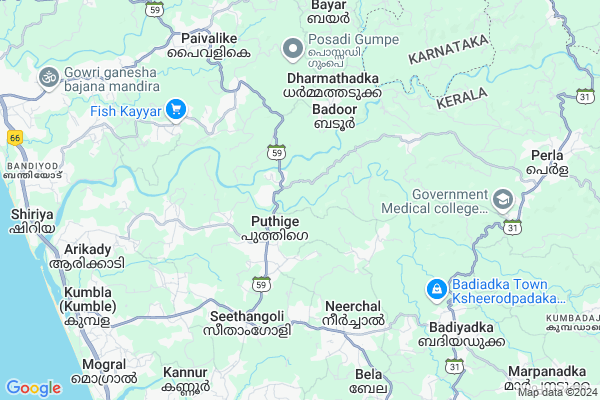
Delampady Map
EDIT Map
Add Your House
 ..
..
Current Corona Virus Infected Patients Count in Kasaragod District
| City Name | District Name | Total Covid cases |
|---|---|---|
| Kasaragod District | Kasaragod | 141 |
| Kasaragod | Kasaragod | 26 |
| Chengala | Kasaragod | 4 |
| Eriyal | Kasaragod | 1 |
| Chemnad | Kasaragod | 1 |
| Mogral Puthur | Kasaragod | 1 |
| Kalanadu | Kasaragod | 1 |
Locality Name :
Delampady
( ദേലംപാടി )
Block Name : Kasargod
District : Kasaragod
State : Kerala
Division : North Kerala
Language : Malayalam. Tulu and Beary Bashe, Kannada, Hindi, Marathi And Konkani
Current Time 01:18 PM
Date: Sunday , Apr 27,2025 (IST)
Time zone: IST (UTC+5:30)
Elevation / Altitude: 18 meters. Above Seal level
Telephone Code / Std Code: 04994
Assembly constituency : Manjeshwar assembly constituency
Assembly MLA : A K M Ashraf
Lok Sabha constituency : Kasaragod parliamentary constituency
Parliament MP : Rajmohan Unnithan
Serpanch Name :
Pin Code : 671552
Post Office Name : Perla
Commodities Prices : Kasargod Market / Mandi
National Highways Reachable To Delampady
Nationa High Way :NH66
Nationa High Way :NH66
Rivers Near Delampady
munchikana thodu
Chandragiri :ಪಲ್ಲತಡ್ಕ
munchikana thodu
Chandragiri :ಪಲ್ಲತಡ್ಕ
About Delampady
Correct below Info and add more info about DelampadyDelampady is a Village in Kasargod Block in Kasaragod District of Kerala State, India. It belongs to North Kerala Division . It is located 14 KM towards North from District head quarters Kasaragod. 13 KM from Kasargod. 593 KM from State capital Thiruvananthapuram
Delampady Pin code is 671552 and postal head office is Perla .
Paivalike ( 7 KM ) , Badiyadka ( 9 KM ) , Madhur ( 10 KM ) , Meenja ( 10 KM ) , Enmakaje ( 11 KM ) are the nearby Villages to Delampady. Delampady is surrounded by Kasargod Block towards South , Bantval Block towards North , Puttur Block towards East , Kanhangad Block towards South .
Kasaragod , Puttur , Mangalore , Kanhangad are the near by Cities to Delampady.
It is near to arabian sea. There is a chance of humidity in the weather.
Delampady 2011 Census Details
Delampady Local Language is Malayalam. Tulu. Delampady Village Total population is 7291 and number of houses are 1314. Female Population is 49.3%. Village literacy rate is 75.8% and the Female Literacy rate is 35.2%.
Population
| Census Parameter | Census Data |
| Total Population | 7291 |
| Total No of Houses | 1314 |
| Female Population % | 49.3 % ( 3598) |
| Total Literacy rate % | 75.8 % ( 5523) |
| Female Literacy rate | 35.2 % ( 2566) |
| Scheduled Tribes Population % | 3.5 % ( 258) |
| Scheduled Caste Population % | 11.3 % ( 823) |
| Working Population % | 40.8 % |
| Child(0 -6) Population by 2011 | 788 |
| Girl Child(0 -6) Population % by 2011 | 50.4 % ( 397) |
Delampady Census More Deatils.
Politics in Delampady
CPM , Indian National Congress , MUL , CPI(M) , IUML , BJP , INC are the major political parties in this area.Polling Stations /Booths near Delampady
1)Govt. Higher Scondary School Angadimugaru (main Building Eastern Portion)2)Govt. High School Heroor New
3)Aided Juniour Basic School Puthige
4)Aided Juniour Basic School Elkana
5)Govt. Juniour Basic School Mugu
HOW TO REACH Delampady
By Rail
Kumbala Rail Way Station is the very nearby railway stations to Delampady.Colleges near Delampady
Tagore College
Address :
Parassinikadavu Ayurveda Medical College
Address : Cherkala, Chengala P.o, Kasargod 671 541
Sa-adiya Arts & Science College
Address : Kalanad P.o, Kasargode
Century College Of Nursing,poinachi
Address : Century College Of Nursing,poinachi, Post Thekkil,
Schools in Delampady
Ghs Adoor
Address : delampady , kumbala , kasaragod , Kerala . PIN- 671543 , Post - Mulleria
Gvhss Delampady
Address : delampady , kumbala , kasaragod , Kerala . PIN- 671543 , Post - Mulleria
Ghs Pandi
Address : delampady , kumbala , kasaragod , Kerala . PIN- 671543 , Post - Mulleria
Gups Pallangod
Address : delampady , kumbala , kasaragod , Kerala . PIN- 671543 , Post - Mulleria
Aups Kuntar
Address : delampady , kumbala , kasaragod , Kerala . PIN- 671543 , Post - Mulleria
Hospitals in Delampady,Kasargod
MALIK DEENAR INSTITUTE OF MANAGEMENT STUDIES
Seethangoli; Bela Village; Kasaragod; Kerala 671321; India
5.8 KM distance Detail
more ..
Petrol Bunks in Delampady,Kasargod
Petrol Station
Kumbla–Badiadka Rd; Darbethadka; Seethangoli; Kerala 671321; India
5.7 KM distance Detail
HP PETROL PUMP - BADIADKA PETROLEUM
HPC Dealer P.o.perdala Badiadka; Kozhicode (calicut); Kerala 671551; India
8.5 KM distance Detail
Paivalike Fuels; BPCL Petrol Pump
Kanyana - Bayar - Uppala Rd; Paivalike; Kerala 671322; India
8.7 KM distance Detail
more ..
Colleges in Delampady,Kasargod
Malik Deenar Institute of Management Studies
Seethangoli – Puthige – Perla Rd; Kasaragod; Kerala 671321; India
5.7 KM distance Detail
Malik Deenar College Of Pharmacy
Seethangoli; Seethangoli – Puthige – Perla Rd; Seethangoli; Kerala 671321; India
5.8 KM distance Detail
more ..
Schools in Delampady,Kasargod
Government Higher Secondary School
Angadimogaru; Angadimogar; Kerala 671321; India
1.0 KM distance Detail
Government LP School
Seethangoli – Puthige – Perla Rd; Kasaragod; Kerala 671321; India
1.5 KM distance Detail
Super Markets in Delampady,Kasargod
Margin Free Market
Seethangoli – Puthige – Perla Rd; Kumbla (Kumble); Kerala 671124; India
5.8 KM distance Detail
Local Parks in Delampady,Kasargod
ALAR TENGINATHOTA
ALAR SHENI VILLAGE; KUKKILA; Seethangoli – Puthige – Perla Rd; Enmakaje; Kerala 671552; India
7.3 KM distance Detail
Police Stations near Delampady,Kasargod
Badiadka Police Station
Kumbla-Badiyadka Road; Badiyadka; Kerala 671551; India
8.4 KM distance Detail
Police Telecommunication Subunit Kasargod
Parakkatta;R.D Nagar.P.O; Kerala; India
13.5 KM distance Detail
District Police Chief's Office
Parakatta; Vidyanagar-Uliyathadka road; Kudlu; Kasaragod.; India
13.5 KM distance Detail
Governement Offices near Delampady,Kasargod
Badoor Village Office
Seethangoli – Puthige – Perla Rd; Badoor; Kerala 671321; India
1.1 KM distance Detail
Puthige Panchayat Office
Seethangoli – Puthige – Perla Rd; Puthige; Kerala 671321; India
1.9 KM distance Detail
About Delampady &
History
How to reach Delampady
Tourist Places Near By Delampady
Schools in Delampady
Colleges in Delampady
Temperature & weather of Delampady
places in Delampady
Delampady photos
More Information
How to reach Delampady
Tourist Places Near By Delampady
Schools in Delampady
Colleges in Delampady
Temperature & weather of Delampady
places in Delampady
Delampady photos
More Information
Village Talk
Post News or Events about this Village
Near Cities
Kasaragod 13 KM near
Puttur 28 KM near
Mangalore 38 KM near
Kanhangad 41 KM near
Kasaragod 13 KM near
Puttur 28 KM near
Mangalore 38 KM near
Kanhangad 41 KM near
Near By Taluks
Manjeshwar 7 KM near
Kasargod 12 KM near
Bantval 29 KM near
Puttur 29 KM near
Manjeshwar 7 KM near
Kasargod 12 KM near
Bantval 29 KM near
Puttur 29 KM near
Near By Air Ports
Bajpe Airport 44 KM near
Mysore Airport 202 KM near
Calicut Airport 217 KM near
Peelamedu Airport 316 KM near
Bajpe Airport 44 KM near
Mysore Airport 202 KM near
Calicut Airport 217 KM near
Peelamedu Airport 316 KM near
Near By Tourist Places
Kasargod 16 KM near
Bekal 26 KM near
Mangalore 36 KM near
Dharamsthala 59 KM near
Kukke Subramanya 71 KM near
Kasargod 16 KM near
Bekal 26 KM near
Mangalore 36 KM near
Dharamsthala 59 KM near
Kukke Subramanya 71 KM near
Near By Districts
Kasaragod 13 KM near
Dakshin Kannad 40 KM near
Kodagu 90 KM near
Udupi 94 KM near
Kasaragod 13 KM near
Dakshin Kannad 40 KM near
Kodagu 90 KM near
Udupi 94 KM near
Near By RailWay Station
Kasaragod Rail Way Station 17 KM near
Kabakaputtur Rail Way Station 28 KM near
Kasaragod Rail Way Station 17 KM near
Kabakaputtur Rail Way Station 28 KM near