| Home | City Bus | Maps | Villages | Cities | Rail | Tourist Places | School | College | Pin Codes | Corona Cases Count |
| Distance Calculator Bus Services IFSC Codes Trace Mobile Number Weather Search Place Trace IP Available Cash ATM/Banks Locate Polling Booth Report an Error contact People |
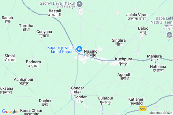
Nissang
Nissang Map
EDIT Map
Add Your House
 ..
..
Current Corona Virus Infected Patients Count in Karnal District
| City Name | District Name | Total Covid cases |
|---|---|---|
| Karnal District | Karnal | 6 |
Locality Name :
Nissang
( निस्संग )
Tehsil Name : Nissing At Chirao
District : Karnal
State : Haryana
Division : Rohtak
Language : Hindi and Punjabi, Haryanvi
Current Time 05:55 AM
Date: Saturday , Apr 26,2025 (IST)
Time zone: IST (UTC+5:30)
Elevation / Altitude: 253 meters. Above Seal level
Telephone Code / Std Code: 0184
Assembly constituency : Nilokheri assembly constituency
Assembly MLA : Dharam Pal Gonder
Lok Sabha constituency : Karnal parliamentary constituency
Parliament MP : Sanjay Bhatia
Serpanch Name :
Pin Code : 132024
Post Office Name : Nissing
Commodities Prices : Asandh Market / Mandi
Nissang Live Weather
Temperature: 26.2 °C
scattered clouds
Humidity: 10%
Wind : 1.8 mt/sec towards E
StationName : "KarnÄ\u0081l"
observed on 33 Mins Back
Temperature: 26.2 °C
scattered clouds
Humidity: 10%
Wind : 1.8 mt/sec towards E
StationName : "KarnÄ\u0081l"
observed on 33 Mins Back
Nissang Weather Forecast for Next 5 days
27-04-2025
26.2°C to 41.8°C
scattered clouds, broken clouds, few clouds, overcast clouds
26.2°C to 41.8°C
scattered clouds, broken clouds, few clouds, overcast clouds
28-04-2025
26.3°C to 42.8°C
overcast clouds, few clouds, clear sky, scattered clouds
26.3°C to 42.8°C
overcast clouds, few clouds, clear sky, scattered clouds
29-04-2025
26.0°C to 43.6°C
clear sky, few clouds
26.0°C to 43.6°C
clear sky, few clouds
30-04-2025
26.9°C to 44.1°C
clear sky, few clouds, broken clouds
26.9°C to 44.1°C
clear sky, few clouds, broken clouds
National Highways Reachable To Nissang
Nationa High Way :NH44
Nationa High Way :NH152;352
Nationa High Way :NH44
Nationa High Way :NH152;352
About Nissang
Correct below Info and add more info about NissangNissang is a Town in Nissing At Chirao Tehsil in Karnal District of Haryana State, India. It belongs to Rohtak Division . It is located 24 KM towards west from District head quarters Karnal. It is a Tehsil head quarter.
Nissang Pin code is 132024 and postal head office is Nissing .
Kuchpura ( 4 KM ) , Agondh ( 5 KM ) , Gonder ( 5 KM ) , Alipur Viran ( 6 KM ) , Baras ( 6 KM ) are the nearby Villages to Nissang. Nissang is surrounded by Pundri Tehsil towards west , Assandh Tehsil towards South , Nilokheri Tehsil towards North , Karnal Tehsil towards East .
Taraori , Karnal , Assandh , Gharaunda are the nearby Cities to Nissang.
Demographics of Nissang
Hindi is the Local Language here.Politics in Nissang
Independent , BJP , INLD , INC are the major political parties in this area.Polling Stations /Booths near Nissang
1)Nissing2)Nissing
3)Nissing
4)Nissing
5)Nissing
HOW TO REACH Nissang
By Rail
There is no railway station near to Nissang in less than 10 km.Govt Health Centers near Nissang
1) KALHERI , , ,2) SITA MAI , , ,
3) SAGGA , , ,
Petrol Bunks in Nissang,Nissing At Chirao
Singla Filling Station Indian Oil Petrol Pump
Nisang; Karnal; SH-8; Kaithal Road; Karnal; Karnal; Haryana 132024; India
1.8 KM distance Detail
Ganpati Filling Station Indian Oil Petrol Pump
Nisang; Karnal; SH-8; Kaithal Road; Karnal; Karnal; Haryana 132024; India
2.4 KM distance Detail
more ..
Colleges in Nissang,Nissing At Chirao
Pratap College of Education; Jundla
Near Bus Stand; Assandh Road; Opp Canara Bank; Jundla; Karnal; Haryana 132036; India
13.2 KM distance Detail
IPSE College of Education
Near Goshala; Jani Road; Karnal; Haryana 132036; India
13.9 KM distance Detail
Rajdhani Polytechnic College
Village Sheikhpura-Manchuri; Karnal-Assandh Main Road; Tehsil - Assandh; Karnal; Haryana 132036; India
14.0 KM distance Detail
more ..
Electronic Shops in Nissang,Nissing At Chirao
SKR NETWORK SYSTEM & COMMUNICATION
Karnal - Kaithal Road; Gondar; Nissing; Haryana 132024; India
1.9 KM distance Detail
Police Stations near Nissang,Nissing At Chirao
KASHI PAUL HOUSE
NEAR; Police Station Building; Salem - Kochi Hwy; Karunagappally; Kerala 690518; India
14.0 KM distance Detail
New Police Line Karnal
Khatha Road; Mustfabad; Karnal; Haryana 132036; India
20.5 KM distance Detail
Governement Offices near Nissang,Nissing At Chirao
Agriculture Development Office
Karnal - Kaithal Rd; Karnal; Haryana 132024; India
9.2 KM distance Detail
About Nissang &
History
How to reach Nissang
Tourist Places Near By Nissang
Schools in Nissang
Colleges in Nissang
Temperature & weather of Nissang
places in Nissang
Nissang photos
More Information
How to reach Nissang
Tourist Places Near By Nissang
Schools in Nissang
Colleges in Nissang
Temperature & weather of Nissang
places in Nissang
Nissang photos
More Information
Town Talk
Post News or Events about this Town
Near Cities
Taraori 23 KM near
Karnal 25 KM near
Assandh 27 KM near
Gharaunda 28 KM near
Taraori 23 KM near
Karnal 25 KM near
Assandh 27 KM near
Gharaunda 28 KM near
Near By Taluks
Nissing At Chirao 8 KM near
Pundri 19 KM near
Assandh 23 KM near
Nilokheri 25 KM near
Nissing At Chirao 8 KM near
Pundri 19 KM near
Assandh 23 KM near
Nilokheri 25 KM near
Near By Air Ports
Muzaffarnagar Airport 103 KM near
Chandigarh Airport 122 KM near
Indira Gandhi International Airport 145 KM near
Dehra Dun Airport 157 KM near
Muzaffarnagar Airport 103 KM near
Chandigarh Airport 122 KM near
Indira Gandhi International Airport 145 KM near
Dehra Dun Airport 157 KM near
Near By Tourist Places
Karna lake 24 KM near
Kurukshetra 38 KM near
panipat 43 KM near
Yamuna-Nagar 75 KM near
Patel Park in Ambala Cantt 85 KM near
Karna lake 24 KM near
Kurukshetra 38 KM near
panipat 43 KM near
Yamuna-Nagar 75 KM near
Patel Park in Ambala Cantt 85 KM near
Near By Districts
Karnal 24 KM near
Kurukshetra 35 KM near
Kaithal 39 KM near
Panipat 43 KM near
Karnal 24 KM near
Kurukshetra 35 KM near
Kaithal 39 KM near
Panipat 43 KM near
Near By RailWay Station
Karnal Rail Way Station 22 KM near
Gharaunda Rail Way Station 28 KM near
Karnal Rail Way Station 22 KM near
Gharaunda Rail Way Station 28 KM near