| Home | City Bus | Maps | Villages | Cities | Rail | Tourist Places | School | College | Pin Codes | Corona Cases Count |
| Distance Calculator Bus Services IFSC Codes Trace Mobile Number Weather Search Place Trace IP Available Cash ATM/Banks Locate Polling Booth Report an Error contact People |
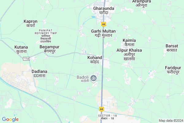
Kohand
Kohand Map
EDIT Map
Add Your House
 ..
..
Current Corona Virus Infected Patients Count in Karnal District
| City Name | District Name | Total Covid cases |
|---|---|---|
| Karnal District | Karnal | 6 |
Locality Name :
Kohand
( कोहंड )
Tehsil Name : Gharaunda (part)
District : Karnal
State : Haryana
Division : Rohtak
Language : Hindi and Punjabi, Haryanvi
Current Time 03:01 PM
Date: Tuesday , Apr 29,2025 (IST)
Time zone: IST (UTC+5:30)
Elevation / Altitude: 244 meters. Above Seal level
Telephone Code / Std Code: 0180
Assembly constituency : Gharaunda assembly constituency
Assembly MLA : Harvinder Kalyan
Lok Sabha constituency : Karnal parliamentary constituency
Parliament MP : Sanjay Bhatia
Serpanch Name :
Pin Code : 132114
Post Office Name : Gharunda
Commodities Prices : Gharaunda Market / Mandi
Kohand Live Weather
Temperature: 39.2 °C
clear sky
Humidity: 14%
Wind : 1.92 mt/sec towards SE
StationName : "Gharaunda"
observed on 57 Mins Back
Temperature: 39.2 °C
clear sky
Humidity: 14%
Wind : 1.92 mt/sec towards SE
StationName : "Gharaunda"
observed on 57 Mins Back
Kohand Weather Forecast for Next 5 days
30-04-2025
28.7°C to 39.1°C
clear sky
28.7°C to 39.1°C
clear sky
01-05-2025
27.2°C to 42.5°C
clear sky, few clouds, overcast clouds, broken clouds
27.2°C to 42.5°C
clear sky, few clouds, overcast clouds, broken clouds
02-05-2025
27.6°C to 43.0°C
overcast clouds, scattered clouds, clear sky, broken clouds
27.6°C to 43.0°C
overcast clouds, scattered clouds, clear sky, broken clouds
03-05-2025
27.4°C to 41.4°C
broken clouds, clear sky, light rain, overcast clouds
27.4°C to 41.4°C
broken clouds, clear sky, light rain, overcast clouds
04-05-2025
25.8°C to 41.1°C
overcast clouds, broken clouds, light rain
25.8°C to 41.1°C
overcast clouds, broken clouds, light rain
National Highways Reachable To Kohand
Nationa High Way :NH248BB
Nationa High Way :NH154A
Nationa High Way :NH248BB
Nationa High Way :NH154A
Rivers Near Kohand
Sumche Tokpo
Sumche Tokpo
About Kohand
Correct below Info and add more info about KohandKohand is a Village in Gharaunda (part) Tehsil in Karnal District of Haryana State, India. It belongs to Rohtak Division . It is located 25 KM towards South from District head quarters Karnal. 7 KM from Gharaunda (Part). 162 KM from State capital Chandigarh
Kohand Pin code is 132114 and postal head office is Gharunda .
Dingermajra ( 2 KM ) , Garhi Multan ( 3 KM ) , Alipur Khalsa ( 4 KM ) , Malikpur ( 4 KM ) , Kaimla ( 4 KM ) are the nearby Villages to Kohand. Kohand is surrounded by Panipat Tehsil towards South , Bapoli Tehsil towards South , Madlauda Tehsil towards west , Karnal Tehsil towards North .
Gharaunda , Panipat , Karnal , Samalkha are the near by Cities to Kohand.
This Place is in the border of the Karnal District and Panipat District. Panipat District Panipat is South towards this place .
Kohand 2011 Census Details
Kohand Local Language is Hindi. Kohand Village Total population is 10193 and number of houses are 1864. Female Population is 45.1%. Village literacy rate is 58.1% and the Female Literacy rate is 22.0%.
Population
| Census Parameter | Census Data |
| Total Population | 10193 |
| Total No of Houses | 1864 |
| Female Population % | 45.1 % ( 4592) |
| Total Literacy rate % | 58.1 % ( 5927) |
| Female Literacy rate | 22.0 % ( 2247) |
| Scheduled Tribes Population % | 0.0 % ( 0) |
| Scheduled Caste Population % | 13.8 % ( 1406) |
| Working Population % | 31.6 % |
| Child(0 -6) Population by 2011 | 1534 |
| Girl Child(0 -6) Population % by 2011 | 44.4 % ( 681) |
Kohand Census More Deatils.
Politics in Kohand
BJP , INLD , INC are the major political parties in this area.Polling Stations /Booths near Kohand
1)Khora Kheri2)Ghoghri Pur
3)Kohand
4)Kohand
5)Kohand
HOW TO REACH Kohand
By Rail
Kohand Rail Way Station , Babarpur Rail Way Station are the very nearby railway stations to Kohand.Colleges near Kohand
Guru Brahmanand Ji Govt. Polytechnical Institute Nilokheri
Address :
Guru Education
Address :
Schools in Kohand
Gsss Kohand
Address : kohand , gharaunda , karnal , Haryana . PIN- 132114 , Post - Gharunda
Baba Balak Ram Kohand
Address : kohand , gharaunda , karnal , Haryana . PIN- 132114 , Post - Gharunda
Sdhm Kohand
Address : kohand , gharaunda , karnal , Haryana . PIN- 132114 , Post - Gharunda
Govt Health Centers near Kohand
1) JAMALPUR , , ,2) Nizampur , , ,
3) DADLANA , , ,
Petrol Bunks in Kohand,Gharaunda (part)
Reliance Petroleum
Gangbad; Karnal; NH-1; G T Karnal Road; Gharaunda; Gharaunda; Haryana 132037; India
1.6 KM distance Detail
more ..
Colleges in Kohand,Gharaunda (part)
Prem Institute of Medical Sciences
98-km. Milestone; NH-I; G.T. Road;Baroli; Panipat; Haryana 132103; India
3.4 KM distance Detail
Shri Ram Polytechnic
4 Km Stone; Refinery Road; Rajapur; Panipat; Haryana 132103; India
3.5 KM distance Detail
more ..
Schools in Kohand,Gharaunda (part)
SMR INTERNATIONAL SCHOOL
Village Aftabgarh;State Highway-11; (between Safidon & Asandh); Jind; Haryana 126112; India
0.9 KM distance Detail
Sargam music classes ( Learn Indian Classical Music)
H. No 871 ; KOHAND (30) NEAR SAINI CHOPAL (KOHAND); BEHIND RAJ MUZIK STUDIO; Gharaunda; Haryana 132114; India
0.9 KM distance Detail
Electronic Shops in Kohand,Gharaunda (part)
Sultan Tyre Puncture
govt primary school triangle near hdfc bank; Asandh Rd; Kohand; Haryana; India
0.9 KM distance Detail
Local Parks in Kohand,Gharaunda (part)
Shantivan ;Eldeco Estate One
C-7; Even Rd; Eldeco Estate; Baberpur Mandi; Sector 4; Haryana 132103; India
5.7 KM distance Detail
Police Stations near Kohand,Gharaunda (part)
Traffic Aid Centre
GT Road ( NH-01); Sector - 18; HUDA; Panipat; Haryana 132103; India
7.0 KM distance Detail
Governement Offices near Kohand,Gharaunda (part)
Concor Office
Container Corporation of India ltd ICD; Baberpur Mandi; Panipat; Haryana 132103; India
4.8 KM distance Detail
About Kohand &
History
How to reach Kohand
Tourist Places Near By Kohand
Schools in Kohand
Colleges in Kohand
Temperature & weather of Kohand
places in Kohand
Kohand photos
More Information
How to reach Kohand
Tourist Places Near By Kohand
Schools in Kohand
Colleges in Kohand
Temperature & weather of Kohand
places in Kohand
Kohand photos
More Information
Village Talk
Post News or Events about this Village
Near Cities
Gharaunda 7 KM near
Panipat 12 KM near
Karnal 25 KM near
Samalkha 32 KM near
Gharaunda 7 KM near
Panipat 12 KM near
Karnal 25 KM near
Samalkha 32 KM near
Near By Taluks
Gharaunda (Part) 7 KM near
Panipat 11 KM near
Madlauda 20 KM near
Bapoli 20 KM near
Gharaunda (Part) 7 KM near
Panipat 11 KM near
Madlauda 20 KM near
Bapoli 20 KM near
Near By Air Ports
Muzaffarnagar Airport 76 KM near
Indira Gandhi International Airport 117 KM near
Chandigarh Airport 148 KM near
Dehra Dun Airport 154 KM near
Muzaffarnagar Airport 76 KM near
Indira Gandhi International Airport 117 KM near
Chandigarh Airport 148 KM near
Dehra Dun Airport 154 KM near
Near By Tourist Places
panipat 12 KM near
Karna lake 31 KM near
Kurukshetra 66 KM near
Yamuna-Nagar 83 KM near
Meerut 101 KM near
panipat 12 KM near
Karna lake 31 KM near
Kurukshetra 66 KM near
Yamuna-Nagar 83 KM near
Meerut 101 KM near
Near By Districts
Panipat 12 KM near
Karnal 25 KM near
Kurukshetra 60 KM near
Sonipat 63 KM near
Panipat 12 KM near
Karnal 25 KM near
Kurukshetra 60 KM near
Sonipat 63 KM near
Near By RailWay Station
Kohand Rail Way Station 1.1 KM near
Babarpur Rail Way Station 5.3 KM near
Gharaunda Rail Way Station 6.7 KM near
Panipat Junction Rail Way Station 12 KM near
Kohand Rail Way Station 1.1 KM near
Babarpur Rail Way Station 5.3 KM near
Gharaunda Rail Way Station 6.7 KM near
Panipat Junction Rail Way Station 12 KM near