| Home | City Bus | Maps | Villages | Cities | Rail | Tourist Places | School | College | Pin Codes | Corona Cases Count |
| Distance Calculator Bus Services IFSC Codes Trace Mobile Number Weather Search Place Trace IP Available Cash ATM/Banks Locate Polling Booth Report an Error contact People |
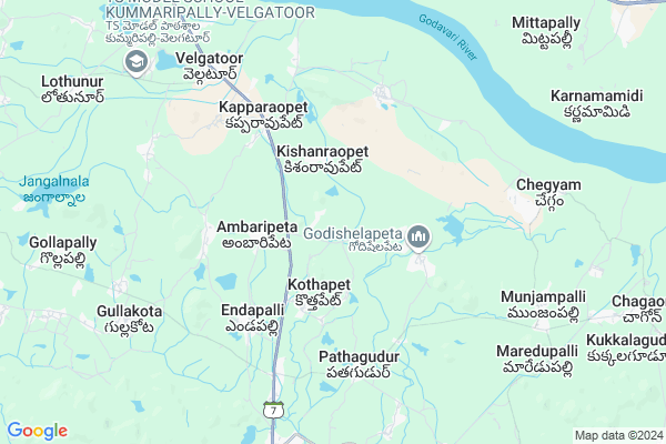
Munjampalli
Munjampalli Map
EDIT Map
Add Your House
 ..
..
Current Corona Virus Infected Patients Count in Karimnagar District
| City Name | District Name | Total Covid cases |
|---|---|---|
| Karimnagar District | Karimnagar | 16 |
| Rajanna Sircilla District | Rajanna Sircilla | 3 |
| Karimnagar | Karimnagar | 3 |
| Peddapalli District | Peddapalli | 2 |
| Siddipet District | Siddipet | 1 |
Locality Name :
Munjampalli
( ముంజంపల్లి )
Mandal Name : Velgatoor
District : Karimnagar
State : Telangana
Region : Telangana
Language : Telugu and Urdu
Current Time 03:26 PM
Date: Tuesday , Apr 29,2025 (IST)
Time zone: IST (UTC+5:30)
Elevation / Altitude: 155 meters. Above Seal level
Telephone Code / Std Code: 08627
Assembly constituency : Dharmapuri assembly constituency
Assembly MLA : Adluri Laxman Kumar
Lok Sabha constituency : Peddapalli parliamentary constituency
Parliament MP : Venkatesh Netha Borlakunta
Serpanch Name :
Pin Code : 505416
Post Office Name : Medaram
Alternate Village Name : Munjampalli , Munjampally
Commodities Prices : Gollapally Market / Mandi
Munjampalli Live Weather
Temperature: 42.0 °C
few clouds
Humidity: 15%
Wind : 1.62 mt/sec towards SE
StationName : "Lakshettipet"
observed on 1 Hours Back
Temperature: 42.0 °C
few clouds
Humidity: 15%
Wind : 1.62 mt/sec towards SE
StationName : "Lakshettipet"
observed on 1 Hours Back
Munjampalli Weather Forecast for Next 5 days
30-04-2025
30.4°C to 42.2°C
few clouds, scattered clouds
30.4°C to 42.2°C
few clouds, scattered clouds
01-05-2025
28.6°C to 43.3°C
scattered clouds, broken clouds, few clouds
28.6°C to 43.3°C
scattered clouds, broken clouds, few clouds
02-05-2025
28.1°C to 43.3°C
scattered clouds, clear sky, few clouds, broken clouds
28.1°C to 43.3°C
scattered clouds, clear sky, few clouds, broken clouds
03-05-2025
29.2°C to 44.0°C
broken clouds, scattered clouds, few clouds, clear sky
29.2°C to 44.0°C
broken clouds, scattered clouds, few clouds, clear sky
04-05-2025
28.9°C to 44.0°C
scattered clouds, clear sky, broken clouds
28.9°C to 44.0°C
scattered clouds, clear sky, broken clouds
Edit below overview about Munjampalli
Edit below overview about Munjampalli
OverView of Munjampalli
As a part of Telangana districts reorganisation it is went into palakurthi Mandal, peddapally district. Peddapally district was separated from erstwhile district of KARIMNAGAREdit below overview about Munjampalli
National Highways Reachable To Munjampalli
Nationa High Way :NH63
Nationa High Way :NH363
Nationa High Way :NH63
Nationa High Way :NH363
Rivers Near Munjampalli
Godavari :गोदावरी :ಗೋದಾವರಿ :गोदावरी :கோதாவரி :గోదావరి
Pedda Vagu
Godavari :गोदावरी :ಗೋದಾವರಿ :गोदावरी :கோதாவரி :గోదావరి
Pedda Vagu
About Munjampalli
Munjampalli is a Village in Velgatoor Mandal in Karimnagar District of Telangana State, India. It belongs to Telangana region . As part Telangana Districts re-organisation , Munjampalli Village Velgatoor Mandal re organised from Karimnagar District to Jagtial district. It is located 48 KM towards North from District head quarters Karimnagar.
Munjampalli Pin code is 505416 and postal head office is Medaram .
Munjampalli is surrounded by Dharmaram Mandal towards South , Luxettipet Mandal towards North , Gollapalli Mandal towards west , Pegadapalli Mandal towards west .
Mancherial , Ramagundam , Jagtial , Mandamarri are the near by Cities to Munjampalli.
This Place is in the border of the Karimnagar District and Adilabad District. Adilabad District Luxettipet is North towards this place .
Demographics of Munjampalli
Telugu is the Local Language here. Total population of Munjampalli is 1312 .Males are 686 and Females are 626 living in 354 Houses. Total area of Munjampalli is 562 hectares.Politics in Munjampalli
TRS , INC are the major political parties in this area.Polling Stations /Booths near Munjampalli
1)Rayapatnam2)Paathagooduru
3)Kothapelli H/o Bommareddy Palli
4)Kothapet
5)Kothapeta
HOW TO REACH Munjampalli
By Road
Ramagundam is the Nearest Town to Munjampalli. Ramagundam is 25 km from Munjampalli. Road connectivity is there from Ramagundam to Munjampalli.By Rail
There is no railway station near to Munjampalli in less than 10 km. How ever there are railway Stations from Near By town Ramagundam. are the railway Stations near to Ramagundam. You can reach from Ramagundam to Munjampalli by road after .Colleges near Munjampalli
Harsha Jr. College, Velgatoor
Address : Velgatoor
Schools near Munjampalli
Zphs Munjampally
Address : munjampalle , velgatoor , karimnagar , Andhra Pradesh . PIN- 505416 , Post - Medaram
Akshara H.s
Address : endapalle , velgatoor , karimnagar , Andhra Pradesh . PIN- 505526 , Post - Endapalli
Zphs Muthunur
Address : muthunur , velgatoor , karimnagar , Andhra Pradesh . PIN- 505526 , Post - Endapalli
Vignan Vidyalayam
Address : velgatoor , velgatoor , karimnagar , Andhra Pradesh . PIN- 505526 , Post - Endapalli
Govt Health Centers near Munjampalli
1) SubCentre veenavanka Ambaripet , 24-Feb , Gollawada , Kondapur Road2) SubCentre veenavanka Paidipalli , 9-Mar , Main Road , Near P.S
3) SubCentre Kukkala Gudoor , 11-Mar , Kukkalagudur , Near Gramapanchayat
Electronic Shops in Munjampalli,Velgatoor
LaxmiCellPoint UppuRamesh
Dharmaram X Rd - Peddapalli; Pathagudoor; Telangana 505416; India
5.9 KM distance Detail
Super Markets in Munjampalli,Velgatoor
Sri Krishna Kiranam and General Stores
; Kapparaopet; Telangana 505526; India
4.4 KM distance Detail
Police Stations near Munjampalli,Velgatoor
PPI sub division on 07.03.2015
Time: 0400 to 0500 hrs; K. ravinder PSI dharmaram conducted vehicle checking; SH 7; Telangana 505416; India
18.8 KM distance Detail
About Munjampalli &
History
How to reach Munjampalli
Tourist Places Near By Munjampalli
Schools in Munjampalli
Colleges in Munjampalli
Temperature & weather of Munjampalli
places in Munjampalli
Munjampalli photos
More Information
How to reach Munjampalli
Tourist Places Near By Munjampalli
Schools in Munjampalli
Colleges in Munjampalli
Temperature & weather of Munjampalli
places in Munjampalli
Munjampalli photos
More Information
Village Talk
Post News or Events about this Village
Near Cities
Mancherial 30 KM near
Ramagundam 31 KM near
Jagtial 34 KM near
Mandamarri 40 KM near
Mancherial 30 KM near
Ramagundam 31 KM near
Jagtial 34 KM near
Mandamarri 40 KM near
Near By Taluks
Velgatoor 0 KM near
Dharmaram 12 KM near
Luxettipet 14 KM near
Gollapalli 16 KM near
Velgatoor 0 KM near
Dharmaram 12 KM near
Luxettipet 14 KM near
Gollapalli 16 KM near
Near By Air Ports
Rajiv Gandhi International Airport 215 KM near
Nanded Airport 227 KM near
Sonegaon Airport 285 KM near
Latur Airport 327 KM near
Rajiv Gandhi International Airport 215 KM near
Nanded Airport 227 KM near
Sonegaon Airport 285 KM near
Latur Airport 327 KM near
Near By Tourist Places
Sirpur 95 KM near
Warangal 110 KM near
Medaram 135 KM near
Chandrapur 143 KM near
Medak 145 KM near
Sirpur 95 KM near
Warangal 110 KM near
Medaram 135 KM near
Chandrapur 143 KM near
Medak 145 KM near
Near By Districts
Karimnagar 46 KM near
Warangal 110 KM near
Nizamabad 132 KM near
Adilabad 134 KM near
Karimnagar 46 KM near
Warangal 110 KM near
Nizamabad 132 KM near
Adilabad 134 KM near
Near By RailWay Station
Ramagundam Rail Way Station 26 KM near
Manchiryal Rail Way Station 29 KM near
Ramagundam Rail Way Station 26 KM near
Manchiryal Rail Way Station 29 KM near