| Home | City Bus | Maps | Villages | Cities | Rail | Tourist Places | School | College | Pin Codes | Corona Cases Count |
| Distance Calculator Bus Services IFSC Codes Trace Mobile Number Weather Search Place Trace IP Available Cash ATM/Banks Locate Polling Booth Report an Error contact People |
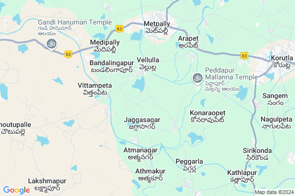
Chintalpet
Chintalpet Map
EDIT Map
Add Your House
 ..
..
Current Corona Virus Infected Patients Count in Karimnagar District
| City Name | District Name | Total Covid cases |
|---|---|---|
| Karimnagar District | Karimnagar | 16 |
| Rajanna Sircilla District | Rajanna Sircilla | 3 |
| Karimnagar | Karimnagar | 3 |
| Peddapalli District | Peddapalli | 2 |
| Siddipet District | Siddipet | 1 |
Locality Name :
Chintalpet
( చింతలపెట్ )
Mandal Name : Metpalli
District : Karimnagar
State : Telangana
Region : Telangana
Language : Telugu and Urdu
Current Time 03:06 PM
Date: Tuesday , Apr 29,2025 (IST)
Time zone: IST (UTC+5:30)
Elevation / Altitude: 293 meters. Above Seal level
Telephone Code / Std Code: 08725
Assembly constituency : Koratla assembly constituency
Assembly MLA : Kalvakuntla Sanjay
Lok Sabha constituency : Nizamabad parliamentary constituency
Parliament MP : ARVIND DHARMAPURI
Serpanch Name :
Pin Code : 505325
Post Office Name : Metpalli
Commodities Prices : Metpally Market / Mandi
Chintalpet Live Weather
Temperature: 39.7 °C
clear sky
Humidity: 17%
Wind : 2.93 mt/sec towards W
StationName : "Koratla"
observed on 2 Hours Back
Temperature: 39.7 °C
clear sky
Humidity: 17%
Wind : 2.93 mt/sec towards W
StationName : "Koratla"
observed on 2 Hours Back
Chintalpet Weather Forecast for Next 5 days
30-04-2025
30.2°C to 41.3°C
few clouds, broken clouds, scattered clouds
30.2°C to 41.3°C
few clouds, broken clouds, scattered clouds
01-05-2025
28.2°C to 42.8°C
clear sky, broken clouds, scattered clouds
28.2°C to 42.8°C
clear sky, broken clouds, scattered clouds
02-05-2025
27.8°C to 43.4°C
broken clouds, clear sky, scattered clouds
27.8°C to 43.4°C
broken clouds, clear sky, scattered clouds
03-05-2025
28.5°C to 43.3°C
broken clouds, scattered clouds, few clouds, clear sky
28.5°C to 43.3°C
broken clouds, scattered clouds, few clouds, clear sky
04-05-2025
29.8°C to 43.6°C
overcast clouds, clear sky, scattered clouds, broken clouds
29.8°C to 43.6°C
overcast clouds, clear sky, scattered clouds, broken clouds
National Highways Reachable To Chintalpet
Nationa High Way :NH63
Nationa High Way :NH63
Rivers Near Chintalpet
Godavari :ગોદાવરી :गोदावरी :ಗೋದಾವರೀ :गोदावरी :గోదావరి
Godavari :ગોદાવરી :गोदावरी :ಗೋದಾವರೀ :गोदावरी :గోదావరి
Godavari :ગોદાવરી :गोदावरी :ಗೋದಾವರೀ :गोदावरी :గోదావరి
Godavari :ગોદાવરી :गोदावरी :ಗೋದಾವರೀ :गोदावरी :గోదావరి
About Chintalpet
Correct below Info and add more info about ChintalpetChintalpet is a Village in Metpalli Mandal in Karimnagar District of Telangana State, India. It belongs to Telangana region . As part Telangana Districts re-organisation , Chintalpet Village Metpalli Mandal re organised from Karimnagar District to Jagtial district. It is located 79 KM towards west from District head quarters Karimnagar.
Chintalpet Pin code is 505325 and postal head office is Metpalli .
Chintalpet is surrounded by Korutla Mandal towards East , Kammarapalle Mandal towards west , Kathalapur Mandal towards South , Ibrahimpatnam Mandal towards North .
Koratla , Jagtial , Nirmal , Sircilla are the near by Cities to Chintalpet.
This Place is in the border of the Karimnagar District and Nizamabad District. Nizamabad District Kammarapalle is west towards this place .
Demographics of Chintalpet
Telugu is the Local Language here.Politics in Chintalpet
TRS , INC are the major political parties in this area.Polling Stations /Booths near Chintalpet
1)Vellulla2)Vellulla Masaipet
3)Indranagar Ratnapur
4)Jaggasagar
5)Jaggasagar
HOW TO REACH Chintalpet
By Rail
There is no railway station near to Chintalpet in less than 10 km. are the Rail way stations reachable from near by towns.By Road
Koratla are the nearby by towns to Chintalpet having road connectivity to ChintalpetColleges near Chintalpet
Sarala Junior College
Address :
Ravindra Mahila Junior College
Address :
Schools near Chintalpet
Sri Sai Chaitanya
Address : metpally (p.t.) , metpalli , karimnagar , Andhra Pradesh . PIN- 505325 , Post - Metpalli
Mathrusri
Address : metpally (p.t.) , metpalli , karimnagar , Andhra Pradesh . PIN- 505325 , Post - Metpalli
Krishnaveni Talent Hs
Address : metpally (p.t.) , metpalli , karimnagar , Andhra Pradesh . PIN- 505325 , Post - Metpalli
Sbvn Hs Metpelly
Address : metpally (p.t.) , metpalli , karimnagar , Andhra Pradesh . PIN- 505325 , Post - Metpalli
Govt Health Centers near Chintalpet
1) Primary Health Centre, Jaggasagar , , Pulenager , Water tank2) Primary Health Centre, Konaraopet , , Main Road , bus stand
3) Primary Health Centre, Medipalli , , korutlaroad , busstand
Hospitals in Chintalpet,Metpalli
Mukkera Srinivas Medical&Genral Store
Ramalachakkapet; Telangana 505325; India
3.8 KM distance Detail
more ..
Petrol Bunks in Chintalpet,Metpalli
Petrol Bunk;Vellulla
Vellulla - Metpally Rd; Vellulla; Telangana 505325; India
3.8 KM distance Detail
DARAM VEERAMALLAIAH & SONS
METPALLI; NEAR BUS STAND;; KARIMNAGAR; Telangana 505325; India
6.0 KM distance Detail
Bharat Petroleum
NH-16; Nizamabad Mancherial Road; Venkatraopet; Metpally; Telangana 505325; India
6.2 KM distance Detail
Daram Veernath Petrol Bunk
Civil Hospital Rd; Boyawada; Metpally; Telangana 505325; India
6.2 KM distance Detail
more ..
Colleges in Chintalpet,Metpalli
Gnanodaya Degree College
KMC Inspection Path; Metpally; Telangana 505325; India
5.4 KM distance Detail
kakathiya institu of technology and science
raghavapet; metpally; Telangana 505331; India
6.1 KM distance Detail
Ravindhra Girls Junior College;Metpally
Adarsha Nagar; Boyawada; Metpally; Telangana 505325; India
6.2 KM distance Detail
NIT Skills India Pvt Ltd
1-8-254;Lingareddy Complex 1st Floor;; Main Road;Metpally; Metpally; Telangana 505325; India
6.2 KM distance Detail
more ..
Schools in Chintalpet,Metpalli
Govt School Masaipet
8-30; Vellulla - Masaipet Rd; Vellulla; Telangana 505325; India
0.4 KM distance Detail
ZP High School
Jaggasagar - Athamakur Road; Jaggasagar; Telangana 505325; India
2.0 KM distance Detail
Electronic Shops in Chintalpet,Metpalli
Sri BALAJI BIKE POINT
Jaggasagar - Athamakur Road; Jaggasagar; Telangana 505325; India
2.8 KM distance Detail
SRIRAMA SIM POINT
Vellulla - Metpally Rd; Boyawada; Metpally; Telangana 505325; India
5.4 KM distance Detail
Hithendra Mechanical Works
Vellula Rd; Adarsha Nagar; Metpally; Telangana 505325; India
5.7 KM distance Detail
Super Markets in Chintalpet,Metpalli
Sri Laxmi Narsimha Agrncies
Ram Nagar Main Rd; Adarsha Nagar; Boyawada; Metpally; Telangana 505325; India
5.8 KM distance Detail
Police Stations near Chintalpet,Metpalli
JGL Sub-division
Vellula Road; Adarsha Nagar; Boyawada; Metpally; Telangana 505325; India
6.2 KM distance Detail
Sub Divisional Police Officer (DSP Office)
Boyawada; Metpally; Telangana 505325; India
6.2 KM distance Detail
About Chintalpet &
History
How to reach Chintalpet
Tourist Places Near By Chintalpet
Schools in Chintalpet
Colleges in Chintalpet
Temperature & weather of Chintalpet
places in Chintalpet
Chintalpet photos
More Information
How to reach Chintalpet
Tourist Places Near By Chintalpet
Schools in Chintalpet
Colleges in Chintalpet
Temperature & weather of Chintalpet
places in Chintalpet
Chintalpet photos
More Information
Village Talk
Post News or Events about this Village
Near Cities
Koratla 12 KM near
Jagtial 34 KM near
Nirmal 49 KM near
Sircilla 55 KM near
Koratla 12 KM near
Jagtial 34 KM near
Nirmal 49 KM near
Sircilla 55 KM near
Near By Taluks
Metpalli 0 KM near
Kammarapalle 11 KM near
Korutla 12 KM near
Kathalapur 12 KM near
Metpalli 0 KM near
Kammarapalle 11 KM near
Korutla 12 KM near
Kathalapur 12 KM near
Near By Air Ports
Nanded Airport 160 KM near
Rajiv Gandhi International Airport 195 KM near
Latur Airport 258 KM near
Sonegaon Airport 289 KM near
Nanded Airport 160 KM near
Rajiv Gandhi International Airport 195 KM near
Latur Airport 258 KM near
Sonegaon Airport 289 KM near
Near By Tourist Places
Medak 102 KM near
Sirpur 141 KM near
Warangal 154 KM near
Chandrapur 163 KM near
Bidar 168 KM near
Medak 102 KM near
Sirpur 141 KM near
Warangal 154 KM near
Chandrapur 163 KM near
Bidar 168 KM near
Near By Districts
Nizamabad 63 KM near
Karimnagar 76 KM near
Adilabad 109 KM near
Warangal 152 KM near
Nizamabad 63 KM near
Karimnagar 76 KM near
Adilabad 109 KM near
Warangal 152 KM near
Near By RailWay Station
Nizamabad Junction Rail Way Station 62 KM near
Kamareddi Rail Way Station 67 KM near
Nizamabad Junction Rail Way Station 62 KM near
Kamareddi Rail Way Station 67 KM near