| Home | City Bus | Maps | Villages | Cities | Rail | Tourist Places | School | College | Pin Codes | Corona Cases Count |
| Distance Calculator Bus Services IFSC Codes Trace Mobile Number Weather Search Place Trace IP Available Cash ATM/Banks Locate Polling Booth Report an Error contact People |
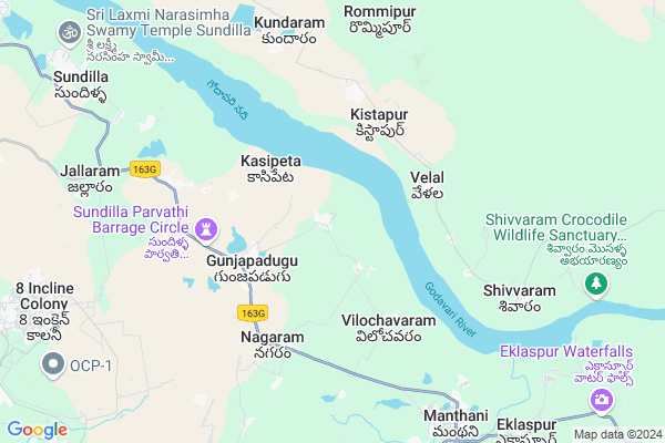
Uppatla
Uppatla Map
EDIT Map
Add Your House
 ..
..
Current Corona Virus Infected Patients Count in Karimnagar District
| City Name | District Name | Total Covid cases |
|---|---|---|
| Karimnagar District | Karimnagar | 16 |
| Rajanna Sircilla District | Rajanna Sircilla | 3 |
| Karimnagar | Karimnagar | 3 |
| Peddapalli District | Peddapalli | 2 |
| Siddipet District | Siddipet | 1 |
Locality Name :
Uppatla
( అప్పట్ల )
Mandal Name : Manthani
District : Karimnagar
State : Telangana
Region : Telangana
Language : Telugu and Urdu
Current Time 02:38 PM
Date: Tuesday , Apr 29,2025 (IST)
Time zone: IST (UTC+5:30)
Elevation / Altitude: 170 meters. Above Seal level
Telephone Code / Std Code: 08729
Assembly constituency : Manthani assembly constituency
Assembly MLA : Duddilla Sridhar Babu
Lok Sabha constituency : Peddapalli parliamentary constituency
Parliament MP : Venkatesh Netha Borlakunta
Serpanch Name :
Pin Code : 505184
Post Office Name : Manthani
Commodities Prices : Peddapalli Market / Mandi
Uppatla Live Weather
Temperature: 41.5 °C
clear sky
Humidity: 17%
Wind : 1.96 mt/sec towards SW
StationName : "Manthani"
observed on Now
Temperature: 41.5 °C
clear sky
Humidity: 17%
Wind : 1.96 mt/sec towards SW
StationName : "Manthani"
observed on Now
Uppatla Weather Forecast for Next 5 days
30-04-2025
30.0°C to 40.9°C
clear sky, few clouds
30.0°C to 40.9°C
clear sky, few clouds
01-05-2025
28.8°C to 43.3°C
scattered clouds, broken clouds, clear sky, few clouds
28.8°C to 43.3°C
scattered clouds, broken clouds, clear sky, few clouds
02-05-2025
28.3°C to 43.8°C
few clouds, clear sky, scattered clouds
28.3°C to 43.8°C
few clouds, clear sky, scattered clouds
03-05-2025
29.2°C to 44.0°C
broken clouds, scattered clouds, clear sky, few clouds
29.2°C to 44.0°C
broken clouds, scattered clouds, clear sky, few clouds
04-05-2025
29.1°C to 43.6°C
few clouds, clear sky, scattered clouds, broken clouds, overcast clouds
29.1°C to 43.6°C
few clouds, clear sky, scattered clouds, broken clouds, overcast clouds
National Highways Reachable To Uppatla
Nationa High Way :NH353C
Nationa High Way :NH353C
Rivers Near Uppatla
Godavari :गोदावरी :ಗೋದಾವರಿ :गोदावरी :கோதாவரி :గోదావరి
Gadamachkla Vagu
Godavari :गोदावरी :ಗೋದಾವರಿ :गोदावरी :கோதாவரி :గోదావరి
Gadamachkla Vagu
About Uppatla
Correct below Info and add more info about UppatlaUppatla is a Village in Manthani Mandal in Karimnagar District of Telangana State, India. It belongs to Telangana region . It is located 70 KM towards East from District head quarters Karimnagar. 9 KM from Manthani.
Uppatla Pin code is 505184 and postal head office is Manthani .
Mustyala ( 7 KM ) , Siripuram ( 7 KM ) , Manthani ( 9 KM ) , Jallaram ( 9 KM ) , Akkepalli ( 9 KM ) are the nearby Villages to Uppatla. Uppatla is surrounded by Jaipur Mandal towards North , Kamanpur Mandal towards west , Mutharam (Manthani) Mandal towards South , Chennur Mandal towards East .
Ramagundam , Mancherial , Mandamarri , Bellampalle are the near by Cities to Uppatla.
Demographics of Uppatla
Telugu is the Local Language here. Total population of Uppatla is 1160 .Males are 607 and Females are 553 living in 264 Houses. Total area of Uppatla is 714 hectares.Politics in Uppatla
TDP , TRS , PRAP , INC are the major political parties in this area.Polling Stations /Booths near Uppatla
1)Upparla Kesharam2)Polaram
3)Gundaram
4)Gunjapadugu
5)Gunjapadugu
HOW TO REACH Uppatla
By Road
Ramagundam is the Nearest Town to Uppatla. Ramagundam is 27 km from Uppatla. Road connectivity is there from Ramagundam to Uppatla.By Rail
There is no railway station near to Uppatla in less than 10 km. How ever there are railway Stations from Near By town Ramagundam. are the railway Stations near to Ramagundam. You can reach from Ramagundam to Uppatla by road after .Colleges near Uppatla
Pranavi Jr Coll, Manthani
Address : Manthani
Govt Jr College (boys) Manthani
Address : Govt Jr College (boys) Manthani
Govt Jr Coll For Girls Manthani
Address : Govt Jr Coll For Girls Manthani
Roshini Degree College
Address : # 2-90/8 & 90/9 Raghavulu Nagar Manthani, Karimna
Government Degree College
Address : Manthani, Karimnagar Dist. - 505 184.
Schools in Uppatla
Mpups Uppatla
Address : uppatla , manthani , karimnagar , Andhra Pradesh . PIN- 505184 , Post - Manthani
Govt Health Centers near Uppatla
1) SubCentre Gunjapadugu , , SC WADA , SC WADA2) SubCentre Nagaram , 1-123 , NEAR G.P , NEAR G.P
3) SubCentre Dharmaram , 4-4-201 , SC COLONY , SC COLONY
Petrol Bunks in Uppatla,Manthani
HP PETROL PUMP - DEVI BHAVANI FILLING STN MANTHANI
Hpcl Dealers Erukulagudem Manthani; Warangal; 505184; India
9.5 KM distance Detail
more ..
Colleges in Uppatla,Manthani
SINDHURA COLLEGE OF ENGINEERING & TECHNOLOGY SIND
NTPC; Jyothinagar Ramagundam; Karimnagar; Telangana 505209; India
8.3 KM distance Detail
more ..
Schools in Uppatla,Manthani
Mandal Praja Parishad School; Potharam
Gunjapadu Uppatla Rd; Potharam; Telangana 505184; India
2.3 KM distance Detail
ZPHS High School Chandanapur
Godavarikhani - Manthani Rd; Jallaram Kamanpur; Telangana 505184; India
6.5 KM distance Detail
Electronic Shops in Uppatla,Manthani
Sri Raghavendra Enterprises And Electronics
Bus Depot Road; Manthani; Telangana 505184; India
8.9 KM distance Detail
Hanuman distributors
Godavarikhani - Manthani Rd; Manthani; Telangana 505184; India
8.9 KM distance Detail
Super Markets in Uppatla,Manthani
LAXMI GENERAL STORES
5-94/A; Gandhi Chowk Dt:; Manthani; Telangana 505184; India
9.0 KM distance Detail
Police Stations near Uppatla,Manthani
2 Town Police Station - 8 Incline Colony
8 Incline Colony; Telangana 505211; India
11.0 KM distance Detail
Governement Offices near Uppatla,Manthani
MeeSeva Center
G Mallaiah Complex; Beside Andhra Bank; 1-22; Manthani; Telangana 505184; India
9.1 KM distance Detail
About Uppatla &
History
How to reach Uppatla
Tourist Places Near By Uppatla
Schools in Uppatla
Colleges in Uppatla
Temperature & weather of Uppatla
places in Uppatla
Uppatla photos
More Information
How to reach Uppatla
Tourist Places Near By Uppatla
Schools in Uppatla
Colleges in Uppatla
Temperature & weather of Uppatla
places in Uppatla
Uppatla photos
More Information
Village Talk
Post News or Events about this Village
Near Cities
Ramagundam 19 KM near
Mancherial 28 KM near
Mandamarri 38 KM near
Bellampalle 45 KM near
Ramagundam 19 KM near
Mancherial 28 KM near
Mandamarri 38 KM near
Bellampalle 45 KM near
Near By Taluks
Manthani 8 KM near
Jaipur 14 KM near
Kamanpur 15 KM near
Mutharam (Manthani) 19 KM near
Manthani 8 KM near
Jaipur 14 KM near
Kamanpur 15 KM near
Mutharam (Manthani) 19 KM near
Near By Air Ports
Rajiv Gandhi International Airport 231 KM near
Nanded Airport 278 KM near
Sonegaon Airport 303 KM near
Vijayawada Airport 304 KM near
Rajiv Gandhi International Airport 231 KM near
Nanded Airport 278 KM near
Sonegaon Airport 303 KM near
Vijayawada Airport 304 KM near
Near By Tourist Places
Medaram 86 KM near
Warangal 88 KM near
Sirpur 95 KM near
Bhamragarh Wildlife Sanctuary 143 KM near
Chandrapur 159 KM near
Medaram 86 KM near
Warangal 88 KM near
Sirpur 95 KM near
Bhamragarh Wildlife Sanctuary 143 KM near
Chandrapur 159 KM near
Near By Districts
Karimnagar 68 KM near
Warangal 90 KM near
Bijapur 139 KM near
Chandrapur 159 KM near
Karimnagar 68 KM near
Warangal 90 KM near
Bijapur 139 KM near
Chandrapur 159 KM near
Near By RailWay Station
Ramagundam Rail Way Station 23 KM near
Manchiryal Rail Way Station 30 KM near
Ramagundam Rail Way Station 23 KM near
Manchiryal Rail Way Station 30 KM near